รูปภาพหรือไฟล์เสียงนี้ ต้นฉบับอยู่ที่ คอมมอนส์ รายละเอียดด้านล่าง เป็นข้อความที่แสดงผลจาก ไฟล์ต้นฉบับในคอมมอนส์ คอมมอนส์เป็นเว็บไซต์ในโครงการสำหรับเก็บรวบรวมสื่อเสรี ที่ คุณสามารถช่วยได้
ความย่อ คำอธิบายAlbania location map.svg Deutsch:
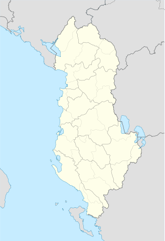
Quadratische Plattkarte, N-S-Streckung 130 %. Geographische Begrenzung der Karte:
N: 42.9° N S: 39.3° N W: 18.3° O O: 21.5° O English:
Equirectangular projection, N/S stretching 130 %. Geographic limits of the map:
N: 42.9° N S: 39.3° N W: 18.3° E O: 21.5° E วันที่ 21 กรกฎาคม พ.ศ. 2551 แหล่งที่มา Own work using: United States National Imagery and Mapping Agency data ผู้สร้างสรรค์ Lencer SVG genesisInfoField
ซอร์สโค้ดของ SVG นี้ตรวจสอบถูกต้องแล้ว
ไฟล์ภาพกราฟิกส์เวกเตอร์นี้ สร้างขึ้นโดยใช้ Adobe Illustrator
แผนที่SVGนี้ถูกสร้างหรือพัฒนาขึ้นจาก Kartenwerkstatt (ห้องปฏิบัติการแผนที่) ของวิกิพีเดียภาษาเยอรมัน ซึ่งคุณสามารถเสนอแผนที่เพื่อพัฒนาได้เช่นเดียวกัน
azərbaycanca ∙ Deutsch (Sie-Form) ∙ čeština ∙ Deutsch ∙ sicilianu ∙ italiano ∙ русский ∙ română ∙ português ∙ English ∙ magyar ∙ Nederlands ∙ slovenščina ∙ polski ∙ latviešu ∙ македонски ∙ español ∙ فارسی ∙ français ∙ suomi ∙ עברית ∙ Plattdüütsch ∙ ქართული ∙ հայերեն ∙ বাংলা ∙ ไทย ∙ 日本語 ∙ 中文 ∙ 中文(简体) ∙ 中文(繁體) ∙ العربية ∙ +/−
การอนุญาตใช้สิทธิ ข้าพเจ้า ในฐานะผู้ถือลิขสิทธิ์ของภาพหรือสื่อนี้ อนุญาตให้ใช้ภาพหรือสื่อนี้ภายใต้เงื่อนไขต่อไปนี้
อนุญาตให้คัดลอก แจกจ่ายและ/หรือดัดแปรเอกสารนี้ภายใต้เงื่อนไขของสัญญาอนุญาตเอกสารเสรีของกนู รุ่น 1.2 หรือรุ่นใด ๆ นับจากนี้ที่ออกโดยมูลนิธิซอฟต์แวร์เสรี โดยไม่มีส่วนใดห้ามแก้ไข ไม่มีข้อความปกหน้าและปกหลัง สำเนาของสัญญาอนุญาตรวมอยู่ในส่วนชื่อ สัญญาอนุญาตเอกสารเสรีของกนู http://www.gnu.org/copyleft/fdl.html GFDL GNU Free Documentation License true true
ไฟล์นี้อยู่ภายใต้สัญญาอนุญาต ครีเอทีฟคอมมอนส์ แบบแสดงที่มา-อนุญาตแบบเดียวกัน 3.0 ต้นฉบับ
คุณสามารถ: ที่จะแบ่งปัน – ที่จะทำสำเนา แจกจ่าย และส่งงานดังกล่าวต่อไปที่จะเรียบเรียงใหม่ – ที่จะดัดแปลงงานดังกล่าว ภายใต้เงื่อนไขต่อไปนี้: แสดงที่มา – คุณต้องให้เกียรติเจ้าของงานอย่างเหมาะสม โดยเพิ่มลิงก์ไปยังสัญญาอนุญาต และระบุหากมีการเปลี่ยนแปลง คุณอาจทำเช่นนี้ได้ในรูปแบบใดก็ได้ตามควร แต่ต้องไม่ใช่ในลักษณะที่แนะว่าผู้ให้อนุญาตสนับสนุนคุณหรือการใช้งานของคุณอนุญาตแบบเดียวกัน – หากคุณดัดแปลง เปลี่ยนรูป หรือต่อเติมงานนี้ คุณต้องใช้สัญญาอนุญาตแบบเดียวกันหรือแบบที่เหมือนกับสัญญาอนุญาตที่ใช้กับงานนี้เท่านั้น https://creativecommons.org/licenses/by-sa/3.0 CC BY-SA 3.0 Creative Commons Attribution-Share Alike 3.0 true true คุณสามารถเลือกสัญญาอนุญาตดังกล่าวตามต้องการ
ไทย เพิ่มคำบรรยายทรรทัดเดียวเพื่อขยายความว่าไฟล์นี้มีอะไร
ประวัติไฟล์ คลิกวันที่/เวลาเพื่อดูไฟล์ที่ปรากฏในขณะนั้น
วันที่/เวลา รูปย่อ ขนาด ผู้ใช้ ความเห็น ปัจจุบัน 02:16, 21 มิถุนายน 2554 688 × 1,002 (168 กิโลไบต์) Vinie007 fix districts 03:56, 23 มีนาคม 2553 685 × 1,002 (152 กิโลไบต์) NordNordWest counties 03:06, 23 มีนาคม 2553 685 × 1,002 (162 กิโลไบต์) NordNordWest update 23:27, 11 กันยายน 2551 685 × 1,002 (278 กิโลไบต์) Lencer {{Information |Description= |Source= |Date= |Author= |Permission= |other_versions= }} 01:36, 10 กันยายน 2551 685 × 1,002 (278 กิโลไบต์) Lencer {{Information |Description= |Source= |Date= |Author= |Permission= |other_versions= }} 19:14, 16 สิงหาคม 2551 685 × 1,002 (279 กิโลไบต์) Lencer {{Information |Description= |Source= |Date= |Author= |Permission= |other_versions= }} 00:00, 22 กรกฎาคม 2551 258 × 377 (254 กิโลไบต์) Lencer {{Information |Description= |Source= |Date= |Author= |Permission= |other_versions= }} 23:42, 21 กรกฎาคม 2551 258 × 377 (254 กิโลไบต์) Lencer {{Information |Description= {{de|Positionskarte von Albanien}} Quadratische Plattkarte, N-S-Streckung 130 %. Geographische Begrenzung der Karte: * N: 42.9° N * S: 39.3° N * W: 18.3° O * O: 21.5° O {{en|Location map of [[:en:Al
หน้าที่มีภาพนี้ ไม่มีหน้าใดโยงมาที่ภาพนี้
การใช้ไฟล์ส่วนกลาง วิกิอื่นต่อไปนี้ใช้ไฟล์นี้:
Skadar Frashër Vlora Organització territorial d'Albània Plantilla:Mapa de les regions d'Albània Plantilya:Location map Albania Puka Krabi Komsi Kalja Kala Golo Kusha Tok Raba Paula Kota Korab Orle Bistrica Tumba Mali i Zi Guri i Zi Veternik Selce Propas Petran Dibra Osoj Ostrovica Miras Mali Grad Mala Reka Lofka Lisec Lipec Leska Lomnica Kraste Krasta Kovacica Gorica Maja e Kodres Klisura Belica ดูการใช้ทั่วโลกเพิ่มเติม ของไฟล์นี้
ภาพนี้มีข้อมูลเพิ่มเติม ซึ่งส่วนใหญ่มาจากกล้องดิจิตอลหรือสแกนเนอร์ที่สามารถเก็บข้อมูลดังกล่าวไว้รวมกับภาพได้ ถ้าภาพนี้ถูกปรับปรุงแก้ไขหรือเปลี่ยนแปลงจากเดิม ข้อมูลบางอย่างจะยังคงไม่เปลี่ยนแปลงเหมือนภาพที่ถูกปรับปรุงแก้ไขนั้น
ไฟล, albania, location, ไฟล, ประว, ไฟล, หน, าท, ภาพน, การใช, ไฟล, วนกลาง, อม, ลเก, ยวก, บภาพขนาดของต, วอย, าง, ของไฟล, กเซล, ความละเอ, ยดอ, กเซล, กเซล, กเซล, กเซล, กเซล, กเซล, ภาพท, ความละเอ, ยดส, งกว, 8206, ไฟล, กเซล, ขนาดไฟล, โลไบต, ปภาพหร, อไฟล, เส, ยงน, นฉ. ifl prawtiifl hnathimiphaphni karichiflswnklang khxmulekiywkbphaphkhnadkhxngtwxyang PNG nikhxngifl SVG ni 411 599 phikesl khwamlaexiydxun 165 240 phikesl 329 480 phikesl 527 768 phikesl 703 1 024 phikesl 1 406 2 048 phikesl 688 1 002 phikesl duphaphthimikhwamlaexiydsungkwa 8206 ifl SVG 688 1 002 phikesl khnadifl 168 kiolibt rupphaphhruxiflesiyngni tnchbbxyuthi khxmmxns raylaexiyddanlang epnkhxkhwamthiaesdngphlcak ifltnchbbinkhxmmxns khxmmxnsepnewbistinokhrngkarsahrbekbrwbrwmsuxesri thi khunsamarthchwyid khwamyx khaxthibayAlbania location map svg Deutsch Positionskarte von Albanien Quadratische Plattkarte N S Streckung 130 nbsp Geographische Begrenzung der Karte N 42 9 N S 39 3 N W 18 3 O O 21 5 O English Location map of Albania Equirectangular projection N S stretching 130 nbsp Geographic limits of the map N 42 9 N S 39 3 N W 18 3 E O 21 5 E wnthi 21 krkdakhm ph s 2551 aehlngthima Own work using United States National Imagery and Mapping Agency data phusrangsrrkh Lencer SVG nbsp genesisInfoField nbsp sxrsokhdkhxng SVG nitrwcsxbthuktxngaelw nbsp iflphaphkrafiksewketxrni srangkhunodyich nbsp Adobe Illustrator aephnthiSVGnithuksranghruxphthnakhuncak Kartenwerkstatt hxngptibtikaraephnthi khxngwikiphiediyphasaeyxrmn sungkhunsamarthesnxaephnthiephuxphthnaidechnediywkn azerbaycanca nbsp Deutsch Sie Form nbsp cestina nbsp Deutsch nbsp sicilianu nbsp italiano nbsp russkij nbsp romană nbsp portugues nbsp English nbsp magyar nbsp Nederlands nbsp slovenscina nbsp polski nbsp latviesu nbsp makedonski nbsp espanol nbsp فارسی nbsp francais nbsp suomi nbsp עברית nbsp Plattduutsch nbsp ქართული nbsp հայերեն nbsp ব ল nbsp ithy nbsp 日本語 nbsp 中文 nbsp 中文 简体 nbsp 中文 繁體 nbsp العربية nbsp karxnuyatichsiththi khapheca inthanaphuthuxlikhsiththikhxngphaphhruxsuxni xnuyatihichphaphhruxsuxniphayitenguxnikhtxipni xnuyatihkhdlxk aeckcayaela hruxddaeprexksarniphayitenguxnikhkhxngsyyaxnuyatexksaresrikhxngknu run 1 2 hruxrunid nbcaknithixxkodymulnithisxftaewresri odyimmiswnidhamaekikh immikhxkhwampkhnaaelapkhlng saenakhxngsyyaxnuyatrwmxyuinswnchux syyaxnuyatexksaresrikhxngknuhttp www gnu org copyleft fdl html GFDL GNU Free Documentation License true trueiflnixyuphayitsyyaxnuyat khriexthifkhxmmxns aebbaesdngthima xnuyataebbediywkn 3 0 tnchbbkhunsamarth thicaaebngpn thicathasaena aeckcay aelasngngandngklawtxip thicaeriyberiyngihm thicaddaeplngngandngklaw phayitenguxnikhtxipni aesdngthima khuntxngihekiyrtiecakhxngnganxyangehmaasm odyephimlingkipyngsyyaxnuyat aelarabuhakmikarepliynaeplng khunxacthaechnniidinrupaebbidkidtamkhwr aettxngimichinlksnathiaenawaphuihxnuyatsnbsnunkhunhruxkarichngankhxngkhun xnuyataebbediywkn hakkhunddaeplng epliynrup hruxtxetimnganni khuntxngichsyyaxnuyataebbediywknhruxaebbthiehmuxnkbsyyaxnuyatthiichkbnganniethannhttps creativecommons org licenses by sa 3 0 CC BY SA 3 0 Creative Commons Attribution Share Alike 3 0 true truekhunsamartheluxksyyaxnuyatdngklawtamtxngkarkhabrryayodyyxithyephimkhabrryaythrrthdediywephuxkhyaykhwamwaiflnimixairxngkvsMap of AlbaniarsesiyKarta AlbaniiyuekhrnMapa Albaniyiixethmthiaesdngxyuiniflniprakxbdwyphusrangbangkhathiimmiixethmwikisnethschuxphusrangsrrkh Lenceryuxaraexl https commons wikimedia org wiki user Lencerchuxphuichwikimiediy LencersthanalikhsiththimilikhsiththisyyaxnuyatGNU Free Documentation License version 1 2 or later nbsp xngkvsCreative Commons Attribution ShareAlike 3 0 Unported nbsp xngkvswnthisrang wnkxtng21 krkdakhm 2008MIME type nbsp xngkvsimage svg xmlchecksum nbsp xngkvsf8863e17b33337913f66a8cf68527405d5d79d69withikarkahnd SHA 1 nbsp xngkvsdata size nbsp xngkvs171 815 ibtkhwamsung1 002 phikeslkhwamkwang688 phikesl prawtiifl khlikwnthi ewlaephuxduiflthipraktinkhnann wnthi ewlarupyxkhnadphuichkhwamehn pccubn02 16 21 mithunayn 2554688 1 002 168 kiolibt Vinie007fix districts 03 56 23 minakhm 2553685 1 002 152 kiolibt NordNordWestcounties 03 06 23 minakhm 2553685 1 002 162 kiolibt NordNordWestupdate 23 27 11 knyayn 2551685 1 002 278 kiolibt Lencer Information Description Source Date Author Permission other versions 01 36 10 knyayn 2551685 1 002 278 kiolibt Lencer Information Description Source Date Author Permission other versions 19 14 16 singhakhm 2551685 1 002 279 kiolibt Lencer Information Description Source Date Author Permission other versions 00 00 22 krkdakhm 2551258 377 254 kiolibt Lencer Information Description Source Date Author Permission other versions 23 42 21 krkdakhm 2551258 377 254 kiolibt Lencer Information Description de Positionskarte von Albanien Quadratische Plattkarte N S Streckung 130 Geographische Begrenzung der Karte N 42 9 N S 39 3 N W 18 3 O O 21 5 O en Location map of en Al hnathimiphaphni immihnaidoyngmathiphaphnikarichiflswnklang wikixuntxipniichiflni karichbn ar wikipedia org زلزال لوزون 2019 karichbn bn wikipedia org ভ গ ল ক আয তন অন য য স র বভ ম র ষ ট র ও ন র ভরশ ল অঞ চলসম হ র ত ল ক karichbn bs wikipedia org Tirana Skadar Frasher Vlora karichbn ca wikipedia org Comtats d Albania Organitzacio territorial d Albania Plantilla Mapa de les regions d Albania karichbn ceb wikipedia org Albanya Plantilya Location map Albania Puka Krabi Komsi Kalja Kala Golo Kusha Tok Raba Paula Kota Korab Orle Bistrica Tumba Mali i Zi Guri i Zi Veternik Selce Propas Petran Dibra Osoj Ostrovica Miras Mali Grad Mala Reka Lofka Lisec Lipec Leska Lomnica Kraste Krasta Kovacica Gorica Maja e Kodres Klisura Belica dukarichthwolkephimetimkhxngiflnikhxmulekiywkbphaph phaphnimikhxmulephimetim sungswnihymacakklxngdicitxlhruxsaeknenxrthisamarthekbkhxmuldngklawiwrwmkbphaphid thaphaphnithukprbprungaekikhhruxepliynaeplngcakedim khxmulbangxyangcayngkhngimepliynaeplngehmuxnphaphthithukprbprungaekikhnnkhwamkwang688 029pxkhwamsung1002 39px ekhathungcak https th wikipedia org wiki ifl Albania location map svg, wikipedia, วิกิ หนังสือ, หนังสือ, ห้องสมุด,
บทความ , อ่าน, ดาวน์โหลด, ฟรี, ดาวน์โหลดฟรี, mp3, วิดีโอ, mp4, 3gp, jpg, jpeg, gif, png, รูปภาพ, เพลง, เพลง, หนัง, หนังสือ, เกม, เกม