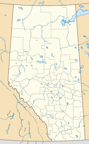
English: This map is made to the same dimensions as most provincial government products, and is intended to replace earlier Alberta locators because
they depict administratively meaningless census divisions, rather than the province's well-established system of counties and municipal districts.
they use vertically exaggerated equirectangular projections, which cause extreme distortion over large, high-latitude areas (i.e. most Canadian provinces).
Projection: EPSG:3401, transverse mercator, central meridian 115W
Extents: -400000 W, 400000 E, 5400000 S, 6700000 N
Feel free to make or request cosmetic modifications.
ไฟล์นี้มีให้ใช้ภายใต้ CC0 1.0 Universal Public Domain Dedication ของครีเอทีฟคอมมอนส์
The person who associated a work with this deed has dedicated the work to the public domain by waiving all of their rights to the work worldwide under copyright law, including all related and neighboring rights, to the extent allowed by law. You can copy, modify, distribute and perform the work, even for commercial purposes, all without asking permission.
http://creativecommons.org/publicdomain/zero/1.0/deed.enCC0Creative Commons Zero, Public Domain Dedicationfalsefalse
ไฟล, alberta, county, point, locator, ไฟล, ประว, ไฟล, หน, าท, ภาพน, การใช, ไฟล, วนกลาง, อม, ลเก, ยวก, บภาพขนาดของต, วอย, าง, ของไฟล, กเซล, ความละเอ, ยดอ, กเซล, กเซล, กเซล, กเซล, กเซล, กเซล, ภาพท, ความละเอ, ยดส, งกว, 8206, ไฟล, กเซล, ขนาดไฟล, โลไบต, ปภาพหร, อไฟ. ifl prawtiifl hnathimiphaphni karichiflswnklang khxmulekiywkbphaphkhnadkhxngtwxyang PNG nikhxngifl SVG ni 369 599 phikesl khwamlaexiydxun 148 240 phikesl 295 480 phikesl 473 768 phikesl 630 1 024 phikesl 1 261 2 048 phikesl 945 1 535 phikesl duphaphthimikhwamlaexiydsungkwa 8206 ifl SVG 945 1 535 phikesl khnadifl 632 kiolibt rupphaphhruxiflesiyngni tnchbbxyuthi khxmmxns raylaexiyddanlang epnkhxkhwamthiaesdngphlcak ifltnchbbinkhxmmxns khxmmxnsepnewbistinokhrngkarsahrbekbrwbrwmsuxesri thi khunsamarthchwyid khwamyx khaxthibayAlberta County Point Locator svg English This map is made to the same dimensions as most provincial government products and is intended to replace earlier Alberta locators because they depict administratively meaningless census divisions rather than the province s well established system of counties and municipal districts they use vertically exaggerated equirectangular projections which cause extreme distortion over large high latitude areas i e most Canadian provinces Projection EPSG 3401 transverse mercator central meridian 115WExtents 400000 W 400000 E 5400000 S 6700000 N Feel free to make or request cosmetic modifications wnthi 6 mithunayn ph s 2562aehlngthima ngankhxngtwphusrangsrrkh awmcphee karxnuyatichsiththi khapheca inthanaphuthuxlikhsiththikhxngphaphhruxsuxni xnuyatihichphaphhruxsuxniphayitenguxnikhtxipni iflnimiihichphayit CC0 1 0 Universal Public Domain Dedication khxngkhriexthifkhxmmxnsThe person who associated a work with this deed has dedicated the work to the public domain by waiving all of their rights to the work worldwide under copyright law including all related and neighboring rights to the extent allowed by law You can copy modify distribute and perform the work even for commercial purposes all without asking permission http creativecommons org publicdomain zero 1 0 deed en CC0 Creative Commons Zero Public Domain Dedication false falsekhabrryayodyyxithyephimkhabrryaythrrthdediywephuxkhyaykhwamwaiflnimixairxngkvsLocator map showing the counties of Alberta Canada ixethmthiaesdngxyuiniflniprakxbdwyphusrangbangkhathiimmiixethmwikisnethschuxphusrangsrrkh awmcpheechuxphuichwikimiediy Awmcpheeyuxaraexl http commons wikimedia org wiki User Awmcpheesthanalikhsiththicopyrighted dedicated to the public domain by copyright holder xngkvssyyaxnuyatCC0 xngkvswnthisrang wnkxtng6 mithunayn 2019thimakhxngiflkarsrangdngedimodyphuxpohld prawtiifl khlikwnthi ewlaephuxduiflthipraktinkhnann wnthi ewlarupyxkhnadphuichkhwamehn pccubn05 10 14 singhakhm 2563945 1 535 632 kiolibt AwmcpheeReduced opacity of county boundaries for legibility 00 52 7 mithunayn 2562945 1 535 613 kiolibt AwmcpheeUser created page with UploadWizard hnathimiphaphni hnatxipni oyngmathiphaphni exdmntn aekhlkari ifpainfxrtmkemxrriy ph s 2559 aemaebb Infobox map aemaebb Infobox map doc mxdul Location map data Canada Alberta mxdul Location map data Canada Alberta doc karichiflswnklang wikixuntxipniichiflni karichbn bn wikipedia org ক য লগ র এডমন টন মড উল অবস থ ন ম নচ ত র উপ ত ত ক ন ড অ য লব র ট মড উল অবস থ ন ম নচ ত র উপ ত ত ক ন ড অ য লব র ট নথ ক য লগ র আন তর জ ত ক ব ম নবন দর karichbn ca wikipedia org Reserva india Alexis 133 Reserva india Alexis Cardinal River 234 Reserva india Alexis Elk River 233 Reserva india Alexis Whitecourt 232 Reserva india Buck Lake 133C Reserva india Wabamun 133A Reserva india Wabamun 133B Reserva india Eden Valley 216 Reserva india Big Horn 144a Reserves indies Stoney 142 143 i 144 Modul Location map data Alberta Modul Location map data Canada Alberta Modul Location map data Canada Alberta us karichbn de wikipedia org Benutzer Klausronja Artikelentwurf karichbn en wikipedia org Vulcan Alberta Red Deer Alberta Grand Centre Alberta Lake Louise Alberta Camrose Alberta Wainwright Alberta Medicine Hat Head Smashed In Buffalo Jump Lethbridge Edmonton International Airport St Albert Alberta Fort McMurray Grande Prairie Bragg Creek Spruce Grove Leduc Alberta Banff Alberta Turner Valley Sylvan Lake Alberta Black Diamond Alberta Fort Chipewyan Hinton Alberta Elk Point Alberta Pincher Creek Vegreville Magrath Alberta Bassano Alberta Willmore Wilderness Park Wetaskiwin Fort Saskatchewan Chateau Lake Louise dukarichthwolkephimetimkhxngiflnikhxmulekiywkbphaph phaphnimikhxmulephimetim sungswnihymacakklxngdicitxlhruxsaeknenxrthisamarthekbkhxmuldngklawiwrwmkbphaphid thaphaphnithukprbprungaekikhhruxepliynaeplngcakedim khxmulbangxyangcayngkhngimepliynaeplngehmuxnphaphthithukprbprungaekikhnnchuxeruxngsnQt SVG DocumentchuxphaphGenerated with Qtkhwamkwang266 7mmkhwamsung433 324mm ekhathungcak https th wikipedia org wiki ifl Alberta County Point Locator svg, wikipedia, วิกิ หนังสือ, หนังสือ, ห้องสมุด,