azərbaycanca ∙ Deutsch (Sie-Form) ∙ čeština ∙ Deutsch ∙ sicilianu ∙ italiano ∙ русский ∙ română ∙ português ∙ English ∙ magyar ∙ Nederlands ∙ slovenščina ∙ polski ∙ latviešu ∙ македонски ∙ español ∙ فارسی ∙ français ∙ suomi ∙ עברית ∙ Plattdüütsch ∙ ქართული ∙ հայերեն ∙ বাংলা ∙ ไทย ∙ 日本語 ∙ 中文 ∙ 中文(简体) ∙ 中文(繁體) ∙ العربية ∙ +/−
Reverted to version as of 13:13, 23 November 2018 (UTC) There is already a version with the Falklands in white at File:Argentina location map (+Falkland).svg for when such a map is needed.
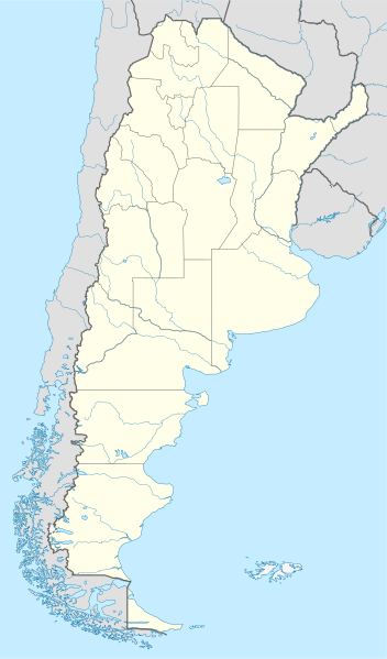
ไฟล, argentina, location, ไฟล, ประว, ไฟล, หน, าท, ภาพน, การใช, ไฟล, วนกลาง, อม, ลเก, ยวก, บภาพขนาดของต, วอย, าง, ของไฟล, กเซล, ความละเอ, ยดอ, กเซล, กเซล, กเซล, กเซล, กเซล, กเซล, ภาพท, ความละเอ, ยดส, งกว, 8206, ไฟล, กเซล, ขนาดไฟล, เมกะไบต, ปภาพหร, อไฟล, เส, ยงน. ifl prawtiifl hnathimiphaphni karichiflswnklang khxmulekiywkbphaphkhnadkhxngtwxyang PNG nikhxngifl SVG ni 352 599 phikesl khwamlaexiydxun 141 240 phikesl 282 480 phikesl 451 768 phikesl 602 1 024 phikesl 1 204 2 048 phikesl 1 418 2 412 phikesl duphaphthimikhwamlaexiydsungkwa 8206 ifl SVG 1 418 2 412 phikesl khnadifl 1 03 emkaibt rupphaphhruxiflesiyngni tnchbbxyuthi khxmmxns raylaexiyddanlang epnkhxkhwamthiaesdngphlcak ifltnchbbinkhxmmxns khxmmxnsepnewbistinokhrngkarsahrbekbrwbrwmsuxesri thi khunsamarthchwyid khwamyx khaxthibayArgentina location map svg Deutsch Positionskarte von Argentinien Quadratische Plattkarte N S Streckung 115 Geographische Begrenzung der Karte N 21 0 S S 56 5 S W 76 5 W O 52 5 WEnglish Location map of Argentina Equirectangular projection N S stretching 115 Geographic limits of the map N 21 0 S S 56 5 S W 76 5 W E 52 5 Wwnthi 07 11 2008aehlngthima own work using United States National Imagery and Mapping Agency data This map violates legal regulations Argentina Ley de la Carta Law No 22963 World Data Base II dataphusrangsrrkh NordNordWestewxrchnxun iflxunthiichiflni Argentina location map Falkland svg Argentina location map Falkland svg Argentina Buenos Aires location map svg Argentina Catamarca location map svg Argentina Chaco location map svg Argentina Chubut location map svg Argentina Corrientes location map svg Argentina Cordoba location map svg Argentina Entre Rios location map svg Argentina Jujuy location map svg Argentina La Pampa location map svg Argentina La Rioja location map svg Argentina Mendoza location map svg Argentina Misiones location map svg Argentina Neuquen location map svg Argentina Salta location map svg Argentina San Juan location map svg Argentina San Luis location map svg Argentina Santa Fe location map svg Argentina Santiago del Estero location map svg Argentina Tierra del Fuego and Staten Island location map svg Argentina Tucuman location map svg Relief Map of Argentina jpg aephnthinithuksranghruxphthnakhuncak Kartenwerkstatt hxngptibtikaraephnthi khxngwikiphiediyphasaeyxrmn sungkhunsamarthesnxaephnthiephuxphthnaidechnediywkn azerbaycanca Deutsch Sie Form cestina Deutsch sicilianu italiano russkij romană portugues English magyar Nederlands slovenscina polski latviesu makedonski espanol فارسی francais suomi עברית Plattduutsch ქართული հայերեն ব ল ithy 日本語 中文 中文 简体 中文 繁體 العربية karxnuyatichsiththi khapheca inthanaphuthuxlikhsiththikhxngphaphhruxsuxni xnuyatihichphaphhruxsuxniphayitenguxnikhtxipni xnuyatihkhdlxk aeckcayaela hruxddaeprexksarniphayitenguxnikhkhxngsyyaxnuyatexksaresrikhxngknu run 1 2 hruxrunid nbcaknithixxkodymulnithisxftaewresri odyimmiswnidhamaekikh immikhxkhwampkhnaaelapkhlng saenakhxngsyyaxnuyatrwmxyuinswnchux syyaxnuyatexksaresrikhxngknuhttp www gnu org copyleft fdl html GFDL GNU Free Documentation License true trueiflnixyuphayitsyyaxnuyat khriexthifkhxmmxns aebbaesdngthima xnuyataebbediywkn 3 0 tnchbbkhunsamarth thicaaebngpn thicathasaena aeckcay aelasngngandngklawtxip thicaeriyberiyngihm thicaddaeplngngandngklaw phayitenguxnikhtxipni aesdngthima khuntxngihekiyrtiecakhxngnganxyangehmaasm odyephimlingkipyngsyyaxnuyat aelarabuhakmikarepliynaeplng khunxacthaechnniidinrupaebbidkidtamkhwr aettxngimichinlksnathiaenawaphuihxnuyatsnbsnunkhunhruxkarichngankhxngkhun xnuyataebbediywkn hakkhunddaeplng epliynrup hruxtxetimnganni khuntxngichsyyaxnuyataebbediywknhruxaebbthiehmuxnkbsyyaxnuyatthiichkbnganniethannhttps creativecommons org licenses by sa 3 0 CC BY SA 3 0 Creative Commons Attribution Share Alike 3 0 true truekhunsamartheluxksyyaxnuyatdngklawtamtxngkarkhabrryayodyyxithyephimkhabrryaythrrthdediywephuxkhyaykhwamwaiflnimixairixethmthiaesdngxyuiniflniprakxbdwyphusrangbangkhathiimmiixethmwikisnethschuxphuichwikimiediy NordNordWestchuxphusrangsrrkh NordNordWestyuxaraexl https commons wikimedia org wiki user NordNordWeststhanalikhsiththimilikhsiththisyyaxnuyatGNU Free Documentation License version 1 2 or later xngkvsCreative Commons Attribution ShareAlike 3 0 Unported xngkvsMIME type xngkvsimage svg xml prawtiifl khlikwnthi ewlaephuxduiflthipraktinkhnann lasud ekasud du ihmkwa 10 ekakwa 10 10 20 50 100 250 500 wnthi ewlarupyxkhnadphuichkhwamehn pccubn22 26 11 singhakhm 25651 418 2 412 1 03 emkaibt JanitoalevicReverted to version as of 02 18 25 May 2021 UTC 07 27 9 phvsphakhm 25651 418 2 412 1 51 emkaibt Buttons0603Reverted to version as of 20 33 29 January 2021 UTC see below 09 18 25 phvsphakhm 25641 418 2 412 1 03 emkaibt MinervaAustralReverted to version as of 03 37 24 November 2018 UTC 03 33 30 mkrakhm 25641 418 2 412 1 51 emkaibt Buttons0603Reverted to version as of 13 13 23 November 2018 UTC There is already a version with the Falklands in white at File Argentina location map Falkland svg for when such a map is needed 10 37 24 phvscikayn 25611 418 2 412 1 03 emkaibt Cacen GymraegReverted to version as of 01 43 6 November 2017 UTC Added claim territories neutral point of view 20 13 23 phvscikayn 25611 418 2 412 1 51 emkaibt Mr James DimseyReverted to version as of 23 25 9 October 2015 UTC 08 43 6 phvscikayn 25601 418 2 412 1 03 emkaibt JanitoalevicAdded Fontana and Plata Lake 08 37 6 phvscikayn 25601 418 2 412 1 02 emkaibt JanitoalevicFixed provincial and international borders 04 36 26 minakhm 25591 418 2 412 997 kiolibt JanitoalevicAdded all the Disputed Territories 02 00 22 minakhm 25591 418 2 412 994 kiolibt Gustavo GirardelliDetalles lasud ekasud du ihmkwa 10 ekakwa 10 10 20 50 100 250 500 hnathimiphaphni hnatxipni oyngmathiphaphni kxnespsixxnedlxurukwy kxrriexnets slta sankhwn praethsxarecntina santaef praethsxarecntina sanmiekledtukumn sanetiyokedlexsetor biexdma priemradibisixxnedxarekhntina futbxlolk 1978 maredlplata rafaexla laplata larioxkha praethsxarecntina xuthyanaehngrthxischikwlsot ekhenrlxlebxar rthbwonsixers emnodsa praethsxarecntina okpaxaemrika 2011 opsads praethsxarecntina orsariox rthsantaef impu rthemnodsa aemaebb Location map Argentina mxdul Location map data Argentina mxdul Location map data Argentina doc karichiflswnklang wikixuntxipniichiflni karichbn af wikipedia org Comodoro Rivadavia Mar del Plata Bariloche La Plata Villa General Belgrano FIFA Sokker Wereldbekertoernooi in 1978 Balcarce Sarmiento Sjabloon Liggingkaart Argentinie Monserrat Buenos Aires Aconcagua Ojos del Salado Los Toldos Coloradorivier Argentinie Rawson karichbn an wikipedia org Buenos Aires Recreo La Plata Reconquista Archentina Rosario Archentina Plantilla Mapa de localizacion Archentina karichbn ar wikipedia org نيكوتشيا بطولة العالم للشباب لكرة القدم 2001 كوبا أمريكا 2011 قالب خريطة مواقع الأرجنتين بطولة أمريكا الجنوبية للشباب تحت 20 سنة 2013 فييدما بارانا انتري ريوس مدينة سانتياغو ديل استيرو ريسيستينسيا سان سلفادور دي خوخوي مدينة لا ريوخا مدينة فورموزا نيوكوين ريو غاليغوس سانتا كروز مدينة سان فرناندو ديل فالي دي كاتاماركا مدينة كومودورو ريفادافيا مدينة بوساداس ميسيونيس مدينة سانتا روزا لا بامبا مدينة سان لويس مدينة ريو كوارتو قرطبة ريكونكيستا سانتا في مدينة كونكورديا انتري ريوس مدينة بويرتو مادرين مدينة تريليو مدينة سان رافائيل مندوزا مدينة كونسبسيون ديل أوروغواي مدينة ألتا غراسيا بيريغامنيو مدينة رافاييلا مدينة dukarichthwolkephimetimkhxngiflnikhxmulekiywkbphaph phaphnimikhxmulephimetim sungswnihymacakklxngdicitxlhruxsaeknenxrthisamarthekbkhxmuldngklawiwrwmkbphaphid thaphaphnithukprbprungaekikhhruxepliynaeplngcakedim khxmulbangxyangcayngkhngimepliynaeplngehmuxnphaphthithukprbprungaekikhnnkhwamkwang1417 848pxkhwamsung2411 723px ekhathungcak https th wikipedia org wiki ifl Argentina location map svg, wikipedia, วิกิ หนังสือ, หนังสือ, ห้องสมุด,
.svg.html)