ข้อมูลเพิ่มเติม This map is part of a series of location maps with unified standards: SVG as file format, standardised colours and name scheme. The boundaries on these maps always show the de facto situation and do not imply any endorsement or acceptance. In case of changes of the shown area the file is updated. The old version will be uploaded as a new file and thus is still available.
วันที่
แหล่งที่มา
Own work using:
United States National Imagery and Mapping Agency data
azərbaycanca ∙ Deutsch (Sie-Form) ∙ čeština ∙ Deutsch ∙ sicilianu ∙ italiano ∙ русский ∙ română ∙ português ∙ English ∙ magyar ∙ Nederlands ∙ slovenščina ∙ polski ∙ latviešu ∙ македонски ∙ español ∙ فارسی ∙ français ∙ suomi ∙ עברית ∙ Plattdüütsch ∙ ქართული ∙ հայերեն ∙ বাংলা ∙ ไทย ∙ 日本語 ∙ 中文 ∙ 中文(简体) ∙ 中文(繁體) ∙ العربية ∙ +/−
การอนุญาตใช้สิทธิ
Usage of this file with:
Map: NordNordWest, Licence: Creative Commons by-sa-3.0 de
explanatory notes: Legally binding is only the full legalcode. For a free usage I recommend to respect the following licence conditions: 1. Provide my name as given above: NordNordWest, 2. a copy of, or the URI for, the applicable license: https://creativecommons.org/licenses/by-sa/3.0/de/legalcode, 3. the title of the work, 4. in the case of an adaptation, a credit identifying the use of the work in the adaptation. This license and the rights granted hereunder will terminate automatically upon any breach by you of the terms of this license. Any of the above conditions can be waived if you get permission from the copyright holder. If you have questions or wish differing conditions, please contact me through nnwestt-online.de or my discussion page
This file has been released under a license which is incompatible with Facebook's licensing terms. It is not permitted to upload this file to Facebook.
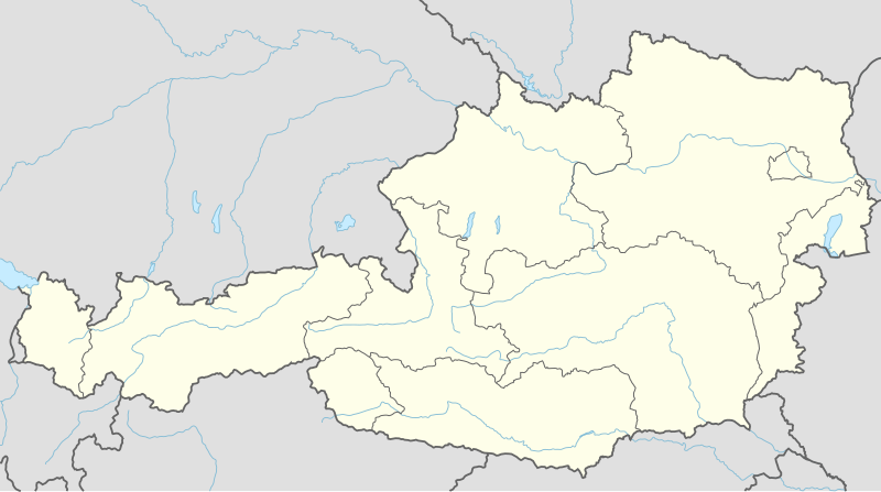
== {{int:filedesc}} == {{Information |Description= {{de|1=Positionskarte von Österreich}} {{en|1=Location map of Austria}} {{Location map series N |stretching=150 |top=49.2 |bottom=46.3 |left=9.4 |right=17.2 }} |Source={{Own using}} * United States Na...
ไฟล, austria, location, ไฟล, ประว, ไฟล, หน, าท, ภาพน, การใช, ไฟล, วนกลาง, อม, ลเก, ยวก, บภาพขนาดของต, วอย, าง, ของไฟล, กเซล, ความละเอ, ยดอ, กเซล, กเซล, กเซล, กเซล, กเซล, กเซล, ภาพท, ความละเอ, ยดส, งกว, 8206, ไฟล, กเซล, ขนาดไฟล, โลไบต, ปภาพหร, อไฟล, เส, ยงน, นฉ. ifl prawtiifl hnathimiphaphni karichiflswnklang khxmulekiywkbphaphkhnadkhxngtwxyang PNG nikhxngifl SVG ni 800 446 phikesl khwamlaexiydxun 320 178 phikesl 640 357 phikesl 1 024 571 phikesl 1 280 713 phikesl 2 560 1 427 phikesl 1 256 700 phikesl duphaphthimikhwamlaexiydsungkwa 8206 ifl SVG 1 256 700 phikesl khnadifl 183 kiolibt rupphaphhruxiflesiyngni tnchbbxyuthi khxmmxns raylaexiyddanlang epnkhxkhwamthiaesdngphlcak ifltnchbbinkhxmmxns khxmmxnsepnewbistinokhrngkarsahrbekbrwbrwmsuxesri thi khunsamarthchwyid khwamyx khaxthibayAustria adm location map svg Deutsch Positionskarte von Osterreich English Location map of Austria Equirectangular projection vertical stretching 150 Border coordinates49 29 4 17 246 3 khxmulephimetim This map is part of a series of location maps with unified standards SVG as file format standardised colours and name scheme The boundaries on these maps always show the de facto situation and do not imply any endorsement or acceptance In case of changes of the shown area the file is updated The old version will be uploaded as a new file and thus is still available wnthi 2 thnwakhm ph s 2557aehlngthima Own work using United States National Imagery and Mapping Agency data World Data Base II data File Austria location map svg ody User Lencerphusrangsrrkh NordNordWestSVG genesisInfoField sxrsokhdkhxng SVG nitrwcsxbthuktxngaelw iflphaphkrafiksewketxrni srangkhunodyich Inkscape aephnthiSVGnithuksranghruxphthnakhuncak Kartenwerkstatt hxngptibtikaraephnthi khxngwikiphiediyphasaeyxrmn sungkhunsamarthesnxaephnthiephuxphthnaidechnediywkn azerbaycanca Deutsch Sie Form cestina Deutsch sicilianu italiano russkij romană portugues English magyar Nederlands slovenscina polski latviesu makedonski espanol فارسی francais suomi עברית Plattduutsch ქართული հայերեն ব ল ithy 日本語 中文 中文 简体 中文 繁體 العربية karxnuyatichsiththi Usage of this file with Map NordNordWest Licence Creative Commons by sa 3 0 de explanatory notes Legally binding is only the full legalcode For a free usage I recommend to respect the following licence conditions 1 Provide my name as given above NordNordWest 2 a copy of or the URI for the applicable license https creativecommons org licenses by sa 3 0 de legalcode 3 the title of the work 4 in the case of an adaptation a credit identifying the use of the work in the adaptation This license and the rights granted hereunder will terminate automatically upon any breach by you of the terms of this license Any of the above conditions can be waived if you get permission from the copyright holder If you have questions or wish differing conditions please contact me through span class nowrap nnwestt online de span or my discussion pageiflnixyuphayitsyyaxnuyat khriexthifkhxmmxns aebbaesdngthima xnuyataebbediywkn 3 0 khxngpraethseyxrmnikaraesdngthima Karte NordNordWest Lizenz Creative Commons by sa 3 0 dekhunsamarth thicaaebngpn thicathasaena aeckcay aelasngngandngklawtxip thicaeriyberiyngihm thicaddaeplngngandngklaw phayitenguxnikhtxipni aesdngthima khuntxngihekiyrtiecakhxngnganxyangehmaasm odyephimlingkipyngsyyaxnuyat aelarabuhakmikarepliynaeplng khunxacthaechnniidinrupaebbidkidtamkhwr aettxngimichinlksnathiaenawaphuihxnuyatsnbsnunkhunhruxkarichngankhxngkhun xnuyataebbediywkn hakkhunddaeplng epliynrup hruxtxetimnganni khuntxngichsyyaxnuyataebbediywknhruxaebbthiehmuxnkbsyyaxnuyatthiichkbnganniethannhttps creativecommons org licenses by sa 3 0 de deed en CC BY SA 3 0 de Creative Commons Attribution Share Alike 3 0 de true true This file has been released under a license which is incompatible with Facebook s licensing terms It is not permitted to upload this file to Facebook khabrryayodyyxithyephimkhabrryaythrrthdediywephuxkhyaykhwamwaiflnimixairxngkvsLocation map of AustriaeyxrmnPositionskarte von OsterreichfrngessCarte avec geolocalisation de l AutricheixethmthiaesdngxyuiniflniprakxbdwypraethsxxsetriysthanalikhsiththimilikhsiththisyyaxnuyatCreative Commons Attribution ShareAlike 3 0 Germany xngkvswnthisrang wnkxtng2 thnwakhm 2014MIME type xngkvsimage svg xml prawtiifl khlikwnthi ewlaephuxduiflthipraktinkhnann wnthi ewlarupyxkhnadphuichkhwamehn pccubn02 02 3 thnwakhm 25571 256 700 183 kiolibt NordNordWest int filedesc Information Description de 1 Positionskarte von Osterreich en 1 Location map of Austria Location map series N stretching 150 top 49 2 bottom 46 3 left 9 4 right 17 2 Source Own using United States Na hnathimiphaphni hnatxipni oyngmathiphaphni karwingkhbephlingoxlimpikvdurxn 1936 khlaekinfwrth chpiththalxnaedredra sngkhthkilekin thaxakasyannanachatiewiynna bathohfksithn bichchxfsohefin pxmprakarohexinslthsbwrkh raychuxaehlngmrdkolkinpraethsxxsetriy rusbkhxmphskhchuth linths lunthsxmes sthanirthifslthsbwrkh sthanirthiflins sthanirthifewiynnatawntk xxsetriynfutbxlbunedislika xinsbrukh hlchtth ebraenaxmxin oxlimpikeyawchnvduhnaw 2012 ichphs imexxrohefin mxdul Location map data Austria mxdul Location map data Austria doc karichiflswnklang wikixuntxipniichiflni karichbn ast wikipedia org Amstetten Viena Minihof Liebau Burgruine Starhemberg Burgruine Aggstein Castiellu d Ambras Donnerskirchen Selva de Bohemia Salzburgu Fucking Graz Innsbruck Linz Palaciu Belvedere Estadiu Ernst Happel Universida de Viena Universida d Economia de Viena Circuitu d Osterreichring Eisenstadt Klagenfurt Sankt Polten Bregenz Modulu Minimapa data Austria Leibnitz Modulu Minimapa data Austria usu Fraxern Banu central de Viena Berg und Lowenherz Aeropuertu de Graz Aeropuertu d Innsbruck Aeropuertu de Klagenfurt Aeropuertu de Linz Catedral de San Esteban de Viena Ferrocarril de Mariazell karichbn as wikipedia org ভ য ন স চ Location map Austria karichbn azb wikipedia org شابلون اوتریش خریطه سی karichbn ban wikipedia org Votivkirche Wina karichbn bh wikipedia org ट म पल ट Infobox hut ट म पल ट Infobox hut doc Module Location map data Austria Module Location map data Austria doc karichbn bn wikipedia org আইজ নস ট ট ট মপ ল ট অবস থ ন ম নচ ত র Austria শ র ন স মড উল অবস থ ন ম নচ ত র উপ ত ত অস ট র য মড উল অবস থ ন ম নচ ত র উপ ত ত অস ট র য নথ ভ য ন আন তর জ ত ক ব ম নবন দর ফ ক karichbn bs wikipedia org Bec dukarichthwolkephimetimkhxngiflnikhxmulekiywkbphaph phaphnimikhxmulephimetim sungswnihymacakklxngdicitxlhruxsaeknenxrthisamarthekbkhxmuldngklawiwrwmkbphaphid thaphaphnithukprbprungaekikhhruxepliynaeplngcakedim khxmulbangxyangcayngkhngimepliynaeplngehmuxnphaphthithukprbprungaekikhnnkhwamkwang1255 891khwamsung700 41803 ekhathungcak https th wikipedia org wiki ifl Austria adm location map svg, wikipedia, วิกิ หนังสือ, หนังสือ, ห้องสมุด,