รูปภาพหรือไฟล์เสียงนี้ ต้นฉบับอยู่ที่ คอมมอนส์ รายละเอียดด้านล่าง เป็นข้อความที่แสดงผลจาก ไฟล์ต้นฉบับในคอมมอนส์ คอมมอนส์เป็นเว็บไซต์ในโครงการสำหรับเก็บรวบรวมสื่อเสรี ที่ คุณสามารถช่วยได้
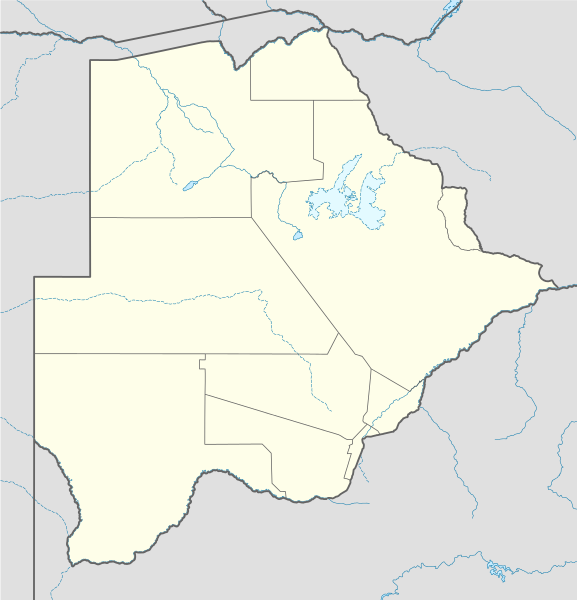
ความย่อ คำอธิบายBotswana location map.svg Deutsch:
Quadratische Plattkarte, N-S-Streckung 105 %. Geographische Begrenzung der Karte:
N: 17.3° S S: 27.5° S W: 19.4° O O: 29.7° O English:
Equirectangular projection, N/S stretching 105 %. Geographic limits of the map:
N: 17.3° S S: 27.5° S W: 19.4° E E: 29.7° E วันที่ 13 สิงหาคม พ.ศ. 2551 แหล่งที่มา own work, using
United States National Imagery and Mapping Agency data World Data Base II data ผู้สร้างสรรค์ NordNordWest SVG genesisInfoField
ซอร์สโค้ดของ SVG นี้ตรวจสอบถูกต้องแล้ว
ไฟล์ภาพกราฟิกส์เวกเตอร์นี้ สร้างขึ้นโดยใช้ Inkscape, or with something else .
แผนที่SVGนี้ถูกสร้างหรือพัฒนาขึ้นจาก Kartenwerkstatt (ห้องปฏิบัติการแผนที่) ของวิกิพีเดียภาษาเยอรมัน ซึ่งคุณสามารถเสนอแผนที่เพื่อพัฒนาได้เช่นเดียวกัน
azərbaycanca ∙ Deutsch (Sie-Form) ∙ čeština ∙ Deutsch ∙ sicilianu ∙ italiano ∙ русский ∙ română ∙ português ∙ English ∙ magyar ∙ Nederlands ∙ slovenščina ∙ polski ∙ latviešu ∙ македонски ∙ español ∙ فارسی ∙ français ∙ suomi ∙ עברית ∙ Plattdüütsch ∙ ქართული ∙ հայերեն ∙ বাংলা ∙ ไทย ∙ 日本語 ∙ 中文 ∙ 中文(简体) ∙ 中文(繁體) ∙ العربية ∙ +/−
การอนุญาตใช้สิทธิ ข้าพเจ้า ในฐานะผู้ถือลิขสิทธิ์ของภาพหรือสื่อนี้ อนุญาตให้ใช้ภาพหรือสื่อนี้ภายใต้เงื่อนไขต่อไปนี้
อนุญาตให้คัดลอก แจกจ่ายและ/หรือดัดแปรเอกสารนี้ภายใต้เงื่อนไขของสัญญาอนุญาตเอกสารเสรีของกนู รุ่น 1.2 หรือรุ่นใด ๆ นับจากนี้ที่ออกโดยมูลนิธิซอฟต์แวร์เสรี โดยไม่มีส่วนใดห้ามแก้ไข ไม่มีข้อความปกหน้าและปกหลัง สำเนาของสัญญาอนุญาตรวมอยู่ในส่วนชื่อ สัญญาอนุญาตเอกสารเสรีของกนู http://www.gnu.org/copyleft/fdl.html GFDL GNU Free Documentation License true true
ไฟล์นี้อยู่ภายใต้สัญญาอนุญาต ครีเอทีฟคอมมอนส์ แบบแสดงที่มา-อนุญาตแบบเดียวกัน 3.0 ต้นฉบับ
คุณสามารถ: ที่จะแบ่งปัน – ที่จะทำสำเนา แจกจ่าย และส่งงานดังกล่าวต่อไปที่จะเรียบเรียงใหม่ – ที่จะดัดแปลงงานดังกล่าว ภายใต้เงื่อนไขต่อไปนี้: แสดงที่มา – คุณต้องให้เกียรติเจ้าของงานอย่างเหมาะสม โดยเพิ่มลิงก์ไปยังสัญญาอนุญาต และระบุหากมีการเปลี่ยนแปลง คุณอาจทำเช่นนี้ได้ในรูปแบบใดก็ได้ตามควร แต่ต้องไม่ใช่ในลักษณะที่แนะว่าผู้ให้อนุญาตสนับสนุนคุณหรือการใช้งานของคุณอนุญาตแบบเดียวกัน – หากคุณดัดแปลง เปลี่ยนรูป หรือต่อเติมงานนี้ คุณต้องใช้สัญญาอนุญาตแบบเดียวกันหรือแบบที่เหมือนกับสัญญาอนุญาตที่ใช้กับงานนี้เท่านั้น https://creativecommons.org/licenses/by-sa/3.0 CC BY-SA 3.0 Creative Commons Attribution-Share Alike 3.0 true true คุณสามารถเลือกสัญญาอนุญาตดังกล่าวตามต้องการ
ไทย เพิ่มคำบรรยายทรรทัดเดียวเพื่อขยายความว่าไฟล์นี้มีอะไร
โปรตุเกส Localização no mapa de Botswana
กาลิเซีย Mapa de Botswana.
ประวัติไฟล์ คลิกวันที่/เวลาเพื่อดูไฟล์ที่ปรากฏในขณะนั้น
วันที่/เวลา รูปย่อ ขนาด ผู้ใช้ ความเห็น ปัจจุบัน 17:07, 21 ธันวาคม 2557 974 × 1,012 (314 กิโลไบต์) Ravenpuff Chobe District 03:37, 12 พฤศจิกายน 2552 974 × 1,012 (313 กิโลไบต์) NordNordWest 00:48, 14 สิงหาคม 2551 975 × 1,012 (222 กิโลไบต์) NordNordWest {{Information |Description= {{de|Positionskarte von Botsuana}} Quadratische Plattkarte, N-S-Streckung 105 %. Geographische Begrenzung der Karte: * N: 17.3° S * S: 27.5° S * W: 19.4° O * O: 29.7° O {{en|Location map of [[:en:Botswana|B
หน้าที่มีภาพนี้ หน้าต่อไปนี้ โยงมาที่ภาพนี้:
การใช้ไฟล์ส่วนกลาง วิกิอื่นต่อไปนี้ใช้ไฟล์นี้:
Lobatse Francistown Ghanzi Kasane Mochudi Palapye Kanye Mahalapye Serowe Molepolole Tshabong Ramotswa Kalkfontein Selebi-Phikwe Gumare Masunga Tlokweng Jwaneng Bobonong Moshupa Orapa Thamaga Kang Sikwane Sowa, Botswana Zutswa Werda, Botswana Struizendam Tshane Vaalhoek Middelputs Bokspits Khuis Rapplespan Sir Seretse Khama Internasionale Lughawe Tuli-blok Makopong D'Kar Kasane Lughawe Francistown-lughawe መለጠፊያ:Location map ቦትስዋና Kalahari Módulu:Mapa de llocalización/datos/Botsuana/usu Xau ดูการใช้ทั่วโลกเพิ่มเติม ของไฟล์นี้
ภาพนี้มีข้อมูลเพิ่มเติม ซึ่งส่วนใหญ่มาจากกล้องดิจิตอลหรือสแกนเนอร์ที่สามารถเก็บข้อมูลดังกล่าวไว้รวมกับภาพได้ ถ้าภาพนี้ถูกปรับปรุงแก้ไขหรือเปลี่ยนแปลงจากเดิม ข้อมูลบางอย่างจะยังคงไม่เปลี่ยนแปลงเหมือนภาพที่ถูกปรับปรุงแก้ไขนั้น
ไฟล, botswana, location, ไฟล, ประว, ไฟล, หน, าท, ภาพน, การใช, ไฟล, วนกลาง, อม, ลเก, ยวก, บภาพขนาดของต, วอย, าง, ของไฟล, กเซล, ความละเอ, ยดอ, กเซล, กเซล, กเซล, กเซล, กเซล, กเซล, ภาพท, ความละเอ, ยดส, งกว, 8206, ไฟล, กเซล, ขนาดไฟล, โลไบต, ปภาพหร, อไฟล, เส, ยงน, น. ifl prawtiifl hnathimiphaphni karichiflswnklang khxmulekiywkbphaphkhnadkhxngtwxyang PNG nikhxngifl SVG ni 577 600 phikesl khwamlaexiydxun 231 240 phikesl 462 480 phikesl 739 768 phikesl 986 1 024 phikesl 1 971 2 048 phikesl 974 1 012 phikesl duphaphthimikhwamlaexiydsungkwa 8206 ifl SVG 974 1 012 phikesl khnadifl 314 kiolibt rupphaphhruxiflesiyngni tnchbbxyuthi khxmmxns raylaexiyddanlang epnkhxkhwamthiaesdngphlcak ifltnchbbinkhxmmxns khxmmxnsepnewbistinokhrngkarsahrbekbrwbrwmsuxesri thi khunsamarthchwyid khwamyx khaxthibayBotswana location map svg Deutsch Positionskarte von Botsuana Quadratische Plattkarte N S Streckung 105 nbsp Geographische Begrenzung der Karte N 17 3 S S 27 5 S W 19 4 O O 29 7 O English Location map of Botswana Equirectangular projection N S stretching 105 nbsp Geographic limits of the map N 17 3 S S 27 5 S W 19 4 E E 29 7 E wnthi 13 singhakhm ph s 2551 aehlngthima own work using United States National Imagery and Mapping Agency data World Data Base II data phusrangsrrkh NordNordWest SVG nbsp genesisInfoField nbsp sxrsokhdkhxng SVG nitrwcsxbthuktxngaelw nbsp iflphaphkrafiksewketxrni srangkhunodyich nbsp Inkscape or with something else aephnthiSVGnithuksranghruxphthnakhuncak Kartenwerkstatt hxngptibtikaraephnthi khxngwikiphiediyphasaeyxrmn sungkhunsamarthesnxaephnthiephuxphthnaidechnediywkn azerbaycanca nbsp Deutsch Sie Form nbsp cestina nbsp Deutsch nbsp sicilianu nbsp italiano nbsp russkij nbsp romană nbsp portugues nbsp English nbsp magyar nbsp Nederlands nbsp slovenscina nbsp polski nbsp latviesu nbsp makedonski nbsp espanol nbsp فارسی nbsp francais nbsp suomi nbsp עברית nbsp Plattduutsch nbsp ქართული nbsp հայերեն nbsp ব ল nbsp ithy nbsp 日本語 nbsp 中文 nbsp 中文 简体 nbsp 中文 繁體 nbsp العربية nbsp karxnuyatichsiththi khapheca inthanaphuthuxlikhsiththikhxngphaphhruxsuxni xnuyatihichphaphhruxsuxniphayitenguxnikhtxipni xnuyatihkhdlxk aeckcayaela hruxddaeprexksarniphayitenguxnikhkhxngsyyaxnuyatexksaresrikhxngknu run 1 2 hruxrunid nbcaknithixxkodymulnithisxftaewresri odyimmiswnidhamaekikh immikhxkhwampkhnaaelapkhlng saenakhxngsyyaxnuyatrwmxyuinswnchux syyaxnuyatexksaresrikhxngknuhttp www gnu org copyleft fdl html GFDL GNU Free Documentation License true true iflnixyuphayitsyyaxnuyat khriexthifkhxmmxns aebbaesdngthima xnuyataebbediywkn 3 0 tnchbbkhunsamarth thicaaebngpn thicathasaena aeckcay aelasngngandngklawtxip thicaeriyberiyngihm thicaddaeplngngandngklaw phayitenguxnikhtxipni aesdngthima khuntxngihekiyrtiecakhxngnganxyangehmaasm odyephimlingkipyngsyyaxnuyat aelarabuhakmikarepliynaeplng khunxacthaechnniidinrupaebbidkidtamkhwr aettxngimichinlksnathiaenawaphuihxnuyatsnbsnunkhunhruxkarichngankhxngkhun xnuyataebbediywkn hakkhunddaeplng epliynrup hruxtxetimnganni khuntxngichsyyaxnuyataebbediywknhruxaebbthiehmuxnkbsyyaxnuyatthiichkbnganniethannhttps creativecommons org licenses by sa 3 0 CC BY SA 3 0 Creative Commons Attribution Share Alike 3 0 true true khunsamartheluxksyyaxnuyatdngklawtamtxngkarkhabrryayodyyxithyephimkhabrryaythrrthdediywephuxkhyaykhwamwaiflnimixairoprtueksLocalizacao no mapa de BotswanakaliesiyMapa de Botswana ixethmthiaesdngxyuiniflniprakxbdwysthanalikhsiththimilikhsiththisyyaxnuyatGNU Free Documentation License version 1 2 or later nbsp xngkvsCreative Commons Attribution ShareAlike 3 0 Unported nbsp xngkvswnthisrang wnkxtng13 singhakhm 2008MIME type nbsp xngkvsimage svg xmlchecksum nbsp xngkvsad3790b6524bd35ab1561d65087eedd3144a45e8withikarkahnd SHA 1 nbsp xngkvsdata size nbsp xngkvs321 841 ibtkhwamsung1 012 phikeslkhwamkwang974 phikesl prawtiifl khlikwnthi ewlaephuxduiflthipraktinkhnann wnthi ewlarupyxkhnadphuichkhwamehn pccubn17 07 21 thnwakhm 2557974 1 012 314 kiolibt RavenpuffChobe District 03 37 12 phvscikayn 2552974 1 012 313 kiolibt NordNordWest 00 48 14 singhakhm 2551975 1 012 222 kiolibt NordNordWest Information Description de Positionskarte von Botsuana Quadratische Plattkarte N S Streckung 105 Geographische Begrenzung der Karte N 17 3 S S 27 5 S W 19 4 O O 29 7 O en Location map of en Botswana B hnathimiphaphni hnatxipni oyngmathiphaphni aefrnsisthawn aemaebb Location map Botswana mxdul Location map data Botswana mxdul Location map data Botswana doc karichiflswnklang wikixuntxipniichiflni karichbn af wikipedia org Maun Lobatse Francistown Ghanzi Kasane Mochudi Palapye Kanye Mahalapye Serowe Molepolole Tshabong Ramotswa Kalkfontein Selebi Phikwe Gumare Masunga Tlokweng Jwaneng Bobonong Moshupa Orapa Thamaga Kang Sikwane Sowa Botswana Zutswa Werda Botswana Struizendam Tshane Vaalhoek Middelputs Bokspits Khuis Rapplespan Sir Seretse Khama Internasionale Lughawe Tuli blok Makopong D Kar Kasane Lughawe Francistown lughawe karichbn am wikipedia org ጋበሮኔ መለጠፊያ Location map ቦትስዋና karichbn ar wikipedia org قالب خريطة مواقع بوتسوانا karichbn arz wikipedia org قالب Location map Botswana karichbn ast wikipedia org Modulu Mapa de llocalizacion datos Botsuana Kalahari Modulu Mapa de llocalizacion datos Botsuana usu Xau karichbn azb wikipedia org کوپونق بوتسوانا dukarichthwolkephimetimkhxngiflnikhxmulekiywkbphaph phaphnimikhxmulephimetim sungswnihymacakklxngdicitxlhruxsaeknenxrthisamarthekbkhxmuldngklawiwrwmkbphaphid thaphaphnithukprbprungaekikhhruxepliynaeplngcakedim khxmulbangxyangcayngkhngimepliynaeplngehmuxnphaphthithukprbprungaekikhnnkhwamkwang974 39502khwamsung1012 3843 ekhathungcak https th wikipedia org wiki ifl Botswana location map svg, wikipedia, วิกิ หนังสือ, หนังสือ, ห้องสมุด,
บทความ , อ่าน, ดาวน์โหลด, ฟรี, ดาวน์โหลดฟรี, mp3, วิดีโอ, mp4, 3gp, jpg, jpeg, gif, png, รูปภาพ, เพลง, เพลง, หนัง, หนังสือ, เกม, เกม