ข้อมูลเพิ่มเติม This map is part of a series of location maps with unified standards: SVG as file format, standardised colours and name scheme. The boundaries on these maps always show the de facto situation and do not imply any endorsement or acceptance. In case of changes of the shown area the file is updated. The old version will be uploaded as a new file and thus is still available.
วันที่
แหล่งที่มา
Own work using:
United States National Imagery and Mapping Agency data
azərbaycanca ∙ Deutsch (Sie-Form) ∙ čeština ∙ Deutsch ∙ sicilianu ∙ italiano ∙ русский ∙ română ∙ português ∙ English ∙ magyar ∙ Nederlands ∙ slovenščina ∙ polski ∙ latviešu ∙ македонски ∙ español ∙ فارسی ∙ français ∙ suomi ∙ עברית ∙ Plattdüütsch ∙ ქართული ∙ հայերեն ∙ বাংলা ∙ ไทย ∙ 日本語 ∙ 中文 ∙ 中文(简体) ∙ 中文(繁體) ∙ العربية ∙ +/−
การอนุญาตใช้สิทธิ
Usage of this file with:
Map: NordNordWest, Licence: Creative Commons by-sa-3.0 de
explanatory notes: Legally binding is only the full legalcode. For a free usage I recommend to respect the following licence conditions: 1. Provide my name as given above: NordNordWest, 2. a copy of, or the URI for, the applicable license: https://creativecommons.org/licenses/by-sa/3.0/de/legalcode, 3. the title of the work, 4. in the case of an adaptation, a credit identifying the use of the work in the adaptation. This license and the rights granted hereunder will terminate automatically upon any breach by you of the terms of this license. Any of the above conditions can be waived if you get permission from the copyright holder. If you have questions or wish differing conditions, please contact me through nnwestt-online.de or my discussion page
This file has been released under a license which is incompatible with Facebook's licensing terms. It is not permitted to upload this file to Facebook.
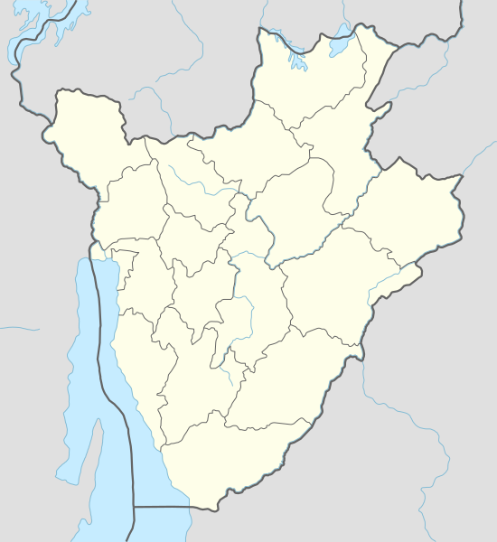
== {{int:filedesc}} == {{Information |Description= {{de|1=Positionskarte von Burundi}} {{en|1=Location map of Burundi}} {{Location map series N |stretching=100 |top=-2.2 |bottom=-4.6 |left=28.8 |right=31.0 }} |Source={{Own using}} * United States Natio...
ไฟล, burundi, location, ไฟล, ประว, ไฟล, หน, าท, ภาพน, การใช, ไฟล, วนกลาง, อม, ลเก, ยวก, บภาพขนาดของต, วอย, าง, ของไฟล, กเซล, ความละเอ, ยดอ, กเซล, กเซล, กเซล, กเซล, กเซล, กเซล, ภาพท, ความละเอ, ยดส, งกว, 8206, ไฟล, กเซล, ขนาดไฟล, โลไบต, ปภาพหร, อไฟล, เส, ยงน, นฉ. ifl prawtiifl hnathimiphaphni karichiflswnklang khxmulekiywkbphaphkhnadkhxngtwxyang PNG nikhxngifl SVG ni 550 599 phikesl khwamlaexiydxun 220 240 phikesl 440 480 phikesl 705 768 phikesl 940 1 024 phikesl 1 879 2 048 phikesl 624 680 phikesl duphaphthimikhwamlaexiydsungkwa 8206 ifl SVG 624 680 phikesl khnadifl 93 kiolibt rupphaphhruxiflesiyngni tnchbbxyuthi khxmmxns raylaexiyddanlang epnkhxkhwamthiaesdngphlcak ifltnchbbinkhxmmxns khxmmxnsepnewbistinokhrngkarsahrbekbrwbrwmsuxesri thi khunsamarthchwyid khwamyx khaxthibayBurundi adm location map svg Deutsch Positionskarte von Burundi English Location map of Burundi Francais Carte de geolocalisation du Burundi Equirectangular projection vertical stretching 100 Border coordinates 2 228 8 31 0 4 6 khxmulephimetim This map is part of a series of location maps with unified standards SVG as file format standardised colours and name scheme The boundaries on these maps always show the de facto situation and do not imply any endorsement or acceptance In case of changes of the shown area the file is updated The old version will be uploaded as a new file and thus is still available wnthi 1 thnwakhm ph s 2557aehlngthima Own work using United States National Imagery and Mapping Agency data World Data Base II dataphusrangsrrkh NordNordWestewxrchnxun 2002 2015 aephnthinithuksranghruxphthnakhuncak Kartenwerkstatt hxngptibtikaraephnthi khxngwikiphiediyphasaeyxrmn sungkhunsamarthesnxaephnthiephuxphthnaidechnediywkn azerbaycanca Deutsch Sie Form cestina Deutsch sicilianu italiano russkij romană portugues English magyar Nederlands slovenscina polski latviesu makedonski espanol فارسی francais suomi עברית Plattduutsch ქართული հայերեն ব ল ithy 日本語 中文 中文 简体 中文 繁體 العربية karxnuyatichsiththi Usage of this file with Map NordNordWest Licence Creative Commons by sa 3 0 de explanatory notes Legally binding is only the full legalcode For a free usage I recommend to respect the following licence conditions 1 Provide my name as given above NordNordWest 2 a copy of or the URI for the applicable license https creativecommons org licenses by sa 3 0 de legalcode 3 the title of the work 4 in the case of an adaptation a credit identifying the use of the work in the adaptation This license and the rights granted hereunder will terminate automatically upon any breach by you of the terms of this license Any of the above conditions can be waived if you get permission from the copyright holder If you have questions or wish differing conditions please contact me through span class nowrap nnwestt online de span or my discussion pageiflnixyuphayitsyyaxnuyat khriexthifkhxmmxns aebbaesdngthima xnuyataebbediywkn 3 0 khxngpraethseyxrmnikaraesdngthima Karte NordNordWest Lizenz Creative Commons by sa 3 0 dekhunsamarth thicaaebngpn thicathasaena aeckcay aelasngngandngklawtxip thicaeriyberiyngihm thicaddaeplngngandngklaw phayitenguxnikhtxipni aesdngthima khuntxngihekiyrtiecakhxngnganxyangehmaasm odyephimlingkipyngsyyaxnuyat aelarabuhakmikarepliynaeplng khunxacthaechnniidinrupaebbidkidtamkhwr aettxngimichinlksnathiaenawaphuihxnuyatsnbsnunkhunhruxkarichngankhxngkhun xnuyataebbediywkn hakkhunddaeplng epliynrup hruxtxetimnganni khuntxngichsyyaxnuyataebbediywknhruxaebbthiehmuxnkbsyyaxnuyatthiichkbnganniethannhttps creativecommons org licenses by sa 3 0 de deed en CC BY SA 3 0 de Creative Commons Attribution Share Alike 3 0 de true true This file has been released under a license which is incompatible with Facebook s licensing terms It is not permitted to upload this file to Facebook khabrryayodyyxithyephimkhabrryaythrrthdediywephuxkhyaykhwamwaiflnimixairixethmthiaesdngxyuiniflniprakxbdwysthanalikhsiththimilikhsiththisyyaxnuyatCreative Commons Attribution ShareAlike 3 0 Germany xngkvswnthisrang wnkxtng1 thnwakhm 2014 prawtiifl khlikwnthi ewlaephuxduiflthipraktinkhnann wnthi ewlarupyxkhnadphuichkhwamehn pccubn00 26 16 knyayn 2558624 680 93 kiolibt NordNordWestupd 22 25 1 thnwakhm 2557624 680 91 kiolibt NordNordWest int filedesc Information Description de 1 Positionskarte von Burundi en 1 Location map of Burundi Location map series N stretching 100 top 2 2 bottom 4 6 left 28 8 right 31 0 Source Own using United States Natio hnathimiphaphni hnatxipni oyngmathiphaphni kietka bucumbura mxdul Location map data Burundi mxdul Location map data Burundi doc karichiflswnklang wikixuntxipniichiflni karichbn af wikipedia org Gitega karichbn an wikipedia org Buyumbura Plantilla Mapa de localizacion Burundi karichbn ast wikipedia org Buxumbura Aeropuertu de Nyanza Lac Gitega karichbn azb wikipedia org بوجومبورا قیتقا بوروندی مورامویا بوروندی کانکوزو بوروندی موارو بوروندی بودانزا بوروندی کاروزی بوروندی سیبیتوک بوروندی کایانزا بوروندی روییقی بوروندی بوروری بوروندی نقوزی بوروندی مویینقا بوروندی روتانا بوروندی ماکامبا بوروندی کیروندو بوروندی karichbn bn wikipedia org মড উল অবস থ ন ম নচ ত র উপ ত ত ব র ন ড মড উল অবস থ ন ম নচ ত র উপ ত ত ব র ন ড নথ ব জ ম ব র karichbn ceb wikipedia org Plantilya Location map Burundi Muga Lua Banda Nambi Mabanda Maganza Karenga Mungwa Kirima Karwa Sasa pagklaro Gara Sango Tamba pagklaro Vumbi Taba Sumba pagklaro Ngombo Ngoma pagklaro Fute Damba Cumba Cimba Bumba dukarichthwolkephimetimkhxngiflnikhxmulekiywkbphaph phaphnimikhxmulephimetim sungswnihymacakklxngdicitxlhruxsaeknenxrthisamarthekbkhxmuldngklawiwrwmkbphaphid thaphaphnithukprbprungaekikhhruxepliynaeplngcakedim khxmulbangxyangcayngkhngimepliynaeplngehmuxnphaphthithukprbprungaekikhnnkhwamkwang623 625pxkhwamsung680 307px ekhathungcak https th wikipedia org wiki ifl Burundi adm location map svg, wikipedia, วิกิ หนังสือ, หนังสือ, ห้องสมุด,