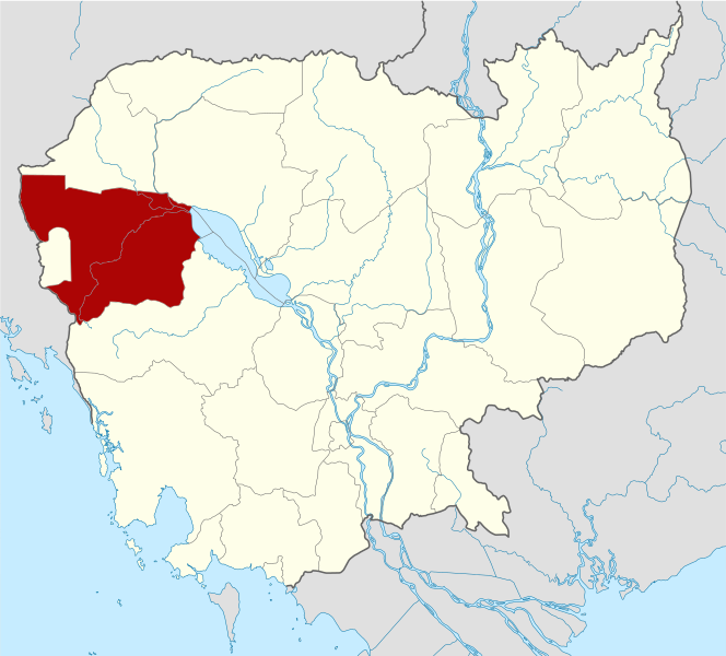
{{Information |Description={{de|Positionskarte von Kambodscha}} Quadratische Plattkarte, N-S-Streckung 105 %. Geographische Begrenzung der Karte: * N: 14.8° N * S: 9.9° N * W: 102.2° O * O: 107.9° O {{en|Location map of [[:en:Cambod
ไฟล, cambodia, battambang, locator, ไฟล, ประว, ไฟล, หน, าท, ภาพน, การใช, ไฟล, วนกลางขนาดของต, วอย, าง, ของไฟล, กเซล, ความละเอ, ยดอ, กเซล, กเซล, กเซล, กเซล, กเซล, กเซล, ภาพท, ความละเอ, ยดส, งกว, 8206, ไฟล, กเซล, ขนาดไฟล, โลไบต, ปภาพหร, อไฟล, เส, ยงน, นฉบ, บอย, . ifl prawtiifl hnathimiphaphni karichiflswnklangkhnadkhxngtwxyang PNG nikhxngifl SVG ni 664 600 phikesl khwamlaexiydxun 266 240 phikesl 531 480 phikesl 850 768 phikesl 1 133 1 024 phikesl 2 267 2 048 phikesl 1 347 1 217 phikesl duphaphthimikhwamlaexiydsungkwa 8206 ifl SVG 1 347 1 217 phikesl khnadifl 748 kiolibt rupphaphhruxiflesiyngni tnchbbxyuthi khxmmxns raylaexiyddanlang epnkhxkhwamthiaesdngphlcak ifltnchbbinkhxmmxns khxmmxnsepnewbistinokhrngkarsahrbekbrwbrwmsuxesri thi khunsamarthchwyid khaxthibayCambodia Battambang locator map svg Deutsch Positionskarte von Kambodscha Quadratische Plattkarte N S Streckung 105 nbsp Geographische Begrenzung der Karte N 14 8 N S 9 9 N W 102 2 O O 107 9 O English Location map of Cambodia with Battambang Province highlighted Equirectangular projection N S stretching 105 nbsp Geographic limits of the map N 14 8 N S 9 9 N W 102 2 E E 107 9 E wnthi 2 kumphaphnth ph s 2553 14 37 UTC aehlngthima Own work based on Cambodia location map svg nbsp ody NordNordWest phusrangsrrkh Kmusser SVG nbsp genesisInfoField nbsp sxrsokhdkhxngifl SVG niimthuktxng nbsp enuxngcakphbkhxphidphlad278 aehng nbsp iflphaphkrafiksewketxr nbsp W3C trwcsxbaelwmikhxphidphladiniflni srangkhunodyich nbsp Adobe Illustrator nbsp aelaody Inkscape phaphni idrbkarprbaetngphaph sunghmaykhwamwacaidrbkarepliynaeplngphaphtangcaktnchbb karprbprung highlighted Battambang Province tnchbbsamarthduidthini Cambodia location map svg prbaetngphaphody Kmusser nbsp khapheca inthanaphuthuxlikhsiththikhxngphaphhruxsuxni xnuyatihichphaphhruxsuxniphayitenguxnikhtxipniiflnixyuphayitsyyaxnuyat khriexthifkhxmmxns aebbaesdngthima xnuyataebbediywkn 3 0 tnchbbkhunsamarth thicaaebngpn thicathasaena aeckcay aelasngngandngklawtxip thicaeriyberiyngihm thicaddaeplngngandngklaw phayitenguxnikhtxipni aesdngthima khuntxngihekiyrtiecakhxngnganxyangehmaasm odyephimlingkipyngsyyaxnuyat aelarabuhakmikarepliynaeplng khunxacthaechnniidinrupaebbidkidtamkhwr aettxngimichinlksnathiaenawaphuihxnuyatsnbsnunkhunhruxkarichngankhxngkhun xnuyataebbediywkn hakkhunddaeplng epliynrup hruxtxetimnganni khuntxngichsyyaxnuyataebbediywknhruxaebbthiehmuxnkbsyyaxnuyatthiichkbnganniethannhttps creativecommons org licenses by sa 3 0 CC BY SA 3 0 Creative Commons Attribution Share Alike 3 0 true true xnuyatihkhdlxk aeckcayaela hruxddaeprexksarniphayitenguxnikhkhxngsyyaxnuyatexksaresrikhxngknu run 1 2 hruxrunid nbcaknithixxkodymulnithisxftaewresri odyimmiswnidhamaekikh immikhxkhwampkhnaaelapkhlng saenakhxngsyyaxnuyatrwmxyuinswnchux syyaxnuyatexksaresrikhxngknuhttp www gnu org copyleft fdl html GFDL GNU Free Documentation License true truekhunsamartheluxksyyaxnuyatdngklawtamtxngkar bnthukkarxphohld This image is a derivative work of the following images File Cambodia location map svg licensed with Cc by sa 3 0 GFDL 2009 02 12T21 35 03Z NordNordWest 1347x1217 728478 Bytes smaller file 2009 02 12T20 56 36Z NordNordWest 1347x1216 1074945 Bytes Information Description de Positionskarte von de Kambodscha Kambodscha Quadratische Plattkarte N S Streckung 105 nbsp Geographische Begrenzung der Karte N 14 8 N S 9 9 N W 102 2 O O 107 9 O khabrryayodyyxithyephimkhabrryaythrrthdediywephuxkhyaykhwamwaiflnimixairixethmthiaesdngxyuiniflniprakxbdwysthanalikhsiththimilikhsiththisyyaxnuyatGNU Free Documentation License version 1 2 or lateral nbsp xngkvsCreative Commons Attribution ShareAlike 3 0 Unported nbsp xngkvswnthisrang wnkxtng2 kumphaphnth 2010 prawtiifl khlikwnthi ewlaephuxduiflthipraktinkhnann wnthi ewlarupyxkhnadphuichkhwamehn pccubn22 16 8 mithunayn 25531 347 1 217 748 kiolibt Kmusser Information Description de Positionskarte von Kambodscha Quadratische Plattkarte N S Streckung 105 Geographische Begrenzung der Karte N 14 8 N S 9 9 N W 102 2 O O 107 9 O en Location map of en Cambod hnathimiphaphni hnatxipni oyngmathiphaphni cnghwdphratabxng karichiflswnklang wikixuntxipniichiflni karichbn ar wikipedia org محافظة باتامبانغ karichbn be wikipedia org Batambang karichbn bg wikipedia org Batambang provinciya karichbn ca wikipedia org Provincia de Battambang karichbn ceb wikipedia org Battambang lalawigan karichbn de wikivoyage org Battambang Provinz karichbn diq wikipedia org Battambang karichbn en wikipedia org Battambang province Battambang Samlaut Multiple Use Area Banan district Battambang Thma Koul District Bavel District Moung Ruessei district Moung Ruessei Rotanak Mondol District Sangkae District Samlout District Sampov Lun District Phnum Proek district Kamrieng district Koas Krala district Template Battambang province Battambang municipality Kantueu Muoy Kantueu Pir Bay Damram Chheu Teal Chaeng Mean Chey Phnum Sampov Snoeng Ta Kream Ta Pung Ta Meun Ou Ta Ki Chrey Thma Koul Anlong Run Chrouy Sdau Boeng Pring Kouk Khmum Bansay Traeng Rung Chrey Tuol Ta Aek Preaek Preah Sdach Rotanak Chamkar Samraong Sla Kaet Kdol Doun Teav Ou Mal Voat Kor dukarichthwolkephimetimkhxngiflni ekhathungcak https th wikipedia org wiki ifl Cambodia Battambang locator map svg, wikipedia, วิกิ หนังสือ, หนังสือ, ห้องสมุด,