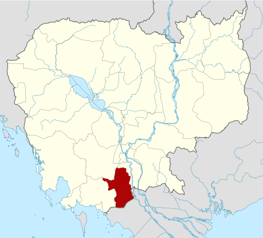
{{Information |Description={{de|Positionskarte von Kambodscha}} Quadratische Plattkarte, N-S-Streckung 105 %. Geographische Begrenzung der Karte: * N: 14.8° N * S: 9.9° N * W: 102.2° O * O: 107.9° O {{en|Location map of [[:en:Cambod
Draft:List of Southeast Asian first-level country subdivisions
استان تاکئو
Catégorie:Province de Takeo
អ្នកប្រើប្រាស់:បូរី៩៦
អ្នកប្រើប្រាស់:សុខសាន្ត
អ្នកប្រើប្រាស់:កឹម ឆៃរ៉ាតកែប
អ្នកប្រើប្រាស់:សួនវ៉ាន់ឆៃសារពត៌មាន
អ្នកប្រើប្រាស់:ឆៃរ៉ាត
Template:茶胶省行政区划
吴哥波雷县
波雷加巴县
基里翁县
德楞县
巴提县
戈安德县
占卡县
伯雷楚萨县
มกราคม 19, 2023
ไฟล, cambodia, takéo, locator, ไฟล, ประว, ไฟล, หน, าท, ภาพน, การใช, ไฟล, วนกลางขนาดของต, วอย, าง, ของไฟล, กเซล, ความละเอ, ยดอ, กเซล, กเซล, กเซล, กเซล, กเซล, กเซล, ภาพท, ความละเอ, ยดส, งกว, 8206, ไฟล, กเซล, ขนาดไฟล, โลไบต, ปภาพหร, อไฟล, เส, ยงน, นฉบ, บอย, คอมมอ. ifl prawtiifl hnathimiphaphni karichiflswnklangkhnadkhxngtwxyang PNG nikhxngifl SVG ni 664 600 phikesl khwamlaexiydxun 266 240 phikesl 531 480 phikesl 850 768 phikesl 1 133 1 024 phikesl 2 267 2 048 phikesl 1 347 1 217 phikesl duphaphthimikhwamlaexiydsungkwa 8206 ifl SVG 1 347 1 217 phikesl khnadifl 731 kiolibt rupphaphhruxiflesiyngni tnchbbxyuthi khxmmxns raylaexiyddanlang epnkhxkhwamthiaesdngphlcak ifltnchbbinkhxmmxns khxmmxnsepnewbistinokhrngkarsahrbekbrwbrwmsuxesri thi khunsamarthchwyid khaxthibayCambodia Takeo locator map svg Deutsch Positionskarte von Kambodscha Quadratische Plattkarte N S Streckung 105 Geographische Begrenzung der Karte N 14 8 N S 9 9 N W 102 2 O O 107 9 O English Location map of Cambodia with Takeo Province highlighted Equirectangular projection N S stretching 105 Geographic limits of the map N 14 8 N S 9 9 N W 102 2 E E 107 9 Ewnthi 2 kumphaphnth ph s 2553 14 37 UTC aehlngthima Own work based on Cambodia location map svgphusrangsrrkh KmusserSVG genesisInfoField sxrsokhdkhxngifl SVG niimthuktxng enuxngcakphbkhxphidphlad278 aehng iflphaphkrafiksewketxr W3C trwcsxbaelwmikhxphidphladiniflni srangkhunodyich Adobe Illustrator aelaody Inkscape phaphni idrbkarprbaetngphaph sunghmaykhwamwacaidrbkarepliynaeplngphaphtangcaktnchbb karprbprung highlighted Takeo Province tnchbbsamarthduidthini Cambodia location map svg prbaetngphaphody Kmusser khapheca inthanaphuthuxlikhsiththikhxngphaphhruxsuxni xnuyatihichphaphhruxsuxniphayitenguxnikhtxipniiflnixyuphayitsyyaxnuyat khriexthifkhxmmxns aebbaesdngthima xnuyataebbediywkn 3 0 tnchbbkhunsamarth thicaaebngpn thicathasaena aeckcay aelasngngandngklawtxip thicaeriyberiyngihm thicaddaeplngngandngklaw phayitenguxnikhtxipni aesdngthima khuntxngihekiyrtiecakhxngnganxyangehmaasm odyephimlingkipyngsyyaxnuyat aelarabuhakmikarepliynaeplng khunxacthaechnniidinrupaebbidkidtamkhwr aettxngimichinlksnathiaenawaphuihxnuyatsnbsnunkhunhruxkarichngankhxngkhun xnuyataebbediywkn hakkhunddaeplng epliynrup hruxtxetimnganni khuntxngichsyyaxnuyataebbediywknhruxaebbthiehmuxnkbsyyaxnuyatthiichkbnganniethannhttps creativecommons org licenses by sa 3 0 CC BY SA 3 0 Creative Commons Attribution Share Alike 3 0 true true xnuyatihkhdlxk aeckcayaela hruxddaeprexksarniphayitenguxnikhkhxngsyyaxnuyatexksaresrikhxngknu run 1 2 hruxrunid nbcaknithixxkodymulnithisxftaewresri odyimmiswnidhamaekikh immikhxkhwampkhnaaelapkhlng saenakhxngsyyaxnuyatrwmxyuinswnchux syyaxnuyatexksaresrikhxngknuhttp www gnu org copyleft fdl html GFDL GNU Free Documentation License true truekhunsamartheluxksyyaxnuyatdngklawtamtxngkar bnthukkarxphohld This image is a derivative work of the following images File Cambodia location map svg licensed with Cc by sa 3 0 GFDL 2009 02 12T21 35 03Z NordNordWest 1347x1217 728478 Bytes smaller file 2009 02 12T20 56 36Z NordNordWest 1347x1216 1074945 Bytes Information Description de Positionskarte von de Kambodscha Kambodscha Quadratische Plattkarte N S Streckung 105 Geographische Begrenzung der Karte N 14 8 N S 9 9 N W 102 2 O O 107 9 O khabrryayodyyxithyephimkhabrryaythrrthdediywephuxkhyaykhwamwaiflnimixairixethmthiaesdngxyuiniflniprakxbdwysthanalikhsiththimilikhsiththisyyaxnuyatGNU Free Documentation License version 1 2 or later xngkvsCreative Commons Attribution ShareAlike 3 0 Unported xngkvswnthisrang wnkxtng2 kumphaphnth 2010 prawtiifl khlikwnthi ewlaephuxduiflthipraktinkhnann wnthi ewlarupyxkhnadphuichkhwamehn pccubn22 32 8 mithunayn 25531 347 1 217 731 kiolibt Kmusser Information Description de Positionskarte von Kambodscha Quadratische Plattkarte N S Streckung 105 Geographische Begrenzung der Karte N 14 8 N S 9 9 N W 102 2 O O 107 9 O en Location map of en Cambod hnathimiphaphni hnatxipni oyngmathiphaphni cnghwdtaaekw karichiflswnklang wikixuntxipniichiflni karichbn ar wikipedia org محافظة تاكو karichbn bg wikipedia org Takeo provinciya karichbn ceb wikipedia org Takeo lalawigan karichbn de wikivoyage org Takeo Provinz karichbn en wikipedia org Takeo province Draft List of Southeast Asian first level country subdivisions karichbn es wikipedia org Provincia de Takeo karichbn et wikipedia org Takevi provints karichbn fa wikipedia org تکئو استان تاکئو karichbn fi wikipedia org Takev maakunta karichbn fr wikipedia org Province de Takeo Categorie Province de Takeo karichbn hi wikipedia org त क ओ प र न त karichbn it wikipedia org Provincia di Takeo karichbn ja wikipedia org タケオ州 karichbn km wikipedia org ខ ត តត ក វ អ នកប រ ប រ ស ប រ ៩៦ អ នកប រ ប រ ស ស ខស ន ត អ នកប រ ប រ ស ក ម ឆ រ តក ប អ នកប រ ប រ ស ស នវ ន ឆ ស រពត ម ន អ នកប រ ប រ ស ឆ រ ត karichbn ko wikipedia org 타케오주 karichbn lv wikipedia org Kambodzas administrativais iedalijums karichbn nl wikipedia org Takev provincie karichbn pl wikipedia org Takev prowincja karichbn ru wikipedia org Takeo provinciya karichbn sco wikipedia org Takeo Province karichbn simple wikipedia org Takeo province karichbn sv wikipedia org Takeo provins karichbn uk wikipedia org Takeo provinciya karichbn ur wikipedia org تاکیو صوبہ karichbn vi wikipedia org Takeo karichbn www wikidata org Q613345 karichbn zh min nan wikipedia org Takeo Seng karichbn zh wikipedia org 茶胶省 Template 茶胶省行政区划 吴哥波雷县 波雷加巴县 基里翁县 德楞县 巴提县 戈安德县 占卡县 伯雷楚萨县 ekhathungcak https th wikipedia org wiki ifl Cambodia Takeo locator map svg, wikipedia, วิกิ หนังสือ, หนังสือ, ห้องสมุด,