รูปภาพหรือไฟล์เสียงนี้ ต้นฉบับอยู่ที่ คอมมอนส์ รายละเอียดด้านล่าง เป็นข้อความที่แสดงผลจาก ไฟล์ต้นฉบับในคอมมอนส์ คอมมอนส์เป็นเว็บไซต์ในโครงการสำหรับเก็บรวบรวมสื่อเสรี ที่ คุณสามารถช่วยได้
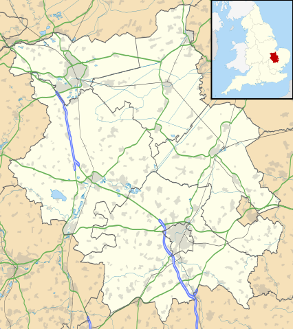
คำอธิบายCambridgeshire UK location map.svg Map of Cambridgeshire, UK with the following information shown:
Administrative borders Coastline, lakes and rivers Roads and railways Urban areas Equirectangular map projection on WGS 84 datum, with N/S stretched 160%
Geographic limits:
West: 0.53W East: 0.55E North: 52.75N South: 51.99N วันที่ 26 กันยายน พ.ศ. 2553 แหล่งที่มา Ordnance Survey OpenData.
Administrative borders and coastline data from Boundary-Line product. All other geographic data from Meridian 2 product. Inset derived from England location map.svg by Spischot. ผู้สร้างสรรค์ Nilfanion, created using Ordnance Survey data การอนุญาต(การใช้ไฟล์นี้ใหม่)
ไฟล์นี้อยู่ภายใต้สัญญาอนุญาต ครีเอทีฟคอมมอนส์ แบบแสดงที่มา-อนุญาตแบบเดียวกัน 3.0 ต้นฉบับ
การแสดงที่มา: Contains Ordnance Survey data © Crown copyright and database right
คุณสามารถ: ที่จะแบ่งปัน – ที่จะทำสำเนา แจกจ่าย และส่งงานดังกล่าวต่อไปที่จะเรียบเรียงใหม่ – ที่จะดัดแปลงงานดังกล่าว ภายใต้เงื่อนไขต่อไปนี้: แสดงที่มา – คุณต้องให้เกียรติเจ้าของงานอย่างเหมาะสม โดยเพิ่มลิงก์ไปยังสัญญาอนุญาต และระบุหากมีการเปลี่ยนแปลง คุณอาจทำเช่นนี้ได้ในรูปแบบใดก็ได้ตามควร แต่ต้องไม่ใช่ในลักษณะที่แนะว่าผู้ให้อนุญาตสนับสนุนคุณหรือการใช้งานของคุณอนุญาตแบบเดียวกัน – หากคุณดัดแปลง เปลี่ยนรูป หรือต่อเติมงานนี้ คุณต้องใช้สัญญาอนุญาตแบบเดียวกันหรือแบบที่เหมือนกับสัญญาอนุญาตที่ใช้กับงานนี้เท่านั้น https://creativecommons.org/licenses/by-sa/3.0 CC BY-SA 3.0 Creative Commons Attribution-Share Alike 3.0 true true เวอร์ชันอื่น File:Cambridgeshire UK district map (blank).svg - Blank map
ไทย เพิ่มคำบรรยายทรรทัดเดียวเพื่อขยายความว่าไฟล์นี้มีอะไร
อังกฤษ Map of Cambridgeshire, UK
ประวัติไฟล์ คลิกวันที่/เวลาเพื่อดูไฟล์ที่ปรากฏในขณะนั้น
วันที่/เวลา รูปย่อ ขนาด ผู้ใช้ ความเห็น ปัจจุบัน 01:41, 27 กันยายน 2553 1,125 × 1,266 (1.79 เมกะไบต์) Nilfanion {{Information |Description=Map of Cambridgeshire, UK with the following information shown: *Administrative borders *Coastline, lakes and rivers *Roads and railways *Urban areas Equirectangular map projection on WGS 84 datum, with N/S
หน้าที่มีภาพนี้ หน้าต่อไปนี้ โยงมาที่ภาพนี้:
การใช้ไฟล์ส่วนกลาง วิกิอื่นต่อไปนี้ใช้ไฟล์นี้:
Kimbolton Castle St Ives, Cambridgeshire Littleport Ramsey Abbey St Neots Eye, Cambridgeshire Eye Green Grantchester Wisbech Coton, Cambridgeshire Flag Fen Burwell, Cambridgeshire Huntingdon Perry, Cambridgeshire Gamlingay Godmanchester Eynesbury, Cambridgeshire Eaton Ford Eaton Socon Kimbolton, Cambridgeshire Chesterton, Cambridge Cambourne Soham Duxford Ramsey, Cambridgeshire Orton, Peterborough Whittlesey March, Cambridgeshire Girton College, Cambridge Chatteris Caldecote, South Cambridgeshire Addenbrooke's Hospital The Abingtons, Cambridgeshire Meldreth Denny Abbey Wimpole Estate Anglesey Abbey Hampton, Peterborough Isleham Witcham Fulbourn Great Wilbraham Little Wilbraham RAF Brampton Ely Cathedral Wilburton ดูการใช้ทั่วโลกเพิ่มเติม ของไฟล์นี้
ภาพนี้มีข้อมูลเพิ่มเติม ซึ่งส่วนใหญ่มาจากกล้องดิจิตอลหรือสแกนเนอร์ที่สามารถเก็บข้อมูลดังกล่าวไว้รวมกับภาพได้ ถ้าภาพนี้ถูกปรับปรุงแก้ไขหรือเปลี่ยนแปลงจากเดิม ข้อมูลบางอย่างจะยังคงไม่เปลี่ยนแปลงเหมือนภาพที่ถูกปรับปรุงแก้ไขนั้น
ไฟล, cambridgeshire, location, ไฟล, ประว, ไฟล, หน, าท, ภาพน, การใช, ไฟล, วนกลาง, อม, ลเก, ยวก, บภาพขนาดของต, วอย, าง, ของไฟล, กเซล, ความละเอ, ยดอ, กเซล, กเซล, กเซล, กเซล, กเซล, กเซล, ภาพท, ความละเอ, ยดส, งกว, 8206, ไฟล, กเซล, ขนาดไฟล, เมกะไบต, ปภาพหร, อไฟล, เส. ifl prawtiifl hnathimiphaphni karichiflswnklang khxmulekiywkbphaphkhnadkhxngtwxyang PNG nikhxngifl SVG ni 533 600 phikesl khwamlaexiydxun 213 240 phikesl 426 480 phikesl 682 768 phikesl 910 1 024 phikesl 1 820 2 048 phikesl 1 125 1 266 phikesl duphaphthimikhwamlaexiydsungkwa 8206 ifl SVG 1 125 1 266 phikesl khnadifl 1 79 emkaibt rupphaphhruxiflesiyngni tnchbbxyuthi khxmmxns raylaexiyddanlang epnkhxkhwamthiaesdngphlcak ifltnchbbinkhxmmxns khxmmxnsepnewbistinokhrngkarsahrbekbrwbrwmsuxesri thi khunsamarthchwyid khaxthibayCambridgeshire UK location map svg Map of Cambridgeshire UK with the following information shown Administrative borders Coastline lakes and rivers Roads and railways Urban areasEquirectangular map projection on WGS 84 datum with N S stretched 160 Geographic limits West 0 53W East 0 55E North 52 75N South 51 99Nwnthi 26 knyayn ph s 2553aehlngthima Ordnance Survey OpenData Administrative borders and coastline data from Boundary Line product All other geographic data from Meridian 2 product Inset derived from England location map svg by Spischot phusrangsrrkh Nilfanion created using Ordnance Survey datakarxnuyat karichiflniihm iflnixyuphayitsyyaxnuyat khriexthifkhxmmxns aebbaesdngthima xnuyataebbediywkn 3 0 tnchbbkaraesdngthima Contains Ordnance Survey data c Crown copyright and database rightkhunsamarth thicaaebngpn thicathasaena aeckcay aelasngngandngklawtxip thicaeriyberiyngihm thicaddaeplngngandngklaw phayitenguxnikhtxipni aesdngthima khuntxngihekiyrtiecakhxngnganxyangehmaasm odyephimlingkipyngsyyaxnuyat aelarabuhakmikarepliynaeplng khunxacthaechnniidinrupaebbidkidtamkhwr aettxngimichinlksnathiaenawaphuihxnuyatsnbsnunkhunhruxkarichngankhxngkhun xnuyataebbediywkn hakkhunddaeplng epliynrup hruxtxetimnganni khuntxngichsyyaxnuyataebbediywknhruxaebbthiehmuxnkbsyyaxnuyatthiichkbnganniethannhttps creativecommons org licenses by sa 3 0 CC BY SA 3 0 Creative Commons Attribution Share Alike 3 0 true trueewxrchnxun File Cambridgeshire UK district map blank svg Blank mapkhabrryayodyyxithyephimkhabrryaythrrthdediywephuxkhyaykhwamwaiflnimixairxngkvsMap of Cambridgeshire UKixethmthiaesdngxyuiniflniprakxbdwyekhmbridcechxrsthanalikhsiththimilikhsiththisyyaxnuyatCreative Commons Attribution ShareAlike 3 0 Unported xngkvswnthisrang wnkxtng26 knyayn 2010 prawtiifl khlikwnthi ewlaephuxduiflthipraktinkhnann wnthi ewlarupyxkhnadphuichkhwamehn pccubn01 41 27 knyayn 25531 125 1 266 1 79 emkaibt Nilfanion Information Description Map of Cambridgeshire UK with the following information shown Administrative borders Coastline lakes and rivers Roads and railways Urban areas Equirectangular map projection on WGS 84 datum with N S hnathimiphaphni hnatxipni oyngmathiphaphni xasnwiharxili hnthingdxn mxdul Location map data United Kingdom Cambridgeshire mxdul Location map data United Kingdom Cambridgeshire doc karichiflswnklang wikixuntxipniichiflni karichbn ar wikipedia org قالب Location map United Kingdom Cambridgeshire karichbn bg wikipedia org Shablon PK Velikobritaniya Kejmbridzhshr karichbn ceb wikipedia org Plantilya Location map United Kingdom Cambridgeshire karichbn en wikipedia org Peterborough Kimbolton Castle St Ives Cambridgeshire Littleport Ramsey Abbey St Neots Eye Cambridgeshire Eye Green Grantchester Wisbech Coton Cambridgeshire Flag Fen Burwell Cambridgeshire Huntingdon Perry Cambridgeshire Gamlingay Godmanchester Eynesbury Cambridgeshire Eaton Ford Eaton Socon Kimbolton Cambridgeshire Chesterton Cambridge Cambourne Soham Duxford Ramsey Cambridgeshire Orton Peterborough Whittlesey March Cambridgeshire Girton College Cambridge Chatteris Caldecote South Cambridgeshire Addenbrooke s Hospital The Abingtons Cambridgeshire Meldreth Denny Abbey Wimpole Estate Anglesey Abbey Hampton Peterborough Isleham Witcham Fulbourn Great Wilbraham Little Wilbraham RAF Brampton Ely Cathedral Wilburton dukarichthwolkephimetimkhxngiflnikhxmulekiywkbphaph phaphnimikhxmulephimetim sungswnihymacakklxngdicitxlhruxsaeknenxrthisamarthekbkhxmuldngklawiwrwmkbphaphid thaphaphnithukprbprungaekikhhruxepliynaeplngcakedim khxmulbangxyangcayngkhngimepliynaeplngehmuxnphaphthithukprbprungaekikhnnkhwamkwang1125khwamsung1266 ekhathungcak https th wikipedia org wiki ifl Cambridgeshire UK location map svg, wikipedia, วิกิ หนังสือ, หนังสือ, ห้องสมุด,
บทความ , อ่าน, ดาวน์โหลด, ฟรี, ดาวน์โหลดฟรี, mp3, วิดีโอ, mp4, 3gp, jpg, jpeg, gif, png, รูปภาพ, เพลง, เพลง, หนัง, หนังสือ, เกม, เกม