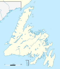
Français : Carte administrative de Terre-Neuve, Canada.
Čeština: Pee Pee Island se nachází v New Foundlandu
Projection équirectangulaire. Image étirée N/S de 160%. Coordonnées des bords de carte :
Top : 52.1
Bottom : 46.52
Left : -59.85
Right : -52.03
วันที่
แหล่งที่มา
Canada Newfoundland and Labrador relief location map.jpg
ผู้สร้างสรรค์
NordNordWest (original map), Flappiefh (cropping, scale and graticules).
เวอร์ชันอื่น
Physical map
This map was improved or created by the Wikigraphists of the Graphic Lab (fr). You can propose images to clean up, improve, create or translate as well.
ไฟล, canada, newfoundland, location, ไฟล, ประว, ไฟล, หน, าท, ภาพน, การใช, ไฟล, วนกลาง, อม, ลเก, ยวก, บภาพขนาดของต, วอย, าง, ของไฟล, กเซล, ความละเอ, ยดอ, กเซล, กเซล, กเซล, กเซล, กเซล, กเซล, ภาพท, ความละเอ, ยดส, งกว, 8206, ไฟล, กเซล, ขนาดไฟล, โลไบต, ปภาพหร, อไฟล. ifl prawtiifl hnathimiphaphni karichiflswnklang khxmulekiywkbphaphkhnadkhxngtwxyang PNG nikhxngifl SVG ni 524 599 phikesl khwamlaexiydxun 210 240 phikesl 420 480 phikesl 672 768 phikesl 896 1 024 phikesl 1 791 2 048 phikesl 824 942 phikesl duphaphthimikhwamlaexiydsungkwa 8206 ifl SVG 824 942 phikesl khnadifl 236 kiolibt rupphaphhruxiflesiyngni tnchbbxyuthi khxmmxns raylaexiyddanlang epnkhxkhwamthiaesdngphlcak ifltnchbbinkhxmmxns khxmmxnsepnewbistinokhrngkarsahrbekbrwbrwmsuxesri thi khunsamarthchwyid khwamyx khaxthibayCanada Newfoundland location map svg Francais Carte administrative de Terre Neuve Canada Cestina Pee Pee Island se nachazi v New FoundlanduProjection equirectangulaire Image etiree N S de 160 Coordonnees des bords de carte Top 52 1 Bottom 46 52 Left 59 85 Right 52 03wnthi 8 phvscikayn ph s 2558aehlngthima Canada Newfoundland and Labrador relief location map jpgphusrangsrrkh NordNordWest original map Flappiefh cropping scale and graticules ewxrchnxun Physical map This map was improved or created by the Wikigraphists of the Graphic Lab fr You can propose images to clean up improve create or translate as well karxnuyatichsiththi iflnixyuphayitsyyaxnuyat khriexthifkhxmmxns aebbaesdngthima xnuyataebbediywkn 3 0 tnchbbkhunsamarth thicaaebngpn thicathasaena aeckcay aelasngngandngklawtxip thicaeriyberiyngihm thicaddaeplngngandngklaw phayitenguxnikhtxipni aesdngthima khuntxngihekiyrtiecakhxngnganxyangehmaasm odyephimlingkipyngsyyaxnuyat aelarabuhakmikarepliynaeplng khunxacthaechnniidinrupaebbidkidtamkhwr aettxngimichinlksnathiaenawaphuihxnuyatsnbsnunkhunhruxkarichngankhxngkhun xnuyataebbediywkn hakkhunddaeplng epliynrup hruxtxetimnganni khuntxngichsyyaxnuyataebbediywknhruxaebbthiehmuxnkbsyyaxnuyatthiichkbnganniethannhttps creativecommons org licenses by sa 3 0 CC BY SA 3 0 Creative Commons Attribution Share Alike 3 0 true truekhabrryayodyyxithyephimkhabrryaythrrthdediywephuxkhyaykhwamwaiflnimixairxngkvsAdministrative map of Newfoundland Canada ixethmthiaesdngxyuiniflniprakxbdwyekaaniwfndaelndsthanalikhsiththimilikhsiththisyyaxnuyatCreative Commons Attribution ShareAlike 3 0 Unported xngkvswnthisrang wnkxtng8 phvscikayn 2015 prawtiifl khlikwnthi ewlaephuxduiflthipraktinkhnann wnthi ewlarupyxkhnadphuichkhwamehn pccubn04 06 9 phvscikayn 2558824 942 236 kiolibt FlappiefhRemoved compass 03 58 9 phvscikayn 2558824 942 244 kiolibt FlappiefhUser created page with UploadWizard hnathimiphaphni hnatxipni oyngmathiphaphni khabsmuthraexwalxn esntcxns rthniwfndaelndaelaaelbradxr aelnosemods mxdul Location map data Canada Newfoundland mxdul Location map data Canada Newfoundland doc karichiflswnklang wikixuntxipniichiflni karichbn ban wikipedia org L Anse aux Meadows karichbn bg wikipedia org Ekologichen rezervat Mistejkn Pojnt karichbn de wikipedia org ECHL Mistaken Point Vorlage Positionskarte Kanada Neufundland ECHL 2019 20 ECHL 2021 22 ECHL 2022 23 karichbn en wikipedia org Geography of Saint Pierre and Miquelon Paradise Newfoundland and Labrador Holyrood Newfoundland and Labrador Harbour Main Chapel s Cove Lakeview Avondale Newfoundland and Labrador Conception Harbour Colliers Newfoundland and Labrador Whitbourne Newfoundland and Labrador Arnold s Cove Come By Chance Newfoundland and Labrador Sunnyside Newfoundland and Labrador Clarenville Port Blandford Traytown Glovertown Gambo Newfoundland and Labrador Gander Newfoundland and Labrador Appleton Newfoundland and Labrador Glenwood Newfoundland and Labrador Norris Arm Bishop s Falls Grand Falls Windsor Badger Newfoundland and Labrador Avalon Peninsula Bonavista Newfoundland and Labrador Corner Brook Cuper s Cove Ferryland Belle Isle Newfoundland and Labrador Upper Island Cove Stephenville Newfoundland and Labrador Cape Spear Deer Lake Newfoundland and Labrador Channel Port aux Basques Cape Race Lawn Newfoundland and Labrador Musgravetown Red Bay Newfoundland and Labrador St Anthony Newfoundland and Labrador Placentia Bay Botwood Twillingate dukarichthwolkephimetimkhxngiflnikhxmulekiywkbphaph phaphnimikhxmulephimetim sungswnihymacakklxngdicitxlhruxsaeknenxrthisamarthekbkhxmuldngklawiwrwmkbphaphid thaphaphnithukprbprungaekikhhruxepliynaeplngcakedim khxmulbangxyangcayngkhngimepliynaeplngehmuxnphaphthithukprbprungaekikhnnkhwamkwang824khwamsung942 ekhathungcak https th wikipedia org wiki ifl Canada Newfoundland location map svg, wikipedia, วิกิ หนังสือ, หนังสือ, ห้องสมุด,