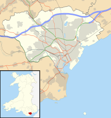
{{Information |Description=Blank map of Cardiff, UK with the following information shown: *Administrative borders *Coastline, lakes and rivers *Roads and railways *Urban areas Equirectangular map projection on WGS 84 datum, with N/S stretch
ไฟล, cardiff, location, ไฟล, ประว, ไฟล, หน, าท, ภาพน, การใช, ไฟล, วนกลางขนาดของต, วอย, าง, ของไฟล, กเซล, ความละเอ, ยดอ, กเซล, กเซล, กเซล, กเซล, กเซล, กเซล, ภาพท, ความละเอ, ยดส, งกว, 8206, ไฟล, กเซล, ขนาดไฟล, โลไบต, ปภาพหร, อไฟล, เส, ยงน, นฉบ, บอย, คอมมอนส, ราย. ifl prawtiifl hnathimiphaphni karichiflswnklangkhnadkhxngtwxyang PNG nikhxngifl SVG ni 562 599 phikesl khwamlaexiydxun 225 240 phikesl 450 480 phikesl 720 768 phikesl 960 1 024 phikesl 1 920 2 048 phikesl 1 187 1 266 phikesl duphaphthimikhwamlaexiydsungkwa 8206 ifl SVG 1 187 1 266 phikesl khnadifl 464 kiolibt rupphaphhruxiflesiyngni tnchbbxyuthi khxmmxns raylaexiyddanlang epnkhxkhwamthiaesdngphlcak ifltnchbbinkhxmmxns khxmmxnsepnewbistinokhrngkarsahrbekbrwbrwmsuxesri thi khunsamarthchwyid khaxthibayCardiff UK location map svg Blank map of Cardiff UK with the following information shown Administrative borders Coastline lakes and rivers Roads and railways Urban areasEquirectangular map projection on WGS 84 datum with N S stretched 160 Geographic limits West 3 35W East 3 05W North 51 57N South 51 37Nwnthi 26 knyayn ph s 2553aehlngthima Ordnance Survey OpenData Administrative borders and coastline data from Boundary Line product All other geographic data from Meridian 2 product Inset derived from File United Kingdom location map svg by NordNordWest phusrangsrrkh Nilfanion created using Ordnance Survey datakarxnuyat karichiflniihm iflnixyuphayitsyyaxnuyat khriexthifkhxmmxns aebbaesdngthima xnuyataebbediywkn 3 0 tnchbbkaraesdngthima Contains Ordnance Survey data c Crown copyright and database rightkhunsamarth thicaaebngpn thicathasaena aeckcay aelasngngandngklawtxip thicaeriyberiyngihm thicaddaeplngngandngklaw phayitenguxnikhtxipni aesdngthima khuntxngihekiyrtiecakhxngnganxyangehmaasm odyephimlingkipyngsyyaxnuyat aelarabuhakmikarepliynaeplng khunxacthaechnniidinrupaebbidkidtamkhwr aettxngimichinlksnathiaenawaphuihxnuyatsnbsnunkhunhruxkarichngankhxngkhun xnuyataebbediywkn hakkhunddaeplng epliynrup hruxtxetimnganni khuntxngichsyyaxnuyataebbediywknhruxaebbthiehmuxnkbsyyaxnuyatthiichkbnganniethannhttps creativecommons org licenses by sa 3 0 CC BY SA 3 0 Creative Commons Attribution Share Alike 3 0 true trueewxrchnxun File Cardiff UK map svg Blank mapkhabrryayodyyxithyephimkhabrryaythrrthdediywephuxkhyaykhwamwaiflnimixairixethmthiaesdngxyuiniflniprakxbdwysthanalikhsiththimilikhsiththisyyaxnuyatCreative Commons Attribution ShareAlike 3 0 Unported xngkvswnthisrang wnkxtng26 knyayn 2010 prawtiifl khlikwnthi ewlaephuxduiflthipraktinkhnann wnthi ewlarupyxkhnadphuichkhwamehn pccubn02 29 27 knyayn 25531 187 1 266 464 kiolibt Nilfanion Information Description Blank map of Cardiff UK with the following information shown Administrative borders Coastline lakes and rivers Roads and railways Urban areas Equirectangular map projection on WGS 84 datum with N S stretch hnathimiphaphni hnatxipni oyngmathiphaphni khardiff karichiflswnklang wikixuntxipniichiflni karichbn ar wikipedia org قالب Location map Wales Cardiff karichbn bh wikipedia org क र ड फ karichbn bn wikipedia org ক র ড ফ karichbn ceb wikipedia org Plantilya Location map Wales Cardiff karichbn cy wikipedia org Caerdydd Nodyn Gwybodlen lle Nodyn Gwybodlen lle doc karichbn da wikipedia org Cardiff karichbn el wikipedia org Protypo Location map Oyalia Karntif karichbn en wikipedia org Cardiff Llandaff Llandaff Cathedral Cardiff Castle List of monastic houses in Wales Thornhill Cardiff Cardiff Bay Castell Coch Gwaelod y Garth Rhiwbina Tremorfa Llanrumney Cathays St Fagans Lisvane Radyr Gabalfa Mynachdy Cyncoed St Mellons Michaelston super Ely Adamsdown Cardiff city centre Whitchurch Cardiff St Fagans National Museum of History Pentyrch Ely Cardiff Canton Cardiff Birchgrove Cardiff The Point Cardiff Coal Exchange Tongwynlais University Hospital of Wales Rhydlafar Cardiff West services Rookwood Hospital Pontprennau Cardiff Gate services Caerau Cardiff Cardiff Royal Infirmary Whitchurch Hospital dukarichthwolkephimetimkhxngiflni ekhathungcak https th wikipedia org wiki ifl Cardiff UK location map svg, wikipedia, วิกิ หนังสือ, หนังสือ, ห้องสมุด,