รูปภาพหรือไฟล์เสียงนี้ ต้นฉบับอยู่ที่ คอมมอนส์ รายละเอียดด้านล่าง เป็นข้อความที่แสดงผลจาก ไฟล์ต้นฉบับในคอมมอนส์ คอมมอนส์เป็นเว็บไซต์ในโครงการสำหรับเก็บรวบรวมสื่อเสรี ที่ คุณสามารถช่วยได้
ความย่อ คำอธิบายChile location map.svg Deutsch:
Quadratische Plattkarte, N-S-Streckung 115 %. Geographische Begrenzung der Karte:
N: 17.4° S S: 56.5° S W: 81.5° W O: 61.5° W English:
Equirectangular projection, N/S stretching 115 %. Geographic limits of the map:
N: 17.4° S S: 56.5° S W: 81.5° W E: 61.5° W Español:
Proyección Equirectangular, N/S con una extensión de 115 %. Límites geográficos del mapa:
N: 17.4° S S: 56.5° S O: 81.5° O E: 61.5° O วันที่ 20 พฤษภาคม พ.ศ. 2551 แหล่งที่มา own work, using
United States National Imagery and Mapping Agency data World Data Base II data ผู้สร้างสรรค์ NordNordWest เวอร์ชันอื่น ไฟล์อื่นที่ใช้ไฟล์นี้:
Chile location map (+claims).svg Chile location map (+1998 agreement rectangle).svg Chile location map (+claims until 1994).svg Chile location map (+claims, 1899).svg Mapa de Chile, año 1899.svg Hippocamelus bisulcus.svg Relief Map of Chile.jpg Telmatobufo bullocki.svg Telmatobufo australis.svg Telmatobufo venustus.svg Pueblos indigenas de Chile.svg Pueblos indigenas de Chile-ver.svg Natural Regions of Chile.svg Arica y Parinacota location map.svg Tarapacá location map.svg Los Lagos location map.svg Aysén location map.svg Chile en Wikiviajes.svg
แผนที่นี้ถูกสร้างหรือพัฒนาขึ้นจาก Kartenwerkstatt (ห้องปฏิบัติการแผนที่) ของวิกิพีเดียภาษาเยอรมัน ซึ่งคุณสามารถเสนอแผนที่เพื่อพัฒนาได้เช่นเดียวกัน
azərbaycanca ∙ Deutsch (Sie-Form) ∙ čeština ∙ Deutsch ∙ sicilianu ∙ italiano ∙ русский ∙ română ∙ português ∙ English ∙ magyar ∙ Nederlands ∙ slovenščina ∙ polski ∙ latviešu ∙ македонски ∙ español ∙ فارسی ∙ français ∙ suomi ∙ עברית ∙ Plattdüütsch ∙ ქართული ∙ հայերեն ∙ বাংলা ∙ ไทย ∙ 日本語 ∙ 中文 ∙ 中文(简体) ∙ 中文(繁體) ∙ العربية ∙ +/−
การอนุญาตใช้สิทธิ ข้าพเจ้า ในฐานะผู้ถือลิขสิทธิ์ของภาพหรือสื่อนี้ อนุญาตให้ใช้ภาพหรือสื่อนี้ภายใต้เงื่อนไขต่อไปนี้
อนุญาตให้คัดลอก แจกจ่ายและ/หรือดัดแปรเอกสารนี้ภายใต้เงื่อนไขของสัญญาอนุญาตเอกสารเสรีของกนู รุ่น 1.2 หรือรุ่นใด ๆ นับจากนี้ที่ออกโดยมูลนิธิซอฟต์แวร์เสรี โดยไม่มีส่วนใดห้ามแก้ไข ไม่มีข้อความปกหน้าและปกหลัง สำเนาของสัญญาอนุญาตรวมอยู่ในส่วนชื่อ สัญญาอนุญาตเอกสารเสรีของกนู http://www.gnu.org/copyleft/fdl.html GFDL GNU Free Documentation License true true
ไฟล์นี้อยู่ภายใต้สัญญาอนุญาต ครีเอทีฟคอมมอนส์ แบบแสดงที่มา-อนุญาตแบบเดียวกัน 3.0 ต้นฉบับ
คุณสามารถ: ที่จะแบ่งปัน – ที่จะทำสำเนา แจกจ่าย และส่งงานดังกล่าวต่อไปที่จะเรียบเรียงใหม่ – ที่จะดัดแปลงงานดังกล่าว ภายใต้เงื่อนไขต่อไปนี้: แสดงที่มา – คุณต้องให้เกียรติเจ้าของงานอย่างเหมาะสม โดยเพิ่มลิงก์ไปยังสัญญาอนุญาต และระบุหากมีการเปลี่ยนแปลง คุณอาจทำเช่นนี้ได้ในรูปแบบใดก็ได้ตามควร แต่ต้องไม่ใช่ในลักษณะที่แนะว่าผู้ให้อนุญาตสนับสนุนคุณหรือการใช้งานของคุณอนุญาตแบบเดียวกัน – หากคุณดัดแปลง เปลี่ยนรูป หรือต่อเติมงานนี้ คุณต้องใช้สัญญาอนุญาตแบบเดียวกันหรือแบบที่เหมือนกับสัญญาอนุญาตที่ใช้กับงานนี้เท่านั้น https://creativecommons.org/licenses/by-sa/3.0 CC BY-SA 3.0 Creative Commons Attribution-Share Alike 3.0 true true คุณสามารถเลือกสัญญาอนุญาตดังกล่าวตามต้องการ
ไทย เพิ่มคำบรรยายทรรทัดเดียวเพื่อขยายความว่าไฟล์นี้มีอะไร
ประวัติไฟล์ คลิกวันที่/เวลาเพื่อดูไฟล์ที่ปรากฏในขณะนั้น
วันที่/เวลา รูปย่อ ขนาด ผู้ใช้ ความเห็น ปัจจุบัน 05:54, 6 กันยายน 2561 1,183 × 2,658 (925 กิโลไบต์) Janitoalevic Ñuble Region 03:30, 4 ธันวาคม 2560 1,183 × 2,658 (921 กิโลไบต์) Janitoalevic color error. 03:28, 4 ธันวาคม 2560 1,183 × 2,658 (921 กิโลไบต์) Janitoalevic Fixed Argentina's Lake Nahuel Huapi 03:25, 4 ธันวาคม 2560 1,183 × 2,658 (920 กิโลไบต์) Janitoalevic . 04:50, 3 ธันวาคม 2560 1,183 × 2,658 (920 กิโลไบต์) Janitoalevic Fixed Argentina-Bolivia border 04:46, 3 ธันวาคม 2560 1,183 × 2,658 (920 กิโลไบต์) Janitoalevic . 07:42, 30 สิงหาคม 2560 1,183 × 2,658 (919 กิโลไบต์) Janitoalevic Fixed size 06:30, 21 สิงหาคม 2560 1,262 × 2,835 (910 กิโลไบต์) Janitoalevic Removed Ñuble Region (Will be fully implemented in 2018) 08:00, 20 สิงหาคม 2560 1,262 × 2,835 (914 กิโลไบต์) Janitoalevic Added Ñuble Region & more precise borders 00:51, 21 มีนาคม 2559 1,183 × 2,658 (826 กิโลไบต์) Janitoalevic Added Maritime Border in Magellan Strait and Beagle Channel.
หน้าที่มีภาพนี้ หน้าต่อไปนี้ โยงมาที่ภาพนี้:
การใช้ไฟล์ส่วนกลาง วิกิอื่นต่อไปนี้ใช้ไฟล์นี้:
Pichilemu FIFA Sokker-Wêreldbekertoernooi in 1962 Chillán Los Ángeles (Chili) Talcahuano Quinta Normal Temuco Puerto Montt Punta Arenas Coyhaique Valdivia Castro (Chili) San Pedro de la Paz Villa Alemana Sjabloon:Liggingkaart Chili Penco Hualpén Chiguayante Hualqui Coronel (Chili) Lota Tomé La Serena Arica Monte Águila (Chili) Vorlage:Positionskarte Chile Valparaíso Santiago de Chile Salamanca (Chile) Fußball-Weltmeisterschaft 1962 Pichilemu Concepción (Chile) Talcahuano Vitacura Lo Barnechea Villa Alemana San Pedro de la Paz Chillán Angol Hualqui Valparaíso Aeropuerto Internacional Carriel Sur Yumbel Salamanca (Chile) La Serena (Chile) Punta Arenas Coihaique ดูการใช้ทั่วโลกเพิ่มเติม ของไฟล์นี้
ภาพนี้มีข้อมูลเพิ่มเติม ซึ่งส่วนใหญ่มาจากกล้องดิจิตอลหรือสแกนเนอร์ที่สามารถเก็บข้อมูลดังกล่าวไว้รวมกับภาพได้ ถ้าภาพนี้ถูกปรับปรุงแก้ไขหรือเปลี่ยนแปลงจากเดิม ข้อมูลบางอย่างจะยังคงไม่เปลี่ยนแปลงเหมือนภาพที่ถูกปรับปรุงแก้ไขนั้น
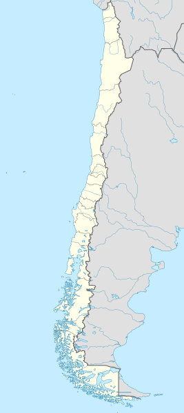
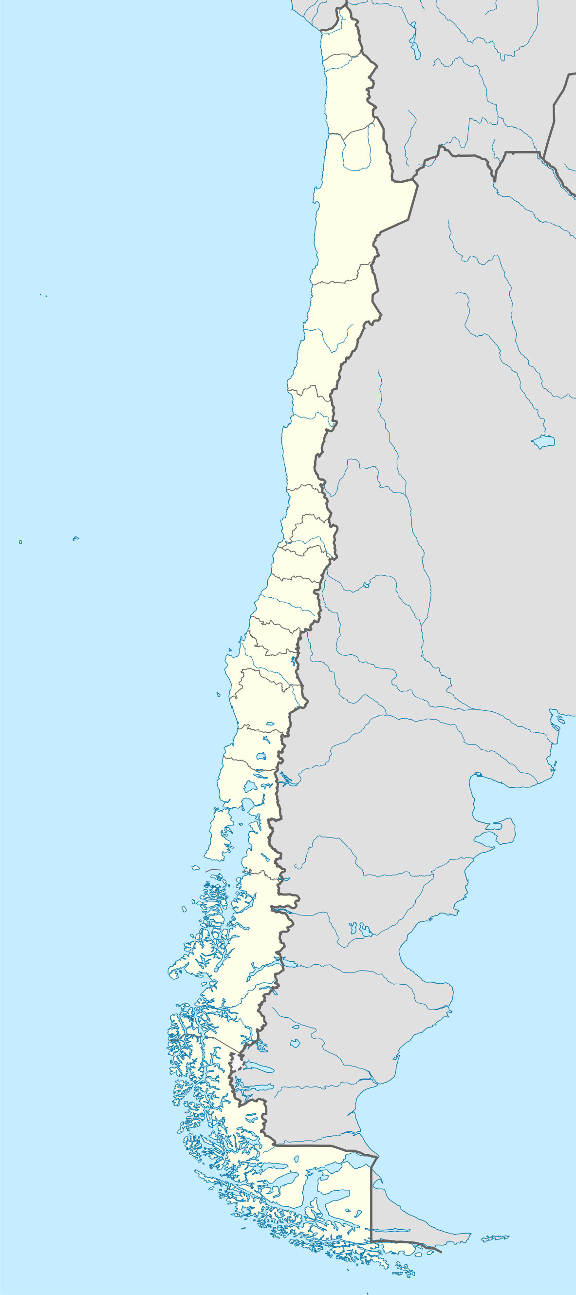
ไฟล, chile, location, ไฟล, ประว, ไฟล, หน, าท, ภาพน, การใช, ไฟล, วนกลาง, อม, ลเก, ยวก, บภาพขนาดของต, วอย, าง, ของไฟล, กเซล, ความละเอ, ยดอ, กเซล, กเซล, กเซล, กเซล, กเซล, กเซล, ภาพท, ความละเอ, ยดส, งกว, 8206, ไฟล, กเซล, ขนาดไฟล, โลไบต, ปภาพหร, อไฟล, เส, ยงน, นฉบ,. ifl prawtiifl hnathimiphaphni karichiflswnklang khxmulekiywkbphaphkhnadkhxngtwxyang PNG nikhxngifl SVG ni 267 600 phikesl khwamlaexiydxun 107 240 phikesl 213 480 phikesl 342 768 phikesl 455 1 024 phikesl 911 2 048 phikesl 1 183 2 658 phikesl duphaphthimikhwamlaexiydsungkwa 8206 ifl SVG 1 183 2 658 phikesl khnadifl 925 kiolibt rupphaphhruxiflesiyngni tnchbbxyuthi khxmmxns raylaexiyddanlang epnkhxkhwamthiaesdngphlcak ifltnchbbinkhxmmxns khxmmxnsepnewbistinokhrngkarsahrbekbrwbrwmsuxesri thi khunsamarthchwyid khwamyx khaxthibayChile location map svg Deutsch Positionskarte von Chile Quadratische Plattkarte N S Streckung 115 Geographische Begrenzung der Karte N 17 4 S S 56 5 S W 81 5 W O 61 5 WEnglish Location map of Chile Equirectangular projection N S stretching 115 Geographic limits of the map N 17 4 S S 56 5 S W 81 5 W E 61 5 WEspanol Mapa de localizacion de Chile Proyeccion Equirectangular N S con una extension de 115 Limites geograficos del mapa N 17 4 S S 56 5 S O 81 5 O E 61 5 Ownthi 20 phvsphakhm ph s 2551aehlngthima own work using United States National Imagery and Mapping Agency data World Data Base II dataphusrangsrrkh NordNordWestewxrchnxun iflxunthiichiflni Chile location map claims svg Chile location map 1998 agreement rectangle svg Chile location map claims until 1994 svg Chile location map claims 1899 svg Mapa de Chile ano 1899 svg Hippocamelus bisulcus svg Relief Map of Chile jpg Telmatobufo bullocki svg Telmatobufo australis svg Telmatobufo venustus svg Pueblos indigenas de Chile svg Pueblos indigenas de Chile ver svg Natural Regions of Chile svg Arica y Parinacota location map svg Tarapaca location map svg Los Lagos location map svg Aysen location map svg Chile en Wikiviajes svg aephnthinithuksranghruxphthnakhuncak Kartenwerkstatt hxngptibtikaraephnthi khxngwikiphiediyphasaeyxrmn sungkhunsamarthesnxaephnthiephuxphthnaidechnediywkn azerbaycanca Deutsch Sie Form cestina Deutsch sicilianu italiano russkij romană portugues English magyar Nederlands slovenscina polski latviesu makedonski espanol فارسی francais suomi עברית Plattduutsch ქართული հայերեն ব ল ithy 日本語 中文 中文 简体 中文 繁體 العربية karxnuyatichsiththi khapheca inthanaphuthuxlikhsiththikhxngphaphhruxsuxni xnuyatihichphaphhruxsuxniphayitenguxnikhtxipni xnuyatihkhdlxk aeckcayaela hruxddaeprexksarniphayitenguxnikhkhxngsyyaxnuyatexksaresrikhxngknu run 1 2 hruxrunid nbcaknithixxkodymulnithisxftaewresri odyimmiswnidhamaekikh immikhxkhwampkhnaaelapkhlng saenakhxngsyyaxnuyatrwmxyuinswnchux syyaxnuyatexksaresrikhxngknuhttp www gnu org copyleft fdl html GFDL GNU Free Documentation License true trueiflnixyuphayitsyyaxnuyat khriexthifkhxmmxns aebbaesdngthima xnuyataebbediywkn 3 0 tnchbbkhunsamarth thicaaebngpn thicathasaena aeckcay aelasngngandngklawtxip thicaeriyberiyngihm thicaddaeplngngandngklaw phayitenguxnikhtxipni aesdngthima khuntxngihekiyrtiecakhxngnganxyangehmaasm odyephimlingkipyngsyyaxnuyat aelarabuhakmikarepliynaeplng khunxacthaechnniidinrupaebbidkidtamkhwr aettxngimichinlksnathiaenawaphuihxnuyatsnbsnunkhunhruxkarichngankhxngkhun xnuyataebbediywkn hakkhunddaeplng epliynrup hruxtxetimnganni khuntxngichsyyaxnuyataebbediywknhruxaebbthiehmuxnkbsyyaxnuyatthiichkbnganniethannhttps creativecommons org licenses by sa 3 0 CC BY SA 3 0 Creative Commons Attribution Share Alike 3 0 true truekhunsamartheluxksyyaxnuyatdngklawtamtxngkarkhabrryayodyyxithyephimkhabrryaythrrthdediywephuxkhyaykhwamwaiflnimixairxngkvsMap of Chileixethmthiaesdngxyuiniflniprakxbdwyaephnthiphusrangbangkhathiimmiixethmwikisnethsyuxaraexl https commons wikimedia org wiki user NordNordWestchuxphuichwikimiediy NordNordWestchuxphusrangsrrkh NordNordWeststhanalikhsiththimilikhsiththisyyaxnuyatGNU Free Documentation License version 1 2 or later xngkvsCreative Commons Attribution ShareAlike 3 0 Unported xngkvswnthisrang wnkxtng20 phvsphakhm 2008 prawtiifl khlikwnthi ewlaephuxduiflthipraktinkhnann lasud ekasud du ihmkwa 10 ekakwa 10 10 20 50 100 250 500 wnthi ewlarupyxkhnadphuichkhwamehn pccubn05 54 6 knyayn 25611 183 2 658 925 kiolibt JanitoalevicNuble Region 03 30 4 thnwakhm 25601 183 2 658 921 kiolibt Janitoaleviccolor error 03 28 4 thnwakhm 25601 183 2 658 921 kiolibt JanitoalevicFixed Argentina 039 s Lake Nahuel Huapi 03 25 4 thnwakhm 25601 183 2 658 920 kiolibt Janitoalevic 04 50 3 thnwakhm 25601 183 2 658 920 kiolibt JanitoalevicFixed Argentina Bolivia border 04 46 3 thnwakhm 25601 183 2 658 920 kiolibt Janitoalevic 07 42 30 singhakhm 25601 183 2 658 919 kiolibt JanitoalevicFixed size 06 30 21 singhakhm 25601 262 2 835 910 kiolibt JanitoalevicRemoved Nuble Region Will be fully implemented in 2018 08 00 20 singhakhm 25601 262 2 835 914 kiolibt JanitoalevicAdded Nuble Region amp more precise borders 00 51 21 minakhm 25591 183 2 658 826 kiolibt JanitoalevicAdded Maritime Border in Magellan Strait and Beagle Channel lasud ekasud du ihmkwa 10 ekakwa 10 10 20 50 100 250 500 hnathimiphaphni hnatxipni oyngmathiphaphni kalama chili kioyta kuriok chiyn tlkawaon bldiebiy blparaxios puntaxaerns puexrotwieliyms futbxlolk 1962 xnotfaksta xikiek xiyaepl xubtiehtuehmuxnginokepiyop ph s 2553 okkimob okpaxaemrika 2015 okepiyop olsxngehels oxsxron aemaebb Location map Chile aemaebb klxngkhxmul nikhm testcases chbbrang epxrotmxn mxdul Location map data Chile mxdul Location map data Chile doc karichiflswnklang wikixuntxipniichiflni karichbn af wikipedia org Antofagasta Pichilemu FIFA Sokker Wereldbekertoernooi in 1962 Chillan Los Angeles Chili Talcahuano Quinta Normal Temuco Puerto Montt Punta Arenas Coyhaique Valdivia Castro Chili San Pedro de la Paz Villa Alemana Sjabloon Liggingkaart Chili Penco Hualpen Chiguayante Hualqui Coronel Chili Lota Tome La Serena Arica Monte Aguila Chili karichbn als wikipedia org Chillan Vorlage Positionskarte Chile Valparaiso Santiago de Chile Salamanca Chile Fussball Weltmeisterschaft 1962 karichbn an wikipedia org Santiago de Chile Pichilemu Concepcion Chile Talcahuano Vitacura Lo Barnechea Villa Alemana San Pedro de la Paz Chillan Angol Hualqui Valparaiso Aeropuerto Internacional Carriel Sur Yumbel Salamanca Chile La Serena Chile Punta Arenas Coihaique dukarichthwolkephimetimkhxngiflnikhxmulekiywkbphaph phaphnimikhxmulephimetim sungswnihymacakklxngdicitxlhruxsaeknenxrthisamarthekbkhxmuldngklawiwrwmkbphaphid thaphaphnithukprbprungaekikhhruxepliynaeplngcakedim khxmulbangxyangcayngkhngimepliynaeplngehmuxnphaphthithukprbprungaekikhnnkhwamkwang1183 0229khwamsung2657 6089 ekhathungcak https th wikipedia org wiki ifl Chile location map svg, wikipedia, วิกิ หนังสือ, หนังสือ, ห้องสมุด,
บทความ , อ่าน, ดาวน์โหลด, ฟรี, ดาวน์โหลดฟรี, mp3, วิดีโอ, mp4, 3gp, jpg, jpeg, gif, png, รูปภาพ, เพลง, เพลง, หนัง, หนังสือ, เกม, เกม