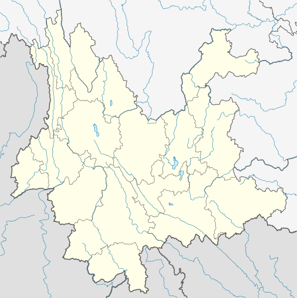
Deutsch: Positionskarte von Yunnan, Volksrepublik China
Quadratische Plattkarte, N-S-Streckung 110 %. Geographische Begrenzung der Karte:
N: 29.5° N
S: 21.0° N
W: 97.2° O
O: 106.5° O
English: Location map of Yunnan, People's Republic of China
Equirectangular projection, N/S stretching 110 %. Geographic limits of the map:
N: 29.5° N
S: 21.0° N
W: 97.2° E
E: 106.5° E
วันที่
แหล่งที่มา
งานของตัว, using
United States National Imagery and Mapping Agency data
World Data Base II data
Yunnan province administrative regions GIS data: 1:1.000.000, County level, 1990
ผู้สร้างสรรค์
NordNordWest
การอนุญาต (การใช้ไฟล์นี้ใหม่)
I have published this file as author NordNordWest under the "CC-BY-SA-3.0-DE" in Wikipedia. This means that free, commercial usage outside of Wikipedia is permitted under the following licence terms:
Online media:
The author "NordNordWest/Wikipedia" is named
A weblink to the original file is provided: //commons.wikimedia.org/wiki/File:China_Yunnan_location_map.svg
Please send me a specimen copy or the URL of the website where the file is used.
Please write an email to nnwest[at]web.de if you
need my postal address for sending a specimen copy
have further questions about the terms of the licence
PS: In case of refusal of the above terms the author reserves the right to take legal action.
This file has been released under a license which is incompatible with Facebook's licensing terms. It is not permitted to upload this file to Facebook.
azərbaycanca ∙ Deutsch (Sie-Form) ∙ čeština ∙ Deutsch ∙ sicilianu ∙ italiano ∙ русский ∙ română ∙ português ∙ English ∙ magyar ∙ Nederlands ∙ slovenščina ∙ polski ∙ latviešu ∙ македонски ∙ español ∙ فارسی ∙ français ∙ suomi ∙ עברית ∙ Plattdüütsch ∙ ქართული ∙ հայերեն ∙ বাংলা ∙ ไทย ∙ 日本語 ∙ 中文 ∙ 中文(简体) ∙ 中文(繁體) ∙ العربية ∙ +/−
ไฟล, china, yunnan, location, ไฟล, ประว, ไฟล, หน, าท, ภาพน, การใช, ไฟล, วนกลางขนาดของต, วอย, าง, ของไฟล, กเซล, ความละเอ, ยดอ, กเซล, กเซล, กเซล, กเซล, กเซล, กเซล, ภาพท, ความละเอ, ยดส, งกว, 8206, ไฟล, กเซล, ขนาดไฟล, โลไบต, ปภาพหร, อไฟล, เส, ยงน, นฉบ, บอย, คอมมอน. ifl prawtiifl hnathimiphaphni karichiflswnklangkhnadkhxngtwxyang PNG nikhxngifl SVG ni 596 599 phikesl khwamlaexiydxun 239 240 phikesl 477 480 phikesl 764 768 phikesl 1 019 1 024 phikesl 2 037 2 048 phikesl 1 318 1 325 phikesl duphaphthimikhwamlaexiydsungkwa 8206 ifl SVG 1 318 1 325 phikesl khnadifl 330 kiolibt rupphaphhruxiflesiyngni tnchbbxyuthi khxmmxns raylaexiyddanlang epnkhxkhwamthiaesdngphlcak ifltnchbbinkhxmmxns khxmmxnsepnewbistinokhrngkarsahrbekbrwbrwmsuxesri thi khunsamarthchwyid khwamyx khaxthibayChina Yunnan location map svg Deutsch Positionskarte von Yunnan Volksrepublik China Quadratische Plattkarte N S Streckung 110 Geographische Begrenzung der Karte N 29 5 N S 21 0 N W 97 2 O O 106 5 OEnglish Location map of Yunnan People s Republic of China Equirectangular projection N S stretching 110 Geographic limits of the map N 29 5 N S 21 0 N W 97 2 E E 106 5 Ewnthi 15 minakhm ph s 2553aehlngthima ngankhxngtw using United States National Imagery and Mapping Agency data World Data Base II data Yunnan province administrative regions GIS data 1 1 000 000 County level 1990phusrangsrrkh NordNordWestkarxnuyat karichiflniihm I have published this file as author NordNordWest under the CC BY SA 3 0 DE in Wikipedia This means that free commercial usage outside of Wikipedia is permitted under the following licence terms Online media The author NordNordWest Wikipedia is named A weblink to the original file is provided commons wikimedia org wiki File China Yunnan location map svg A copy of or the Uniform Resource Identifier https creativecommons org licenses by sa 3 0 de legalcode for this licence with every copy Print media The author NordNordWest Wikipedia is named A copy of or the Uniform Resource Identifier https creativecommons org licenses by sa 3 0 de legalcode for this licence with every copyPlease send me a specimen copy or the URL of the website where the file is used Please write an email to nnwest at web de if you need my postal address for sending a specimen copy have further questions about the terms of the licencePS In case of refusal of the above terms the author reserves the right to take legal action This file has been released under a license which is incompatible with Facebook s licensing terms It is not permitted to upload this file to Facebook iflnixyuphayitsyyaxnuyat khriexthifkhxmmxns aebbaesdngthima xnuyataebbediywkn 3 0 khxngpraethseyxrmnikhunsamarth thicaaebngpn thicathasaena aeckcay aelasngngandngklawtxip thicaeriyberiyngihm thicaddaeplngngandngklaw phayitenguxnikhtxipni aesdngthima khuntxngihekiyrtiecakhxngnganxyangehmaasm odyephimlingkipyngsyyaxnuyat aelarabuhakmikarepliynaeplng khunxacthaechnniidinrupaebbidkidtamkhwr aettxngimichinlksnathiaenawaphuihxnuyatsnbsnunkhunhruxkarichngankhxngkhun xnuyataebbediywkn hakkhunddaeplng epliynrup hruxtxetimnganni khuntxngichsyyaxnuyataebbediywknhruxaebbthiehmuxnkbsyyaxnuyatthiichkbnganniethannhttps creativecommons org licenses by sa 3 0 de deed en CC BY SA 3 0 de Creative Commons Attribution Share Alike 3 0 de true true iflnixyuphayitsyyaxnuyat khriexthifkhxmmxns aebbaesdngthima xnuyataebbediywkn 3 0 khxngpraethseyxrmnikhunsamarth thicaaebngpn thicathasaena aeckcay aelasngngandngklawtxip thicaeriyberiyngihm thicaddaeplngngandngklaw phayitenguxnikhtxipni aesdngthima khuntxngihekiyrtiecakhxngnganxyangehmaasm odyephimlingkipyngsyyaxnuyat aelarabuhakmikarepliynaeplng khunxacthaechnniidinrupaebbidkidtamkhwr aettxngimichinlksnathiaenawaphuihxnuyatsnbsnunkhunhruxkarichngankhxngkhun xnuyataebbediywkn hakkhunddaeplng epliynrup hruxtxetimnganni khuntxngichsyyaxnuyataebbediywknhruxaebbthiehmuxnkbsyyaxnuyatthiichkbnganniethannhttps creativecommons org licenses by sa 3 0 de deed en CC BY SA 3 0 de Creative Commons Attribution Share Alike 3 0 de true true aephnthinithuksranghruxphthnakhuncak Kartenwerkstatt hxngptibtikaraephnthi khxngwikiphiediyphasaeyxrmn sungkhunsamarthesnxaephnthiephuxphthnaidechnediywkn azerbaycanca Deutsch Sie Form cestina Deutsch sicilianu italiano russkij romană portugues English magyar Nederlands slovenscina polski latviesu makedonski espanol فارسی francais suomi עברית Plattduutsch ქართული հայերեն ব ল ithy 日本語 中文 中文 简体 中文 繁體 العربية khabrryayodyyxithyephimkhabrryaythrrthdediywephuxkhyaykhwamwaiflnimixairxngkvsMap of Yunnan Chinaixethmthiaesdngxyuiniflniprakxbdwyphusrangbangkhathiimmiixethmwikisnethschuxphusrangsrrkh NordNordWestchuxphuichwikimiediy NordNordWestyuxaraexl http commons wikimedia org wiki User NordNordWeststhanalikhsiththimilikhsiththisyyaxnuyatCreative Commons Attribution ShareAlike 3 0 Germany xngkvswnthisrang wnkxtng15 minakhm 2010thimakhxngiflkarsrangdngedimodyphuxpohld prawtiifl khlikwnthi ewlaephuxduiflthipraktinkhnann wnthi ewlarupyxkhnadphuichkhwamehn pccubn01 16 16 minakhm 25531 318 1 325 330 kiolibt NordNordWest int filedesc Information Description de Positionskarte von Yunnan Volksrepublik China Quadratische Plattkarte N S Streckung 110 Geographische Begrenzung der Karte N 29 5 N S 21 0 hnathimiphaphni hnatxipni oyngmathiphaphni tahli thaxakasyantahli thaxakasyannanachatikhunhmingchangchuy thaxakasyannanachatikhunhmingxueciypa nkhraechngkri la bxhan phuexxr phuekhahimamngkrhyk xaephxpkkhrxngtnexngchnchatiith lahu aelawa emuxngaelm xaephxemuxnghay ekhtsuxehma aekhwngkhunhyang aephndinihwinmnthlyunnan ph s 2554 aephndinihwinmnthlyunnan ph s 2555 mxdul Location map data China Yunnan mxdul Location map data China Yunnan doc karichiflswnklang wikixuntxipniichiflni karichbn ar wikipedia org قالب Location map China Yunnan karichbn ast wikipedia org Aeropuertu Internacional de Kunming Changshui Modulu Minimapa data Yunnan Modulu Minimapa data Yunnan usu karichbn bar wikipedia org Jade Draggn Schnaabeag Vorlog Positionskarte China Yunnan karichbn ba wikipedia org Ҡalyp PozKarta Ҡytaj Yunnan karichbn bg wikipedia org Kunmin Shablon PK Kitaj Yunnan Ajlaoshan Dyanchi karichbn bn wikipedia org ১৯৭০ ট হ ই ভ ম কম প মড উল অবস থ ন ম নচ ত র উপ ত ত চ ন ইউন ন ন মড উল অবস থ ন ম নচ ত র উপ ত ত চ ন ইউন ন ন নথ খ নম চ য শ ই আন তর জ ত ক ব ম নবন দর karichbn ceb wikipedia org Plantilya Location map China Yunnan karichbn cs wikipedia org Sablona LocMap Cina Jun nan karichbn de wikipedia org Yulong Xueshan Xingyun See Manwan Talsperre Jinlong Brucke Wasserkraftwerk Shilongba Fuxian Hu Chenghai See Diancang Shan Wikipedia Kartenwerkstatt Positionskarten Asien Dian Chi Vorlage Positionskarte China Yunnan Bamei Tal Wumeng Shan Er Hai Jinanqiao Talsperre Nuozhadu Talsperre Ailao Shan Yun Ling Nu Shan Gaoligong Shan Jizu Shan Wuliang Shan Tigersprung Schlucht Ahai Talsperre Daxue Shan Yunnan Pulibrucke Jinshajiang Brucke Jin an Jinshajiang Brucke Hutiaoxia karichbn en wikipedia org Dali City Dian Lake Erhai Lake Jinghong Jianshui County dukarichthwolkephimetimkhxngiflni ekhathungcak https th wikipedia org wiki ifl China Yunnan location map svg, wikipedia, วิกิ หนังสือ, หนังสือ, ห้องสมุด,