This file is a map of a municipality in Japan created and uploaded by Lincun on Japanese Wikipedia. It may also be a file based on one of these maps (see info in file history or author field for more info on later editors). Source:
English: Data used : Ministry of Land, Infrastructure, Transport and Tourism - National Land Numerical Information (Administrative Area (N03) / Lake (W09))
日本語: 使用データ : 国土交通省 国土数値情報(行政区域(N03)・湖沼(W09))
The original file was licensed {{GFDL}} and {{Cc-by-sa-3.0}}. See this category for more files like this. ป้ายนี้มิใช่ป้ายแสดงสถานะลิขสิทธิ์ ดังนั้นการระบุสถานะลิขสิทธิ์จึงต้องกระทำแยกต่างหาก ดูที่ Commons:Lincensing
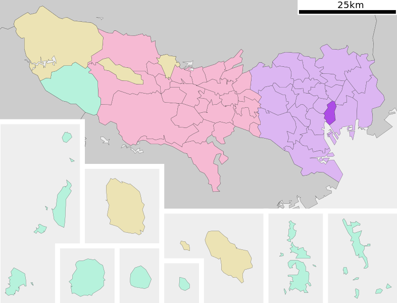
{{Information| |Description= Location of Chuo-ku in Tokyo Prefecture |Source= Japanese wiki [http://ja.wikipedia.org/wiki/%E3%83%95%E3%82%A1%E3%82%A4%E3%83%AB:%E5%9F%BA%E7%A4%8E%E8%87%AA%E6%B2%BB%E4%BD%93%E4%BD%8D%E7%BD%AE%E5%9B%B3_13102.svg] |Date=~~~
ไฟล, chuo, tokyo, prefecture, ไฟล, ประว, ไฟล, หน, าท, ภาพน, การใช, ไฟล, วนกลาง, อม, ลเก, ยวก, บภาพขนาดของต, วอย, าง, ของไฟล, กเซล, ความละเอ, ยดอ, กเซล, กเซล, กเซล, กเซล, กเซล, ภาพท, ความละเอ, ยดส, งกว, 8206, ไฟล, กเซล, ขนาดไฟล, โลไบต, ปภาพหร, อไฟล, เส, ยงน, นฉ. ifl prawtiifl hnathimiphaphni karichiflswnklang khxmulekiywkbphaphkhnadkhxngtwxyang PNG nikhxngifl SVG ni 786 599 phikesl khwamlaexiydxun 315 240 phikesl 630 480 phikesl 1 007 768 phikesl 1 280 976 phikesl 2 560 1 952 phikesl duphaphthimikhwamlaexiydsungkwa 8206 ifl SVG 800 610 phikesl khnadifl 38 kiolibt rupphaphhruxiflesiyngni tnchbbxyuthi khxmmxns raylaexiyddanlang epnkhxkhwamthiaesdngphlcak ifltnchbbinkhxmmxns khxmmxnsepnewbistinokhrngkarsahrbekbrwbrwmsuxesri thi khunsamarthchwyid khwamyx khaxthibayChuo ku in Tokyo Prefecture Ja svg English Location of Chuo ku in Tokyo Prefecture 日本語 ja 東京都中央区位置図 wnthi 8 knyayn ph s 2550 aehlngthima Original file ngankhxngtw Data 国土交通省 国土数値情報 行政区域 N03 湖沼 W09 phusrangsrrkh Lincun karxnuyat karichiflniihm This file is a map of a municipality in Japan created and uploaded by Lincun on Japanese Wikipedia It may also be a file based on one of these maps see info in file history or author field for more info on later editors Source English Data used nbsp Ministry of Land Infrastructure Transport and Tourism National Land Numerical Information Administrative Area N03 Lake W09 日本語 使用データ nbsp 国土交通省 国土数値情報 行政区域 N03 湖沼 W09 The original file was licensed GFDL and Cc by sa 3 0 See this category for more files like this paynimiichpayaesdngsthanalikhsiththi dngnnkarrabusthanalikhsiththicungtxngkrathaaeyktanghak duthi Commons Lincensing karxnuyatichsiththi xnuyatihkhdlxk aeckcayaela hruxddaeprexksarniphayitenguxnikhkhxngsyyaxnuyatexksaresrikhxngknu run 1 2 hruxrunid nbcaknithixxkodymulnithisxftaewresri odyimmiswnidhamaekikh immikhxkhwampkhnaaelapkhlng saenakhxngsyyaxnuyatrwmxyuinswnchux syyaxnuyatexksaresrikhxngknuhttp www gnu org copyleft fdl html GFDL GNU Free Documentation License true true iflnixyuphayitsyyaxnuyat khriexthifkhxmmxns aebbaesdngthima xnuyataebbediywkn 3 0 tnchbbkhunsamarth thicaaebngpn thicathasaena aeckcay aelasngngandngklawtxip thicaeriyberiyngihm thicaddaeplngngandngklaw phayitenguxnikhtxipni aesdngthima khuntxngihekiyrtiecakhxngnganxyangehmaasm odyephimlingkipyngsyyaxnuyat aelarabuhakmikarepliynaeplng khunxacthaechnniidinrupaebbidkidtamkhwr aettxngimichinlksnathiaenawaphuihxnuyatsnbsnunkhunhruxkarichngankhxngkhun xnuyataebbediywkn hakkhunddaeplng epliynrup hruxtxetimnganni khuntxngichsyyaxnuyataebbediywknhruxaebbthiehmuxnkbsyyaxnuyatthiichkbnganniethannhttps creativecommons org licenses by sa 3 0 CC BY SA 3 0 Creative Commons Attribution Share Alike 3 0 true true bnthukkarxphohld This file was moved from Japanese Wikipedia See below for original file information File name 基礎自治体位置図 13102 svg Description 基礎自治体位置図画像情報 東京都 中央区 File history wnthi ewla UTC khnad phuich khwamehn 8 knyayn ph s 2550 23 26 20 800x622 Lincun 基礎自治体位置図画像情報 東京都 中央区 10 knyayn ph s 2550 11 38 25 800x682 Lincun 基礎自治体位置図画像情報 東京都 中央区 Page history wnthi ewla UTC Flag phuich khwamyx 8 knyayn ph s 2550 23 26 20 Lincun 基礎自治体位置図画像情報 東京都 中央区 10 knyayn ph s 2550 11 38 25 Lincun 画像 基礎自治体位置図 13102 svg の新しい版をアップロードしました 基礎自治体位置図画像情報 東京都 中央区 13 phvscikayn ph s 2550 18 28 09 l Trashwriter 24 phvscikayn ph s 2550 10 42 46 Lincun Undo revision 16118863 by Special Contributions Trashwriter Trashwriter User talk Trashwriter 会話 Deutsch nbsp English nbsp makedonski nbsp 한국어 nbsp 日本語 nbsp فارسی nbsp khabrryayodyyxithyephimkhabrryaythrrthdediywephuxkhyaykhwamwaiflnimixairixethmthiaesdngxyuiniflniprakxbdwysthanalikhsiththimilikhsiththisyyaxnuyatGNU Free Documentation License version 1 2 or lateral nbsp xngkvsCreative Commons Attribution ShareAlike 3 0 Unported nbsp xngkvs prawtiifl khlikwnthi ewlaephuxduiflthipraktinkhnann wnthi ewlarupyxkhnadphuichkhwamehn pccubn13 20 7 phvscikayn 2563800 610 38 kiolibt AichiWikiFixerUpdate 01 04 12 mithunayn 2552800 682 23 kiolibt Krisgrotius Information Description Location of Chuo ku in Tokyo Prefecture Source Japanese wiki http ja wikipedia org wiki E3 83 95 E3 82 A1 E3 82 A4 E3 83 AB E5 9F BA E7 A4 8E E8 87 AA E6 B2 BB E4 BD 93 E4 BD 8D E7 BD AE E5 9B B3 13102 svg Date 18 38 10 knyayn 2550800 682 23 kiolibt Lincun 基礎自治体位置図画像情報 東京都 中央区 06 26 9 knyayn 2550800 622 23 kiolibt Lincun 基礎自治体位置図画像情報 東京都 中央区 hnathimiphaphni hnatxipni oyngmathiphaphni ekhtchuox otekiyw karichiflswnklang wikixuntxipniichiflni karichbn ar wikipedia org تشوأو طوكيو karichbn arz wikipedia org تشوآو طوكيو karichbn ca wikipedia org Chuō karichbn ceb wikipedia org Chuō ku distrito karichbn da wikipedia org Chuuou Tokyo karichbn de wikipedia org Chuō Tokio karichbn en wikipedia org Ginza Kyōbashi Tokyo Chuō Tokyo Tsukiji fish market Tsukiji Nihonbashi Yaesu Hama rikyu Gardens Tsukishima Kabuki za Nihombashi Station Tokyo City Air Terminal Ginza Station Hatchōbori Station Tokyo Mitsukoshimae Station Suitengumae Station Higashi nihombashi Station Higashi ginza Station Muromachi Tokyo Kayabachō Station Tsukishima Station Bakurochō Station Bakuro yokoyama Station Nihonbashi Mitsui Tower Mandarin Oriental Tokyo Suitengu Tokyo Template Chuō Tokyo Kabutocho Hakozakicho Tokyo Hongokucho Harumi Tokyo Tsukudajima Taimei Elementary School Chuo Elementary School Tokyo Nihonbashi Bakurochō karichbn es wikipedia org Chuō Tokio karichbn et wikipedia org Chuō karichbn eu wikipedia org Chuō ku Tokio karichbn fa wikipedia org چوئو کو توکیو karichbn fi wikipedia org Chuō Tokio karichbn gan wikipedia org 中央區 東京都 karichbn gl wikipedia org Chuō Toquio karichbn he wikipedia org צ ואו karichbn ht wikipedia org Chuo dukarichthwolkephimetimkhxngiflnikhxmulekiywkbphaph phaphnimikhxmulephimetim sungswnihymacakklxngdicitxlhruxsaeknenxrthisamarthekbkhxmuldngklawiwrwmkbphaphid thaphaphnithukprbprungaekikhhruxepliynaeplngcakedim khxmulbangxyangcayngkhngimepliynaeplngehmuxnphaphthithukprbprungaekikhnnchuxeruxngsn東京都行政区画地図khwamkwang800pxkhwamsung610px ekhathungcak https th wikipedia org wiki ifl Chuo ku in Tokyo Prefecture Ja svg, wikipedia, วิกิ หนังสือ, หนังสือ, ห้องสมุด,