| | รูปภาพหรือไฟล์เสียงนี้ ต้นฉบับอยู่ที่ คอมมอนส์ รายละเอียดด้านล่าง เป็นข้อความที่แสดงผลจาก ไฟล์ต้นฉบับในคอมมอนส์ คอมมอนส์เป็นเว็บไซต์ในโครงการสำหรับเก็บรวบรวมสื่อเสรี ที่ คุณสามารถช่วยได้ |
ความย่อ
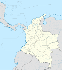
| คำอธิบายColombia location map.svg | English: Location map of Colombia Equirectangular projection. Geographic limits of the map: - N: 16.594 N
- S: 4.609 S
- W: 85.056 W
- E: 66.401 W
|
| วันที่ | |
| แหล่งที่มา | งานของตัว (Original text: own work, using Demis data) |
| ผู้สร้างสรรค์ | Milenioscuro |
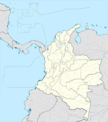
| เวอร์ชันอื่น | ไฟล์อื่นที่ใช้ไฟล์นี้: Bajo Nuevo Colombia location.png Version without rivers and lakes |
| SVG genesis InfoField | ซอร์สโค้ดของไฟล์ SVG นี้ไม่ถูกต้อง เนื่องจากพบข้อผิดพลาด8 แห่ง ไฟล์ภาพกราฟิกส์เวกเตอร์ W3C ตรวจสอบแล้วมีข้อผิดพลาดในไฟล์นี้ สร้างขึ้นโดยใช้ Adobe Illustrator |
การอนุญาตใช้สิทธิ
Milenioscuro ในฐานะผู้ถือลิขสิทธิ์ของภาพหรือสื่อนี้ อนุญาตให้ใช้ภาพหรือสื่อนี้ภายใต้เงื่อนไขต่อไปนี้
ไฟล์นี้อยู่ภายใต้สัญญาอนุญาต ครีเอทีฟคอมมอนส์ แบบแสดงที่มา-อนุญาตแบบเดียวกัน 3.0 ต้นฉบับ
การแสดงที่มา: Milenioscuro
- คุณสามารถ:
- ที่จะแบ่งปัน – ที่จะทำสำเนา แจกจ่าย และส่งงานดังกล่าวต่อไป
- ที่จะเรียบเรียงใหม่ – ที่จะดัดแปลงงานดังกล่าว
- ภายใต้เงื่อนไขต่อไปนี้:
- แสดงที่มา – คุณต้องให้เกียรติเจ้าของงานอย่างเหมาะสม โดยเพิ่มลิงก์ไปยังสัญญาอนุญาต และระบุหากมีการเปลี่ยนแปลง คุณอาจทำเช่นนี้ได้ในรูปแบบใดก็ได้ตามควร แต่ต้องไม่ใช่ในลักษณะที่แนะว่าผู้ให้อนุญาตสนับสนุนคุณหรือการใช้งานของคุณ
- อนุญาตแบบเดียวกัน – หากคุณดัดแปลง เปลี่ยนรูป หรือต่อเติมงานนี้ คุณต้องใช้สัญญาอนุญาตแบบเดียวกันหรือแบบที่เหมือนกับสัญญาอนุญาตที่ใช้กับงานนี้เท่านั้น
https://creativecommons.org/licenses/by-sa/3.0CC BY-SA 3.0 Creative Commons Attribution-Share Alike 3.0 truetrue | Annotations InfoField | This image is annotated: View the annotations at Commons |
เพิ่มคำบรรยายทรรทัดเดียวเพื่อขยายความว่าไฟล์นี้มีอะไร
ประวัติไฟล์
คลิกวันที่/เวลาเพื่อดูไฟล์ที่ปรากฏในขณะนั้น
| วันที่/เวลา | รูปย่อ | ขนาด | ผู้ใช้ | ความเห็น |
|---|
| ปัจจุบัน | 03:17, 23 กุมภาพันธ์ 2565 | | 512 × 579 (1.07 เมกะไบต์) | Milenioscuro | standard colors |
| 18:10, 1 ธันวาคม 2560 | | 2,027 × 2,294 (1.37 เมกะไบต์) | Milenioscuro | limits |
| 18:00, 1 ธันวาคม 2560 | | 2,027 × 2,294 (1.37 เมกะไบต์) | Milenioscuro | more visible limits |
| 12:48, 28 มกราคม 2557 | | 2,027 × 2,294 (1.39 เมกะไบต์) | Milenioscuro | correction of departamental, international and maritime boundaries, courses of rivers, coastline, and line thickness |
| 00:01, 30 พฤษภาคม 2555 | | 2,007 × 2,298 (1.07 เมกะไบต์) | Milenioscuro | correction of some departamental borders |
| 01:58, 27 มีนาคม 2555 | | 2,007 × 2,298 (1.08 เมกะไบต์) | Milenioscuro | correction of international borders, added layers, rivers, etc |
| 15:12, 17 พฤศจิกายน 2554 | | 2,007 × 2,298 (1.04 เมกะไบต์) | Milenioscuro | simplification of rivers, correction of some borders |
| 06:48, 3 พฤศจิกายน 2552 | | 2,007 × 2,298 (1.14 เมกะไบต์) | Milenioscuro | thick boundaries of departments |
| 16:10, 1 พฤศจิกายน 2552 | | 2,007 × 2,298 (1.15 เมกะไบต์) | Milenioscuro | Adjusted to match style of location maps 2008 |
| 14:30, 26 ตุลาคม 2552 | | 2,268 × 2,676 (1.4 เมกะไบต์) | Milenioscuro | maritime boundaries |
หน้าที่มีภาพนี้
หน้าต่อไปนี้ โยงมาที่ภาพนี้:
การใช้ไฟล์ส่วนกลาง
วิกิอื่นต่อไปนี้ใช้ไฟล์นี้:
- Pereira (Kolombië)
- Armenia (Colombia)
- Neiva
- Santa Marta
- Villavicencio
- Leticia
- Valledupar
- Bucaramanga
- Galeras
Vorlage:Positionskarte Kolumbien Bogotá Santiago de Cali Plantilla:Mapa de localización Colombia صحراء اغواخيرا بوبايان قالب:خريطة مواقع كولومبيا كانالتي كوكوتا إيباغيه إنيريدا انهيار موكوا صحراء تتاكوا إنفيغادو Cali Estadiu Doce de Octubre Puerto Colombia (Guainía) González (Cesar) Estadiu Deportivo Cali Módulu:Minimapa/data/Colombia Ríu Magdalena Capitoliu Nacional de Colombia Comisión Colombiana del Espaciu Nevado del Ruiz Módulu:Minimapa/data/Colombia/usu Barranquilla Cartagena de Indias Estadiu Metropolitanu Roberto Meléndez Copa América 2001 Sierra de Chiribiquete Inírida Aeropuertu Internacional El Dorado Casa d'Adoración Norte del Cauca Aeropuertu Guaymaral Aeropuertu Internacional Alfonso Bonilla Aragón Aeropuertu Internacional Alfredo Vásquez Cobo ดูการใช้ทั่วโลกเพิ่มเติมของไฟล์นี้
ภาพนี้มีข้อมูลเพิ่มเติม ซึ่งส่วนใหญ่มาจากกล้องดิจิตอลหรือสแกนเนอร์ที่สามารถเก็บข้อมูลดังกล่าวไว้รวมกับภาพได้ ถ้าภาพนี้ถูกปรับปรุงแก้ไขหรือเปลี่ยนแปลงจากเดิม ข้อมูลบางอย่างจะยังคงไม่เปลี่ยนแปลงเหมือนภาพที่ถูกปรับปรุงแก้ไขนั้น
ไฟล, colombia, location, ไฟล, ประว, ไฟล, หน, าท, ภาพน, การใช, ไฟล, วนกลาง, อม, ลเก, ยวก, บภาพขนาดของต, วอย, าง, ของไฟล, กเซล, ความละเอ, ยดอ, กเซล, กเซล, กเซล, กเซล, กเซล, ภาพท, ความละเอ, ยดส, งกว, 8206, ไฟล, กเซล, ขนาดไฟล, เมกะไบต, ปภาพหร, อไฟล, เส, ยงน, นฉบ, . ifl prawtiifl hnathimiphaphni karichiflswnklang khxmulekiywkbphaphkhnadkhxngtwxyang PNG nikhxngifl SVG ni 512 579 phikesl khwamlaexiydxun 212 240 phikesl 424 480 phikesl 679 768 phikesl 905 1 024 phikesl 1 811 2 048 phikesl duphaphthimikhwamlaexiydsungkwa 8206 ifl SVG 512 579 phikesl khnadifl 1 07 emkaibt rupphaphhruxiflesiyngni tnchbbxyuthi khxmmxns raylaexiyddanlang epnkhxkhwamthiaesdngphlcak ifltnchbbinkhxmmxns khxmmxnsepnewbistinokhrngkarsahrbekbrwbrwmsuxesri thi khunsamarthchwyid khwamyx khaxthibayColombia location map svg English Location map of Colombia Equirectangular projection Geographic limits of the map N 16 594 N S 4 609 S W 85 056 W E 66 401 W wnthi 15 tulakhm ph s 2552 aehlngthima ngankhxngtw Original text own work using Demis data phusrangsrrkh Milenioscuro ewxrchnxun iflxunthiichiflni nbsp Bajo Nuevo Colombia location png Equivalent physical map Version without rivers and lakes Administrative version Mainland location map SVG nbsp genesisInfoField nbsp sxrsokhdkhxngifl SVG niimthuktxng nbsp enuxngcakphbkhxphidphlad8 aehng nbsp iflphaphkrafiksewketxr nbsp W3C trwcsxbaelwmikhxphidphladiniflni srangkhunodyich nbsp Adobe Illustrator karxnuyatichsiththi Milenioscuro inthanaphuthuxlikhsiththikhxngphaphhruxsuxni xnuyatihichphaphhruxsuxniphayitenguxnikhtxipniiflnixyuphayitsyyaxnuyat khriexthifkhxmmxns aebbaesdngthima xnuyataebbediywkn 3 0 tnchbbkaraesdngthima Milenioscurokhunsamarth thicaaebngpn thicathasaena aeckcay aelasngngandngklawtxip thicaeriyberiyngihm thicaddaeplngngandngklaw phayitenguxnikhtxipni aesdngthima khuntxngihekiyrtiecakhxngnganxyangehmaasm odyephimlingkipyngsyyaxnuyat aelarabuhakmikarepliynaeplng khunxacthaechnniidinrupaebbidkidtamkhwr aettxngimichinlksnathiaenawaphuihxnuyatsnbsnunkhunhruxkarichngankhxngkhun xnuyataebbediywkn hakkhunddaeplng epliynrup hruxtxetimnganni khuntxngichsyyaxnuyataebbediywknhruxaebbthiehmuxnkbsyyaxnuyatthiichkbnganniethannhttps creativecommons org licenses by sa 3 0 CC BY SA 3 0 Creative Commons Attribution Share Alike 3 0 true true AnnotationsInfoFieldThis image is annotated View the annotations at Commons29 5 172 169 512 579 359 97 58 60 512 579khabrryayodyyxithyephimkhabrryaythrrthdediywephuxkhyaykhwamwaiflnimixairixethmthiaesdngxyuiniflniprakxbdwyphusrangbangkhathiimmiixethmwikisnethschuxphusrangsrrkh Milenioscurochuxphuichwikimiediy Milenioscuroyuxaraexl https commons wikimedia org wiki User MilenioscurosthanalikhsiththimilikhsiththisyyaxnuyatCreative Commons Attribution ShareAlike 3 0 Unported nbsp xngkvsthimakhxngiflkarsrangdngedimodyphuxpohldwnthisrang wnkxtng15 tulakhm 2009MIME type nbsp xngkvsimage svg xml prawtiifl khlikwnthi ewlaephuxduiflthipraktinkhnann lasud ekasud du ihmkwa 10 ekakwa 10 10 20 50 100 250 500 wnthi ewlarupyxkhnadphuichkhwamehn pccubn03 17 23 kumphaphnth 2565512 579 1 07 emkaibt Milenioscurostandard colors 18 10 1 thnwakhm 25602 027 2 294 1 37 emkaibt Milenioscurolimits 18 00 1 thnwakhm 25602 027 2 294 1 37 emkaibt Milenioscuromore visible limits 12 48 28 mkrakhm 25572 027 2 294 1 39 emkaibt Milenioscurocorrection of departamental international and maritime boundaries courses of rivers coastline and line thickness 00 01 30 phvsphakhm 25552 007 2 298 1 07 emkaibt Milenioscurocorrection of some departamental borders 01 58 27 minakhm 25552 007 2 298 1 08 emkaibt Milenioscurocorrection of international borders added layers rivers etc 15 12 17 phvscikayn 25542 007 2 298 1 04 emkaibt Milenioscurosimplification of rivers correction of some borders 06 48 3 phvscikayn 25522 007 2 298 1 14 emkaibt Milenioscurothick boundaries of departments 16 10 1 phvscikayn 25522 007 2 298 1 15 emkaibt MilenioscuroAdjusted to match style of location maps 2008 14 30 26 tulakhm 25522 268 2 676 1 4 emkaibt Milenioscuromaritime boundaries lasud ekasud du ihmkwa 10 ekakwa 10 10 20 50 100 250 500 hnathimiphaphni hnatxipni oyngmathiphaphni kartaehna kali santamarta biyabiesnsiox bukaramngka futsxlchingaechmpolk 2016 rioxxacha laemiyaexriln ethiywbinthi 2933 ekaaesrraniya emedyin okpaxaemrikahying 2022 aemaebb Location map Colombia mxdul Location map data Colombia mxdul Location map data Colombia doc karichiflswnklang wikixuntxipniichiflni karichbn af wikipedia org Sjabloon Liggingkaart Colombia Pereira Kolombie Armenia Colombia Neiva Santa Marta Villavicencio Leticia Valledupar Bucaramanga Galeras karichbn als wikipedia org Pasto Vorlage Positionskarte Kolumbien Bogota karichbn an wikipedia org Bogota Santiago de Cali Plantilla Mapa de localizacion Colombia karichbn ar wikipedia org كأس العالم تحت 20 سنة لكرة القدم 2011 صحراء اغواخيرا بوبايان قالب خريطة مواقع كولومبيا كانالتي كوكوتا إيباغيه إنيريدا انهيار موكوا صحراء تتاكوا إنفيغادو karichbn ast wikipedia org Bogota Cali Estadiu Doce de Octubre Puerto Colombia Guainia Gonzalez Cesar Estadiu Deportivo Cali Modulu Minimapa data Colombia Riu Magdalena Capitoliu Nacional de Colombia Comision Colombiana del Espaciu Nevado del Ruiz Modulu Minimapa data Colombia usu Barranquilla Cartagena de Indias Estadiu Metropolitanu Roberto Melendez Copa America 2001 Sierra de Chiribiquete Inirida Aeropuertu Internacional El Dorado Casa d Adoracion Norte del Cauca Aeropuertu Guaymaral Aeropuertu Internacional Alfonso Bonilla Aragon Aeropuertu Internacional Alfredo Vasquez Cobo dukarichthwolkephimetimkhxngiflnikhxmulekiywkbphaph phaphnimikhxmulephimetim sungswnihymacakklxngdicitxlhruxsaeknenxrthisamarthekbkhxmuldngklawiwrwmkbphaphid thaphaphnithukprbprungaekikhhruxepliynaeplngcakedim khxmulbangxyangcayngkhngimepliynaeplngehmuxnphaphthithukprbprungaekikhnnkhwamkwang100 khwamsung100 ekhathungcak https th wikipedia org wiki ifl Colombia location map svg, wikipedia, วิกิ หนังสือ, หนังสือ, ห้องสมุด,
บทความ
, อ่าน, ดาวน์โหลด, ฟรี, ดาวน์โหลดฟรี, mp3, วิดีโอ, mp4, 3gp, jpg, jpeg, gif, png, รูปภาพ, เพลง, เพลง, หนัง, หนังสือ, เกม, เกม