คำอธิบายDelaware County Indiana Incorporated and Unincorporated areas Muncie highlighted.svg
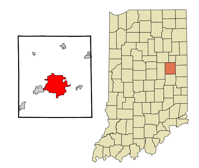
This map shows the incorporated and unincorporated areas in Delaware County, Indiana, highlighting Muncie in red. It was created with a custom script with US Census Bureau data and modified with Inkscape.
วันที่
แหล่งที่มา
My own work, based on public domain information. Based on similar map concepts by Ixnayonthetimmay
ผู้สร้างสรรค์
Arkyan
Please note: This is a re-upload of a preexisting image that was deleted due to appearing like a duplicate. The previous map file had an XML error that prevented the image from showing up properly. This error has been fixed, and the image is being re-uploaded on 25 October 2008. Ixnayonthetimmay
{{Information |Description=This map shows the incorporated and unincorporated areas in Delaware County, Indiana, highlighting Muncie in red. It was created w
ไฟล, delaware, county, indiana, incorporated, unincorporated, areas, muncie, highlighted, ไฟล, ประว, ไฟล, หน, าท, ภาพน, การใช, ไฟล, วนกลางขนาดของต, วอย, าง, ของไฟล, กเซล, ความละเอ, ยดอ, กเซล, กเซล, กเซล, กเซล, กเซล, ภาพท, ความละเอ, ยดส, งกว, 8206, ไฟล, กเซล, ข. ifl prawtiifl hnathimiphaphni karichiflswnklangkhnadkhxngtwxyang PNG nikhxngifl SVG ni 650 550 phikesl khwamlaexiydxun 284 240 phikesl 567 480 phikesl 908 768 phikesl 1 210 1 024 phikesl 2 420 2 048 phikesl duphaphthimikhwamlaexiydsungkwa 8206 ifl SVG 650 550 phikesl khnadifl 108 kiolibt rupphaphhruxiflesiyngni tnchbbxyuthi khxmmxns raylaexiyddanlang epnkhxkhwamthiaesdngphlcak ifltnchbbinkhxmmxns khxmmxnsepnewbistinokhrngkarsahrbekbrwbrwmsuxesri thi khunsamarthchwyid khaxthibayDelaware County Indiana Incorporated and Unincorporated areas Muncie highlighted svg This map shows the incorporated and unincorporated areas in Delaware County Indiana highlighting Muncie in red It was created with a custom script with US Census Bureau data and modified with Inkscape wnthi 12 tulakhm ph s 2550aehlngthima My own work based on public domain information Based on similar map concepts by Ixnayonthetimmayphusrangsrrkh Arkyan Please note This is a re upload of a preexisting image that was deleted due to appearing like a duplicate The previous map file had an XML error that prevented the image from showing up properly This error has been fixed and the image is being re uploaded on 25 October 2008 Ixnayonthetimmay khapheca inthanaphuthuxlikhsiththikhxngphaphhruxsuxni xnuyatihichphaphhruxsuxniphayitenguxnikhtxipni xnuyatihkhdlxk aeckcayaela hruxddaeprexksarniphayitenguxnikhkhxngsyyaxnuyatexksaresrikhxngknu run 1 2 hruxrunid nbcaknithixxkodymulnithisxftaewresri odyimmiswnidhamaekikh immikhxkhwampkhnaaelapkhlng saenakhxngsyyaxnuyatrwmxyuinswnchux syyaxnuyatexksaresrikhxngknuhttp www gnu org copyleft fdl html GFDL GNU Free Documentation License true trueiflnixyuphayitsyyaxnuyat khriexthifkhxmmxns aebbaesdngthima xnuyataebbediywkn 3 0 tnchbbkhunsamarth thicaaebngpn thicathasaena aeckcay aelasngngandngklawtxip thicaeriyberiyngihm thicaddaeplngngandngklaw phayitenguxnikhtxipni aesdngthima khuntxngihekiyrtiecakhxngnganxyangehmaasm odyephimlingkipyngsyyaxnuyat aelarabuhakmikarepliynaeplng khunxacthaechnniidinrupaebbidkidtamkhwr aettxngimichinlksnathiaenawaphuihxnuyatsnbsnunkhunhruxkarichngankhxngkhun xnuyataebbediywkn hakkhunddaeplng epliynrup hruxtxetimnganni khuntxngichsyyaxnuyataebbediywknhruxaebbthiehmuxnkbsyyaxnuyatthiichkbnganniethannpayaesdngsthanalikhsiththinithukephimephuxihepniptamkarepliynaeplngsyyaxnuyatkhxngmulnithiwikimiediy cak GFDL ipyng GFDL khwbkhukb CC BY SA 3 0 http creativecommons org licenses by sa 3 0 CC BY SA 3 0 Creative Commons Attribution Share Alike 3 0 true trueiflnixyuphayitsyyaxnuyatkhriexthifkhxmmxns runaesdngthima xnuyataebbediywkn 2 5 thwip 2 0 thwip aela 1 0 thwipkhunsamarth thicaaebngpn thicathasaena aeckcay aelasngngandngklawtxip thicaeriyberiyngihm thicaddaeplngngandngklaw phayitenguxnikhtxipni aesdngthima khuntxngihekiyrtiecakhxngnganxyangehmaasm odyephimlingkipyngsyyaxnuyat aelarabuhakmikarepliynaeplng khunxacthaechnniidinrupaebbidkidtamkhwr aettxngimichinlksnathiaenawaphuihxnuyatsnbsnunkhunhruxkarichngankhxngkhun xnuyataebbediywkn hakkhunddaeplng epliynrup hruxtxetimnganni khuntxngichsyyaxnuyataebbediywknhruxaebbthiehmuxnkbsyyaxnuyatthiichkbnganniethannhttps creativecommons org licenses by sa 2 5 CC BY SA 2 5 Creative Commons Attribution Share Alike 2 5 true truekhunsamartheluxksyyaxnuyatdngklawtamtxngkarkhabrryayodyyxithyephimkhabrryaythrrthdediywephuxkhyaykhwamwaiflnimixairixethmthiaesdngxyuiniflniprakxbdwysthanalikhsiththimilikhsiththisyyaxnuyatCreative Commons Attribution ShareAlike 3 0 Unported xngkvsCreative Commons Attribution ShareAlike 2 5 Generic xngkvsCreative Commons Attribution ShareAlike 2 0 Generic xngkvsGNU Free Documentation License version 1 2 or later xngkvsCreative Commons Attribution ShareAlike 1 0 Generic xngkvswnthisrang wnkxtng12 tulakhm 2007MIME type xngkvsimage svg xml prawtiifl khlikwnthi ewlaephuxduiflthipraktinkhnann wnthi ewlarupyxkhnadphuichkhwamehn pccubn00 38 26 tulakhm 2551650 550 108 kiolibt Ixnayonthetimmay Information Description This map shows the incorporated and unincorporated areas in Delaware County Indiana highlighting Muncie in red It was created w hnathimiphaphni hnatxipni oyngmathiphaphni mnsi rthxindiaexna karichiflswnklang wikixuntxipniichiflni karichbn ar wikipedia org مونسي إنديانا karichbn arz wikipedia org مونسى ديلاوير karichbn azb wikipedia org مونسی ایندیانا karichbn ca wikipedia org Muncie Indiana karichbn ceb wikipedia org Muncie kapital sa kondado karichbn cy wikipedia org Muncie Indiana karichbn eu wikipedia org Muncie Indiana karichbn fa wikipedia org مونسی ایندیانا karichbn fr wikipedia org Muncie karichbn ht wikipedia org Muncie Indiana karichbn hu wikipedia org Muncie Indiana karichbn io wikipedia org Muncie Indiana karichbn it wikipedia org Muncie Indiana karichbn ro wikipedia org Muncie Indiana karichbn sh wikipedia org Muncie Indiana karichbn sr wikipedia org Mansi Indiјana karichbn tt wikipedia org Mansi Indiana karichbn ur wikipedia org منسی انڈیانا karichbn www wikidata org Q932981 karichbn zh min nan wikipedia org Muncie Indiana ekhathungcak https th wikipedia org wiki ifl Delaware County Indiana Incorporated and Unincorporated areas Muncie highlighted svg, wikipedia, วิกิ หนังสือ, หนังสือ, ห้องสมุด,