ภาพนี้ ได้รับการปรับแต่งภาพ ซึ่งหมายความว่าจะได้รับการเปลี่ยนแปลงภาพต่างจากต้นฉบับ การปรับปรุง: recoloured with some thicker boundary lines. ต้นฉบับสามารถดูได้ที่นี่: English metropolitan and non-metropolitan counties 2010.svg. ปรับแต่งภาพโดย Dr Greg.
This image is a derivative work of the following images:
File:English_metropolitan_and_non-metropolitan_counties_2010.svg licensed with Cc-by-sa-3.0, GFDL
2010-11-23T22:01:59Z Nilfanion 1108x1345 (340057 Bytes) England only
2010-11-23T22:00:28Z Nilfanion 1108x1345 (376231 Bytes) {{Information |Description=Map showing the [[w:Metropolitan and non-metropolitan counties of England|Metropolitan and non-metropolitan counties of England]], in 2010. Equirectangular map projection on WGS 84 datum, with N/S
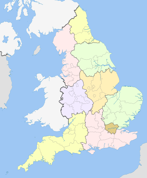
== {{int:filedesc}} == {{Information |Description={{en|Map showing the en:Regions of England and the constituent metropolitan and non-metropolitan counties, in 2009. Equirectangular m...
ไฟล, english, regions, 2009, ไฟล, ประว, ไฟล, หน, าท, ภาพน, การใช, ไฟล, วนกลางขนาดของต, วอย, าง, ของไฟล, กเซล, ความละเอ, ยดอ, กเซล, กเซล, กเซล, กเซล, กเซล, กเซล, ภาพท, ความละเอ, ยดส, งกว, 8206, ไฟล, กเซล, ขนาดไฟล, โลไบต, ปภาพหร, อไฟล, เส, ยงน, นฉบ, บอย, คอมมอนส. ifl prawtiifl hnathimiphaphni karichiflswnklangkhnadkhxngtwxyang PNG nikhxngifl SVG ni 494 600 phikesl khwamlaexiydxun 198 240 phikesl 395 480 phikesl 633 768 phikesl 843 1 024 phikesl 1 687 2 048 phikesl 1 108 1 345 phikesl duphaphthimikhwamlaexiydsungkwa 8206 ifl SVG 1 108 1 345 phikesl khnadifl 365 kiolibt rupphaphhruxiflesiyngni tnchbbxyuthi khxmmxns raylaexiyddanlang epnkhxkhwamthiaesdngphlcak ifltnchbbinkhxmmxns khxmmxnsepnewbistinokhrngkarsahrbekbrwbrwmsuxesri thi khunsamarthchwyid khwamyx khaxthibayEnglish regions 2009 svg English Map showing the Regions of England and the constituent metropolitan and non metropolitan counties in 2009 Equirectangular map projection on WGS 84 datum with N S stretched 170 Geographic limits West 6 75W East 2 0E North 56 0N South 49 75N wnthi 21 emsayn ph s 2555 19 53 UTC aehlngthima This file was derived from English metropolitan and non metropolitan counties 2010 svg nbsp phusrangsrrkh English metropolitan and non metropolitan counties 2010 svg Nilfanion derivative work Dr Greg phaphni idrbkarprbaetngphaph sunghmaykhwamwacaidrbkarepliynaeplngphaphtangcaktnchbb karprbprung recoloured with some thicker boundary lines tnchbbsamarthduidthini English metropolitan and non metropolitan counties 2010 svg prbaetngphaphody Dr Greg nbsp karxnuyatichsiththi khapheca inthanaphuthuxlikhsiththikhxngphaphhruxsuxni xnuyatihichphaphhruxsuxniphayitenguxnikhtxipniiflnixyuphayitsyyaxnuyat khriexthifkhxmmxns aebbaesdngthima xnuyataebbediywkn 3 0 tnchbbkaraesdngthima Nilfanion and Dr Gregkhunsamarth thicaaebngpn thicathasaena aeckcay aelasngngandngklawtxip thicaeriyberiyngihm thicaddaeplngngandngklaw phayitenguxnikhtxipni aesdngthima khuntxngihekiyrtiecakhxngnganxyangehmaasm odyephimlingkipyngsyyaxnuyat aelarabuhakmikarepliynaeplng khunxacthaechnniidinrupaebbidkidtamkhwr aettxngimichinlksnathiaenawaphuihxnuyatsnbsnunkhunhruxkarichngankhxngkhun xnuyataebbediywkn hakkhunddaeplng epliynrup hruxtxetimnganni khuntxngichsyyaxnuyataebbediywknhruxaebbthiehmuxnkbsyyaxnuyatthiichkbnganniethannhttps creativecommons org licenses by sa 3 0 CC BY SA 3 0 Creative Commons Attribution Share Alike 3 0 true true xnuyatihkhdlxk aeckcayaela hruxddaeprexksarniphayitenguxnikhkhxngsyyaxnuyatexksaresrikhxngknu run 1 2 hruxrunid nbcaknithixxkodymulnithisxftaewresri odyimmiswnidhamaekikh immikhxkhwampkhnaaelapkhlng saenakhxngsyyaxnuyatrwmxyuinswnchux syyaxnuyatexksaresrikhxngknuhttp www gnu org copyleft fdl html GFDL GNU Free Documentation License true truekhunsamartheluxksyyaxnuyatdngklawtamtxngkar bnthukkarxphohld This image is a derivative work of the following images File English metropolitan and non metropolitan counties 2010 svg licensed with Cc by sa 3 0 GFDL 2010 11 23T22 01 59Z Nilfanion 1108x1345 340057 Bytes England only 2010 11 23T22 00 28Z Nilfanion 1108x1345 376231 Bytes Information Description Map showing the w Metropolitan and non metropolitan counties of England Metropolitan and non metropolitan counties of England in 2010 Equirectangular map projection on WGS 84 datum with N S Uploaded with derivativeFXkhabrryayodyyxithyephimkhabrryaythrrthdediywephuxkhyaykhwamwaiflnimixairixethmthiaesdngxyuiniflniprakxbdwysthanalikhsiththimilikhsiththisyyaxnuyatCreative Commons Attribution ShareAlike 3 0 Unported nbsp xngkvsGNU Free Documentation License version 1 2 or lateral nbsp xngkvswnthisrang wnkxtng21 emsayn 2012 prawtiifl khlikwnthi ewlaephuxduiflthipraktinkhnann wnthi ewlarupyxkhnadphuichkhwamehn pccubn03 04 22 emsayn 25551 108 1 345 365 kiolibt Dr Greg int filedesc Information Description en Map showing the en Regions of England and the constituent metropolitan and non metropolitan counties in 2009 Equirectangular m hnathimiphaphni hnatxipni oyngmathiphaphni phumiphakhkhxngpraethsxngkvs ekhtkarpkkhrxngkhxngpraethsxngkvs phuich Kanitthapuy aemaebb aephnthixngkvs phakhkarpkkhrxng hmwdhmu bukhkhlcaknxrthxistxingaelnd hmwdhmu bukhkhlcaknxrthewstxingaelnd hmwdhmu bukhkhlcakyxrkechxraelahmebxr hmwdhmu bukhkhlcakxistmidaelns hmwdhmu bukhkhlcakxistxxfxingaelnd hmwdhmu bukhkhlcakesathxistxingaelnd hmwdhmu bukhkhlcakesathewstxingaelnd hmwdhmu bukhkhlcakewstmidaelns karichiflswnklang wikixuntxipniichiflni karichbn bg wikipedia org Administrativno delenie na Angliya Regioni v Angliya Shablon Regioni na Angliya karichbn bs wikipedia org Regije Engleske Sablon Regije Engleske karta karichbn en wikipedia org List of forests in the United Kingdom Subdivisions of England Regional assembly England Regional development agency Lists of schools in England User Ric36 Sandbox Talk Politics of England Template England Labelled Map United Kingdom constitutional law Local authority leaders board Regions of England Constitution of the United Kingdom Category People by region in England Category Cities in England by region Category NUTS 1 statistical regions of England Devolution in the United Kingdom User talk Iridescent Archive 17 Category British school stubs User Ric36 sandbox User Bermicourt Template Lists of hills of English counties karichbn es wikipedia org Categoria Localidades de Inglaterra por region karichbn fo wikipedia org Ongland Fyrimynd England Labelled Map karichbn fr wikipedia org Region d Angleterre Modele Regions Angleterre karichbn hi wikipedia org इ ग ल ड क क ष त र karichbn id wikipedia org Pembagian administratif Inggris karichbn it wikipedia org Devoluzione nel Regno Unito karichbn ja wikipedia org Template イングランド地図ラベル付 イングランドの行政区画 リージョン イングランド イギリスにおける権限委譲 karichbn mr wikipedia org इ ग ल डच प रद श karichbn pl wikipedia org Regiony Anglii Szablon Regiony Anglii Wikipedysta Interfector Szablony map karichbn pnb wikipedia org انگلستان سانچہ England Labelled Map karichbn pt wikipedia org Inglaterra Regioes da Inglaterra Predefinicao Divisoes regionais da Inglaterra karichbn sd wikipedia org انگلينڊ جا خطا سانچو England Labelled Map karichbn sq wikipedia org Rajonet e Anglise Stampa England Labelled Map dukarichthwolkephimetimkhxngiflni ekhathungcak https th wikipedia org wiki ifl English regions 2009 svg, wikipedia, วิกิ หนังสือ, หนังสือ, ห้องสมุด,