azərbaycanca ∙ Deutsch (Sie-Form) ∙ čeština ∙ Deutsch ∙ sicilianu ∙ italiano ∙ русский ∙ română ∙ português ∙ English ∙ magyar ∙ Nederlands ∙ slovenščina ∙ polski ∙ latviešu ∙ македонски ∙ español ∙ فارسی ∙ français ∙ suomi ∙ עברית ∙ Plattdüütsch ∙ ქართული ∙ հայերեն ∙ বাংলা ∙ ไทย ∙ 日本語 ∙ 中文 ∙ 中文(简体) ∙ 中文(繁體) ∙ العربية ∙ +/−
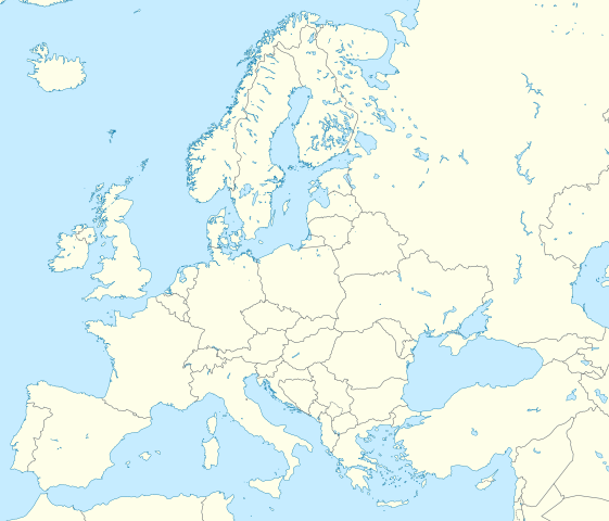
== Summary == {{Information |Description= {{de|Positionskarte Europa; Politisch mit Staatsgrenzen; Flächentreue Azimutalprojektion}} {{en|Location map Europe; Political with state boundaries; Lambert azimuthal equal-area pro
ไฟล, europe, blank, laea, location, ไฟล, ประว, ไฟล, หน, าท, ภาพน, การใช, ไฟล, วนกลาง, อม, ลเก, ยวก, บภาพขนาดของต, วอย, าง, ของไฟล, กเซล, ความละเอ, ยดอ, กเซล, กเซล, กเซล, กเซล, กเซล, กเซล, ภาพท, ความละเอ, ยดส, งกว, 8206, ไฟล, กเซล, ขนาดไฟล, เมกะไบต, ปภาพหร, อไฟ. ifl prawtiifl hnathimiphaphni karichiflswnklang khxmulekiywkbphaphkhnadkhxngtwxyang PNG nikhxngifl SVG ni 701 599 phikesl khwamlaexiydxun 281 240 phikesl 561 480 phikesl 898 768 phikesl 1 198 1 024 phikesl 2 395 2 048 phikesl 1 401 1 198 phikesl duphaphthimikhwamlaexiydsungkwa 8206 ifl SVG 1 401 1 198 phikesl khnadifl 1 42 emkaibt rupphaphhruxiflesiyngni tnchbbxyuthi khxmmxns raylaexiyddanlang epnkhxkhwamthiaesdngphlcak ifltnchbbinkhxmmxns khxmmxnsepnewbistinokhrngkarsahrbekbrwbrwmsuxesri thi khunsamarthchwyid Bosnia khwamyx khaxthibayEurope blank laea location map svg Deutsch Positionskarte Europa Politisch mit Staatsgrenzen Flachentreue Azimutalprojektion English Location map Europe Political with state boundaries Lambert azimuthal equal area projection Projection LAEA Europe EPSG 3035 Longitude of projection center 10 E Latitude of projection center 52 N Map extent LAEA Europe Xmin Ymin to Xmax Ymax 2555000 1350000 to 7405000 5500000 Map extent WGS84 lon lat of lower left and upper right corner 8 9067 33 2307 to 72 9617 58 9174 nbsp iflkrafiksni srangkhunodyich nbsp GeoTools wnthi minakhm ph s 2553 aehlngthima ngankhxngtw Data from http naturalearthdata com Scale 1 10 Mio phusrangsrrkh Alexrk2 ewxrchnxun iflxunthiichiflni United Kingdom and North West France svg Western Europe World Heritage Sites png aekikh Blank political map Political map with state boundaries inland water and rivers European Union NATO members European countries Physical map Physical map with land cover Bluemarble Before 1990 Larger cut with Europe s limits stereographic projection aephnthinithuksranghruxphthnakhuncak Kartenwerkstatt hxngptibtikaraephnthi khxngwikiphiediyphasaeyxrmn sungkhunsamarthesnxaephnthiephuxphthnaidechnediywkn azerbaycanca nbsp Deutsch Sie Form nbsp cestina nbsp Deutsch nbsp sicilianu nbsp italiano nbsp russkij nbsp romană nbsp portugues nbsp English nbsp magyar nbsp Nederlands nbsp slovenscina nbsp polski nbsp latviesu nbsp makedonski nbsp espanol nbsp فارسی nbsp francais nbsp suomi nbsp עברית nbsp Plattduutsch nbsp ქართული nbsp հայերեն nbsp ব ল nbsp ithy nbsp 日本語 nbsp 中文 nbsp 中文 简体 nbsp 中文 繁體 nbsp العربية nbsp karxnuyatichsiththi khapheca inthanaphuthuxlikhsiththikhxngphaphhruxsuxni xnuyatihichphaphhruxsuxniphayitenguxnikhtxipniiflnixyuphayitsyyaxnuyat khriexthifkhxmmxns aebbaesdngthima xnuyataebbediywkn 3 0 tnchbbkhunsamarth thicaaebngpn thicathasaena aeckcay aelasngngandngklawtxip thicaeriyberiyngihm thicaddaeplngngandngklaw phayitenguxnikhtxipni aesdngthima khuntxngihekiyrtiecakhxngnganxyangehmaasm odyephimlingkipyngsyyaxnuyat aelarabuhakmikarepliynaeplng khunxacthaechnniidinrupaebbidkidtamkhwr aettxngimichinlksnathiaenawaphuihxnuyatsnbsnunkhunhruxkarichngankhxngkhun xnuyataebbediywkn hakkhunddaeplng epliynrup hruxtxetimnganni khuntxngichsyyaxnuyataebbediywknhruxaebbthiehmuxnkbsyyaxnuyatthiichkbnganniethannhttps creativecommons org licenses by sa 3 0 CC BY SA 3 0 Creative Commons Attribution Share Alike 3 0 true truekhabrryayodyyxithyephimkhabrryaythrrthdediywephuxkhyaykhwamwaiflnimixairxngkvsAn unlabeled map of EuropeixethmthiaesdngxyuiniflniprakxbdwyElizabeth Fry nbsp xngkvsphusrangbangkhathiimmiixethmwikisnethschuxphusrangsrrkh Alexrk2yuxaraexl https commons wikimedia org wiki user Alexrk2chuxphuichwikimiediy Alexrk2sthanalikhsiththimilikhsiththisyyaxnuyatCreative Commons Attribution ShareAlike 3 0 Unported nbsp xngkvsthimakhxngiflkarsrangdngedimodyphuxpohldwnthisrang wnkxtngminakhm 2010MIME type nbsp xngkvsimage svg xml prawtiifl khlikwnthi ewlaephuxduiflthipraktinkhnann wnthi ewlarupyxkhnadphuichkhwamehn pccubn10 13 9 minakhm 25631 401 1 198 1 42 emkaibt RatherousAdd more inland water for better accuracy 17 28 1 kumphaphnth 25631 401 1 198 1 84 emkaibt Thayts disputed crimea golan heights and other minor border tweaks 03 50 12 minakhm 25531 401 1 198 1 84 emkaibt Alexrk2fixing inland water 02 58 12 minakhm 25531 401 1 198 1 83 emkaibt Alexrk2 Summary Information Description de Positionskarte Europa Politisch mit Staatsgrenzen Flachentreue Azimutalprojektion en Location map Europe Political with state boundaries Lambert azimuthal equal area pro hnathimiphaphni hnatxipni oyngmathiphaphni kilaedflimpik kharkiw khirxf samara salamngka sikhtifkhar suchawa dndi pharalimpikvduhnaw msyid xasnwiharkxrodba rxtethxrdam wladikhfkhas wxlelybxlchaychingaechmpyuorp 2021 xnthkya xaetxera xinetxrenchnaenlaechmepiynskhph vdukal 2015 xinetxrenchnaenlaechmepiynskhph vdukal 2018 xinetxrenchnaenlaechmepiynskhph vdukal 2019 xiecfskh xufa ekhrmlinaehngmxsok edxasuepxrlik epnsa ehtukradyinginxxsol ph s 2565 ehtuocmtiinkhxngsaebrk exlista aebdmintnchingaechmpolk oslonk owrl oxernburk mxdul Location map data Europe mxdul Location map data Europe doc karichiflswnklang wikixuntxipniichiflni karichbn ab wikipedia org Amodul Location map data Europe Amodul Location map data Europe doc karichbn af wikipedia org Gebruiker SpesBona Boedapest Sjabloon Liggingkaart Europa Nyiregyhaza Groep van Sewe Espoo karichbn als wikipedia org Vorlage Positionskarte Europa karichbn ar wikipedia org دوري أبطال أوروبا 2000 01 دوري أبطال أوروبا 1994 95 دوري أبطال أوروبا 1995 96 دوري أبطال أوروبا 1996 97 مطار ميونخ الدولي قالب خريطة مواقع أوروبا بطولات رابطة محترفي التنس 500 نقطة محكمة العدل للاتحاد الأوروبي الدوري الأوروبي لكرة السلة قالب خريطة موقع أوروبا دوري أبطال أوروبا لكرة اليد الدوري الأوروبي 2016 17 الكأس الدولية للأبطال 2016 دوري أبطال أوروبا 2017 18 الكأس الدولية للأبطال 2019 قائمة مدن الاتحاد الأوروبي حسب تعداد السكان المسلمين ناسداك نورديك قالب 2019 20 coronavirus pandemic data Map dots يوروكوربس دوري المؤتمر الأوروبي 2021 22 دوري السوبر الأوروبي الدوري الأوروبي 2022 23 سباق الجائزة الكبرى للدراجات النارية موسم 2022 karichbn arz wikipedia org وحدة Location map data Europe doc قلعة مونسورياو karichbn ast wikipedia org Mar d Azov Archipielagu d Estocolmu Modulu Minimapa data Europa Modulu Minimapa data Europa usu karichbn av wikipedia org Halip BakӀKarta Evropa karichbn azb wikipedia org مادرید آتاتورک هاوا آلانی ایوانوفو سانتا ماریا د هوئرتا تربیخا سهخین تاربنا کاستل د کاستیس بیتوریا پلانس وال د لاقوارت dukarichthwolkephimetimkhxngiflnikhxmulekiywkbphaph phaphnimikhxmulephimetim sungswnihymacakklxngdicitxlhruxsaeknenxrthisamarthekbkhxmuldngklawiwrwmkbphaphid thaphaphnithukprbprungaekikhhruxepliynaeplngcakedim khxmulbangxyangcayngkhngimepliynaeplngehmuxnphaphthithukprbprungaekikhnnkhwamkwang1401 34khwamsung1198 34 ekhathungcak https th wikipedia org wiki ifl Europe blank laea location map svg, wikipedia, วิกิ หนังสือ, หนังสือ, ห้องสมุด,