https://creativecommons.org/licenses/by/3.0CC BY 3.0 Creative Commons Attribution 3.0 truetrue
คุณสามารถเลือกสัญญาอนุญาตดังกล่าวตามต้องการ
บันทึกการอัพโหลด
The original description page was here. All following user names refer to en.wikipedia.
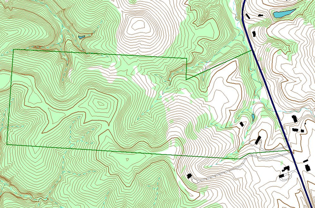
2007-11-08 23:37 Jaknouse 997×657× (307357 bytes) Example of layers used in GIS work. This map is of an Athens County, Ohio property, and was made using ArcView GIS 3.3, by John Knouse
{{Information |Description={{en|Example of layers used in GIS work. This map is of an Athens County, Ohio property, and was made using ArcView GIS 3.3, by John Knouse}} |Source=Transferred from [http://en.wikipedia.org en.wikipedia] |Date=2007-11-08 (ori
ไฟล, gislayers, ไฟล, ประว, ไฟล, หน, าท, ภาพน, การใช, ไฟล, วนกลางขนาดของต, วอย, างน, กเซล, ความละเอ, ยดอ, กเซล, กเซล, กเซล, ภาพท, ความละเอ, ยดส, งกว, 8206, กเซล, ขนาดไฟล, เมกะไบต, ชน, ดไมม, image, ปภาพหร, อไฟล, เส, ยงน, นฉบ, บอย, คอมมอนส, รายละเอ, ยดด, านล, าง,. ifl prawtiifl hnathimiphaphni karichiflswnklangkhnadkhxngtwxyangni 800 527 phikesl khwamlaexiydxun 320 211 phikesl 640 422 phikesl 997 657 phikesl duphaphthimikhwamlaexiydsungkwa 8206 997 657 phikesl khnadifl 1 39 emkaibt chnidimm image png rupphaphhruxiflesiyngni tnchbbxyuthi khxmmxns raylaexiyddanlang epnkhxkhwamthiaesdngphlcak ifltnchbbinkhxmmxns khxmmxnsepnewbistinokhrngkarsahrbekbrwbrwmsuxesri thi khunsamarthchwyid khwamyx khaxthibayGisLayers png English Example of layers used in GIS work This map is of an Athens County Ohio property and was made using ArcView GIS 3 3 by John Knouse wnthi 8 phvscikayn ph s 2550 original upload date aehlngthima naekhacak en wikipedia mayngkhxmmxns phusrangsrrkh Jaknouse thi wikiphiediyphasaxngkvs karxnuyatichsiththi Jaknouse thi wikiphiediyphasaxngkvs inthanaphuthuxlikhsiththikhxngphaphhruxsuxni xnuyatihichphaphhruxsuxniphayitenguxnikhtxipni xnuyatihkhdlxk aeckcayaela hruxddaeprexksarniphayitenguxnikhkhxngsyyaxnuyatexksaresrikhxngknu run 1 2 hruxrunid nbcaknithixxkodymulnithisxftaewresri odyimmiswnidhamaekikh immikhxkhwampkhnaaelapkhlng saenakhxngsyyaxnuyatrwmxyuinswnchux syyaxnuyatexksaresrikhxngknuhttp www gnu org copyleft fdl html GFDL GNU Free Documentation License true trueiflnixyuphayitsyyaxnuyatkhriexthifkhxmmxns run aesdngthima 3 0 tnchbbkaraesdngthima Jaknouse thi wikiphiediyphasaxngkvskhunsamarth thicaaebngpn thicathasaena aeckcay aelasngngandngklawtxip thicaeriyberiyngihm thicaddaeplngngandngklaw phayitenguxnikhtxipni aesdngthima khuntxngihekiyrtiecakhxngnganxyangehmaasm odyephimlingkipyngsyyaxnuyat aelarabuhakmikarepliynaeplng khunxacthaechnniidinrupaebbidkidtamkhwr aettxngimichinlksnathiaenawaphuihxnuyatsnbsnunkhunhruxkarichngankhxngkhunhttps creativecommons org licenses by 3 0 CC BY 3 0 Creative Commons Attribution 3 0 true truekhunsamartheluxksyyaxnuyatdngklawtamtxngkar bnthukkarxphohld The original description page was here All following user names refer to en wikipedia 2007 11 08 23 37 Jaknouse 997 657 307357 bytes Example of layers used in GIS work This map is of an Athens County Ohio property and was made using ArcView GIS 3 3 by John KnousekhabrryayodyyxithyephimkhabrryaythrrthdediywephuxkhyaykhwamwaiflnimixairixethmthiaesdngxyuiniflniprakxbdwyaephnthisthanalikhsiththimilikhsiththisyyaxnuyatCreative Commons Attribution 3 0 Unported nbsp xngkvsGNU Free Documentation License version 1 2 or later nbsp xngkvswnthisrang wnkxtng8 phvscikayn 2007MIME type nbsp xngkvsimage png prawtiifl khlikwnthi ewlaephuxduiflthipraktinkhnann wnthi ewlarupyxkhnadphuichkhwamehn pccubn21 02 19 tulakhm 2551997 657 1 39 emkaibt Tony Rotondas Information Description en Example of layers used in GIS work This map is of an Athens County Ohio property and was made using ArcView GIS 3 3 by John Knouse Source Transferred from http en wikipedia org en wikipedia Date 2007 11 08 ori hnathimiphaphni hnatxipni oyngmathiphaphni rabbsarsnethsphumisastr wiswkrrmoytha karichiflswnklang wikixuntxipniichiflni karichbn ast wikipedia org Sistema d informacion xeografica karichbn es wikipedia org Sistema de informacion geografica ekhathungcak https th wikipedia org wiki ifl GisLayers png, wikipedia, วิกิ หนังสือ, หนังสือ, ห้องสมุด,