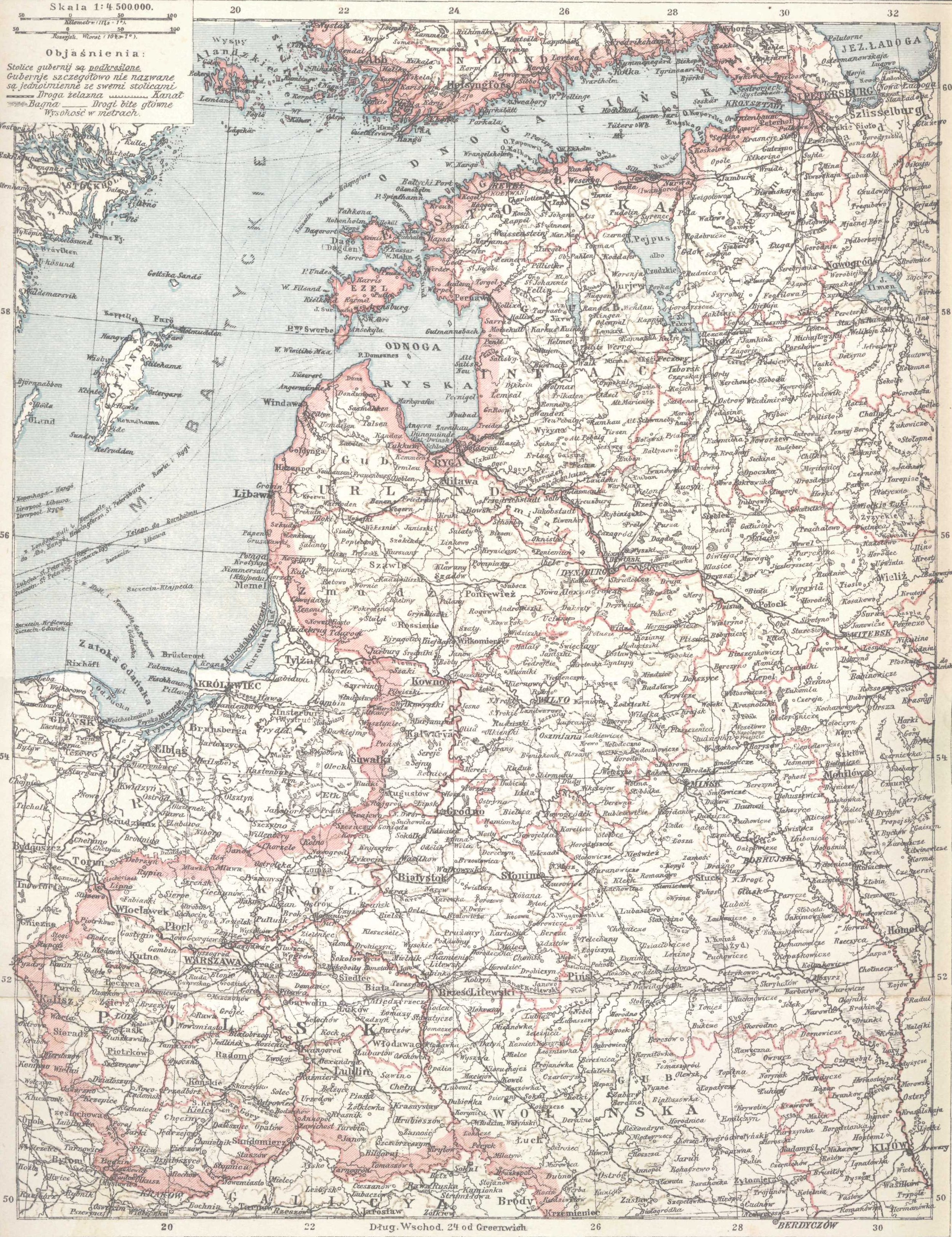
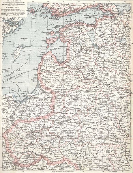
คำอธิบายGubernie zachodnie krolestwo polskie 1902.jpg
English: Western Governorships of the Russian Empire and Polish Kingdom in 1902. Map from Olgebrand's Encyclopedia (lithography) printed in Warszawa, 1902
Polski: Mapa "Gubernie Zachodnie i Królestwo Polskie" z encyklopedii Samuela Orgelbranda z r. 1902 - litografia
วันที่
แหล่งที่มา
pl:S._Orgelbranda_Encyklopedia_Powszechna_(1898)
Geotemporal data
Date depicted
พิกัดแผนที่
Western Governorships of the Russian Empire, Polish Kingdom
ไฟล, gubernie, zachodnie, krolestwo, polskie, 1902, ไฟล, ประว, ไฟล, หน, าท, ภาพน, การใช, ไฟล, วนกลาง, อม, ลเก, ยวก, บภาพขนาดของต, วอย, างน, กเซล, ความละเอ, ยดอ, กเซล, กเซล, กเซล, กเซล, กเซล, ภาพท, ความละเอ, ยดส, งกว, 8206, กเซล, ขนาดไฟล, เมกะไบต, ชน, ดไมม, ima. ifl prawtiifl hnathimiphaphni karichiflswnklang khxmulekiywkbphaphkhnadkhxngtwxyangni 461 599 phikesl khwamlaexiydxun 185 240 phikesl 369 480 phikesl 591 768 phikesl 788 1 024 phikesl 2 500 3 247 phikesl duphaphthimikhwamlaexiydsungkwa 8206 2 500 3 247 phikesl khnadifl 2 21 emkaibt chnidimm image jpeg rupphaphhruxiflesiyngni tnchbbxyuthi khxmmxns raylaexiyddanlang epnkhxkhwamthiaesdngphlcak ifltnchbbinkhxmmxns khxmmxnsepnewbistinokhrngkarsahrbekbrwbrwmsuxesri thi khunsamarthchwyid khwamyx khaxthibayGubernie zachodnie krolestwo polskie 1902 jpg English Western Governorships of the Russian Empire and Polish Kingdom in 1902 Map from Olgebrand s Encyclopedia lithography printed in Warszawa 1902 Polski Mapa Gubernie Zachodnie i Krolestwo Polskie z encyklopedii Samuela Orgelbranda z r 1902 litografia wnthi 2444 hrux 2445 aehlngthima pl S Orgelbranda Encyklopedia Powszechna 1898 nbsp Geotemporal data Date depicted 2444 hrux 2445 phikdaephnthi Western Governorships of the Russian Empire Polish Kingdom khxbekht N 61 0721239 N W 16 412033 E E 33 0932989 E S 49 5983809 N phikdxangxingthangphumisastr duaephnthithixangxingthangphumisastrcak Wikimaps Warper nbsp Bibliographic data phasa opaelnd karxnuyatichsiththi scanned by myself source Samuel Orgelbrand s Universal Encyclopedia with illustrations and maps edited in sixteen volumes 1898 1904 plus two volumes of suplement 1911 amp 1912 Public domain Public domain false false nganniepnsatharnsmbti inpraethstnkaenidaelapraethsxun thirayaewlakarkhumkhrxnglikhsiththinxykwa 100 pihlngcakphusrangsrrkhnganesiychiwit nganniepnsatharnsmbtiinshrthxemrika enuxngcakidrbkarephyaephr hruxkhuncdthaebiyntxsanknganlikhsiththiaehngshrth kxnwnthi 1 mkrakhm kh s 1928 iflniidthukrabuwaimmikhxcakdphayitkdhmaylikhsiththi rwmthungsiththithiekiywkhxngaelathiiklekhiyngknhttps creativecommons org publicdomain mark 1 0 PDM Creative Commons Public Domain Mark 1 0 false false prawtiifl khlikwnthi ewlaephuxduiflthipraktinkhnann wnthi ewlarupyxkhnadphuichkhwamehn pccubn06 20 20 krkdakhm 25532 500 3 247 2 21 emkaibt BeaoRemoved border 20 01 23 kumphaphnth 25482 572 3 522 1 28 emkaibt JuloWestern Governorships of Russian Empire and Polish Kingdom in 1902 hnathimiphaphni immihnaidoyngmathiphaphnikarichiflswnklang wikixuntxipniichiflni karichbn ar wikipedia org طباعة حجرية karichbn be wikipedia org Gistoryya Belarusi karichbn ca wikipedia org Historia de Bielorussia karichbn cs wikipedia org Dejiny Beloruska karichbn de wikipedia org Wolost Polangen karichbn en wikipedia org Lithography Subdivisions of Congress Poland Subdivisions of the Polish Lithuanian territories following the partitions Saint Petersburg Warsaw railway User Alainr345 Sandbox User Alainr345 Sandbox Graphics User Ajh1492 PK Grobinas aprinkis User Jjpachano sandbox4 karichbn et wikipedia org Valgevene ajalugu Litograafia Balti kubermangud Balti raudtee Varssavi kindralkubermang Kitsaroopmeline raudtee Eestis Valga Ruhja Parnu raudtee Raudteetransport Latis Pihkva Riia raudtee 20 sajand Eestis karichbn fi wikipedia org Minskin kuvernementti Grodnon kuvernementti karichbn fr wikipedia org Histoire de la Bielorussie karichbn it wikipedia org Regno del Congresso karichbn ka wikipedia org პოლონეთის რუსული ანექსია პოლონეთის სამეფო karichbn lt wikipedia org Litografija Naudotojas CD 1902 karichbn lt wikibooks org Lietuvos metrastis 1902 karichbn lv wikipedia org Attels Latgales karte poliski 1902 jpg karichbn ml wikipedia org ല ത ത ഗ ര ഫ karichbn pl wikipedia org Litografia Krolestwo Polskie kongresowe Ziemie zabrane Historia Bialorusi Wikipedysta Julo Archiwum1 Historia Polski 1831 1914 Podzial administracyjny Krolestwa Polskiego Wikipedysta Justych brudnopis Gubernie zachodnie karichbn pt wikipedia org Divisao administrativa dos territorios poloneses apos as particoes Divisao administrativa do Congresso da Polonia Polonia do Congresso karichbn ro wikipedia org Litografie karichbn sr wikipedia org Istoriјa Belorusiјe karichbn tg wikipedia org Tarihi Belarus dukarichthwolkephimetimkhxngiflnikhxmulekiywkbphaph phaphnimikhxmulephimetim sungswnihymacakklxngdicitxlhruxsaeknenxrthisamarthekbkhxmuldngklawiwrwmkbphaphid thaphaphnithukprbprungaekikhhruxepliynaeplngcakedim khxmulbangxyangcayngkhngimepliynaeplngehmuxnphaphthithukprbprungaekikhnn error0 ekhathungcak https th wikipedia org wiki ifl Gubernie zachodnie krolestwo polskie 1902 jpg, wikipedia, วิกิ หนังสือ, หนังสือ, ห้องสมุด,