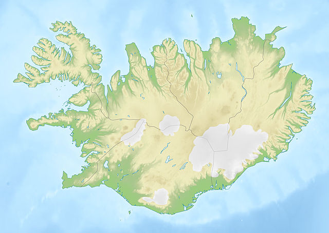
{{Information |Description={{de|Positionskarte von Island}} Quadratische Plattkarte, N-S-Streckung 230 %. Geographische Begrenzung der Karte: * N: 66.8° N * S: 63.1° N * W: 25° W * O: 13° W {{en|Location map of Iceland
ไฟล, iceland, relief, ไฟล, ประว, ไฟล, หน, าท, ภาพน, การใช, ไฟล, วนกลาง, อม, ลเก, ยวก, บภาพขนาดของต, วอย, างน, กเซล, ความละเอ, ยดอ, กเซล, กเซล, กเซล, กเซล, ภาพท, ความละเอ, ยดส, งกว, 8206, กเซล, ขนาดไฟล, โลไบต, ชน, ดไมม, image, jpeg, ปภาพหร, อไฟล, เส, ยงน, นฉบ, . ifl prawtiifl hnathimiphaphni karichiflswnklang khxmulekiywkbphaphkhnadkhxngtwxyangni 800 567 phikesl khwamlaexiydxun 320 227 phikesl 640 454 phikesl 1 024 726 phikesl 1 200 851 phikesl duphaphthimikhwamlaexiydsungkwa 8206 1 200 851 phikesl khnadifl 161 kiolibt chnidimm image jpeg rupphaphhruxiflesiyngni tnchbbxyuthi khxmmxns raylaexiyddanlang epnkhxkhwamthiaesdngphlcak ifltnchbbinkhxmmxns khxmmxnsepnewbistinokhrngkarsahrbekbrwbrwmsuxesri thi khunsamarthchwyid khaxthibayIceland relief map jpg Deutsch Positionskarte von Island Quadratische Plattkarte N S Streckung 230 nbsp Geographische Begrenzung der Karte N 66 8 N S 63 1 N W 25 W O 13 W English Location map of Iceland Equirectangular projection N S stretching 230 nbsp Geographic limits of the map N 66 8 N S 63 1 N W 25 W E 13 W wnthi 20 tulakhm ph s 2553 13 37 UTC aehlngthima Iceland location map svg SRTM30 phusrangsrrkh Iceland location map svg NordNordWest derivative work Viktor V talk phaphni idrbkarprbaetngphaph sunghmaykhwamwacaidrbkarepliynaeplngphaphtangcaktnchbb tnchbbsamarthduidthini Iceland location map svg nbsp khapheca inthanaphuthuxlikhsiththikhxngphaphhruxsuxni xnuyatihichphaphhruxsuxniphayitenguxnikhtxipniiflnixyuphayitsyyaxnuyat khriexthifkhxmmxns aebbaesdngthima xnuyataebbediywkn 3 0 tnchbbkhunsamarth thicaaebngpn thicathasaena aeckcay aelasngngandngklawtxip thicaeriyberiyngihm thicaddaeplngngandngklaw phayitenguxnikhtxipni aesdngthima khuntxngihekiyrtiecakhxngnganxyangehmaasm odyephimlingkipyngsyyaxnuyat aelarabuhakmikarepliynaeplng khunxacthaechnniidinrupaebbidkidtamkhwr aettxngimichinlksnathiaenawaphuihxnuyatsnbsnunkhunhruxkarichngankhxngkhun xnuyataebbediywkn hakkhunddaeplng epliynrup hruxtxetimnganni khuntxngichsyyaxnuyataebbediywknhruxaebbthiehmuxnkbsyyaxnuyatthiichkbnganniethannhttps creativecommons org licenses by sa 3 0 CC BY SA 3 0 Creative Commons Attribution Share Alike 3 0 true true xnuyatihkhdlxk aeckcayaela hruxddaeprexksarniphayitenguxnikhkhxngsyyaxnuyatexksaresrikhxngknu run 1 2 hruxrunid nbcaknithixxkodymulnithisxftaewresri odyimmiswnidhamaekikh immikhxkhwampkhnaaelapkhlng saenakhxngsyyaxnuyatrwmxyuinswnchux syyaxnuyatexksaresrikhxngknuhttp www gnu org copyleft fdl html GFDL GNU Free Documentation License true truekhunsamartheluxksyyaxnuyatdngklawtamtxngkar bnthukkarxphohld This image is a derivative work of the following images File Iceland location map svg licensed with Cc by sa 3 0 GFDL 2008 07 03T15 25 55Z NordNordWest 1186x841 277400 Bytes corrected 2008 06 30T19 38 28Z NordNordWest 1186x841 275750 Bytes 2008 06 29T17 37 15Z NordNordWest 1186x841 279815 Bytes Information Description de Positionskarte von de Island Island Quadratische Plattkarte N S Streckung 230 nbsp Geographische Begrenzung der Karte N 66 8 N S 63 1 N W 25 W O 13 W en Location m Uploaded with derivativeFXkhabrryayodyyxithyephimkhabrryaythrrthdediywephuxkhyaykhwamwaiflnimixairixethmthiaesdngxyuiniflniprakxbdwysthanalikhsiththimilikhsiththisyyaxnuyatCreative Commons Attribution ShareAlike 3 0 Unported nbsp xngkvsGNU Free Documentation License version 1 2 or later nbsp xngkvswnthisrang wnkxtng20 tulakhm 2010 prawtiifl khlikwnthi ewlaephuxduiflthipraktinkhnann wnthi ewlarupyxkhnadphuichkhwamehn pccubn22 23 20 tulakhm 25531 200 851 161 kiolibt Viktor Vm 20 39 20 tulakhm 25531 000 709 124 kiolibt Viktor V Information Description de Positionskarte von Island Quadratische Plattkarte N S Streckung 230 Geographische Begrenzung der Karte N 66 8 N S 63 1 N W 25 W O 13 W en Location map of Iceland hnathimiphaphni hnatxipni oyngmathiphaphni krimswxthn kullfxss phuekhaiflaikh sokkafxss eslyalnsfxss exyyafiytlaeyxkhuts mxdul Location map data Iceland mxdul Location map data Iceland doc karichiflswnklang wikixuntxipniichiflni karichbn als wikipedia org Vorlage Positionskarte Island karichbn an wikipedia org Eyjafjallajokull karichbn ar wikipedia org ريكيافيك قالب خريطة مواقع آيسلندا karichbn ast wikipedia org Modulu Minimapa data Islandia Modulu Minimapa data Islandia usu karichbn av wikipedia org Shablon BakIKarta Islandiya karichbn az wikipedia org Surtsey Eyyafyatlayokudl Qrimsvotn Sablon Yer xeritesi Islandiya Tinqvedlir Reykyanes yarimadasi Kleyvarvatn Launqanes Vatnsnes yarimadasi Xoup golu Bulandsnes Melrakkasletta Tryodlaskaqi Snayfedlsnes Hekla vulkani Eyya fiord Stoksnes Enniskorti stansiya Youlnir Qrimsey adasi Eldey karichbn ban wikipedia org Taman Nasional Vatnajokull karichbn bar wikipedia org Island Vorlog Positionskarte Island Adalvik karichbn ba wikipedia org Ҡalyp PozKarta Islandiya karichbn be wikipedia org Tyngvadlavatn Sog Blanda Gekla Cyoyrsay Hvitau Mivatn Tayrysvatn Yokulsay ay F yodlum Yolfusa Apavatn Lejgarvatn Keryz Ingalfsf yal Laki Hoyp Skyaylfandaflyoyt dukarichthwolkephimetimkhxngiflnikhxmulekiywkbphaph phaphnimikhxmulephimetim sungswnihymacakklxngdicitxlhruxsaeknenxrthisamarthekbkhxmuldngklawiwrwmkbphaphid thaphaphnithukprbprungaekikhhruxepliynaeplngcakedim khxmulbangxyangcayngkhngimepliynaeplngehmuxnphaphthithukprbprungaekikhnnkarcdwangphaphpktikhwamlaexiydaenwnxn91 059 dpikhwamlaexiydaenwtng91 059 dpisxftaewrthiichAdobe Photoshop CS3 Windowsaekikhphaphlasud19 20 20 tulakhm 2553sepssisRGB ekhathungcak https th wikipedia org wiki ifl Iceland relief map jpg, wikipedia, วิกิ หนังสือ, หนังสือ, ห้องสมุด,