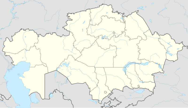
This map is part of a series of location maps with unified standards: SVG as file format, standardised colours and name scheme. The boundaries on these maps always show the de facto situation and do not imply any endorsement or acceptance. In case of changes of the shown area the file is updated. The old version will be uploaded as a new file and thus is still available.
วันที่
แหล่งที่มา
Own work using:
United States National Imagery and Mapping Agency data
azərbaycanca ∙ Deutsch (Sie-Form) ∙ čeština ∙ Deutsch ∙ sicilianu ∙ italiano ∙ русский ∙ română ∙ português ∙ English ∙ magyar ∙ Nederlands ∙ slovenščina ∙ polski ∙ latviešu ∙ македонски ∙ español ∙ فارسی ∙ français ∙ suomi ∙ עברית ∙ Plattdüütsch ∙ ქართული ∙ հայերեն ∙ বাংলা ∙ ไทย ∙ 日本語 ∙ 中文 ∙ 中文(简体) ∙ 中文(繁體) ∙ العربية ∙ +/−
การอนุญาตใช้สิทธิ
Usage of this file with:
Map: NordNordWest, Licence: Creative Commons by-sa-3.0 de
explanatory notes: Legally binding is only the full legalcode. For a free usage I recommend to respect the following licence conditions: 1. Provide my name as given above: NordNordWest, 2. a copy of, or the URI for, the applicable license: https://creativecommons.org/licenses/by-sa/3.0/de/legalcode, 3. the title of the work, 4. in the case of an adaptation, a credit identifying the use of the work in the adaptation. This license and the rights granted hereunder will terminate automatically upon any breach by you of the terms of this license. Any of the above conditions can be waived if you get permission from the copyright holder. If you have questions or wish differing conditions, please contact me through nnwestt-online.de or my discussion page
This file has been released under a license which is incompatible with Facebook's licensing terms. It is not permitted to upload this file to Facebook.
== {{int:filedesc}} == {{Information |Description= {{de|1=Positionskarte von Kasachstan}} {{en|1=Location map of Kazakhstan}} {{Location map series N |stretching=150 |top=56 |bottom=40 |left=46 |right=88 }} |Source={{Own using}} * United States Nationa...
ไฟล, kazakhstan, location, ไฟล, ประว, ไฟล, หน, าท, ภาพน, การใช, ไฟล, วนกลาง, อม, ลเก, ยวก, บภาพขนาดของต, วอย, าง, ของไฟล, กเซล, ความละเอ, ยดอ, กเซล, กเซล, กเซล, กเซล, กเซล, กเซล, ภาพท, ความละเอ, ยดส, งกว, 8206, ไฟล, กเซล, ขนาดไฟล, โลไบต, ปภาพหร, อไฟล, เส, ยงน,. ifl prawtiifl hnathimiphaphni karichiflswnklang khxmulekiywkbphaphkhnadkhxngtwxyang PNG nikhxngifl SVG ni 800 457 phikesl khwamlaexiydxun 320 183 phikesl 640 366 phikesl 1 024 585 phikesl 1 280 732 phikesl 2 560 1 463 phikesl 1 984 1 134 phikesl duphaphthimikhwamlaexiydsungkwa 8206 ifl SVG 1 984 1 134 phikesl khnadifl 562 kiolibt rupphaphhruxiflesiyngni tnchbbxyuthi khxmmxns raylaexiyddanlang epnkhxkhwamthiaesdngphlcak ifltnchbbinkhxmmxns khxmmxnsepnewbistinokhrngkarsahrbekbrwbrwmsuxesri thi khunsamarthchwyid khwamyx khaxthibayKazakhstan adm location map svg Deutsch Positionskarte von Kasachstan English Location map of Kazakhstan Equirectangular projection vertical stretching 150 nbsp Border coordinates5646 88 40 nbsp khxmulephimetim This map is part of a series of location maps with unified standards SVG as file format standardised colours and name scheme The boundaries on these maps always show the de facto situation and do not imply any endorsement or acceptance In case of changes of the shown area the file is updated The old version will be uploaded as a new file and thus is still available wnthi 26 knyayn ph s 2557 aehlngthima Own work using United States National Imagery and Mapping Agency data World Data Base II data phusrangsrrkh NordNordWest ewxrchnxun 2018 2022 aephnthinithuksranghruxphthnakhuncak Kartenwerkstatt hxngptibtikaraephnthi khxngwikiphiediyphasaeyxrmn sungkhunsamarthesnxaephnthiephuxphthnaidechnediywkn azerbaycanca nbsp Deutsch Sie Form nbsp cestina nbsp Deutsch nbsp sicilianu nbsp italiano nbsp russkij nbsp romană nbsp portugues nbsp English nbsp magyar nbsp Nederlands nbsp slovenscina nbsp polski nbsp latviesu nbsp makedonski nbsp espanol nbsp فارسی nbsp francais nbsp suomi nbsp עברית nbsp Plattduutsch nbsp ქართული nbsp հայերեն nbsp ব ল nbsp ithy nbsp 日本語 nbsp 中文 nbsp 中文 简体 nbsp 中文 繁體 nbsp العربية nbsp karxnuyatichsiththi Usage of this file with Map NordNordWest Licence Creative Commons by sa 3 0 de explanatory notes Legally binding is only the full legalcode For a free usage I recommend to respect the following licence conditions 1 Provide my name as given above NordNordWest 2 a copy of or the URI for the applicable license https creativecommons org licenses by sa 3 0 de legalcode 3 the title of the work 4 in the case of an adaptation a credit identifying the use of the work in the adaptation This license and the rights granted hereunder will terminate automatically upon any breach by you of the terms of this license Any of the above conditions can be waived if you get permission from the copyright holder If you have questions or wish differing conditions please contact me through span class nowrap nnwestt online de span or my discussion pageiflnixyuphayitsyyaxnuyat khriexthifkhxmmxns aebbaesdngthima xnuyataebbediywkn 3 0 khxngpraethseyxrmnikaraesdngthima Karte NordNordWest Lizenz Creative Commons by sa 3 0 dekhunsamarth thicaaebngpn thicathasaena aeckcay aelasngngandngklawtxip thicaeriyberiyngihm thicaddaeplngngandngklaw phayitenguxnikhtxipni aesdngthima khuntxngihekiyrtiecakhxngnganxyangehmaasm odyephimlingkipyngsyyaxnuyat aelarabuhakmikarepliynaeplng khunxacthaechnniidinrupaebbidkidtamkhwr aettxngimichinlksnathiaenawaphuihxnuyatsnbsnunkhunhruxkarichngankhxngkhun xnuyataebbediywkn hakkhunddaeplng epliynrup hruxtxetimnganni khuntxngichsyyaxnuyataebbediywknhruxaebbthiehmuxnkbsyyaxnuyatthiichkbnganniethannhttps creativecommons org licenses by sa 3 0 de deed en CC BY SA 3 0 de Creative Commons Attribution Share Alike 3 0 de true true This file has been released under a license which is incompatible with Facebook s licensing terms It is not permitted to upload this file to Facebook khabrryayodyyxithyephimkhabrryaythrrthdediywephuxkhyaykhwamwaiflnimixairepxresiyنقشۀ قزاقستانixethmthiaesdngxyuiniflniprakxbdwysthanalikhsiththimilikhsiththisyyaxnuyatCreative Commons Attribution ShareAlike 3 0 Germany nbsp xngkvswnthisrang wnkxtng26 knyayn 2014MIME type nbsp xngkvsimage svg xml prawtiifl khlikwnthi ewlaephuxduiflthipraktinkhnann wnthi ewlarupyxkhnadphuichkhwamehn pccubn21 16 4 tulakhm 25651 984 1 134 562 kiolibt NordNordWestupd 2022 02 45 22 kumphaphnth 25651 984 1 134 554 kiolibt NordNordWestcorr 04 41 26 mithunayn 25611 984 1 134 619 kiolibt NordNordWestcorr 22 48 26 knyayn 25571 984 1 134 618 kiolibt NordNordWest int filedesc Information Description de 1 Positionskarte von Kasachstan en 1 Location map of Kazakhstan Location map series N stretching 150 top 56 bottom 40 left 46 right 88 Source Own using United States Nationa hnathimiphaphni hnatxipni oyngmathiphaphni khxstain khaskhsthanphriemiyrlik kharakhnedx changawuxesiyn tledxokrkhn thaxakasyannanachatixlmaetx pfoldar raychuxaehlngmrdkolkinpraethskhaskhsthan wxlelybxlhyingchingaechmpsomsrexechiy 2022 wusekiyemiyn xnusawriybrrcusphxaeristnbb xnusawriybrrcusphokhcha xahemiyt yasawiy xketxeb xketa xlmaetx xstana xaetxera ekhxesilxxrda echimeknt epiyotrpfl exkhibastus owrl ibokhnurkhxsomodrm aemaebb Location map Kazakhstan mxdul Location map data Kazakhstan mxdul Location map data Kazakhstan doc karichiflswnklang wikixuntxipniichiflni karichbn af wikipedia org Sjabloon Liggingkaart Kasakstan karichbn an wikipedia org Astana Almaty Plantilla Mapa de localizacion Cazaquistan karichbn ar wikipedia org أتيراو قالب خريطة مواقع كازاخستان مطار بتروبافل مطار آستانا الدولي أوسكمان شتشوتشينسك تركستان مدينة حريق حافلة كازاخستان 2018 karichbn ast wikipedia org Oskemen Mar d Aral Sur Astana Oral Kazakstan Atirau Cosmodromu de Baikonur Almaty Mar d Aral Llagu Baljash Riu Ural Karaganda Modulu Minimapa data Kazakstan Modulu Minimapa data Kazakstan usu karichbn azb wikipedia org بایکونور اوزای سایتی آلماتی شابلون Location map Kazakhstan سایرام ساتبایو روسیه ایستپنوقورزک آکتاو روسیه بالخاش روسیه جزکازقان تورکوستان شهر سمئی karichbn az wikipedia org Astana Merkezi Asiya Balxas Almati Sablon Yer xeritesi Sablon Yer xeritesi doc Sablon Yer xeritesi Sablon Yer xeritesi Qazaxistan Taraz Otrar Pavlodar Ekibastuz Sayram Qizilorda dukarichthwolkephimetimkhxngiflnikhxmulekiywkbphaph phaphnimikhxmulephimetim sungswnihymacakklxngdicitxlhruxsaeknenxrthisamarthekbkhxmuldngklawiwrwmkbphaphid thaphaphnithukprbprungaekikhhruxepliynaeplngcakedim khxmulbangxyangcayngkhngimepliynaeplngehmuxnphaphthithukprbprungaekikhnnkhwamkwang1984 253pxkhwamsung1133 857px ekhathungcak https th wikipedia org wiki ifl Kazakhstan adm location map svg, wikipedia, วิกิ หนังสือ, หนังสือ, ห้องสมุด,