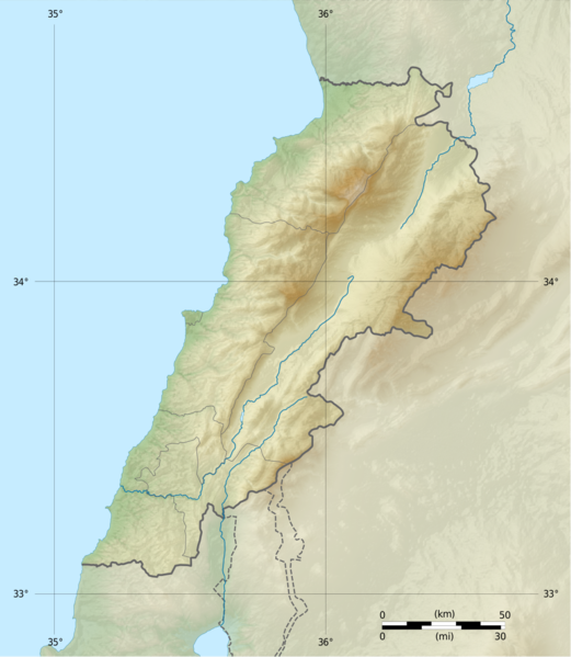
Quadratische Plattkarte, N-S-Streckung 115 %. Geographische Begrenzung der Karte:
Français : Carte physique vierge du Liban, destinée à la géolocalisation.
Projection equirectangulaire, N/S stretching 115 %. Limites géographiques de la carte:
English: Location map of Lebanon
Equirectangular projection, N/S stretching 115 %. Geographic limits of the map:
N: 34.9° N
S: 32.8° N
W: 34.8° E
E: 36.9° E
วันที่
แหล่งที่มา
Topographic background map: Own work
Sources of data:
SRTM30 Plus
NASA SRTM3 (public domain)
All additional data taken from File:Lebanon_location_map.svg created by NordNordWest under GFDL/CC-BY-SA 3.0
ผู้สร้างสรรค์
Vivepat and NordNordWest
การอนุญาต (การใช้ไฟล์นี้ใหม่)
Attribution and Share-Alike required
Any use of this map can be made as long as you credit me (Eric Gaba – Wikimedia Commons user: Sting) and Wikimedia Commons user: NordNordWest as the authors and distribute the copies and derivative works under the same license(s) that the one(s) stated below. A message with a reply address would also be greatly appreciated.
ไฟล, lebanon, location, topographic, ไฟล, ประว, ไฟล, หน, าท, ภาพน, การใช, ไฟล, วนกลางขนาดของต, วอย, างน, กเซล, ความละเอ, ยดอ, กเซล, กเซล, กเซล, ภาพท, ความละเอ, ยดส, งกว, 8206, กเซล, ขนาดไฟล, โลไบต, ชน, ดไมม, image, ปภาพหร, อไฟล, เส, ยงน, นฉบ, บอย, คอมมอนส, ราย. ifl prawtiifl hnathimiphaphni karichiflswnklangkhnadkhxngtwxyangni 521 599 phikesl khwamlaexiydxun 209 240 phikesl 417 480 phikesl 993 1 142 phikesl duphaphthimikhwamlaexiydsungkwa 8206 993 1 142 phikesl khnadifl 990 kiolibt chnidimm image png rupphaphhruxiflesiyngni tnchbbxyuthi khxmmxns raylaexiyddanlang epnkhxkhwamthiaesdngphlcak ifltnchbbinkhxmmxns khxmmxnsepnewbistinokhrngkarsahrbekbrwbrwmsuxesri thi khunsamarthchwyid khwamyx taaehnngthitngklxng33 nbsp 50 nbsp 00 nbsp ehnux 35 nbsp 40 nbsp 00 nbsp tawnxxk nbsp phaphniaelaphaphxun n sthanthiediywknthi OpenStreetMap33 833333 35 666667 khaxthibayLebanon location map Topographic png Deutsch Positionskarte des Libanon Quadratische Plattkarte N S Streckung 115 nbsp Geographische Begrenzung der Karte Francais nbsp Carte physique vierge du Liban destinee a la geolocalisation Projection equirectangulaire N S stretching 115 nbsp Limites geographiques de la carte English Location map of Lebanon Equirectangular projection N S stretching 115 nbsp Geographic limits of the map N 34 9 N S 32 8 N W 34 8 E E 36 9 E wnthi 16 mithunayn ph s 2555 aehlngthima Topographic background map Own work Sources of data SRTM30 Plus NASA SRTM3 public domain All additional data taken from File Lebanon location map svg created by NordNordWest under GFDL CC BY SA 3 0 phusrangsrrkh Vivepat and NordNordWest karxnuyat karichiflniihm Attribution and Share Alike required Any use of this map can be made as long as you credit me Eric Gaba Wikimedia Commons user Sting nbsp and Wikimedia Commons user NordNordWest as the authors and distribute the copies and derivative works under the same license s that the one s stated below A message with a reply address would also be greatly appreciated ewxrchnxun Equivalent administrative map Blank physical map no boundaries karxnuyatichsiththi khapheca inthanaphuthuxlikhsiththikhxngphaphhruxsuxni xnuyatihichphaphhruxsuxniphayitenguxnikhtxipni xnuyatihkhdlxk aeckcayaela hruxaekikhexksarniphayitenguxnikhkhxngsyyaxnuyatexksaresrikhxngknu run 1 2 nithixxkodymulnithisxftaewresri odyimmiswnidhamaekikh immikhxkhwampkhnaaelapkhlng saenakhxngsyyaxnuyatrwmxyuinswnchux syyaxnuyatexksaresrikhxngknu 1 2 nbsp ethann http www gnu org licenses old licenses fdl 1 2 html GFDL 1 2 GNU Free Documentation License 1 2 true true xnuyatihkhdlxk aeckcayaela hruxddaeprexksarniphayitenguxnikhkhxngsyyaxnuyatexksaresrikhxngknu run 1 3 hruxrunid nbcaknithixxkodymulnithisxftaewresri odyimmiswnidhamaekikh immikhxkhwampkhnaaelapkhlng saenakhxngsyyaxnuyatrwmxyuinswnchux syyaxnuyatexksaresrikhxngknu www gnu org licenses fdl 1 3 html GFDL 1 3 GNU Free Documentation License 1 3 true true If this file is eligible for relicensing it may also be used under the Creative Commons Attribution ShareAlike 3 0 license The relicensing status of this image needs to be manually reviewed by an experienced user You can help العربي ة nbsp belaruskaya tarashkevica nbsp English nbsp francais nbsp magyar nbsp italiano nbsp 日本語 nbsp 한국어 nbsp makedonski nbsp മലയ ള nbsp sicilianu nbsp ukrayinska nbsp 中文 nbsp khunsamartheluxksyyaxnuyatdngklawtamtxngkarkhabrryayodyyxithyephimkhabrryaythrrthdediywephuxkhyaykhwamwaiflnimixairixethmthiaesdngxyuiniflniprakxbdwysthanalikhsiththimilikhsiththisyyaxnuyatGNU Free Documentation License version 1 2 nbsp xngkvsGNU Free Documentation License version 1 3 or later nbsp xngkvswnthisrang wnkxtng16 mithunayn 2012coordinates of the point of view nbsp xngkvs33 49 59 999 N 35 40 0 001 EMIME type nbsp xngkvsimage pngchecksum nbsp xngkvs1a6c8526df2cc76a4a21b45961d01b3e722f0500withikarkahnd SHA 1 nbsp xngkvsdata size nbsp xngkvs1 013 653 ibtkhwamsung1 142 phikeslkhwamkwang993 phikesl prawtiifl khlikwnthi ewlaephuxduiflthipraktinkhnann wnthi ewlarupyxkhnadphuichkhwamehn pccubn13 17 22 mithunayn 2560993 1 142 990 kiolibt Vivepatcorrection lat lon 13 10 22 mithunayn 2560993 1 142 990 kiolibt VivepatLattitude error correction 12 59 22 mithunayn 2560993 1 142 990 kiolibt Vivepatupdate of the map using the Wikipedia maps conventions 05 12 16 mithunayn 25551 581 1 818 3 35 emkaibt Dr Brains hnathimiphaphni hnatxipni oyngmathiphaphni xlkurnatusesadax ebrut isdxn karichiflswnklang wikixuntxipniichiflni karichbn als wikipedia org Vorlage Positionskarte Libanon karichbn an wikipedia org Mont de Liban karichbn ar wikipedia org قالب خريطة مواقع لبنان جباع نهر بيروت نهر الزهراني مستخدم عبد المؤمن مسودات خرائط الشام وحدة Location map data Lebanon وحدة Location map data Lebanon شرح نهر الغدير زلزال بيروت 551 عساف أبو رحال زلزال شحيم 1956 زلازل سورية في 1759 معبد بلاط karichbn arz wikipedia org جبل اتش اد دچيچ karichbn ast wikipedia org Modulu Mapa de llocalizacion datos El Libanu usu karichbn az wikipedia org Tanrinin sidr agaclari Sablon Yer xeritesi Livan Biqa vadisi Baatara selalesi Cebel Lubnan karichbn bn wikipedia org ব র ত মড উল অবস থ ন ম নচ ত র উপ ত ত ল ব নন মড উল অবস থ ন ম নচ ত র উপ ত ত ল ব নন নথ আল উওয ইস য ত মসজ দ ক দ শ উপত যক স দ karichbn bs wikipedia org Sablon Lokacijska karta Liban karichbn ca wikipedia org Mont Liban Modul Location map data Liban Modul Location map data Liban us karichbn ceb wikipedia org Nahr el Ghadir karichbn ce wikipedia org Kep Mettigan karta Livan karichbn cs wikipedia org Sablona LocMap Libanon Kurnat as Sauda karichbn da wikipedia org Skabelon Kortpositioner Libanon Bruger Palnatoke Autolister Geografi Middelhavets floder Antilibanon karichbn el wikipedia org Protypo Location map Libanos karichbn en wikipedia org Sidon Tyre Lebanon Beirut Arqa Mount Lebanon Siege of Tyre 332 BC Kadisha Valley Siege of Tripoli Qurnat as Sawda Cedars of God dukarichthwolkephimetimkhxngiflni ekhathungcak https th wikipedia org wiki ifl Lebanon location map Topographic png, wikipedia, วิกิ หนังสือ, หนังสือ, ห้องสมุด,