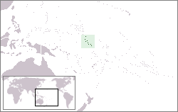
== Summary == Location map for the Gilbert Islands within Kiribati. Category:Maps of Kiribati == Licensing == {{self|cc-by-sa-2.5}}
หน้าที่มีภาพนี้
ไม่มีหน้าใดโยงมาที่ภาพนี้
การใช้ไฟล์ส่วนกลาง
วิกิอื่นต่อไปนี้ใช้ไฟล์นี้:
Gilbertinseln
Diskussion:Kiribati/Archiv/1
Benutzer:ThomasJa276/Japanische Eroberung der Gilbertinseln
User:Kmusser/Images
Gilbert Adaları
มิถุนายน 21, 2023
ไฟล, locationgilbert, ไฟล, ประว, ไฟล, หน, าท, ภาพน, การใช, ไฟล, วนกลางไม, ภาพท, รายละเอ, ยดส, งกว, าน, locationgilbert, 8206, กเซล, ขนาดไฟล, โลไบต, ชน, ดไมม, image, ปภาพหร, อไฟล, เส, ยงน, นฉบ, บอย, คอมมอนส, รายละเอ, ยดด, านล, าง, เป, นข, อความท, แสดงผลจาก, ไฟล. ifl prawtiifl hnathimiphaphni karichiflswnklangimmiphaphthimiraylaexiydsungkwani LocationGilbert png 8206 250 158 phikesl khnadifl 4 kiolibt chnidimm image png rupphaphhruxiflesiyngni tnchbbxyuthi khxmmxns raylaexiyddanlang epnkhxkhwamthiaesdngphlcak ifltnchbbinkhxmmxns khxmmxnsepnewbistinokhrngkarsahrbekbrwbrwmsuxesri thi khunsamarthchwyid khwamyx khaxthibayLocationGilbert png Location map for the Gilbert Islands within Kiribati wnthi 19 thnwakhm ph s 2549 original upload date aehlngthima No machine readable source provided Own work assumed based on copyright claims phusrangsrrkh No machine readable author provided Kmusser assumed based on copyright claims karxnuyatichsiththi khapheca inthanaphuthuxlikhsiththikhxngphaphhruxsuxni xnuyatihichphaphhruxsuxniphayitenguxnikhtxipniiflnixyuphayitsyyaxnuyat khriexthifkhxmmxns aebbaesdngthima xnuyataebbediywkn 2 5 thwipkhunsamarth thicaaebngpn thicathasaena aeckcay aelasngngandngklawtxip thicaeriyberiyngihm thicaddaeplngngandngklaw phayitenguxnikhtxipni aesdngthima khuntxngihekiyrtiecakhxngnganxyangehmaasm odyephimlingkipyngsyyaxnuyat aelarabuhakmikarepliynaeplng khunxacthaechnniidinrupaebbidkidtamkhwr aettxngimichinlksnathiaenawaphuihxnuyatsnbsnunkhunhruxkarichngankhxngkhun xnuyataebbediywkn hakkhunddaeplng epliynrup hruxtxetimnganni khuntxngichsyyaxnuyataebbediywknhruxaebbthiehmuxnkbsyyaxnuyatthiichkbnganniethannhttps creativecommons org licenses by sa 2 5 CC BY SA 2 5 Creative Commons Attribution Share Alike 2 5 true truekhabrryayodyyxithyephimkhabrryaythrrthdediywephuxkhyaykhwamwaiflnimixairixethmthiaesdngxyuiniflniprakxbdwysthanalikhsiththimilikhsiththisyyaxnuyatCreative Commons Attribution ShareAlike 2 5 Generic nbsp xngkvswnthisrang wnkxtng19 thnwakhm 2006 prawtiifl khlikwnthi ewlaephuxduiflthipraktinkhnann wnthi ewlarupyxkhnadphuichkhwamehn pccubn16 16 2 krkdakhm 2552250 158 4 kiolibt Telim torhighlighting the Gilbert Islands only 03 10 20 thnwakhm 2549250 158 4 kiolibt Kmusser Summary Location map for the Gilbert Islands within Kiribati Category Maps of Kiribati Licensing self cc by sa 2 5 hnathimiphaphni immihnaidoyngmathiphaphnikarichiflswnklang wikixuntxipniichiflni karichbn af wikipedia org Kiribati karichbn als wikipedia org Kiribati karichbn de wikipedia org Kiribati Gilbertinseln Diskussion Kiribati Archiv 1 Benutzer ThomasJa276 Japanische Eroberung der Gilbertinseln karichbn en wikipedia org Gilbert Islands User Kmusser Images karichbn eo wikipedia org Gilbertoj karichbn es wikipedia org Islas Gilbert karichbn et wikipedia org Gilberti saared karichbn eu wikipedia org Gilbert uharteak karichbn fi wikipedia org Gilbertsaaret karichbn gl wikipedia org Illas Gilbert karichbn ja wikipedia org ギルバート マーシャル諸島の戦い karichbn ko wikipedia org 길버트 제도 karichbn la wikipedia org Insulae Gilbertenses karichbn li wikipedia org Gilberteilenj karichbn mk wikipedia org Gilbertovi Ostrovi karichbn pt wikipedia org Ilhas Gilbert karichbn sh wikipedia org Gilbertovi otoci karichbn tl wikipedia org Kapuluang Gilbert karichbn tr wikipedia org Kiribati Gilbert Adalari karichbn uk wikipedia org Ostrovi Gilberta karichbn vi wikipedia org Quần đảo Gilbert karichbn zh yue wikipedia org 驕拔群島 karichbn zh wikipedia org 吉尔伯特群岛 ekhathungcak https th wikipedia org wiki ifl LocationGilbert png, wikipedia, วิกิ หนังสือ, หนังสือ, ห้องสมุด,