คำอธิบายLocator map RB Mittelfranken in Bavaria.svg
Deutsch: Lage von Regierungsbezirk Mittelfranken in Bayern, Deutschland
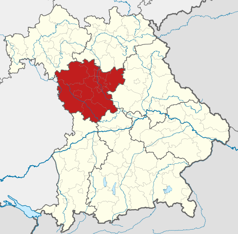
English: Locator map of Regierungsbezirk Mittelfranken in Bavaria, Germany.
วันที่
แหล่งที่มา
Deutsch: Eigene Arbeit, basiert auf:
English: Own work, based on:
File:Germany location map.svg, NordNordWest
File:Bavaria location map.svg, TUBS
ผู้สร้างสรรค์
TUBS
เวอร์ชันอื่น
This SVG map is part of a locator map series applying the widespread location map scheme. Please see root category to browse for more.
More ▼
ทวีปแอฟริกา
Algeria • Angola • Benin • Botswana • Burkina Faso • Burundi • Cameroon • Cape Verde • Central African Republic • Chad • Comoros • Côte d'Ivoire • Democratic Republic of the Congo • Republic of the Congo • Djibouti • Egypt • Equatorial Guinea • Eritrea • Eswatini • Ethiopia • Gabon • Gambia • Ghana • Guinea-Bissau • Guinea • Kenya • Lesotho • Liberia • Libya • Madagascar • Malawi • Mali • Mauritania • Mauritius • Morocco • Mozambique • Namibia • Niger • Nigeria • Rwanda • (Sahrawi Arab Democratic Republic) • Senegal • Seychelles • Sierre Leone • Somalia • Somaliland • South Africa • South Sudan • Sudan • São Tomé and Príncipe • Tanzania • Togo • Tunisia • Uganda • Yemen • Zambia • Zimbabwe
ทวีปเอเชีย
(Abkhazia) • Afghanistan • Armenia • Azerbaijan • Bahrain • Bangladesh • Bhutan • Brunei • Cambodia • China • Republic of China • Cyprus • East Timor • Egypt • Georgia • India • Indonesia • Iran • Iraq • Israel • Japan • Jordan • Kazakhstan • Kuwait • Kyrgyzstan • Laos • Lebanon • Malaysia • Maldives • Mongolia • Myanmar • Nepal • North Korea • (Northern Cyprus) • Oman • Pakistan • (Palestine) • Papua New Guinea • Philippines • Qatar • Russia • Saudi Arabia • Singapore • South Korea • (South Ossetia) • Sri Lanka • Syria • Tajikistan • Thailand • Turkey • Turkmenistan • United Arab Emirates • Uzbekistan • Vietnam • Yemen
ทวีปยุโรป
(European Union) • (Abkhazia) • Albania • Andorra • Armenia • Austria • Azerbaijan • Belarus • Belgium • Bosnia and Herzegovina • Bulgaria • Czech Republic • Croatia • Cyprus • Denmark • Estonia • Finland • France • Georgia • Germany • Greece • (Guernsey) • Hungary • Iceland • Ireland • Italy • (Jersey) • Kazakhstan • (Kosovo) • Latvia • Liechtenstein • Lithuania • Luxembourg • Malta • (Isle of Man) • Moldova • Monaco • Montenegro • Netherlands • North Macedonia • (Northern Cyprus) • Norway • Poland • Portugal • Romania • Russia • San Marino • Serbia • Slovakia • Slovenia • (South Ossetia) • Spain • Sweden • Switzerland • Turkey • Ukraine • United Kingdom • Vatican City
ทวีปอเมริกาเหนือ
Antigua and Barbuda • Bahamas • Barbados • Belize • Canada • Costa Rica • Cuba • Dominica • Dominican Republic • El Salvador • Grenada • Guatemala • Haiti • Honduras • Iceland • Jamaica • Mexico • Nicaragua • Panama • Saint Kitts and Nevis • Saint Lucia • Saint Vincent and the Grenadines • Trinidad and Tobago • United States
โอเชียเนีย
Australia • (Cook Islands) • Fiji • Indonesia • Kiribati • Marshall Islands • Micronesia • Nauru • New Zealand • (Niue) • Palau • Papua New Guinea • Samoa • Solomon Islands • Tonga • Tuvalu • Vanuatu
ทวีปอเมริกาใต้
Argentina • Bolivia • Brazil • Chile • Colombia • Ecuador • Guyana • Panama • Paraguay • Peru • Suriname • Trinidad and Tobago • Uruguay • Venezuela
ทวีปแอนตาร์กติกา
-
Locator maps design recommendations ▼
Principles
Design Guidelines are based on ▸location map design of the German map shop (in German). It's preferable to derive new locator maps from existing location maps. Please keep both size and ratio in this case. Thus the new locator maps may still be applied as location map (▸Guide). Marker color is supposed to be darkred. Waterbodies may be transparent, to show other objects better. Please be aware that this guide is only a recommendation. It’s not an inevitable law!
Color template
Template toolbox
Other optional map elements
Subdivision of a country
Country within an international organization
Country without context projected on the globe
Country without context
Highlight small areas
Marker
Merged markers
“Glowing” edges
Zoom
Zoom
Zoom
“Remote” areas and mini maps
Mini maps show where the depicted area actually is situated. Check out ▸Vorlage:Positionskarte+ (in German) and ▸Modèle:Carte en coin (in French) of how to insert a mini map in virtually every map.
Small maps apply different scales
Small map applies same scale as main map
Mini map with box
Depicted continent dark grey
Zoomed box on a world map also showing the remote part of country
Disputed areas
rest of Serbia: foreign or the same country?
Kosovo: part of Serbia?
Whether South Ossetia or Abkhazia form a part of Georgia is disputed. The marked Georgian administrative region however is partly under Georgian control (solid red) while other parts are part break-away "country" South Ossetia (hatched).
India claims some northern areas (hatched) while other areas are controlled by India but challenged by other countries. India claims all of Kashmir (red areas), while it controls only the southern part of it (cf. broad red stripes vs. narrow red stripes).
Western Sahara: part of Morocco?
Like above. However, the map differentiates whether the disputed area is controlled by Morocco or not.
Locator map of Taiwan in China. Map hatches all areas that are claimed but not controlled by China. Hence, highlighted Taiwan is also hatched grey/red.
Greyed special objects
Glaciers
Urbanized areas
Backgrounds
Relief
Relief (like before, but outlines highlighted)
Satellite view
Land cover
Relief
Corresponding imagemaps ▼
ทวีปแอฟริกา
Algeria • Angola • Benin • Botswana • Burkina Faso • Burundi • Cameroon • Cape Verde • Central African Republic • Chad • Comoros • Côte d'Ivoire • Democratic Republic of the Congo • Repbulic of the Congo • Djibouti • Egypt • Equatorial Guinea • Eritrea • Ethiopia • Gabon • Gambia • Ghana • Guinea-Bissau • Guinea • Kenya • Lesotho • Liberia • Libya • Madagascar • Malawi • Mali • Mauritania • Mauritius • Morocco • Mozambique • Namibia • Niger • Nigeria • Rwanda • (Sahrawi Arab Democratic Republic) • Senegal • Seychelles • Sierre Leone • Somalia • South Africa • South Sudan • Sudan • Swaziland • São Tomé and Príncipe • Tanzania • Togo • Tunisia • Uganda • Yemen • Zambia • Zimbabwe
ทวีปเอเชีย
(Abkhazia) • Afghanistan • Armenia • Azerbaijan • Bahrain • Bangladesh • Bhutan • Brunei • Cambodia • China• Republic of China • Cyprus • East Timor • Egypt • Georgia • India • Indonesia • Iran • Iraq • Israel • Japan • Jordan • Kazakhstan • Kuwait • Kyrgyzstan • Laos • Lebanon • Malaysia • Maldives • Mongolia • Myanmar • Nepal • North Korea • (Northern Cyprus) • Oman • Pakistan • (Palestine) • Papua New Guinea• Philippines • Qatar • Russia • Saudi Arabia • Singapore • South Korea • (South Ossetia) • Sri Lanka • Syria • Tajikistan • Thailand • Turkey • Turkmenistan• United Arab Emirates • Uzbekistan • Vietnam • Yemen
ทวีปยุโรป
(Abkhazia) • Albania • Andorra • Armenia • Austria • Azerbaijan • Belarus • Belgium • Bosnia and Herzegovina • Bulgaria • Czech Republic • Croatia • Cyprus • Denmark • Estonia • Finland • France • Georgia • Germany • Greece • (Guernsey) • Hungary • Iceland • Ireland • Italy • (Jersey) • Kazakhstan • (Kosovo) • Latvia • Liechtenstein • Lithuania • Luxembourg • Macedonia • Malta • (Isle of Man) • Moldova • Monaco • Montenegro • Netherlands • (Northern Cyprus) • Norway • Poland • Portugal • Romania • Russia • San Marino • Serbia • Slovakia • Slovenia • (South Ossetia) • Spain • Sweden • Switzerland • Turkey • Ukraine • United Kingdom • Vatican City
ทวีปอเมริกาเหนือ
Antigua and Barbuda • Bahamas • Barbados • Belize • Canada • Costa Rica • Cuba • Dominica • Dominican Republic • El Salvador • Grenada • Guatemala • Haiti • Honduras • Iceland • Jamaica • Mexico • Nicaragua • Panama • Saint Kitts and Nevis • Saint Lucia • Saint Vincent and the Grenadines • Trinidad and Tobago • United States
โอเชียเนีย
Australia • Brunei • (Cook Islands) • East Timor • Fiji • Indonesia • Kiribati • Marshall Islands • Micronesia • Nauru • New Zealand • (Niue) • Palau • Papua New Guinea • Samoa • Solomon Islands • Tonga • Tuvalu • Vanuatu
ทวีปอเมริกาใต้
Argentina • Bolivia • Brazil • Chile • Colombia • Ecuador • Guyana • Panama • Paraguay • Peru • Suriname • Trinidad and Tobago • Uruguay • Venezuela
=={{int:filedesc}}== {{Information |Description= {{de|Lage von Regierungsbezirk Mittelfranken in Bayern, Deutschland}} {{en|Locator map of Regierungsbezirk Mittelfranken in Bavaria, [[:en:Germany|Germany]
ไฟล, locator, mittelfranken, bavaria, ไฟล, ประว, ไฟล, หน, าท, ภาพน, การใช, ไฟล, วนกลางขนาดของต, วอย, าง, ของไฟล, กเซล, ความละเอ, ยดอ, กเซล, กเซล, กเซล, กเซล, กเซล, กเซล, ภาพท, ความละเอ, ยดส, งกว, 8206, ไฟล, กเซล, ขนาดไฟล, โลไบต, ปภาพหร, อไฟล, เส, ยงน, นฉบ, บอย. ifl prawtiifl hnathimiphaphni karichiflswnklangkhnadkhxngtwxyang PNG nikhxngifl SVG ni 608 600 phikesl khwamlaexiydxun 243 240 phikesl 487 480 phikesl 779 768 phikesl 1 038 1 024 phikesl 2 077 2 048 phikesl 867 855 phikesl duphaphthimikhwamlaexiydsungkwa 8206 ifl SVG 867 855 phikesl khnadifl 1 010 kiolibt rupphaphhruxiflesiyngni tnchbbxyuthi khxmmxns raylaexiyddanlang epnkhxkhwamthiaesdngphlcak ifltnchbbinkhxmmxns khxmmxnsepnewbistinokhrngkarsahrbekbrwbrwmsuxesri thi khunsamarthchwyid khwamyx khaxthibayLocator map RB Mittelfranken in Bavaria svg Deutsch Lage von Regierungsbezirk Mittelfranken in Bayern Deutschland English Locator map of Regierungsbezirk Mittelfranken in Bavaria Germany wnthi ph s 2552aehlngthima Deutsch Eigene Arbeit basiert auf English Own work based on File Germany location map svg NordNordWest File Bavaria location map svg TUBSphusrangsrrkh TUBSewxrchnxun This SVG map is part of a locator map series applying the widespread location map scheme Please see root category to browse for more More thwipaexfrikaAlgeria Angola Benin Botswana Burkina Faso Burundi Cameroon Cape Verde Central African Republic Chad Comoros Cote d Ivoire Democratic Republic of the Congo Republic of the Congo Djibouti Egypt Equatorial Guinea Eritrea Eswatini Ethiopia Gabon Gambia Ghana Guinea Bissau Guinea Kenya Lesotho Liberia Libya Madagascar Malawi Mali Mauritania Mauritius Morocco Mozambique Namibia Niger Nigeria Rwanda Sahrawi Arab Democratic Republic Senegal Seychelles Sierre Leone Somalia Somaliland South Africa South Sudan Sudan Sao Tome and Principe Tanzania Togo Tunisia Uganda Yemen Zambia Zimbabwethwipexechiy Abkhazia Afghanistan Armenia Azerbaijan Bahrain Bangladesh Bhutan Brunei Cambodia China Republic of China Cyprus East Timor Egypt Georgia India Indonesia Iran Iraq Israel Japan Jordan Kazakhstan Kuwait Kyrgyzstan Laos Lebanon Malaysia Maldives Mongolia Myanmar Nepal North Korea Northern Cyprus Oman Pakistan Palestine Papua New Guinea Philippines Qatar Russia Saudi Arabia Singapore South Korea South Ossetia Sri Lanka Syria Tajikistan Thailand Turkey Turkmenistan United Arab Emirates Uzbekistan Vietnam Yementhwipyuorp European Union Abkhazia Albania Andorra Armenia Austria Azerbaijan Belarus Belgium Bosnia and Herzegovina Bulgaria Czech Republic Croatia Cyprus Denmark Estonia Finland France Georgia Germany Greece Guernsey Hungary Iceland Ireland Italy Jersey Kazakhstan Kosovo Latvia Liechtenstein Lithuania Luxembourg Malta Isle of Man Moldova Monaco Montenegro Netherlands North Macedonia Northern Cyprus Norway Poland Portugal Romania Russia San Marino Serbia Slovakia Slovenia South Ossetia Spain Sweden Switzerland Turkey Ukraine United Kingdom Vatican CitythwipxemrikaehnuxAntigua and Barbuda Bahamas Barbados Belize Canada Costa Rica Cuba Dominica Dominican Republic El Salvador Grenada Guatemala Haiti Honduras Iceland Jamaica Mexico Nicaragua Panama Saint Kitts and Nevis Saint Lucia Saint Vincent and the Grenadines Trinidad and Tobago United StatesoxechiyeniyAustralia Cook Islands Fiji Indonesia Kiribati Marshall Islands Micronesia Nauru New Zealand Niue Palau Papua New Guinea Samoa Solomon Islands Tonga Tuvalu VanuatuthwipxemrikaitArgentina Bolivia Brazil Chile Colombia Ecuador Guyana Panama Paraguay Peru Suriname Trinidad and Tobago Uruguay Venezuelathwipaexntarktika Locator maps design recommendations Principles Design Guidelines are based on location map design of the German map shop in German It s preferable to derive new locator maps from existing location maps Please keep both size and ratio in this case Thus the new locator maps may still be applied as location map Guide Marker color is supposed to be darkred Waterbodies may be transparent to show other objects better Please be aware that this guide is only a recommendation It s not an inevitable law Color template Template toolbox Other optional map elements Subdivision of a country Country within an international organization Country without context projected on the globe Country without contextHighlight small areas Marker Merged markers Glowing edges Zoom Zoom Zoom Remote areas and mini maps Mini maps show where the depicted area actually is situated Check out Vorlage Positionskarte in German and Modele Carte en coin in French of how to insert a mini map in virtually every map Small maps apply different scales Small map applies same scale as main map Mini map with box Depicted continent dark grey Zoomed box on a world map also showing the remote part of countryDisputed areas rest of Serbia foreign or the same country Kosovo part of Serbia Whether South Ossetia or Abkhazia form a part of Georgia is disputed The marked Georgian administrative region however is partly under Georgian control solid red while other parts are part break away country South Ossetia hatched India claims some northern areas hatched while other areas are controlled by India but challenged by other countries India claims all of Kashmir red areas while it controls only the southern part of it cf broad red stripes vs narrow red stripes Western Sahara part of Morocco Like above However the map differentiates whether the disputed area is controlled by Morocco or not Locator map of Taiwan in China Map hatches all areas that are claimed but not controlled by China Hence highlighted Taiwan is also hatched grey red Greyed special objects Glaciers Urbanized areasBackgrounds Relief Relief like before but outlines highlighted Satellite view Land cover ReliefCorresponding imagemaps thwipaexfrikaAlgeria Angola Benin Botswana Burkina Faso Burundi Cameroon Cape Verde Central African Republic Chad Comoros Cote d Ivoire Democratic Republic of the Congo Repbulic of the Congo Djibouti Egypt Equatorial Guinea Eritrea Ethiopia Gabon Gambia Ghana Guinea Bissau Guinea Kenya Lesotho Liberia Libya Madagascar Malawi Mali Mauritania Mauritius Morocco Mozambique Namibia Niger Nigeria Rwanda Sahrawi Arab Democratic Republic Senegal Seychelles Sierre Leone Somalia South Africa South Sudan Sudan Swaziland Sao Tome and Principe Tanzania Togo Tunisia Uganda Yemen Zambia Zimbabwethwipexechiy Abkhazia Afghanistan Armenia Azerbaijan Bahrain Bangladesh Bhutan Brunei Cambodia China Republic of China Cyprus East Timor Egypt Georgia India Indonesia Iran Iraq Israel Japan Jordan Kazakhstan Kuwait Kyrgyzstan Laos Lebanon Malaysia Maldives Mongolia Myanmar Nepal North Korea Northern Cyprus Oman Pakistan Palestine Papua New Guinea Philippines Qatar Russia Saudi Arabia Singapore South Korea South Ossetia Sri Lanka Syria Tajikistan Thailand Turkey Turkmenistan United Arab Emirates Uzbekistan Vietnam Yementhwipyuorp Abkhazia Albania Andorra Armenia Austria Azerbaijan Belarus Belgium Bosnia and Herzegovina Bulgaria Czech Republic Croatia Cyprus Denmark Estonia Finland France Georgia Germany Greece Guernsey Hungary Iceland Ireland Italy Jersey Kazakhstan Kosovo Latvia Liechtenstein Lithuania Luxembourg Macedonia Malta Isle of Man Moldova Monaco Montenegro Netherlands Northern Cyprus Norway Poland Portugal Romania Russia San Marino Serbia Slovakia Slovenia South Ossetia Spain Sweden Switzerland Turkey Ukraine United Kingdom Vatican CitythwipxemrikaehnuxAntigua and Barbuda Bahamas Barbados Belize Canada Costa Rica Cuba Dominica Dominican Republic El Salvador Grenada Guatemala Haiti Honduras Iceland Jamaica Mexico Nicaragua Panama Saint Kitts and Nevis Saint Lucia Saint Vincent and the Grenadines Trinidad and Tobago United StatesoxechiyeniyAustralia Brunei Cook Islands East Timor Fiji Indonesia Kiribati Marshall Islands Micronesia Nauru New Zealand Niue Palau Papua New Guinea Samoa Solomon Islands Tonga Tuvalu VanuatuthwipxemrikaitArgentina Bolivia Brazil Chile Colombia Ecuador Guyana Panama Paraguay Peru Suriname Trinidad and Tobago Uruguay VenezuelaOtherthwipaexntarktika aephnthiolk lukolk karxnuyatichsiththi khapheca inthanaphuthuxlikhsiththikhxngphaphhruxsuxni xnuyatihichphaphhruxsuxniphayitenguxnikhtxipni xnuyatihkhdlxk aeckcayaela hruxddaeprexksarniphayitenguxnikhkhxngsyyaxnuyatexksaresrikhxngknu run 1 2 hruxrunid nbcaknithixxkodymulnithisxftaewresri odyimmiswnidhamaekikh immikhxkhwampkhnaaelapkhlng saenakhxngsyyaxnuyatrwmxyuinswnchux syyaxnuyatexksaresrikhxngknuhttp www gnu org copyleft fdl html GFDL GNU Free Documentation License true trueiflnixyuphayitsyyaxnuyatkhriexthifkhxmmxns runaesdngthima xnuyataebbediywkn 3 0 tnchbb 2 5 thwip 2 0 thwip aela 1 0 thwipkhunsamarth thicaaebngpn thicathasaena aeckcay aelasngngandngklawtxip thicaeriyberiyngihm thicaddaeplngngandngklaw phayitenguxnikhtxipni aesdngthima khuntxngihekiyrtiecakhxngnganxyangehmaasm odyephimlingkipyngsyyaxnuyat aelarabuhakmikarepliynaeplng khunxacthaechnniidinrupaebbidkidtamkhwr aettxngimichinlksnathiaenawaphuihxnuyatsnbsnunkhunhruxkarichngankhxngkhun xnuyataebbediywkn hakkhunddaeplng epliynrup hruxtxetimnganni khuntxngichsyyaxnuyataebbediywknhruxaebbthiehmuxnkbsyyaxnuyatthiichkbnganniethannhttps creativecommons org licenses by sa 3 0 CC BY SA 3 0 Creative Commons Attribution Share Alike 3 0 true truekhunsamartheluxksyyaxnuyatdngklawtamtxngkarkhabrryayodyyxithyephimkhabrryaythrrthdediywephuxkhyaykhwamwaiflnimixairixethmthiaesdngxyuiniflniprakxbdwyphusrangbangkhathiimmiixethmwikisnethsyuxaraexl https commons wikimedia org wiki user TUBSchuxphuichwikimiediy TUBSchuxphusrangsrrkh TUBSsthanalikhsiththimilikhsiththisyyaxnuyatCreative Commons Attribution ShareAlike 2 0 Generic xngkvsCreative Commons Attribution ShareAlike 3 0 Unported xngkvsCreative Commons Attribution ShareAlike 2 5 Generic xngkvsGNU Free Documentation License version 1 2 or later xngkvsCreative Commons Attribution ShareAlike 1 0 Generic xngkvswnthisrang wnkxtng2009 prawtiifl khlikwnthi ewlaephuxduiflthipraktinkhnann wnthi ewlarupyxkhnadphuichkhwamehn pccubn01 11 26 minakhm 2552867 855 1 010 kiolibt TUBS int filedesc Information Description de Lage von Regierungsbezirk Mittelfranken in Bayern Deutschland en Locator map of Regierungsbezirk Mittelfranken in Bavaria en Germany Germany hnathimiphaphni hnatxipni oyngmathiphaphni mithethilfrngekhin karichiflswnklang wikixuntxipniichiflni karichbn an wikipedia org Franconia Meya karichbn ar wikipedia org فرانكونيا الوسطى karichbn az wikipedia org Merkezi Frankoniya karichbn bar wikipedia org Middlfrankn karichbn bg wikipedia org Sredna Frankoniya karichbn ca wikipedia org Mittelfranken karichbn cs wikipedia org Stredni Franky karichbn de wikipedia org Mittelfranken Bezirk Bayern Liste der Wappen in Bayern Benutzer Holger1959 BY 1 Regierungsbezirk Bayern karichbn en wikipedia org Middle Franconia Bezirksoberliga Mittelfranken Mittelfranken Cup Bezirksliga Mittelfranken 2 Bezirksliga Mittelfranken 1 karichbn eo wikipedia org Meza Frankonio karichbn es wikipedia org Franconia Media Anexo Municipios de Baviera karichbn et wikipedia org Kesk Frangimaa ringkond karichbn eu wikipedia org Frankonia Erdikoa karichbn fa wikipedia org فرانکن وسطی karichbn frr wikipedia org Mittelfranken karichbn fr wikipedia org District de Moyenne Franconie karichbn gl wikipedia org Franconia Media karichbn hu wikipedia org Kozep Frankfold bajor regio Nemetorszag kormanyzati keruletei karichbn hy wikipedia org Միջին Ֆրանկոնիա karichbn lmo wikipedia org Media Franconia karichbn nds wikipedia org Middelfranken karichbn nl wikipedia org Mittelfranken karichbn os wikipedia org Astaeukkag Frankoni karichbn pl wikipedia org Srodkowa Frankonia karichbn pl wikivoyage org Srodkowa Frankonia karichbn pl wiktionary org Srodkowa Frankonia karichbn ro wikipedia org Franconia Mijlocie karichbn ru wikipedia org Srednyaya Frankoniya karichbn simple wikipedia org Middle Franconia karichbn sv wikipedia org Mittelfranken karichbn tr wikipedia org Orta Frankonya karichbn ur wikipedia org فرینکونیا وسطی karichbn vi wikipedia org Mittelfranken karichbn www wikidata org Q10551 ekhathungcak https th wikipedia org wiki ifl Locator map RB Mittelfranken in Bavaria svg, wikipedia, วิกิ หนังสือ, หนังสือ, ห้องสมุด,