ข้อมูลเพิ่มเติม This map is part of a series of location maps with unified standards: SVG as file format, standardised colours and name scheme. The boundaries on these maps always show the de facto situation and do not imply any endorsement or acceptance. In case of changes of the shown area the file is updated. The old version will be uploaded as a new file and thus is still available.
วันที่
แหล่งที่มา
Own work using:
United States National Imagery and Mapping Agency data
azərbaycanca ∙ Deutsch (Sie-Form) ∙ čeština ∙ Deutsch ∙ sicilianu ∙ italiano ∙ русский ∙ română ∙ português ∙ English ∙ magyar ∙ Nederlands ∙ slovenščina ∙ polski ∙ latviešu ∙ македонски ∙ español ∙ فارسی ∙ français ∙ suomi ∙ עברית ∙ Plattdüütsch ∙ ქართული ∙ հայերեն ∙ বাংলা ∙ ไทย ∙ 日本語 ∙ 中文 ∙ 中文(简体) ∙ 中文(繁體) ∙ العربية ∙ +/−
การอนุญาตใช้สิทธิ
Usage of this file with:
Map: NordNordWest, Licence: Creative Commons by-sa-3.0 de
explanatory notes: Legally binding is only the full legalcode. For a free usage I recommend to respect the following licence conditions: 1. Provide my name as given above: NordNordWest, 2. a copy of, or the URI for, the applicable license: https://creativecommons.org/licenses/by-sa/3.0/de/legalcode, 3. the title of the work, 4. in the case of an adaptation, a credit identifying the use of the work in the adaptation. This license and the rights granted hereunder will terminate automatically upon any breach by you of the terms of this license. Any of the above conditions can be waived if you get permission from the copyright holder. If you have questions or wish differing conditions, please contact me through nnwestt-online.de or my discussion page
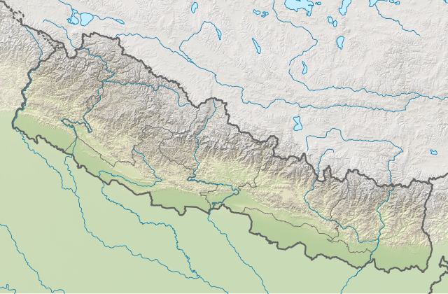
== {{int:filedesc}} == {{Information |description= {{de|1=Positionskarte von Nepal}} {{en|1=Location map of Nepal}} {{Location map series N |stretching=114 |top=31.0 |bottom=26.0 |left=79.8 |right=88.5 }} |source={{Own using}} * United States National Imagery and Mapping Agency data * SRTM3 data |date=2018-06-05 |author={{U|NordNordWest}} |permission= |other_versions=<gallery>Nepal adm location map.svg</gallery> }} {{Kartenwerkstatt}} == {{int:license-header}} == {{User:NordNordWest/LicenceM...
ไฟล, nepal, location, ไฟล, ประว, ไฟล, หน, าท, ภาพน, การใช, ไฟล, วนกลาง, อม, ลเก, ยวก, บภาพขนาดของต, วอย, าง, ของไฟล, กเซล, ความละเอ, ยดอ, กเซล, กเซล, กเซล, กเซล, กเซล, กเซล, ภาพท, ความละเอ, ยดส, งกว, 8206, ไฟล, กเซล, ขนาดไฟล, เมกะไบต, ปภาพหร, อไฟล, เส, ยงน, นฉ. ifl prawtiifl hnathimiphaphni karichiflswnklang khxmulekiywkbphaphkhnadkhxngtwxyang PNG nikhxngifl SVG ni 800 524 phikesl khwamlaexiydxun 320 210 phikesl 640 419 phikesl 1 024 671 phikesl 1 280 839 phikesl 2 560 1 678 phikesl 1 100 721 phikesl duphaphthimikhwamlaexiydsungkwa 8206 ifl SVG 1 100 721 phikesl khnadifl 1 86 emkaibt rupphaphhruxiflesiyngni tnchbbxyuthi khxmmxns raylaexiyddanlang epnkhxkhwamthiaesdngphlcak ifltnchbbinkhxmmxns khxmmxnsepnewbistinokhrngkarsahrbekbrwbrwmsuxesri thi khunsamarthchwyid khwamyx khaxthibayNepal rel location map svg Deutsch Positionskarte von Nepal English Location map of Nepal including the 7 provinces Equirectangular projection vertical stretching 114 nbsp Border coordinates31 079 8 88 5 26 0 nbsp khxmulephimetim This map is part of a series of location maps with unified standards SVG as file format standardised colours and name scheme The boundaries on these maps always show the de facto situation and do not imply any endorsement or acceptance In case of changes of the shown area the file is updated The old version will be uploaded as a new file and thus is still available wnthi 5 mithunayn ph s 2561 aehlngthima Own work using United States National Imagery and Mapping Agency data SRTM3 data phusrangsrrkh NordNordWest ewxrchnxun aephnthinithuksranghruxphthnakhuncak Kartenwerkstatt hxngptibtikaraephnthi khxngwikiphiediyphasaeyxrmn sungkhunsamarthesnxaephnthiephuxphthnaidechnediywkn azerbaycanca nbsp Deutsch Sie Form nbsp cestina nbsp Deutsch nbsp sicilianu nbsp italiano nbsp russkij nbsp romană nbsp portugues nbsp English nbsp magyar nbsp Nederlands nbsp slovenscina nbsp polski nbsp latviesu nbsp makedonski nbsp espanol nbsp فارسی nbsp francais nbsp suomi nbsp עברית nbsp Plattduutsch nbsp ქართული nbsp հայերեն nbsp ব ল nbsp ithy nbsp 日本語 nbsp 中文 nbsp 中文 简体 nbsp 中文 繁體 nbsp العربية nbsp karxnuyatichsiththi Usage of this file with Map NordNordWest Licence Creative Commons by sa 3 0 de explanatory notes Legally binding is only the full legalcode For a free usage I recommend to respect the following licence conditions 1 Provide my name as given above NordNordWest 2 a copy of or the URI for the applicable license https creativecommons org licenses by sa 3 0 de legalcode 3 the title of the work 4 in the case of an adaptation a credit identifying the use of the work in the adaptation This license and the rights granted hereunder will terminate automatically upon any breach by you of the terms of this license Any of the above conditions can be waived if you get permission from the copyright holder If you have questions or wish differing conditions please contact me through span class nowrap nnwest span typeof mw File span title span span t online de span or my discussion page iflnixyuphayitsyyaxnuyat khriexthifkhxmmxns aebbaesdngthima xnuyataebbediywkn 3 0 khxngpraethseyxrmnikaraesdngthima Karte NordNordWest Lizenz Creative Commons by sa 3 0 dekhunsamarth thicaaebngpn thicathasaena aeckcay aelasngngandngklawtxip thicaeriyberiyngihm thicaddaeplngngandngklaw phayitenguxnikhtxipni aesdngthima khuntxngihekiyrtiecakhxngnganxyangehmaasm odyephimlingkipyngsyyaxnuyat aelarabuhakmikarepliynaeplng khunxacthaechnniidinrupaebbidkidtamkhwr aettxngimichinlksnathiaenawaphuihxnuyatsnbsnunkhunhruxkarichngankhxngkhun xnuyataebbediywkn hakkhunddaeplng epliynrup hruxtxetimnganni khuntxngichsyyaxnuyataebbediywknhruxaebbthiehmuxnkbsyyaxnuyatthiichkbnganniethannhttps creativecommons org licenses by sa 3 0 de deed en CC BY SA 3 0 de Creative Commons Attribution Share Alike 3 0 de true truekhabrryayodyyxithyephimkhabrryaythrrthdediywephuxkhyaykhwamwaiflnimixairixethmthiaesdngxyuiniflniprakxbdwysthanalikhsiththimilikhsiththisyyaxnuyatCreative Commons Attribution ShareAlike 3 0 Germany nbsp xngkvswnthisrang wnkxtng5 mithunayn 2018MIME type nbsp xngkvsimage svg xml prawtiifl khlikwnthi ewlaephuxduiflthipraktinkhnann wnthi ewlarupyxkhnadphuichkhwamehn pccubn01 00 3 mithunayn 25631 100 721 1 86 emkaibt NordNordWestcorr 00 14 23 minakhm 25631 100 721 1 86 emkaibt NordNordWestcorr 23 51 20 phvscikayn 25621 100 721 1 86 emkaibt NordNordWestcorr 22 07 5 mithunayn 25611 100 721 1 86 emkaibt NordNordWest int filedesc Information description de 1 Positionskarte von Nepal en 1 Location map of Nepal Location map series N stretching 114 top 31 0 bottom 26 0 left 79 8 right 88 5 source Own using United States National Imagery and Mapping Agency data SRTM3 data date 2018 06 05 author U NordNordWest permission other versions lt gallery gt Nepal adm location map svg lt gallery gt Kartenwerkstatt int license header User NordNordWest LicenceM hnathimiphaphni hnatxipni oyngmathiphaphni kbilphsdu karrthifaehngrthbalenpal thaelsabephwa thaxakasyannanachatiopkhra mnaslu yxdekhakhngechnecxnga raniopkhri lumphiniwn xuthyanaehngchaticitwn xuthyanaehngchatiskhrmatha ekhamachapuccher ekhaexewxerst aephndinihwinpraethsenpal ph s 2566 aephndinihwinpraethsenpal phvsphakhm ph s 2558 aephndinihwinpraethsenpal emsayn ph s 2558 aephndinihwinrthsikkhim ph s 2554 aemaebb Location map aemaebb Location map doc karichiflswnklang wikixuntxipniichiflni karichbn ab wikipedia org Ashablon Location map Ashablon Location map doc Amodul Location map data Nepal Amodul Location map data Nepal doc karichbn an wikipedia org Everest Kangchenjunga Lhotse Makalu karichbn ar wikipedia org وحدة Location map data Nepal وحدة Location map data Nepal شرح karichbn ast wikipedia org Plantia Minimapa Nepal karichbn az wikipedia org Everest Sablon Yer xeritesi Nepal Nepal zelzelesi 2015 Makalu Barun Milli Parki Annapurna Lhotze Makalu Co Oyu Dhaulagiri Manaslu Tilico gol Cenub Asirimi Mahalanqur Himal Camlanq Nuptze karichbn ban wikipedia org Everest Taman Nasional Sagarmatha Taman Nasional Banke Taman Nasional Langtang Taman Nasional Rara Taman Nasional Shey Phoksundo Taman Nasional Khaptad Taman Nasional Bardiya Taman Nasional Makalu Barun Taman Nasional Shivapuri Nagarjun Taman Nasional Shuklaphanta Taman Nasional Parsa Lebah Kathmandu karichbn bar wikipedia org Vorlog Positionskarte Nepal karichbn bcl wikipedia org Plantilya Location map doc Kathmandu Gokyo Ri karichbn be wikipedia org Anapurna Dzhamalungma Dhaylagiry Kanchendzhanga Makalu Cho Ajyu Shablon Na karce Nepal dukarichthwolkephimetimkhxngiflnikhxmulekiywkbphaph phaphnimikhxmulephimetim sungswnihymacakklxngdicitxlhruxsaeknenxrthisamarthekbkhxmuldngklawiwrwmkbphaphid thaphaphnithukprbprungaekikhhruxepliynaeplngcakedim khxmulbangxyangcayngkhngimepliynaeplngehmuxnphaphthithukprbprungaekikhnnkhwamkwang1099 919pxkhwamsung720 688px ekhathungcak https th wikipedia org wiki ifl Nepal rel location map svg, wikipedia, วิกิ หนังสือ, หนังสือ, ห้องสมุด,