รูปภาพหรือไฟล์เสียงนี้ ต้นฉบับอยู่ที่ คอมมอนส์ รายละเอียดด้านล่าง เป็นข้อความที่แสดงผลจาก ไฟล์ต้นฉบับในคอมมอนส์ คอมมอนส์เป็นเว็บไซต์ในโครงการสำหรับเก็บรวบรวมสื่อเสรี ที่ คุณสามารถช่วยได้
ความย่อ คำอธิบายNetherlands location map.svg Deutsch:
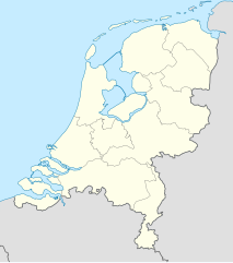
Quadratische Plattkarte, N-S-Streckung 160 %. Geographische Begrenzung der Karte:
N: 53.7° N S: 50.6° N W: 3.1° O O: 7.5° O English:
Equirectangular projection, N/S stretching 160 %. Geographic limits of the map:
N: 53.7° N S: 50.6° N W: 3.1° E O: 7.5° E วันที่ 24 กรกฎาคม พ.ศ. 2551 แหล่งที่มา own work, using
United States National Imagery and Mapping Agency data World Data Base II data ผู้สร้างสรรค์ Lencer เวอร์ชันอื่น ไฟล์อื่นที่ใช้ไฟล์นี้: Regenbogen location map.svg
แผนที่นี้ถูกสร้างหรือพัฒนาขึ้นจาก Kartenwerkstatt (ห้องปฏิบัติการแผนที่) ของวิกิพีเดียภาษาเยอรมัน ซึ่งคุณสามารถเสนอแผนที่เพื่อพัฒนาได้เช่นเดียวกัน
azərbaycanca ∙ Deutsch (Sie-Form) ∙ čeština ∙ Deutsch ∙ sicilianu ∙ italiano ∙ русский ∙ română ∙ português ∙ English ∙ magyar ∙ Nederlands ∙ slovenščina ∙ polski ∙ latviešu ∙ македонски ∙ español ∙ فارسی ∙ français ∙ suomi ∙ עברית ∙ Plattdüütsch ∙ ქართული ∙ հայերեն ∙ বাংলা ∙ ไทย ∙ 日本語 ∙ 中文 ∙ 中文(简体) ∙ 中文(繁體) ∙ العربية ∙ +/−
การอนุญาตใช้สิทธิ ข้าพเจ้า ในฐานะผู้ถือลิขสิทธิ์ของภาพหรือสื่อนี้ อนุญาตให้ใช้ภาพหรือสื่อนี้ภายใต้เงื่อนไขต่อไปนี้
อนุญาตให้คัดลอก แจกจ่ายและ/หรือดัดแปรเอกสารนี้ภายใต้เงื่อนไขของสัญญาอนุญาตเอกสารเสรีของกนู รุ่น 1.2 หรือรุ่นใด ๆ นับจากนี้ที่ออกโดยมูลนิธิซอฟต์แวร์เสรี โดยไม่มีส่วนใดห้ามแก้ไข ไม่มีข้อความปกหน้าและปกหลัง สำเนาของสัญญาอนุญาตรวมอยู่ในส่วนชื่อ สัญญาอนุญาตเอกสารเสรีของกนู http://www.gnu.org/copyleft/fdl.html GFDL GNU Free Documentation License true true
ไฟล์นี้อยู่ภายใต้สัญญาอนุญาต ครีเอทีฟคอมมอนส์ แบบแสดงที่มา-อนุญาตแบบเดียวกัน 3.0 ต้นฉบับ
คุณสามารถ: ที่จะแบ่งปัน – ที่จะทำสำเนา แจกจ่าย และส่งงานดังกล่าวต่อไปที่จะเรียบเรียงใหม่ – ที่จะดัดแปลงงานดังกล่าว ภายใต้เงื่อนไขต่อไปนี้: แสดงที่มา – คุณต้องให้เกียรติเจ้าของงานอย่างเหมาะสม โดยเพิ่มลิงก์ไปยังสัญญาอนุญาต และระบุหากมีการเปลี่ยนแปลง คุณอาจทำเช่นนี้ได้ในรูปแบบใดก็ได้ตามควร แต่ต้องไม่ใช่ในลักษณะที่แนะว่าผู้ให้อนุญาตสนับสนุนคุณหรือการใช้งานของคุณอนุญาตแบบเดียวกัน – หากคุณดัดแปลง เปลี่ยนรูป หรือต่อเติมงานนี้ คุณต้องใช้สัญญาอนุญาตแบบเดียวกันหรือแบบที่เหมือนกับสัญญาอนุญาตที่ใช้กับงานนี้เท่านั้น https://creativecommons.org/licenses/by-sa/3.0 CC BY-SA 3.0 Creative Commons Attribution-Share Alike 3.0 true true คุณสามารถเลือกสัญญาอนุญาตดังกล่าวตามต้องการ
ไทย เพิ่มคำบรรยายทรรทัดเดียวเพื่อขยายความว่าไฟล์นี้มีอะไร
ดัตช์ Locatie kaart Roermond Nederland
ประวัติไฟล์ คลิกวันที่/เวลาเพื่อดูไฟล์ที่ปรากฏในขณะนั้น
วันที่/เวลา รูปย่อ ขนาด ผู้ใช้ ความเห็น ปัจจุบัน 18:26, 5 มกราคม 2562 888 × 1,001 (139 กิโลไบต์) Thayts small border corrections 19:26, 2 มกราคม 2562 888 × 1,001 (139 กิโลไบต์) Thayts fixed border segments 18:54, 30 ธันวาคม 2561 888 × 1,001 (145 กิโลไบต์) NordNordWest upd 2019 05:25, 18 กุมภาพันธ์ 2556 888 × 1,001 (153 กิโลไบต์) Io Herodotus added Maasvakte2 23:57, 31 กรกฎาคม 2555 888 × 1,001 (145 กิโลไบต์) NordNordWest upd 23:56, 31 กรกฎาคม 2555 888 × 1,001 (145 กิโลไบต์) NordNordWest upd 00:32, 4 มีนาคม 2554 888 × 1,001 (225 กิโลไบต์) Lencer fix border 23:26, 11 กันยายน 2551 888 × 1,001 (230 กิโลไบต์) Lencer {{Information |Description= |Source= |Date= |Author= |Permission= |other_versions= }} 22:15, 10 กันยายน 2551 888 × 1,001 (230 กิโลไบต์) Lencer {{Information |Description= |Source= |Date= |Author= |Permission= |other_versions= }} 01:35, 10 กันยายน 2551 888 × 1,001 (229 กิโลไบต์) Lencer {{Information |Description= |Source= |Date= |Author= |Permission= |other_versions= }}
หน้าที่มีภาพนี้ หน้าต่อไปนี้ โยงมาที่ภาพนี้:
การใช้ไฟล์ส่วนกลาง วิกิอื่นต่อไปนี้ใช้ไฟล์นี้:
Amersfoort Kruiningen Sjabloon:Liggingkaart Nederland Waarde (plek) Middelstum Stedum Garnwerd Adorp Ulrum Leens Kloosterburen Termunten Noordpolderzijl 't Zandt Groede Krieketwêreldbeker 1999 Saasveld, Nederland Nederlandse nasionale krieketspan Vorlage:Positionskarte Niederlande መለጠፊያ:Location map ሆላንድ ኔመሕን ለይድን ሮተርዳም ደን ሃግ ኢውትረሕት Amsterdam Aalsmeer Alkmaar Amstelveen Andijk Anna Paulowna Beemster Bergen (Holanda Septentrional) Beverwijk Blaricum Bloemendaal Bussum Castricum Den Helder Diemen Drechterland Edam-Volendam Enkhuizen Graft-De Rijp Haarlem Haarlemmerliede en Spaarnwoude ดูการใช้ทั่วโลกเพิ่มเติม ของไฟล์นี้
ภาพนี้มีข้อมูลเพิ่มเติม ซึ่งส่วนใหญ่มาจากกล้องดิจิตอลหรือสแกนเนอร์ที่สามารถเก็บข้อมูลดังกล่าวไว้รวมกับภาพได้ ถ้าภาพนี้ถูกปรับปรุงแก้ไขหรือเปลี่ยนแปลงจากเดิม ข้อมูลบางอย่างจะยังคงไม่เปลี่ยนแปลงเหมือนภาพที่ถูกปรับปรุงแก้ไขนั้น
ไฟล, netherlands, location, ไฟล, ประว, ไฟล, หน, าท, ภาพน, การใช, ไฟล, วนกลาง, อม, ลเก, ยวก, บภาพขนาดของต, วอย, าง, ของไฟล, กเซล, ความละเอ, ยดอ, กเซล, กเซล, กเซล, กเซล, กเซล, กเซล, ภาพท, ความละเอ, ยดส, งกว, 8206, ไฟล, กเซล, ขนาดไฟล, โลไบต, ปภาพหร, อไฟล, เส, ยงน. ifl prawtiifl hnathimiphaphni karichiflswnklang khxmulekiywkbphaphkhnadkhxngtwxyang PNG nikhxngifl SVG ni 532 600 phikesl khwamlaexiydxun 213 240 phikesl 426 480 phikesl 681 768 phikesl 908 1 024 phikesl 1 817 2 048 phikesl 888 1 001 phikesl duphaphthimikhwamlaexiydsungkwa 8206 ifl SVG 888 1 001 phikesl khnadifl 139 kiolibt rupphaphhruxiflesiyngni tnchbbxyuthi khxmmxns raylaexiyddanlang epnkhxkhwamthiaesdngphlcak ifltnchbbinkhxmmxns khxmmxnsepnewbistinokhrngkarsahrbekbrwbrwmsuxesri thi khunsamarthchwyid khwamyx khaxthibayNetherlands location map svg Deutsch Positionskarte der Niederlande Quadratische Plattkarte N S Streckung 160 Geographische Begrenzung der Karte N 53 7 N S 50 6 N W 3 1 O O 7 5 OEnglish Location map of the Netherlands Equirectangular projection N S stretching 160 Geographic limits of the map N 53 7 N S 50 6 N W 3 1 E O 7 5 Ewnthi 24 krkdakhm ph s 2551aehlngthima own work using United States National Imagery and Mapping Agency data World Data Base II dataphusrangsrrkh Lencerewxrchnxun relief version Netherlands 1944 iflxunthiichiflni Regenbogen location map svg aephnthinithuksranghruxphthnakhuncak Kartenwerkstatt hxngptibtikaraephnthi khxngwikiphiediyphasaeyxrmn sungkhunsamarthesnxaephnthiephuxphthnaidechnediywkn azerbaycanca Deutsch Sie Form cestina Deutsch sicilianu italiano russkij romană portugues English magyar Nederlands slovenscina polski latviesu makedonski espanol فارسی francais suomi עברית Plattduutsch ქართული հայերեն ব ল ithy 日本語 中文 中文 简体 中文 繁體 العربية karxnuyatichsiththi khapheca inthanaphuthuxlikhsiththikhxngphaphhruxsuxni xnuyatihichphaphhruxsuxniphayitenguxnikhtxipni xnuyatihkhdlxk aeckcayaela hruxddaeprexksarniphayitenguxnikhkhxngsyyaxnuyatexksaresrikhxngknu run 1 2 hruxrunid nbcaknithixxkodymulnithisxftaewresri odyimmiswnidhamaekikh immikhxkhwampkhnaaelapkhlng saenakhxngsyyaxnuyatrwmxyuinswnchux syyaxnuyatexksaresrikhxngknuhttp www gnu org copyleft fdl html GFDL GNU Free Documentation License true trueiflnixyuphayitsyyaxnuyat khriexthifkhxmmxns aebbaesdngthima xnuyataebbediywkn 3 0 tnchbbkhunsamarth thicaaebngpn thicathasaena aeckcay aelasngngandngklawtxip thicaeriyberiyngihm thicaddaeplngngandngklaw phayitenguxnikhtxipni aesdngthima khuntxngihekiyrtiecakhxngnganxyangehmaasm odyephimlingkipyngsyyaxnuyat aelarabuhakmikarepliynaeplng khunxacthaechnniidinrupaebbidkidtamkhwr aettxngimichinlksnathiaenawaphuihxnuyatsnbsnunkhunhruxkarichngankhxngkhun xnuyataebbediywkn hakkhunddaeplng epliynrup hruxtxetimnganni khuntxngichsyyaxnuyataebbediywknhruxaebbthiehmuxnkbsyyaxnuyatthiichkbnganniethannhttps creativecommons org licenses by sa 3 0 CC BY SA 3 0 Creative Commons Attribution Share Alike 3 0 true truekhunsamartheluxksyyaxnuyatdngklawtamtxngkarkhabrryayodyyxithyephimkhabrryaythrrthdediywephuxkhyaykhwamwaiflnimixairdtchLocatie kaart Roermond Nederlandixethmthiaesdngxyuiniflniprakxbdwypraethsenethxraelndphusrangbangkhathiimmiixethmwikisnethschuxphuichwikimiediy Lencerchuxphusrangsrrkh Lenceryuxaraexl https commons wikimedia org wiki user LencersthanalikhsiththimilikhsiththisyyaxnuyatCreative Commons Attribution ShareAlike 3 0 Unported xngkvsGNU Free Documentation License version 1 2 or later xngkvswnthisrang wnkxtng24 krkdakhm 2008MIME type xngkvsimage svg xml prawtiifl khlikwnthi ewlaephuxduiflthipraktinkhnann lasud ekasud du ihmkwa 10 ekakwa 10 10 20 50 100 250 500 wnthi ewlarupyxkhnadphuichkhwamehn pccubn18 26 5 mkrakhm 2562888 1 001 139 kiolibt Thaytssmall border corrections 19 26 2 mkrakhm 2562888 1 001 139 kiolibt Thaytsfixed border segments 18 54 30 thnwakhm 2561888 1 001 145 kiolibt NordNordWestupd 2019 05 25 18 kumphaphnth 2556888 1 001 153 kiolibt Io Herodotusadded Maasvakte2 23 57 31 krkdakhm 2555888 1 001 145 kiolibt NordNordWestupd 23 56 31 krkdakhm 2555888 1 001 145 kiolibt NordNordWestupd 00 32 4 minakhm 2554888 1 001 225 kiolibt Lencerfix border 23 26 11 knyayn 2551888 1 001 230 kiolibt Lencer Information Description Source Date Author Permission other versions 22 15 10 knyayn 2551888 1 001 230 kiolibt Lencer Information Description Source Date Author Permission other versions 01 35 10 knyayn 2551888 1 001 229 kiolibt Lencer Information Description Source Date Author Permission other versions lasud ekasud du ihmkwa 10 ekakwa 10 10 20 50 100 250 500 hnathimiphaphni hnatxipni oyngmathiphaphni futbxlchingaechmpaehngchatiyuorp 2000 rxtethxrdam wxlelybxlchaychingaechmpyuorp 2019 wxlelybxlhyingchingaechmpolk 2022 sokhklnd ewnol exrsetxdiwisi exerxdiwisi exerxdiwisi vdukal 2019 20 karichiflswnklang wikixuntxipniichiflni karichbn af wikipedia org Lughawe Schiphol Amersfoort Kruiningen Sjabloon Liggingkaart Nederland Waarde plek Middelstum Stedum Garnwerd Adorp Ulrum Leens Kloosterburen Termunten Noordpolderzijl t Zandt Groede Krieketwereldbeker 1999 Saasveld Nederland Nederlandse nasionale krieketspan karichbn als wikipedia org Fussball Europameisterschaft 2000 Vorlage Positionskarte Niederlande karichbn am wikipedia org ዶስቡርግ መለጠፊያ Location map ሆላንድ ኔመሕን ለይድን ሮተርዳም ደን ሃግ ኢውትረሕት karichbn an wikipedia org Rotterdam Amsterdam Aalsmeer Alkmaar Amstelveen Andijk Anna Paulowna Beemster Bergen Holanda Septentrional Beverwijk Blaricum Bloemendaal Bussum Castricum Den Helder Diemen Drechterland Edam Volendam Enkhuizen Graft De Rijp Haarlem Haarlemmerliede en Spaarnwoude dukarichthwolkephimetimkhxngiflnikhxmulekiywkbphaph phaphnimikhxmulephimetim sungswnihymacakklxngdicitxlhruxsaeknenxrthisamarthekbkhxmuldngklawiwrwmkbphaphid thaphaphnithukprbprungaekikhhruxepliynaeplngcakedim khxmulbangxyangcayngkhngimepliynaeplngehmuxnphaphthithukprbprungaekikhnnkhwamkwang887 641pxkhwamsung1000 512px ekhathungcak https th wikipedia org wiki ifl Netherlands location map svg, wikipedia, วิกิ หนังสือ, หนังสือ, ห้องสมุด,
บทความ , อ่าน, ดาวน์โหลด, ฟรี, ดาวน์โหลดฟรี, mp3, วิดีโอ, mp4, 3gp, jpg, jpeg, gif, png, รูปภาพ, เพลง, เพลง, หนัง, หนังสือ, เกม, เกม