Image:O'Hare International Airport (USGS).png, Image:O'Hare International Airport (USGS) Current.png, Image:O'Hare International Airport (USGS) Phase1.png, Image:O'Hare International Airport (USGS) Phase2.png, Image:O'Hare International Airport (USGS) Final.png
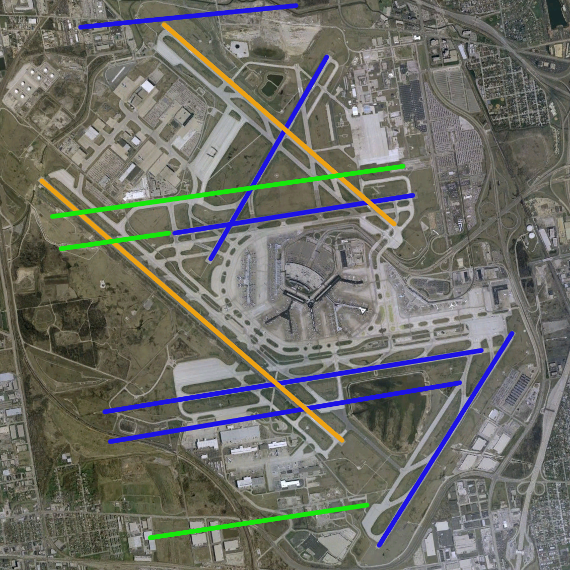
ไฟล, hare, international, airport, usgs, phase3, ไฟล, ประว, ไฟล, หน, าท, ภาพน, การใช, ไฟล, ามโครงการขนาดของต, วอย, างน, กเซล, ความละเอ, ยดอ, กเซล, กเซล, กเซล, กเซล, ภาพท, ความละเอ, ยดส, งกว, 8206, กเซล, ขนาดไฟล, เมกะไบต, ชน, ดไมม, image, ปภาพหร, อไฟล, เส, ยงน,. ifl prawtiifl hnathimiphaphni karichiflkhamokhrngkarkhnadkhxngtwxyangni 600 600 phikesl khwamlaexiydxun 240 240 phikesl 480 480 phikesl 768 768 phikesl 1 132 1 132 phikesl duphaphthimikhwamlaexiydsungkwa 8206 1 132 1 132 phikesl khnadifl 2 1 emkaibt chnidimm image png rupphaphhruxiflesiyngni tnchbbxyuthi khxmmxns raylaexiyddanlang epnkhxkhwamthiaesdngphlcak ifltnchbbinkhxmmxns khxmmxnsepnewbistinokhrngkarsahrbekbrwbrwmsuxesri thi khunsamarthchwyid khaxthibayO Hare International Airport USGS Phase3 png O Hare International Airport modernization program phase 3 runway configuration blue existing green new orange removed aehlngthima NASA World Wind Screenshot USGS urban ortho 1 phusrangsrrkh Public domain Public domain false false This image is in the public domain in the United States because it only contains materials that originally came from the United States Geological Survey an agency of the United States Department of the Interior For more information see the official USGS copyright policy Bahasa Indonesia nbsp catala nbsp cestina nbsp Deutsch nbsp eesti nbsp English nbsp espanol nbsp francais nbsp galego nbsp italiano nbsp Nederlands nbsp portugues nbsp polski nbsp sicilianu nbsp suomi nbsp Tiếng Việt nbsp Turkce nbsp blgarski nbsp makedonski nbsp russkij nbsp മലയ ള nbsp 한국어 nbsp 日本語 nbsp 中文 nbsp 中文 简体 nbsp 中文 繁體 nbsp العربية nbsp فارسی nbsp Runway overlay by User Wangi ewxrchnxun Image O Hare International Airport USGS png Image O Hare International Airport USGS Current png Image O Hare International Airport USGS Phase1 png Image O Hare International Airport USGS Phase2 png Image O Hare International Airport USGS Final png prawtiifl khlikwnthi ewlaephuxduiflthipraktinkhnann wnthi ewlarupyxkhnadphuichkhwamehn pccubn06 54 19 kumphaphnth 25521 132 1 132 2 1 emkaibt MahahahaneapneapCompressed 04 49 1 krkdakhm 25501 132 1 132 2 12 emkaibt Brianskioptimized de interlaced 16 58 14 phvsphakhm 25491 132 1 132 2 55 emkaibt Wangi Information Description O 039 Hare International Airport modernization program phase 3 runway configuration blue existing green new orange removed Source NASA World Wind Screenshot USGS urban ortho http egov cityofchicago org city we hnathimiphaphni hnatxipni oyngmathiphaphni thaxakasyannanachatioxaehr karichiflkhamokhrngkar wikixuntxipniichiflni karichbn de wikipedia org Chicago O Hare International Airport karichbn en wikipedia org User Wangi Images karichbn fr wikipedia org Aeroport international O Hare de Chicago karichbn id wikipedia org Bandar Udara Internasional O Hare karichbn pl wikipedia org Port lotniczy Chicago O Hare karichbn ru wikipedia org O Hara aeroport karichbn zh wikipedia org 奥黑尔国际机场 ekhathungcak https th wikipedia org wiki ifl O 27Hare International Airport USGS Phase3 png, wikipedia, วิกิ หนังสือ, หนังสือ, ห้องสมุด,