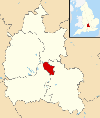
{{Information |Description=Map of Oxfordshire, UK with Oxford highlighted. Equirectangular map projection on WGS 84 datum, with N/S stretched 160% |Source=Ordnance Survey [https://www.ordnancesurvey.co
ไฟล, oxford, locator, ไฟล, ประว, ไฟล, หน, าท, ภาพน, การใช, ไฟล, วนกลางขนาดของต, วอย, าง, ของไฟล, กเซล, ความละเอ, ยดอ, กเซล, กเซล, กเซล, กเซล, กเซล, กเซล, ภาพท, ความละเอ, ยดส, งกว, 8206, ไฟล, กเซล, ขนาดไฟล, โลไบต, ปภาพหร, อไฟล, เส, ยงน, นฉบ, บอย, คอมมอนส, รายละ. ifl prawtiifl hnathimiphaphni karichiflswnklangkhnadkhxngtwxyang PNG nikhxngifl SVG ni 510 599 phikesl khwamlaexiydxun 204 240 phikesl 408 480 phikesl 653 768 phikesl 871 1 024 phikesl 1 742 2 048 phikesl 1 077 1 266 phikesl duphaphthimikhwamlaexiydsungkwa 8206 ifl SVG 1 077 1 266 phikesl khnadifl 921 kiolibt rupphaphhruxiflesiyngni tnchbbxyuthi khxmmxns raylaexiyddanlang epnkhxkhwamthiaesdngphlcak ifltnchbbinkhxmmxns khxmmxnsepnewbistinokhrngkarsahrbekbrwbrwmsuxesri thi khunsamarthchwyid khaxthibayOxford UK locator map svg Map of Oxfordshire UK with Oxford highlighted Equirectangular map projection on WGS 84 datum with N S stretched 160 wnthi 2 singhakhm ph s 2554aehlngthima Ordnance Survey OpenData Coastline and administrative boundary data from Boundary Line product Lake data from Meridian 2 product Inset derived from England location map svg by Spischot phusrangsrrkh Nilfanion created using Ordnance Survey datakarxnuyat karichiflniihm iflnixyuphayitsyyaxnuyat khriexthifkhxmmxns aebbaesdngthima xnuyataebbediywkn 3 0 tnchbbkaraesdngthima Contains Ordnance Survey data c Crown copyright and database rightkhunsamarth thicaaebngpn thicathasaena aeckcay aelasngngandngklawtxip thicaeriyberiyngihm thicaddaeplngngandngklaw phayitenguxnikhtxipni aesdngthima khuntxngihekiyrtiecakhxngnganxyangehmaasm odyephimlingkipyngsyyaxnuyat aelarabuhakmikarepliynaeplng khunxacthaechnniidinrupaebbidkidtamkhwr aettxngimichinlksnathiaenawaphuihxnuyatsnbsnunkhunhruxkarichngankhxngkhun xnuyataebbediywkn hakkhunddaeplng epliynrup hruxtxetimnganni khuntxngichsyyaxnuyataebbediywknhruxaebbthiehmuxnkbsyyaxnuyatthiichkbnganniethannhttps creativecommons org licenses by sa 3 0 CC BY SA 3 0 Creative Commons Attribution Share Alike 3 0 true truekhabrryayodyyxithyephimkhabrryaythrrthdediywephuxkhyaykhwamwaiflnimixairixethmthiaesdngxyuiniflniprakxbdwysthanalikhsiththimilikhsiththisyyaxnuyatCreative Commons Attribution ShareAlike 3 0 Unported xngkvswnthisrang wnkxtng2 singhakhm 2011 prawtiifl khlikwnthi ewlaephuxduiflthipraktinkhnann wnthi ewlarupyxkhnadphuichkhwamehn pccubn17 00 2 singhakhm 25541 077 1 266 921 kiolibt Nilfanion Information Description Map of Oxfordshire UK with Oxford highlighted Equirectangular map projection on WGS 84 datum with N S stretched 160 Source Ordnance Survey https www ordnancesurvey co hnathimiphaphni hnatxipni oyngmathiphaphni xxksfxrd karichiflswnklang wikixuntxipniichiflni karichbn ar wikipedia org أكسفورد karichbn arz wikipedia org اوكسفورد karichbn ast wikipedia org Oxford karichbn azb wikipedia org آکسفورد karichbn bg wikipedia org Oksfordshr karichbn bn wikipedia org অক সফ র ড karichbn ca wikipedia org Oxford karichbn ceb wikipedia org Oxford kapital sa kondado sa Hiniusang Gingharian karichbn ckb wikipedia org ئۆکسفۆڕد karichbn cy wikipedia org Dinas Rhydychen karichbn diq wikipedia org Oxford karichbn el wikipedia org O3fordh karichbn en wikipedia org Oxford User Maproom lmaps karichbn eu wikipedia org Oxford karichbn fa wikipedia org آکسفورد karichbn fi wikipedia org Oxford karichbn fy wikipedia org Oxford karichbn incubator wikimedia org Wp grc Ὀ3wnia Wp khw آکسفرڈ Wp khw اوکسفرڈ karichbn io wikipedia org Oxford karichbn it wikipedia org Oxford karichbn ja wikipedia org オックスフォード Category オックスフォード Category オックスフォード出身の人物 karichbn la wikipedia org Oxonia karichbn mr wikipedia org ऑक सफर ड karichbn no wikipedia org Oxford Kategori Personer fra Oxford karichbn pl wikipedia org City of Oxford karichbn pnb wikipedia org آکسفورڈ karichbn sco wikipedia org Oxford karichbn sd wikipedia org آڪسفورڊ karichbn simple wikipedia org Oxford karichbn sl wikipedia org Oxford karichbn sv wikipedia org Anvandare Lsjbot Dubletter Oxford Oxford District karichbn tr wikipedia org Oxford karichbn ur wikipedia org اوکسفرڈ karichbn vi wikipedia org Oxford karichbn vo wikipedia org Oxford karichbn www wikidata org Q34217 karichbn yi wikipedia org אקספארד karichbn zea wikipedia org Oxford karichbn zh yue wikipedia org 牛津 karichbn zh wikipedia org 牛津 ekhathungcak https th wikipedia org wiki ifl Oxford UK locator map svg, wikipedia, วิกิ หนังสือ, หนังสือ, ห้องสมุด,