รูปภาพหรือไฟล์เสียงนี้ ต้นฉบับอยู่ที่ คอมมอนส์ รายละเอียดด้านล่าง เป็นข้อความที่แสดงผลจาก ไฟล์ต้นฉบับในคอมมอนส์ คอมมอนส์เป็นเว็บไซต์ในโครงการสำหรับเก็บรวบรวมสื่อเสรี ที่ คุณสามารถช่วยได้
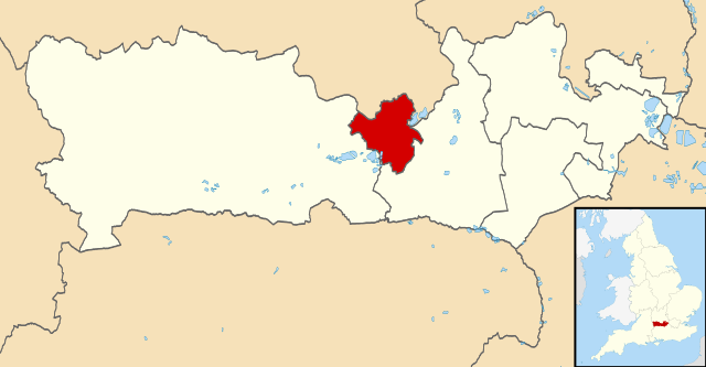
คำอธิบายReading UK locator map.svg Map of Berkshire, UK with Reading highlighted.
Equirectangular map projection on WGS 84 datum, with N/S stretched 160% วันที่ 2 สิงหาคม พ.ศ. 2554 แหล่งที่มา Ordnance Survey OpenData
Coastline and administrative boundary data from Boundary-Line product. Lake data from Meridian 2 product. ผู้สร้างสรรค์ Nilfanion, created using Ordnance Survey data การอนุญาต(การใช้ไฟล์นี้ใหม่)
ไฟล์นี้อยู่ภายใต้สัญญาอนุญาต ครีเอทีฟคอมมอนส์ แบบแสดงที่มา-อนุญาตแบบเดียวกัน 3.0 ต้นฉบับ
การแสดงที่มา: Contains Ordnance Survey data © Crown copyright and database right
คุณสามารถ: ที่จะแบ่งปัน – ที่จะทำสำเนา แจกจ่าย และส่งงานดังกล่าวต่อไปที่จะเรียบเรียงใหม่ – ที่จะดัดแปลงงานดังกล่าว ภายใต้เงื่อนไขต่อไปนี้: แสดงที่มา – คุณต้องให้เกียรติเจ้าของงานอย่างเหมาะสม โดยเพิ่มลิงก์ไปยังสัญญาอนุญาต และระบุหากมีการเปลี่ยนแปลง คุณอาจทำเช่นนี้ได้ในรูปแบบใดก็ได้ตามควร แต่ต้องไม่ใช่ในลักษณะที่แนะว่าผู้ให้อนุญาตสนับสนุนคุณหรือการใช้งานของคุณอนุญาตแบบเดียวกัน – หากคุณดัดแปลง เปลี่ยนรูป หรือต่อเติมงานนี้ คุณต้องใช้สัญญาอนุญาตแบบเดียวกันหรือแบบที่เหมือนกับสัญญาอนุญาตที่ใช้กับงานนี้เท่านั้น https://creativecommons.org/licenses/by-sa/3.0 CC BY-SA 3.0 Creative Commons Attribution-Share Alike 3.0 true true
ไทย เพิ่มคำบรรยายทรรทัดเดียวเพื่อขยายความว่าไฟล์นี้มีอะไร
ประวัติไฟล์ คลิกวันที่/เวลาเพื่อดูไฟล์ที่ปรากฏในขณะนั้น
วันที่/เวลา รูปย่อ ขนาด ผู้ใช้ ความเห็น ปัจจุบัน 16:44, 2 สิงหาคม 2554 1,425 × 741 (735 กิโลไบต์) Nilfanion {{Information |Description=Map of Berkshire, UK with Reading highlighted. Equirectangular map projection on WGS 84 datum, with N/S stretched 160% |Source=Ordnance Survey [https://www.ordnance
หน้าที่มีภาพนี้ หน้าต่อไปนี้ โยงมาที่ภาพนี้:
การใช้ไฟล์ส่วนกลาง วิกิอื่นต่อไปนี้ใช้ไฟล์นี้:
Category:レディング出身の人物 Category:レディング การใช้บน pl.wikivoyage.org
ไฟล, reading, locator, ไฟล, ประว, ไฟล, หน, าท, ภาพน, การใช, ไฟล, วนกลางขนาดของต, วอย, าง, ของไฟล, กเซล, ความละเอ, ยดอ, กเซล, กเซล, กเซล, กเซล, กเซล, กเซล, ภาพท, ความละเอ, ยดส, งกว, 8206, ไฟล, กเซล, ขนาดไฟล, โลไบต, ปภาพหร, อไฟล, เส, ยงน, นฉบ, บอย, คอมมอนส, รายล. ifl prawtiifl hnathimiphaphni karichiflswnklangkhnadkhxngtwxyang PNG nikhxngifl SVG ni 800 416 phikesl khwamlaexiydxun 320 166 phikesl 640 333 phikesl 1 024 532 phikesl 1 280 666 phikesl 2 560 1 331 phikesl 1 425 741 phikesl duphaphthimikhwamlaexiydsungkwa 8206 ifl SVG 1 425 741 phikesl khnadifl 735 kiolibt rupphaphhruxiflesiyngni tnchbbxyuthi khxmmxns raylaexiyddanlang epnkhxkhwamthiaesdngphlcak ifltnchbbinkhxmmxns khxmmxnsepnewbistinokhrngkarsahrbekbrwbrwmsuxesri thi khunsamarthchwyid khaxthibayReading UK locator map svg Map of Berkshire UK with Reading highlighted Equirectangular map projection on WGS 84 datum with N S stretched 160 wnthi 2 singhakhm ph s 2554 aehlngthima Ordnance Survey OpenData Coastline and administrative boundary data from Boundary Line product Lake data from Meridian 2 product Inset derived from England location map svg by Spischot phusrangsrrkh Nilfanion created using Ordnance Survey data karxnuyat karichiflniihm iflnixyuphayitsyyaxnuyat khriexthifkhxmmxns aebbaesdngthima xnuyataebbediywkn 3 0 tnchbbkaraesdngthima Contains Ordnance Survey data c Crown copyright and database rightkhunsamarth thicaaebngpn thicathasaena aeckcay aelasngngandngklawtxip thicaeriyberiyngihm thicaddaeplngngandngklaw phayitenguxnikhtxipni aesdngthima khuntxngihekiyrtiecakhxngnganxyangehmaasm odyephimlingkipyngsyyaxnuyat aelarabuhakmikarepliynaeplng khunxacthaechnniidinrupaebbidkidtamkhwr aettxngimichinlksnathiaenawaphuihxnuyatsnbsnunkhunhruxkarichngankhxngkhun xnuyataebbediywkn hakkhunddaeplng epliynrup hruxtxetimnganni khuntxngichsyyaxnuyataebbediywknhruxaebbthiehmuxnkbsyyaxnuyatthiichkbnganniethannhttps creativecommons org licenses by sa 3 0 CC BY SA 3 0 Creative Commons Attribution Share Alike 3 0 true truekhabrryayodyyxithyephimkhabrryaythrrthdediywephuxkhyaykhwamwaiflnimixairixethmthiaesdngxyuiniflniprakxbdwysthanalikhsiththimilikhsiththisyyaxnuyatCreative Commons Attribution ShareAlike 3 0 Unported nbsp xngkvswnthisrang wnkxtng2 singhakhm 2011 prawtiifl khlikwnthi ewlaephuxduiflthipraktinkhnann wnthi ewlarupyxkhnadphuichkhwamehn pccubn16 44 2 singhakhm 25541 425 741 735 kiolibt Nilfanion Information Description Map of Berkshire UK with Reading highlighted Equirectangular map projection on WGS 84 datum with N S stretched 160 Source Ordnance Survey https www ordnance hnathimiphaphni hnatxipni oyngmathiphaphni erding barkechxr karichiflswnklang wikixuntxipniichiflni karichbn bg wikipedia org Brkshr karichbn bn wikipedia org র ড karichbn cy wikipedia org Bwrdeistref Reading karichbn en wikipedia org Reading Berkshire karichbn fi wikipedia org Reading karichbn frr wikipedia org Reading karichbn fr wikipedia org Liste des paroisses civiles du Berkshire karichbn ja wikipedia org レディング Category レディング出身の人物 Category レディング karichbn ml wikipedia org റ ഡ ഗ ബ ർക ഷയർ karichbn mr wikipedia org र ड ग बर कश यर karichbn no wikipedia org Kategori Personer fra Reading karichbn pl wikipedia org Reading borough karichbn pl wikivoyage org Reading karichbn pt wikipedia org Reading karichbn sco wikipedia org Reading Berkshire karichbn simple wikipedia org Reading Berkshire karichbn sv wikipedia org Reading distrikt karichbn tr wikipedia org Reading karichbn ur wikipedia org ریڈنگ بارکشائر karichbn www wikidata org Q21496716 karichbn zh classical wikipedia org 雷丁 karichbn zh wikipedia org 雷丁 ekhathungcak https th wikipedia org wiki ifl Reading UK locator map svg, wikipedia, วิกิ หนังสือ, หนังสือ, ห้องสมุด,
บทความ , อ่าน, ดาวน์โหลด, ฟรี, ดาวน์โหลดฟรี, mp3, วิดีโอ, mp4, 3gp, jpg, jpeg, gif, png, รูปภาพ, เพลง, เพลง, หนัง, หนังสือ, เกม, เกม