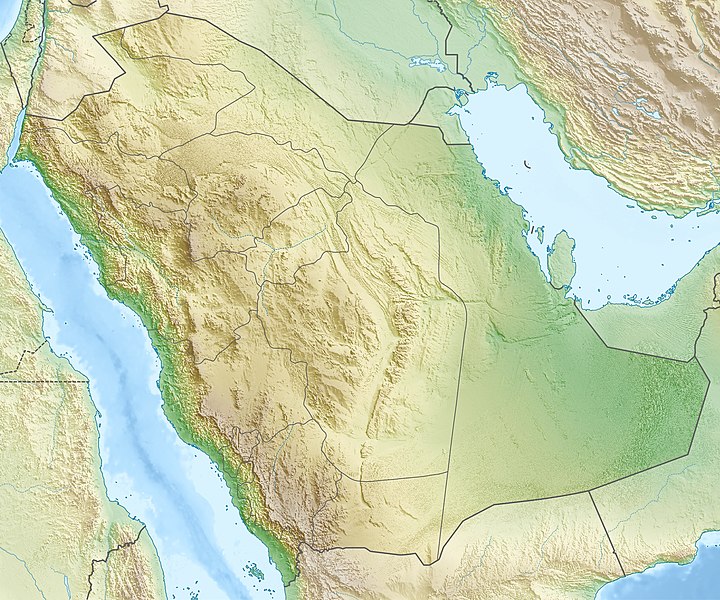
This file has an extracted image: File:Saudi Arabia relief location map (cropped).jpg.
Equivalent administrative map
This image was uploaded in the JPEG format even though it consists of non-photographic data. This information could be stored more efficiently or accurately in the PNG or SVG format. If possible, please upload a PNG or SVG version of this image without compression artifacts, derived from a non-JPEG source (or with existing artifacts removed). After doing so, please tag the JPEG version with {{Superseded|NewImage.ext}} and remove this tag. This tag should not be applied to photographs or scans. For more information, see {{BadJPEG}}.
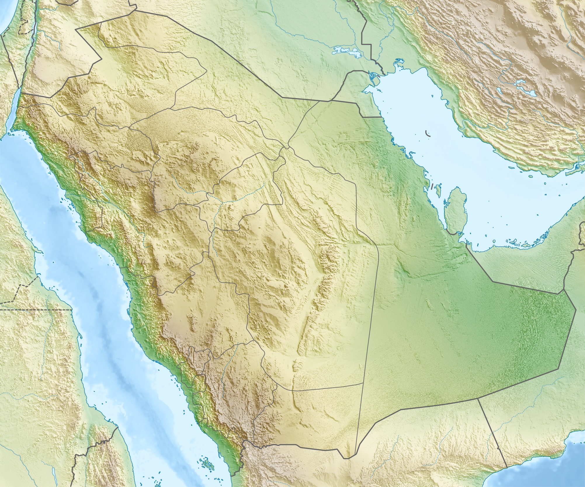
{{Information |Description={{de|Physische Positionskarte von {{w|Saudi-Arabien|3=de}}}} Quadratische Plattkarte, N-S-Streckung 110 %. Geographische Begrenzung der Karte: * N: 32.5° N * S: 16.0° N * W: 34.2° O * O: 56.0° O {{en|Physical location map of
ไฟล, saudi, arabia, relief, location, ไฟล, ประว, ไฟล, หน, าท, ภาพน, การใช, ไฟล, วนกลาง, อม, ลเก, ยวก, บภาพขนาดของต, วอย, างน, กเซล, ความละเอ, ยดอ, กเซล, กเซล, กเซล, กเซล, กเซล, ภาพท, ความละเอ, ยดส, งกว, 8206, กเซล, ขนาดไฟล, เมกะไบต, ชน, ดไมม, image, jpeg, ปภาพ. ifl prawtiifl hnathimiphaphni karichiflswnklang khxmulekiywkbphaphkhnadkhxngtwxyangni 720 600 phikesl khwamlaexiydxun 288 240 phikesl 577 480 phikesl 922 768 phikesl 1 230 1 024 phikesl 2 003 1 668 phikesl duphaphthimikhwamlaexiydsungkwa 8206 2 003 1 668 phikesl khnadifl 1 67 emkaibt chnidimm image jpeg rupphaphhruxiflesiyngni tnchbbxyuthi khxmmxns raylaexiyddanlang epnkhxkhwamthiaesdngphlcak ifltnchbbinkhxmmxns khxmmxnsepnewbistinokhrngkarsahrbekbrwbrwmsuxesri thi khunsamarthchwyid khaxthibaySaudi Arabia relief location map jpg Deutsch Physische Positionskarte von Saudi Arabien Quadratische Plattkarte N S Streckung 110 Geographische Begrenzung der Karte N 32 5 N S 16 0 N W 34 2 O O 56 0 OEnglish Physical location map of Saudi Arabia Equirectangular projection N S stretching 110 Geographic limits of the map N 32 5 N S 16 0 N W 34 2 E E 56 0 Ewnthi 16 phvsphakhm ph s 2553aehlngthima ngankhxngtw using map data from administrative map by NordNordWest The relief was created from SRTM 30 relief data phusrangsrrkh Carportkarxnuyat karichiflniihm iflnixyuphayitsyyaxnuyat khriexthifkhxmmxns aebbaesdngthima xnuyataebbediywkn 3 0 tnchbbkhunsamarth thicaaebngpn thicathasaena aeckcay aelasngngandngklawtxip thicaeriyberiyngihm thicaddaeplngngandngklaw phayitenguxnikhtxipni aesdngthima khuntxngihekiyrtiecakhxngnganxyangehmaasm odyephimlingkipyngsyyaxnuyat aelarabuhakmikarepliynaeplng khunxacthaechnniidinrupaebbidkidtamkhwr aettxngimichinlksnathiaenawaphuihxnuyatsnbsnunkhunhruxkarichngankhxngkhun xnuyataebbediywkn hakkhunddaeplng epliynrup hruxtxetimnganni khuntxngichsyyaxnuyataebbediywknhruxaebbthiehmuxnkbsyyaxnuyatthiichkbnganniethannhttps creativecommons org licenses by sa 3 0 CC BY SA 3 0 Creative Commons Attribution Share Alike 3 0 true trueewxrchnxun This file has an extracted image File Saudi Arabia relief location map cropped jpg Equivalent administrative map This image was uploaded in the JPEG format even though it consists of non photographic data This information could be stored more efficiently or accurately in the PNG or SVG format If possible please upload a PNG or SVG version of this image without compression artifacts derived from a non JPEG source or with existing artifacts removed After doing so please tag the JPEG version with Superseded NewImage ext and remove this tag This tag should not be applied to photographs or scans For more information see BadJPEG khabrryayodyyxithyephimkhabrryaythrrthdediywephuxkhyaykhwamwaiflnimixairixethmthiaesdngxyuiniflniprakxbdwypraethssaxudixaraebiynamndibpiotreliymnamnGhawar Field xngkvsbangkhathiimmiixethmwikisnethsphusrangbangkhathiimmiixethmwikisnethshnathikhxngwtthuphayitpraphcnni changphaphchuxphusrangsrrkh Carportchuxphuichwikimiediy Carportyuxaraexl http commons wikimedia org wiki User CarportsthanalikhsiththimilikhsiththisyyaxnuyatCreative Commons Attribution ShareAlike 3 0 Unported xngkvswnthisrang wnkxtng16 phvsphakhm 2010thimakhxngiflkarsrangdngedimodyphuxpohldMIME type xngkvsimage jpeg prawtiifl khlikwnthi ewlaephuxduiflthipraktinkhnann wnthi ewlarupyxkhnadphuichkhwamehn pccubn00 28 17 phvsphakhm 25532 003 1 668 1 67 emkaibt Carport Information Description de Physische Positionskarte von w Saudi Arabien 3 de Quadratische Plattkarte N S Streckung 110 Geographische Begrenzung der Karte N 32 5 N S 16 0 N W 34 2 O O 56 0 O en Physical location map of hnathimiphaphni hnatxipni oyngmathiphaphni yabalunnur yabalusesadah yabldkka yablxasrb yablesar yiddah thiwekhachmmr thiwekhahiyas thaxakasyannanachatixlxahsax thaxakasyanphayinpraethsturxyf thaxakasyanphayinpraethsbichah thaxakasyanphayinpraethsxlbahah thaxakasyanxleyaf thaxakasyaninpraethsxlkueraayat mkkah xlmadinah hrrxtkhxybr ekhaxaeraafah aemaebb Location map Saudi Arabia mxdul Location map data Saudi Arabia mxdul Location map data Saudi Arabia doc karichiflswnklang wikixuntxipniichiflni karichbn ace wikipedia org Pola Location map Saudi Arabia karichbn als wikipedia org Vorlage Positionskarte Saudi Arabien karichbn ar wikipedia org جدة عنيزة البقيع مقبرة المعلاة حائل العوامية غار حراء غار ثور توارن تاروت جزيرة الدمام الهفوف مقبرة العود الجش القطيف سكاكا جرول مدائن صالح صفوى العلا جامع حسن عناني القديح موقق القاعد قناء جانين الكهفة البعايث حلة محيش الخويلدية ناوان دارين القطيف الشملي غمرة السعودية سيهات الزرقاء قرية رغدان الخبراء القصيم الشقيق جازان قصر بن عقيل البصر بريدة المعيقلات حزنة قرية معمل غاز حرض المطية الرس سوق لبدة الجفر الأحساء محافظة القرى الفرع dukarichthwolkephimetimkhxngiflnikhxmulekiywkbphaph phaphnimikhxmulephimetim sungswnihymacakklxngdicitxlhruxsaeknenxrthisamarthekbkhxmuldngklawiwrwmkbphaphid thaphaphnithukprbprungaekikhhruxepliynaeplngcakedim khxmulbangxyangcayngkhngimepliynaeplngehmuxnphaphthithukprbprungaekikhnn error0 ekhathungcak https th wikipedia org wiki ifl Saudi Arabia relief location map jpg, wikipedia, วิกิ หนังสือ, หนังสือ, ห้องสมุด,