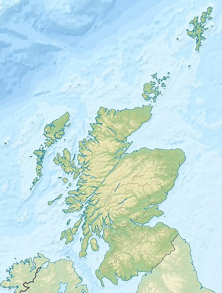
ไฟล, scotland, relief, location, ไฟล, ประว, ไฟล, หน, าท, ภาพน, การใช, ไฟล, วนกลาง, อม, ลเก, ยวก, บภาพขนาดของต, วอย, างน, กเซล, ความละเอ, ยดอ, กเซล, กเซล, กเซล, กเซล, ภาพท, ความละเอ, ยดส, งกว, 8206, กเซล, ขนาดไฟล, โลไบต, ชน, ดไมม, image, jpeg, ปภาพหร, อไฟล, เส,. ifl prawtiifl hnathimiphaphni karichiflswnklang khxmulekiywkbphaphkhnadkhxngtwxyangni 456 600 phikesl khwamlaexiydxun 182 240 phikesl 365 480 phikesl 584 768 phikesl 1 128 1 483 phikesl duphaphthimikhwamlaexiydsungkwa 8206 1 128 1 483 phikesl khnadifl 927 kiolibt chnidimm image jpeg rupphaphhruxiflesiyngni tnchbbxyuthi khxmmxns raylaexiyddanlang epnkhxkhwamthiaesdngphlcak ifltnchbbinkhxmmxns khxmmxnsepnewbistinokhrngkarsahrbekbrwbrwmsuxesri thi khunsamarthchwyid khwamyx khaxthibayScotland relief location map jpg Deutsch Positionskarte von Schottland Vereinigtes Konigreich Quadratische Plattkarte N S Streckung 170 Geographische Begrenzung der Karte N 61 0 N S 54 5 N W 8 8 W O 0 4 W English Location map of Scotland United Kingdom Equirectangular projection N S stretching 170 Geographic limits of the map N 61 0 N S 54 5 N W 8 8 W E 0 4 Wwnthi 25 mithunayn ph s 2553 23 28 UTC aehlngthima ngankhxngtwphusrangsrrkh Scotland location map svg Eric Gaba NordNordWest derivative work Uwe Dederingewxrchnxun Equivalent political map original karxnuyatichsiththi khapheca inthanaphuthuxlikhsiththikhxngphaphhruxsuxni xnuyatihichphaphhruxsuxniphayitenguxnikhtxipniiflnixyuphayitsyyaxnuyat khriexthifkhxmmxns aebbaesdngthima xnuyataebbediywkn 3 0 tnchbbkaraesdngthima Eric Gaba NordNordWest Uwe Dederingkhunsamarth thicaaebngpn thicathasaena aeckcay aelasngngandngklawtxip thicaeriyberiyngihm thicaddaeplngngandngklaw phayitenguxnikhtxipni aesdngthima khuntxngihekiyrtiecakhxngnganxyangehmaasm odyephimlingkipyngsyyaxnuyat aelarabuhakmikarepliynaeplng khunxacthaechnniidinrupaebbidkidtamkhwr aettxngimichinlksnathiaenawaphuihxnuyatsnbsnunkhunhruxkarichngankhxngkhun xnuyataebbediywkn hakkhunddaeplng epliynrup hruxtxetimnganni khuntxngichsyyaxnuyataebbediywknhruxaebbthiehmuxnkbsyyaxnuyatthiichkbnganniethannhttps creativecommons org licenses by sa 3 0 CC BY SA 3 0 Creative Commons Attribution Share Alike 3 0 true true xnuyatihkhdlxk aeckcayaela hruxddaeprexksarniphayitenguxnikhkhxngsyyaxnuyatexksaresrikhxngknu run 1 2 hruxrunid nbcaknithixxkodymulnithisxftaewresri odyimmiswnidhamaekikh immikhxkhwampkhnaaelapkhlng saenakhxngsyyaxnuyatrwmxyuinswnchux syyaxnuyatexksaresrikhxngknuhttp www gnu org copyleft fdl html GFDL GNU Free Documentation License true truekhunsamartheluxksyyaxnuyatdngklawtamtxngkar bnthukkarxphohld This image is a derivative work of the following images File Scotland location map svg licensed with Cc by sa 3 0 GFDL 2008 10 09T18 27 35Z NordNordWest 1128x1483 829918 Bytes Information Description de Positionskarte von de Schottland Schottland de Vereinigtes Konigreich Vereinigtes Konigreich Quadratische Plattkarte N S Streckung 170 Geographische Begrenzung der Karte Uploaded with derivativeFXkhabrryayodyyxithyephimkhabrryaythrrthdediywephuxkhyaykhwamwaiflnimixairxngkvsRelief location map of Scotland in the United Kingdomixethmthiaesdngxyuiniflniprakxbdwypraethsskxtaelndphusrangbangkhathiimmiixethmwikisnethshnathikhxngwtthuphayitpraphcnni changphaphchuxphusrangsrrkh Eric Gabachuxphuichwikimiediy Stingyuxaraexl http commons wikimedia org wiki User StingsthanalikhsiththimilikhsiththisyyaxnuyatCreative Commons Attribution ShareAlike 3 0 Unported xngkvsGNU Free Documentation License version 1 2 or later xngkvsthimakhxngiflkarsrangdngedimodyphuxpohldwnthisrang wnkxtng25 mithunayn 2010MIME type xngkvsimage jpeg prawtiifl khlikwnthi ewlaephuxduiflthipraktinkhnann wnthi ewlarupyxkhnadphuichkhwamehn pccubn06 30 26 mithunayn 25531 128 1 483 927 kiolibt Uwe Dedering Information Description de Positionskarte von Schottland Vereinigtes Konigreich Quadratische Plattkarte N S Streckung 170 Geographische Begrenzung der Karte N 61 0 N S 54 5 N W hnathimiphaphni hnatxipni oyngmathiphaphni klasokw lxkenss saphanfxrth xxrkniy xinewxrenss aexebxrdin aemaebb Location map aemaebb Location map doc aemaebb Location map Scotland aemaebb Location mark aemaebb Location mark doc mxdul Location map data Scotland mxdul Location map data UK Scotland mxdul Location map data UK Scotland doc karichiflswnklang wikixuntxipniichiflni karichbn am wikipedia org መለጠፊያ Location map doc መለጠፊያ Location map Scotland karichbn ar wikipedia org قالب خريطة مواقع قالب خريطة مواقع شرح قالب خريطة مواقع إسكتلندا قالب خريطة مواقع ملعب جزيرة أران نقاش المستخدم ياسين الأسطى أرشيف 3 صخرة الرجل الكبير karichbn arz wikipedia org قالب خريطة مواقع قالب خريطة مواقع شرح قالب Location map شرح قالب خريطة مواقع إسكتلندا karichbn ast wikipedia org Modulu Minimapa data Escocia Modulu Minimapa data Escocia usu karichbn as wikipedia org স চ Location mark স চ Location mark doc স চ Location mark স চ Location mark doc karichbn awa wikipedia org ख च Location mark ख च Location mark ख च Location mark doc ख च Location mark doc karichbn azb wikipedia org ادینبورق شابلون Location map Scotland relief ابردین karichbn az wikipedia org Sablon Yer xeritesi Boyuk Britaniya Sotlandiya Orkney adalari Arran ada Fer adasi Ayona karichbn bar wikipedia org Vorlog Positionskarte Schottland karichbn ba wikipedia org Ҡalyp PozKarta Bojok Britaniya Shotlandiya karichbn be tarask wikipedia org Shablyon Lyakalizacyjnaya mapa Shatlyandyi karichbn be wikipedia org Ben Nevis Shablon Na karce Shatlandyya Aran vostray Ejlsa Krejg Gryn erd Skaj Unutranyya Gebrydskiya astravy Loh Lohi Loh Nes Kintajr Fert of Klajd B yut Dy basejn Paynochnaga mora karichbn bg wikipedia org Sejnt Andryus Abrdijn Edinburg dukarichthwolkephimetimkhxngiflnikhxmulekiywkbphaph phaphnimikhxmulephimetim sungswnihymacakklxngdicitxlhruxsaeknenxrthisamarthekbkhxmuldngklawiwrwmkbphaphid thaphaphnithukprbprungaekikhhruxepliynaeplngcakedim khxmulbangxyangcayngkhngimepliynaeplngehmuxnphaphthithukprbprungaekikhnn error0 ekhathungcak https th wikipedia org wiki ifl Scotland relief location map jpg, wikipedia, วิกิ หนังสือ, หนังสือ, ห้องสมุด,