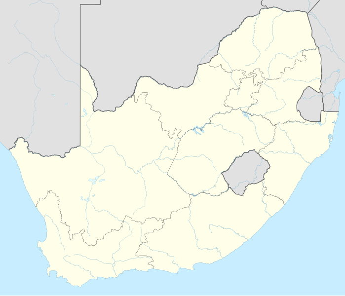
This map is part of a series of location maps with unified standards: SVG as file format, standardised colours and name scheme. The boundaries on these maps always show the de facto situation and do not imply any endorsement or acceptance. In case of changes of the shown area the file is updated. The old version will be uploaded as a new file and thus is still available.
วันที่
แหล่งที่มา
Own work using:
United States National Imagery and Mapping Agency data
azərbaycanca ∙ Deutsch (Sie-Form) ∙ čeština ∙ Deutsch ∙ sicilianu ∙ italiano ∙ русский ∙ română ∙ português ∙ English ∙ magyar ∙ Nederlands ∙ slovenščina ∙ polski ∙ latviešu ∙ македонски ∙ español ∙ فارسی ∙ français ∙ suomi ∙ עברית ∙ Plattdüütsch ∙ ქართული ∙ հայերեն ∙ বাংলা ∙ ไทย ∙ 日本語 ∙ 中文 ∙ 中文(简体) ∙ 中文(繁體) ∙ العربية ∙ +/−
การอนุญาตใช้สิทธิ
Usage of this file with:
Map: NordNordWest, Licence: Creative Commons by-sa-3.0 de
explanatory notes: Legally binding is only the full legalcode. For a free usage I recommend to respect the following licence conditions: 1. Provide my name as given above: NordNordWest, 2. a copy of, or the URI for, the applicable license: https://creativecommons.org/licenses/by-sa/3.0/de/legalcode, 3. the title of the work, 4. in the case of an adaptation, a credit identifying the use of the work in the adaptation. This license and the rights granted hereunder will terminate automatically upon any breach by you of the terms of this license. Any of the above conditions can be waived if you get permission from the copyright holder. If you have questions or wish differing conditions, please contact me through nnwestt-online.de or my discussion page
This file has been released under a license which is incompatible with Facebook's licensing terms. It is not permitted to upload this file to Facebook.
== {{int:filedesc}} == {{Information |Description= {{de|1=Positionskarte von Südafrika}} {{en|1=Location map of South Africa}} {{Location map series N |stretching=110 |top=-21.8 |bottom=-35.2 |left=16.0 |right=33.2 }} |Source={{Own using}} * United St...
ไฟล, south, africa, location, ไฟล, ประว, ไฟล, หน, าท, ภาพน, การใช, ไฟล, วนกลาง, อม, ลเก, ยวก, บภาพขนาดของต, วอย, าง, ของไฟล, กเซล, ความละเอ, ยดอ, กเซล, กเซล, กเซล, กเซล, กเซล, กเซล, ภาพท, ความละเอ, ยดส, งกว, 8206, ไฟล, กเซล, ขนาดไฟล, โลไบต, ปภาพหร, อไฟล, เส, ย. ifl prawtiifl hnathimiphaphni karichiflswnklang khxmulekiywkbphaphkhnadkhxngtwxyang PNG nikhxngifl SVG ni 699 599 phikesl khwamlaexiydxun 280 240 phikesl 560 480 phikesl 896 768 phikesl 1 195 1 024 phikesl 2 389 2 048 phikesl 2 031 1 741 phikesl duphaphthimikhwamlaexiydsungkwa 8206 ifl SVG 2 031 1 741 phikesl khnadifl 458 kiolibt rupphaphhruxiflesiyngni tnchbbxyuthi khxmmxns raylaexiyddanlang epnkhxkhwamthiaesdngphlcak ifltnchbbinkhxmmxns khxmmxnsepnewbistinokhrngkarsahrbekbrwbrwmsuxesri thi khunsamarthchwyid khwamyx khaxthibaySouth Africa adm location map svg Deutsch Positionskarte von Sudafrika English Location map of South Africa Equirectangular projection vertical stretching 110 nbsp Border coordinates 21 816 0 33 2 35 2 nbsp khxmulephimetim This map is part of a series of location maps with unified standards SVG as file format standardised colours and name scheme The boundaries on these maps always show the de facto situation and do not imply any endorsement or acceptance In case of changes of the shown area the file is updated The old version will be uploaded as a new file and thus is still available wnthi 2 kumphaphnth ph s 2558 aehlngthima Own work using United States National Imagery and Mapping Agency data World Data Base II data South Africa Municipal Demarcation Board phusrangsrrkh NordNordWest aephnthinithuksranghruxphthnakhuncak Kartenwerkstatt hxngptibtikaraephnthi khxngwikiphiediyphasaeyxrmn sungkhunsamarthesnxaephnthiephuxphthnaidechnediywkn azerbaycanca nbsp Deutsch Sie Form nbsp cestina nbsp Deutsch nbsp sicilianu nbsp italiano nbsp russkij nbsp romană nbsp portugues nbsp English nbsp magyar nbsp Nederlands nbsp slovenscina nbsp polski nbsp latviesu nbsp makedonski nbsp espanol nbsp فارسی nbsp francais nbsp suomi nbsp עברית nbsp Plattduutsch nbsp ქართული nbsp հայերեն nbsp ব ল nbsp ithy nbsp 日本語 nbsp 中文 nbsp 中文 简体 nbsp 中文 繁體 nbsp العربية nbsp karxnuyatichsiththi Usage of this file with Map NordNordWest Licence Creative Commons by sa 3 0 de explanatory notes Legally binding is only the full legalcode For a free usage I recommend to respect the following licence conditions 1 Provide my name as given above NordNordWest 2 a copy of or the URI for the applicable license https creativecommons org licenses by sa 3 0 de legalcode 3 the title of the work 4 in the case of an adaptation a credit identifying the use of the work in the adaptation This license and the rights granted hereunder will terminate automatically upon any breach by you of the terms of this license Any of the above conditions can be waived if you get permission from the copyright holder If you have questions or wish differing conditions please contact me through span class nowrap nnwest span typeof mw File span title span span t online de span or my discussion pageiflnixyuphayitsyyaxnuyat khriexthifkhxmmxns aebbaesdngthima xnuyataebbediywkn 3 0 khxngpraethseyxrmnikaraesdngthima Karte NordNordWest Lizenz Creative Commons by sa 3 0 dekhunsamarth thicaaebngpn thicathasaena aeckcay aelasngngandngklawtxip thicaeriyberiyngihm thicaddaeplngngandngklaw phayitenguxnikhtxipni aesdngthima khuntxngihekiyrtiecakhxngnganxyangehmaasm odyephimlingkipyngsyyaxnuyat aelarabuhakmikarepliynaeplng khunxacthaechnniidinrupaebbidkidtamkhwr aettxngimichinlksnathiaenawaphuihxnuyatsnbsnunkhunhruxkarichngankhxngkhun xnuyataebbediywkn hakkhunddaeplng epliynrup hruxtxetimnganni khuntxngichsyyaxnuyataebbediywknhruxaebbthiehmuxnkbsyyaxnuyatthiichkbnganniethannhttps creativecommons org licenses by sa 3 0 de deed en CC BY SA 3 0 de Creative Commons Attribution Share Alike 3 0 de true true This file has been released under a license which is incompatible with Facebook s licensing terms It is not permitted to upload this file to Facebook khabrryayodyyxithyephimkhabrryaythrrthdediywephuxkhyaykhwamwaiflnimixairxngkvsPosition map of South AfricaeyxrmnPositionskarte SudafrikaixethmthiaesdngxyuiniflniprakxbdwypraethsaexfrikaitaephnthisthanalikhsiththimilikhsiththisyyaxnuyatCreative Commons Attribution ShareAlike 3 0 Germany nbsp xngkvswnthisrang wnkxtng2 kumphaphnth 2015 prawtiifl khlikwnthi ewlaephuxduiflthipraktinkhnann wnthi ewlarupyxkhnadphuichkhwamehn pccubn01 17 3 kumphaphnth 25582 031 1 741 458 kiolibt NordNordWest int filedesc Information Description de 1 Positionskarte von Sudafrika en 1 Location map of South Africa Location map series N stretching 110 top 21 8 bottom 35 2 left 16 0 right 33 2 Source Own using United St hnathimiphaphni hnatxipni oyngmathiphaphni blumfxnethn praethsaexfrikait phrithxeriy phxrtexlisaebth futbxlolk 2010 raychuxaehlngmrdkolkinpraethsaexfrikait xumbxmebla ekhpthawn esathaexfriknphriemiyrdiwichn edxrbn ochnensebirk opholkhwani mxdul Location map data South Africa mxdul Location map data South Africa doc karichiflswnklang wikixuntxipniichiflni karichbn ab wikipedia org Amodul Location map data South Africa Amodul Location map data South Africa doc karichbn af wikipedia org Barberton dubbelsinnig Vredefortkoepel Wellington FIFA Sokker Wereldbekertoernooi in 2010 Fietas Hatfield Pretoria Olifantsrivier Langeberg Werelderfenisgebiede in Suid Afrika Adelaide Springbokke Gebruiker SpesBona Rugbywereldbeker 1995 Aberdeen dubbelsinnig Emmaus Gebruiker BenBezuidenhout Sandput FIFA Sokker Konfederasiebeker in 2009 Sebokeng Augrabieswaterval Moordenaarskaroo Wildekus Kliprivier Tsitsawaterval Premiersokkerliga Swartrivier dubbelsinnig Proteas Buffelsrivier Mooirivier dubbelsinnig Wilgerivier Afrikanasiesbeker 2013 Pondoland Warrenton Boipatong UMgungundlovu Boesmansrivier dubbelsinnig Boesmanspruit Watervalrivier Mpumalanga Ngqura hawe Mountain View Suid Afrikaanse Lugmagmuseum Rugby uitdaagreeks Vier en twintig Riviere Verenigde Rugbykampioenskap Elandsrivier meersinnig Afrikanasiesbeker 1996 Krieketwereldbeker 2003 Spitskopdam Blinkwaterspruit Heuningspruit dukarichthwolkephimetimkhxngiflnikhxmulekiywkbphaph phaphnimikhxmulephimetim sungswnihymacakklxngdicitxlhruxsaeknenxrthisamarthekbkhxmuldngklawiwrwmkbphaphid thaphaphnithukprbprungaekikhhruxepliynaeplngcakedim khxmulbangxyangcayngkhngimepliynaeplngehmuxnphaphthithukprbprungaekikhnnkhwamkwang2031 464pxkhwamsung1740 957px ekhathungcak https th wikipedia org wiki ifl South Africa adm location map svg, wikipedia, วิกิ หนังสือ, หนังสือ, ห้องสมุด,