รูปภาพหรือไฟล์เสียงนี้ ต้นฉบับอยู่ที่ คอมมอนส์ รายละเอียดด้านล่าง เป็นข้อความที่แสดงผลจาก ไฟล์ต้นฉบับในคอมมอนส์ คอมมอนส์เป็นเว็บไซต์ในโครงการสำหรับเก็บรวบรวมสื่อเสรี ที่ คุณสามารถช่วยได้
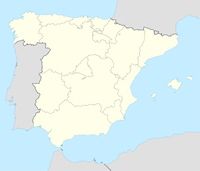
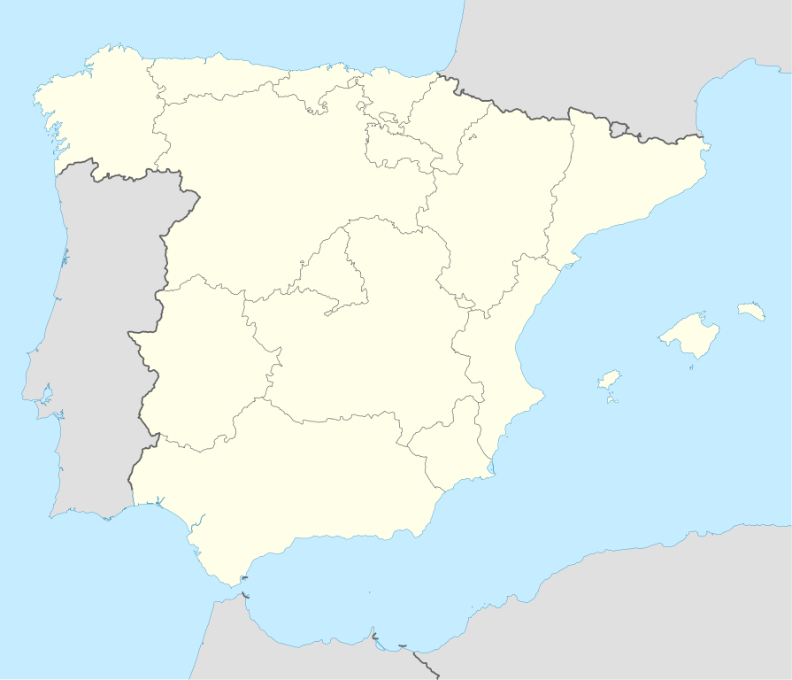
ความย่อ คำอธิบายSpain location map.svg Deutsch: Positionskarte von Spanien
Quadratische Plattkarte, N-S-Streckung 130 %. Geographische Begrenzung der Karte:
N: 44.4° N S: 34.7° N W: 9.9° W O: 4.8° O English: Location map of Spain
Equirectangular projection, N/S stretching 130 %. Geographic limits of the map:
N: 44.4° N S: 34.7° N W: 9.9° W E: 4.8° E วันที่ 4 กรกฎาคม พ.ศ. 2551 แหล่งที่มา งานของตัว ผู้สร้างสรรค์ NordNordWest เวอร์ชันอื่น ไฟล์อื่นที่ใช้ไฟล์นี้:
100 montaditos footprint in Spain and Andorra.png: Iberian Peninsula location map.svg: Spain location map with Canary Islands.png: Iberia sry2627 map.svg: Spain location map with provinces.svg: SVG genesisInfoField
ซอร์สโค้ดของ SVG นี้ตรวจสอบถูกต้องแล้ว
ไฟล์ภาพกราฟิกส์เวกเตอร์นี้ สร้างขึ้นโดยใช้ Inkscape โดย NordNordWest
แผนที่SVGนี้ถูกสร้างหรือพัฒนาขึ้นจาก Kartenwerkstatt (ห้องปฏิบัติการแผนที่) ของวิกิพีเดียภาษาเยอรมัน ซึ่งคุณสามารถเสนอแผนที่เพื่อพัฒนาได้เช่นเดียวกัน
azərbaycanca ∙ Deutsch (Sie-Form) ∙ čeština ∙ Deutsch ∙ sicilianu ∙ italiano ∙ русский ∙ română ∙ português ∙ English ∙ magyar ∙ Nederlands ∙ slovenščina ∙ polski ∙ latviešu ∙ македонски ∙ español ∙ فارسی ∙ français ∙ suomi ∙ עברית ∙ Plattdüütsch ∙ ქართული ∙ հայերեն ∙ বাংলা ∙ ไทย ∙ 日本語 ∙ 中文 ∙ 中文(简体) ∙ 中文(繁體) ∙ العربية ∙ +/−
การอนุญาตใช้สิทธิ ข้าพเจ้า ในฐานะผู้ถือลิขสิทธิ์ของภาพหรือสื่อนี้ อนุญาตให้ใช้ภาพหรือสื่อนี้ภายใต้เงื่อนไขต่อไปนี้
อนุญาตให้คัดลอก แจกจ่ายและ/หรือดัดแปรเอกสารนี้ภายใต้เงื่อนไขของสัญญาอนุญาตเอกสารเสรีของกนู รุ่น 1.2 หรือรุ่นใด ๆ นับจากนี้ที่ออกโดยมูลนิธิซอฟต์แวร์เสรี โดยไม่มีส่วนใดห้ามแก้ไข ไม่มีข้อความปกหน้าและปกหลัง สำเนาของสัญญาอนุญาตรวมอยู่ในส่วนชื่อ สัญญาอนุญาตเอกสารเสรีของกนู http://www.gnu.org/copyleft/fdl.html GFDL GNU Free Documentation License true true
ไฟล์นี้อยู่ภายใต้สัญญาอนุญาต ครีเอทีฟคอมมอนส์ แบบแสดงที่มา-อนุญาตแบบเดียวกัน 3.0 ต้นฉบับ
คุณสามารถ: ที่จะแบ่งปัน – ที่จะทำสำเนา แจกจ่าย และส่งงานดังกล่าวต่อไปที่จะเรียบเรียงใหม่ – ที่จะดัดแปลงงานดังกล่าว ภายใต้เงื่อนไขต่อไปนี้: แสดงที่มา – คุณต้องให้เกียรติเจ้าของงานอย่างเหมาะสม โดยเพิ่มลิงก์ไปยังสัญญาอนุญาต และระบุหากมีการเปลี่ยนแปลง คุณอาจทำเช่นนี้ได้ในรูปแบบใดก็ได้ตามควร แต่ต้องไม่ใช่ในลักษณะที่แนะว่าผู้ให้อนุญาตสนับสนุนคุณหรือการใช้งานของคุณอนุญาตแบบเดียวกัน – หากคุณดัดแปลง เปลี่ยนรูป หรือต่อเติมงานนี้ คุณต้องใช้สัญญาอนุญาตแบบเดียวกันหรือแบบที่เหมือนกับสัญญาอนุญาตที่ใช้กับงานนี้เท่านั้น https://creativecommons.org/licenses/by-sa/3.0 CC BY-SA 3.0 Creative Commons Attribution-Share Alike 3.0 true true คุณสามารถเลือกสัญญาอนุญาตดังกล่าวตามต้องการ
ไทย เพิ่มคำบรรยายทรรทัดเดียวเพื่อขยายความว่าไฟล์นี้มีอะไร
ประวัติไฟล์ คลิกวันที่/เวลาเพื่อดูไฟล์ที่ปรากฏในขณะนั้น
วันที่/เวลา รูปย่อ ขนาด ผู้ใช้ ความเห็น ปัจจุบัน 21:23, 7 กรกฎาคม 2551 1,184 × 1,016 (536 กิโลไบต์) NordNordWest 20:58, 4 กรกฎาคม 2551 1,184 × 1,016 (785 กิโลไบต์) NordNordWest corrected 20:54, 4 กรกฎาคม 2551 1,184 × 1,016 (791 กิโลไบต์) NordNordWest {{Information |Description= {{de|Positionskarte von Spanien}} Quadratische Plattkarte, N-S-Streckung 130 %. Geographische Begrenzung der Karte: * N: 44.4° N * S: 34.7° N * W: 9.9° W * O: 4.8° O {{en|Location map of Spain}
หน้าที่มีภาพนี้ มีหน้าที่ใช้ไฟล์นี้มากกว่า 100 หน้า รายการต่อไปนี้แสดงหน้าที่ใช้ไฟล์นี้ 100 หน้าแรกเท่านั้น มีรายการเต็ม
ดูการเชื่อมโยง มายังไฟล์นี้เพิ่มเติม
การใช้ไฟล์ส่วนกลาง วิกิอื่นต่อไปนี้ใช้ไฟล์นี้:
Alt Empordà Almazán Ágreda San Leonardo de Yagüe Abejar Adradas Alconaba Alcubilla de las Peñas Aldealafuente Alcubilla de Avellaneda Aldealices Almajano Yelo Aldealpozo Aldealseñor Alentisque Aliud Almaluez Almarza Cubilla Covaleda Ciria Cigudosa Dévanos Cihuela Coscurita Barca Nepas Nolay Noviercas Liceras La Losilla Portillo de Soria Oncala Ólvega Rioseco de Soria La Riba de Escalote Renieblas Quintana Redonda Los Rábanos Recuerda Rebollar Almazul Baraona Blacos Calatañazor Candilichera ดูการใช้ทั่วโลกเพิ่มเติม ของไฟล์นี้
ภาพนี้มีข้อมูลเพิ่มเติม ซึ่งส่วนใหญ่มาจากกล้องดิจิตอลหรือสแกนเนอร์ที่สามารถเก็บข้อมูลดังกล่าวไว้รวมกับภาพได้ ถ้าภาพนี้ถูกปรับปรุงแก้ไขหรือเปลี่ยนแปลงจากเดิม ข้อมูลบางอย่างจะยังคงไม่เปลี่ยนแปลงเหมือนภาพที่ถูกปรับปรุงแก้ไขนั้น
ไฟล, spain, location, ไฟล, ประว, ไฟล, หน, าท, ภาพน, การใช, ไฟล, วนกลาง, อม, ลเก, ยวก, บภาพขนาดของต, วอย, าง, ของไฟล, กเซล, ความละเอ, ยดอ, กเซล, กเซล, กเซล, กเซล, กเซล, กเซล, ภาพท, ความละเอ, ยดส, งกว, 8206, ไฟล, กเซล, ขนาดไฟล, โลไบต, ปภาพหร, อไฟล, เส, ยงน, นฉบ,. ifl prawtiifl hnathimiphaphni karichiflswnklang khxmulekiywkbphaphkhnadkhxngtwxyang PNG nikhxngifl SVG ni 699 600 phikesl khwamlaexiydxun 280 240 phikesl 559 480 phikesl 895 768 phikesl 1 193 1 024 phikesl 2 387 2 048 phikesl 1 184 1 016 phikesl duphaphthimikhwamlaexiydsungkwa 8206 ifl SVG 1 184 1 016 phikesl khnadifl 536 kiolibt rupphaphhruxiflesiyngni tnchbbxyuthi khxmmxns raylaexiyddanlang epnkhxkhwamthiaesdngphlcak ifltnchbbinkhxmmxns khxmmxnsepnewbistinokhrngkarsahrbekbrwbrwmsuxesri thi khunsamarthchwyid khwamyx khaxthibaySpain location map svg Deutsch Positionskarte von Spanien Quadratische Plattkarte N S Streckung 130 Geographische Begrenzung der Karte N 44 4 N S 34 7 N W 9 9 W O 4 8 O English Location map of Spain Equirectangular projection N S stretching 130 Geographic limits of the map N 44 4 N S 34 7 N W 9 9 W E 4 8 Ewnthi 4 krkdakhm ph s 2551aehlngthima ngankhxngtwphusrangsrrkh NordNordWestewxrchnxun iflxunthiichiflni 100 montaditos footprint in Spain and Andorra png Iberian Peninsula location map svg Spain location map with Canary Islands png Iberia sry2627 map svg Spain location map with provinces svg SVG genesisInfoField sxrsokhdkhxng SVG nitrwcsxbthuktxngaelw iflphaphkrafiksewketxrni srangkhunodyich Inkscape ody NordNordWest aephnthiSVGnithuksranghruxphthnakhuncak Kartenwerkstatt hxngptibtikaraephnthi khxngwikiphiediyphasaeyxrmn sungkhunsamarthesnxaephnthiephuxphthnaidechnediywkn azerbaycanca Deutsch Sie Form cestina Deutsch sicilianu italiano russkij romană portugues English magyar Nederlands slovenscina polski latviesu makedonski espanol فارسی francais suomi עברית Plattduutsch ქართული հայերեն ব ল ithy 日本語 中文 中文 简体 中文 繁體 العربية karxnuyatichsiththi khapheca inthanaphuthuxlikhsiththikhxngphaphhruxsuxni xnuyatihichphaphhruxsuxniphayitenguxnikhtxipni xnuyatihkhdlxk aeckcayaela hruxddaeprexksarniphayitenguxnikhkhxngsyyaxnuyatexksaresrikhxngknu run 1 2 hruxrunid nbcaknithixxkodymulnithisxftaewresri odyimmiswnidhamaekikh immikhxkhwampkhnaaelapkhlng saenakhxngsyyaxnuyatrwmxyuinswnchux syyaxnuyatexksaresrikhxngknuhttp www gnu org copyleft fdl html GFDL GNU Free Documentation License true trueiflnixyuphayitsyyaxnuyat khriexthifkhxmmxns aebbaesdngthima xnuyataebbediywkn 3 0 tnchbbkhunsamarth thicaaebngpn thicathasaena aeckcay aelasngngandngklawtxip thicaeriyberiyngihm thicaddaeplngngandngklaw phayitenguxnikhtxipni aesdngthima khuntxngihekiyrtiecakhxngnganxyangehmaasm odyephimlingkipyngsyyaxnuyat aelarabuhakmikarepliynaeplng khunxacthaechnniidinrupaebbidkidtamkhwr aettxngimichinlksnathiaenawaphuihxnuyatsnbsnunkhunhruxkarichngankhxngkhun xnuyataebbediywkn hakkhunddaeplng epliynrup hruxtxetimnganni khuntxngichsyyaxnuyataebbediywknhruxaebbthiehmuxnkbsyyaxnuyatthiichkbnganniethannhttps creativecommons org licenses by sa 3 0 CC BY SA 3 0 Creative Commons Attribution Share Alike 3 0 true truekhunsamartheluxksyyaxnuyatdngklawtamtxngkarkhabrryayodyyxithyephimkhabrryaythrrthdediywephuxkhyaykhwamwaiflnimixairixethmthiaesdngxyuiniflniprakxbdwyotelodphusrangbangkhathiimmiixethmwikisnethschuxphuichwikimiediy NordNordWestchuxphusrangsrrkh NordNordWestyuxaraexl https commons wikimedia org wiki user NordNordWeststhanalikhsiththimilikhsiththisyyaxnuyatCreative Commons Attribution ShareAlike 3 0 Unported xngkvsGNU Free Documentation License version 1 2 or later xngkvswnthisrang wnkxtng4 krkdakhm 2008MIME type xngkvsimage svg xmlthimakhxngiflkarsrangdngedimodyphuxpohld prawtiifl khlikwnthi ewlaephuxduiflthipraktinkhnann wnthi ewlarupyxkhnadphuichkhwamehn pccubn21 23 7 krkdakhm 25511 184 1 016 536 kiolibt NordNordWest 20 58 4 krkdakhm 25511 184 1 016 785 kiolibt NordNordWestcorrected 20 54 4 krkdakhm 25511 184 1 016 791 kiolibt NordNordWest Information Description de Positionskarte von Spanien Quadratische Plattkarte N S Streckung 130 Geographische Begrenzung der Karte N 44 4 N S 34 7 N W 9 9 W O 4 8 O en Location map of Spain hnathimiphaphni mihnathiichiflnimakkwa 100 hna raykartxipniaesdnghnathiichiflni 100 hnaaerkethann miraykaretmkranada kranuleys kxrodba praethssepn kndixa kmbrils klp emuxng ksetyxnedlaplana ksetlydaaefls kadis karthingraebidthiekrnika kardaaedw kalatayud kuexngka praethssepn khaexn chatiwa sntnedr sntakuolmadakramaaent snlukaredbarraemda sakunot sabaedly salxw salamngka saxakun siwtaedlyadamanxrka chiorna txredsiys txrerbiexkha tarrasa tarraokna talaebraedlaeryna badaokhs badaolna baresolna bik biyarerxl biyaokhoysa biladakns biok buyyxl priemraefedrasixxn pxnefrrada pmoplna plma macxrka paelnesiy paaetrna fiekrs futbxlolk 1982 mxnsxn mneyw mnaersa msyid xasnwiharkxrodba madrid mataor manakx martuerly marebya maox muresiy yummaoch raychuxaehlngmrdkolkinpraethssepn lalika lalika vdukal 2010 11 lalika vdukal 2011 12 lalika vdukal 2012 13 lalika vdukal 2013 14 lalika vdukal 2014 15 lalika vdukal 2017 18 lalika vdukal 2018 19 lalika vdukal 2019 20 lalika vdukal 2020 21 lalika vdukal 2021 22 lalika vdukal 2022 23 lawlyduyoch laaeswdurechly xlkalaedkwdaxira xlkuediy xlkxy praethssepn xlsira xletxa xabila xaliknet xibisa emuxng xuruexyya xulxt ekrwileynt eskundadibisixxn vdukal 2016 17 ednixa ebnikasim ebnidxrm epnisokla exlda exlech aeyyda otrotsa oxkyya praethssepn oxntiyeynt oxwaernes aemaebb Location map Spain chbbrang futbxlchingaechmpsomsrolk 2001 mxdul Location map data Spain dukarechuxmoyngmayngiflniephimetim karichiflswnklang wikixuntxipniichiflni karichbn ace wikipedia org Seunaleuek Location map Spain Sevilla karichbn af wikipedia org Cadaques Alt Emporda Almazan Agreda San Leonardo de Yague Abejar Adradas Alconaba Alcubilla de las Penas Aldealafuente Alcubilla de Avellaneda Aldealices Almajano Yelo Aldealpozo Aldealsenor Alentisque Aliud Almaluez Almarza Cubilla Covaleda Ciria Cigudosa Devanos Cihuela Coscurita Barca Nepas Nolay Noviercas Liceras La Losilla Portillo de Soria Oncala olvega Rioseco de Soria La Riba de Escalote Renieblas Quintana Redonda Los Rabanos Recuerda Rebollar Almazul Baraona Blacos Calatanazor Candilichera dukarichthwolkephimetimkhxngiflnikhxmulekiywkbphaph phaphnimikhxmulephimetim sungswnihymacakklxngdicitxlhruxsaeknenxrthisamarthekbkhxmuldngklawiwrwmkbphaphid thaphaphnithukprbprungaekikhhruxepliynaeplngcakedim khxmulbangxyangcayngkhngimepliynaeplngehmuxnphaphthithukprbprungaekikhnnkhwamkwang1183 5554khwamsung1015 8372 ekhathungcak https th wikipedia org wiki ifl Spain location map svg, wikipedia, วิกิ หนังสือ, หนังสือ, ห้องสมุด,
บทความ , อ่าน, ดาวน์โหลด, ฟรี, ดาวน์โหลดฟรี, mp3, วิดีโอ, mp4, 3gp, jpg, jpeg, gif, png, รูปภาพ, เพลง, เพลง, หนัง, หนังสือ, เกม, เกม