This file is a map of a municipality in Japan created and uploaded by Lincun on Japanese Wikipedia. It may also be a file based on one of these maps (see info in file history or author field for more info on later editors). Source:
English: Data used : Ministry of Land, Infrastructure, Transport and Tourism - National Land Numerical Information (Administrative Area (N03) / Lake (W09))
日本語: 使用データ : 国土交通省 国土数値情報(行政区域(N03)・湖沼(W09))
The original file was licensed {{GFDL}} and {{Cc-by-sa-3.0}}. See this category for more files like this. ป้ายนี้มิใช่ป้ายแสดงสถานะลิขสิทธิ์ ดังนั้นการระบุสถานะลิขสิทธิ์จึงต้องกระทำแยกต่างหาก ดูที่ Commons:Lincensing
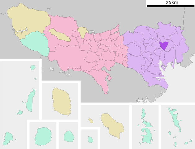
{{Information| |Description= Location of Taitō-ku in Tokyo Prefecture |Source= Japanese wiki [http://ja.wikipedia.org/wiki/%E3%83%95%E3%82%A1%E3%82%A4%E3%83%AB:%E5%9F%BA%E7%A4%8E%E8%87%AA%E6%B2%BB%E4%BD%93%E4%BD%8D%E7%BD%AE%E5%9B%B3_13106.svg] |Date=~
ไฟล, taitō, tokyo, prefecture, ไฟล, ประว, ไฟล, หน, าท, ภาพน, การใช, ไฟล, วนกลาง, อม, ลเก, ยวก, บภาพขนาดของต, วอย, าง, ของไฟล, กเซล, ความละเอ, ยดอ, กเซล, กเซล, กเซล, กเซล, กเซล, ภาพท, ความละเอ, ยดส, งกว, 8206, ไฟล, กเซล, ขนาดไฟล, โลไบต, ปภาพหร, อไฟล, เส, ยงน, น. ifl prawtiifl hnathimiphaphni karichiflswnklang khxmulekiywkbphaphkhnadkhxngtwxyang PNG nikhxngifl SVG ni 786 599 phikesl khwamlaexiydxun 315 240 phikesl 630 480 phikesl 1 007 768 phikesl 1 280 976 phikesl 2 560 1 952 phikesl duphaphthimikhwamlaexiydsungkwa 8206 ifl SVG 800 610 phikesl khnadifl 39 kiolibt rupphaphhruxiflesiyngni tnchbbxyuthi khxmmxns raylaexiyddanlang epnkhxkhwamthiaesdngphlcak ifltnchbbinkhxmmxns khxmmxnsepnewbistinokhrngkarsahrbekbrwbrwmsuxesri thi khunsamarthchwyid khwamyx khaxthibayTaitō ku in Tokyo Prefecture Ja svg English Location of Taitō ku in Tokyo Prefecture 日本語 ja 東京都台東区位置図wnthi 8 knyayn ph s 2550aehlngthima Original file ngankhxngtw Data 国土交通省 国土数値情報 行政区域 N03 湖沼 W09 phusrangsrrkh Lincunkarxnuyat karichiflniihm This file is a map of a municipality in Japan created and uploaded by Lincun on Japanese Wikipedia It may also be a file based on one of these maps see info in file history or author field for more info on later editors Source English Data used Ministry of Land Infrastructure Transport and Tourism National Land Numerical Information Administrative Area N03 Lake W09 日本語 使用データ 国土交通省 国土数値情報 行政区域 N03 湖沼 W09 The original file was licensed GFDL and Cc by sa 3 0 See this category for more files like this paynimiichpayaesdngsthanalikhsiththi dngnnkarrabusthanalikhsiththicungtxngkrathaaeyktanghak duthi Commons Lincensing karxnuyatichsiththi xnuyatihkhdlxk aeckcayaela hruxddaeprexksarniphayitenguxnikhkhxngsyyaxnuyatexksaresrikhxngknu run 1 2 hruxrunid nbcaknithixxkodymulnithisxftaewresri odyimmiswnidhamaekikh immikhxkhwampkhnaaelapkhlng saenakhxngsyyaxnuyatrwmxyuinswnchux syyaxnuyatexksaresrikhxngknuhttp www gnu org copyleft fdl html GFDL GNU Free Documentation License true trueiflnixyuphayitsyyaxnuyat khriexthifkhxmmxns aebbaesdngthima xnuyataebbediywkn 3 0 tnchbbkhunsamarth thicaaebngpn thicathasaena aeckcay aelasngngandngklawtxip thicaeriyberiyngihm thicaddaeplngngandngklaw phayitenguxnikhtxipni aesdngthima khuntxngihekiyrtiecakhxngnganxyangehmaasm odyephimlingkipyngsyyaxnuyat aelarabuhakmikarepliynaeplng khunxacthaechnniidinrupaebbidkidtamkhwr aettxngimichinlksnathiaenawaphuihxnuyatsnbsnunkhunhruxkarichngankhxngkhun xnuyataebbediywkn hakkhunddaeplng epliynrup hruxtxetimnganni khuntxngichsyyaxnuyataebbediywknhruxaebbthiehmuxnkbsyyaxnuyatthiichkbnganniethannhttps creativecommons org licenses by sa 3 0 CC BY SA 3 0 Creative Commons Attribution Share Alike 3 0 true true bnthukkarxphohld This file was moved from Japanese Wikipedia See below for original file information File name 基礎自治体位置図 13106 svgDescription 基礎自治体位置図画像情報 東京都 台東区 File history wnthi ewla UTC khnad phuich khwamehn8 knyayn ph s 2550 23 28 40 800x622 Lincun 基礎自治体位置図画像情報 東京都 台東区 12 knyayn ph s 2550 13 54 50 800x682 Lincun 基礎自治体位置図画像情報 東京都 台東区 Page history wnthi ewla UTC Flag phuich khwamyx 8 knyayn ph s 2550 23 28 40 Lincun 基礎自治体位置図画像情報 東京都 台東区 12 knyayn ph s 2550 13 54 50 Lincun 画像 基礎自治体位置図 13106 svg の新しい版をアップロードしました 基礎自治体位置図画像情報 東京都 台東区 Deutsch English makedonski 한국어 日本語 فارسی khabrryayodyyxithyephimkhabrryaythrrthdediywephuxkhyaykhwamwaiflnimixairixethmthiaesdngxyuiniflniprakxbdwysthanalikhsiththimilikhsiththisyyaxnuyatCreative Commons Attribution ShareAlike 3 0 Unported xngkvsGNU Free Documentation License version 1 2 or later xngkvs prawtiifl khlikwnthi ewlaephuxduiflthipraktinkhnann wnthi ewlarupyxkhnadphuichkhwamehn pccubn13 21 7 phvscikayn 2563800 610 39 kiolibt AichiWikiFixerUpdate 03 04 17 mithunayn 2552800 682 23 kiolibt Krisgrotius Information Description Location of Taitō ku in Tokyo Prefecture Source Japanese wiki http ja wikipedia org wiki E3 83 95 E3 82 A1 E3 82 A4 E3 83 AB E5 9F BA E7 A4 8E E8 87 AA E6 B2 BB E4 BD 93 E4 BD 8D E7 BD AE E5 9B B3 13106 svg Date 20 54 12 knyayn 2550800 682 23 kiolibt Lincun 基礎自治体位置図画像情報 東京都 台東区 06 28 9 knyayn 2550800 622 23 kiolibt Lincun 基礎自治体位置図画像情報 東京都 台東区 hnathimiphaphni hnatxipni oyngmathiphaphni ekhtithot karichiflswnklang wikixuntxipniichiflni karichbn ar wikipedia org تايتو طوكيو karichbn arz wikipedia org تايتو طوكيو karichbn az wikipedia org Tayto Akihabara Ueno zooparki Sablon Tayto karichbn ca wikipedia org Taitō karichbn ceb wikipedia org Taitō ku karichbn ce wikipedia org Tajto mahsus rajon karichbn da wikipedia org Taitou karichbn de wikipedia org Taitō karichbn en wikipedia org Akihabara Taitō Asakusa Ueno Station Okachimachi Station Ueno Park Sensō ji Ueno Ueno Zoo Tokyo University of the Arts Tokyo National Museum National Museum of Nature and Science Asakusabashi Asakusa Station Asakusa Station Tsukuba Express National Museum of Western Art Keisei Ueno Station Kan ei ji Sogakudo Concert Hall Asakusabashi Station Kuramae Station Shinobazu Pond Shitamachi Museum Tokyo Metropolitan Art Museum Shin okachimachi Station Tokyo Bunka Kaikan Ueno hirokoji Station Naka okachimachi Station Ueno okachimachi Station Yanaka Tokyo Ueno Tōshō gu Shitaya Template Taitō karichbn eo wikipedia org Kvartalo Taito karichbn eu wikipedia org Taitō Tokio karichbn fa wikipedia org تایتو کو توکیو karichbn fi wikipedia org Taitō karichbn gan wikipedia org 台東區 karichbn gl wikipedia org Taitō dukarichthwolkephimetimkhxngiflnikhxmulekiywkbphaph phaphnimikhxmulephimetim sungswnihymacakklxngdicitxlhruxsaeknenxrthisamarthekbkhxmuldngklawiwrwmkbphaphid thaphaphnithukprbprungaekikhhruxepliynaeplngcakedim khxmulbangxyangcayngkhngimepliynaeplngehmuxnphaphthithukprbprungaekikhnnchuxeruxngsn東京都行政区画地図khwamkwang800pxkhwamsung610px ekhathungcak https th wikipedia org wiki ifl Taitō ku in Tokyo Prefecture Ja svg, wikipedia, วิกิ หนังสือ, หนังสือ, ห้องสมุด,