更新:2010年3月23日 2007-09-23 07:58 (UTC) / Update: 1 January 2013 (UTC)
แหล่งที่มา
Original file: งานของตัว
Data: 国土交通省 国土数値情報(行政区域(N03)・湖沼(W09))
ผู้สร้างสรรค์
Lincun / Update: ja:User:Knua
การอนุญาต (การใช้ไฟล์นี้ใหม่)
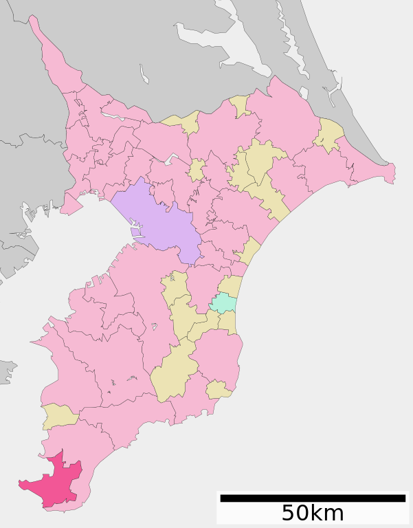
This file is a map of a municipality in Japan created and uploaded by Lincun on Japanese Wikipedia. It may also be a file based on one of these maps (see info in file history or author field for more info on later editors). Source:
English: Data used : Ministry of Land, Infrastructure, Transport and Tourism - National Land Numerical Information (Administrative Area (N03) / Lake (W09))
日本語: 使用データ : 国土交通省 国土数値情報(行政区域(N03)・湖沼(W09))
The original file was licensed {{GFDL}} and {{Cc-by-sa-3.0}}. See this category for more files like this. ป้ายนี้มิใช่ป้ายแสดงสถานะลิขสิทธิ์ ดังนั้นการระบุสถานะลิขสิทธิ์จึงต้องกระทำแยกต่างหาก ดูที่ Commons:Lincensing
ไฟล, tateyama, chiba, prefecture, ไฟล, ประว, ไฟล, หน, าท, ภาพน, การใช, ไฟล, วนกลาง, อม, ลเก, ยวก, บภาพขนาดของต, วอย, าง, ของไฟล, กเซล, ความละเอ, ยดอ, กเซล, กเซล, กเซล, กเซล, กเซล, ภาพท, ความละเอ, ยดส, งกว, 8206, ไฟล, กเซล, ขนาดไฟล, โลไบต, ปภาพหร, อไฟล, เส, ยงน. ifl prawtiifl hnathimiphaphni karichiflswnklang khxmulekiywkbphaphkhnadkhxngtwxyang PNG nikhxngifl SVG ni 446 570 phikesl khwamlaexiydxun 188 240 phikesl 375 480 phikesl 601 768 phikesl 801 1 024 phikesl 1 602 2 048 phikesl duphaphthimikhwamlaexiydsungkwa 8206 ifl SVG 446 570 phikesl khnadifl 32 kiolibt rupphaphhruxiflesiyngni tnchbbxyuthi khxmmxns raylaexiyddanlang epnkhxkhwamthiaesdngphlcak ifltnchbbinkhxmmxns khxmmxnsepnewbistinokhrngkarsahrbekbrwbrwmsuxesri thi khunsamarthchwyid khwamyx khaxthibayTateyama in Chiba Prefecture Ja svg English Location of Tateyama in Chiba Prefecture 日本語 ja 千葉県館山市位置図 wnthi 更新 2010年3月23日 2007 09 23 07 58 UTC Update 1 January 2013 UTC aehlngthima Original file ngankhxngtw Data 国土交通省 国土数値情報 行政区域 N03 湖沼 W09 phusrangsrrkh Lincun Update ja User Knua karxnuyat karichiflniihm This file is a map of a municipality in Japan created and uploaded by Lincun on Japanese Wikipedia It may also be a file based on one of these maps see info in file history or author field for more info on later editors Source English Data used nbsp Ministry of Land Infrastructure Transport and Tourism National Land Numerical Information Administrative Area N03 Lake W09 日本語 使用データ nbsp 国土交通省 国土数値情報 行政区域 N03 湖沼 W09 The original file was licensed GFDL and Cc by sa 3 0 See this category for more files like this paynimiichpayaesdngsthanalikhsiththi dngnnkarrabusthanalikhsiththicungtxngkrathaaeyktanghak duthi Commons Lincensing karxnuyatichsiththi xnuyatihkhdlxk aeckcayaela hruxddaeprexksarniphayitenguxnikhkhxngsyyaxnuyatexksaresrikhxngknu run 1 2 hruxrunid nbcaknithixxkodymulnithisxftaewresri odyimmiswnidhamaekikh immikhxkhwampkhnaaelapkhlng saenakhxngsyyaxnuyatrwmxyuinswnchux syyaxnuyatexksaresrikhxngknuhttp www gnu org copyleft fdl html GFDL GNU Free Documentation License true true iflnixyuphayitsyyaxnuyat khriexthifkhxmmxns aebbaesdngthima xnuyataebbediywkn 3 0 tnchbbkhunsamarth thicaaebngpn thicathasaena aeckcay aelasngngandngklawtxip thicaeriyberiyngihm thicaddaeplngngandngklaw phayitenguxnikhtxipni aesdngthima khuntxngihekiyrtiecakhxngnganxyangehmaasm odyephimlingkipyngsyyaxnuyat aelarabuhakmikarepliynaeplng khunxacthaechnniidinrupaebbidkidtamkhwr aettxngimichinlksnathiaenawaphuihxnuyatsnbsnunkhunhruxkarichngankhxngkhun xnuyataebbediywkn hakkhunddaeplng epliynrup hruxtxetimnganni khuntxngichsyyaxnuyataebbediywknhruxaebbthiehmuxnkbsyyaxnuyatthiichkbnganniethannhttps creativecommons org licenses by sa 3 0 CC BY SA 3 0 Creative Commons Attribution Share Alike 3 0 true truekhabrryayodyyxithyephimkhabrryaythrrthdediywephuxkhyaykhwamwaiflnimixairixethmthiaesdngxyuiniflniprakxbdwysthanalikhsiththimilikhsiththisyyaxnuyatCreative Commons Attribution ShareAlike 3 0 Unported nbsp xngkvsGNU Free Documentation License version 1 2 or later nbsp xngkvsMIME type nbsp xngkvsimage svg xml prawtiifl khlikwnthi ewlaephuxduiflthipraktinkhnann wnthi ewlarupyxkhnadphuichkhwamehn pccubn00 26 24 singhakhm 2564446 570 32 kiolibt Ketchup901Add links 23 00 5 mkrakhm 2556446 570 13 kiolibt Knuaupdate 20 27 24 minakhm 2553446 570 13 kiolibt Lincun 基礎自治体位置図画像情報 千葉県 館山市 20100323 14 50 21 phvscikayn 2552620 872 22 kiolibt Monaneko Information Description en 1 Location of Tateyama in Chiba Prefecture ja 1 千葉県館山市の位置 Source ja File 基礎自治体位置図 12205 svg Author ja User Lincun Date 2007 09 23 07 58 UTC Permission other versions 14 58 23 knyayn 2550620 872 22 kiolibt Lincun 基礎自治体位置図画像情報 千葉県 館山市 hnathimiphaphni hnatxipni oyngmathiphaphni thaetyama karichiflswnklang wikixuntxipniichiflni karichbn ar wikipedia org تاته ياما تشيبا karichbn azb wikipedia org تاتیاما چیبا karichbn ce wikipedia org Tateyama gӀala karichbn de wikipedia org Tateyama Chiba karichbn en wikipedia org Tateyama Chiba karichbn eu wikipedia org Tateyama Chiba karichbn fa wikipedia org تاته یاما چیبا karichbn fi wikipedia org Tateyama karichbn gl wikipedia org Tateyama Chiba karichbn hu wikipedia org Tatejama Csiba karichbn id wikipedia org Tateyama Chiba karichbn ja wikipedia org 館山市 karichbn ko wikipedia org 다테야마시 karichbn ms wikipedia org Tateyama Chiba karichbn mzn wikipedia org تاتیاما چیبا karichbn pl wikipedia org Prefektura Chiba karichbn ro wikipedia org Tateyama Chiba karichbn sv wikipedia org Tateyama karichbn sw wikipedia org Tateyama Chiba karichbn tg wikipedia org Tateyama karichbn tt wikipedia org Tateyama shәһәr karichbn ur wikipedia org تاتییاما چیبا karichbn www wikidata org Q646755 karichbn zh classical wikipedia org 館山市 karichbn zh min nan wikipedia org Tateyama chhi karichbn zh wikipedia org 館山市khxmulekiywkbphaph phaphnimikhxmulephimetim sungswnihymacakklxngdicitxlhruxsaeknenxrthisamarthekbkhxmuldngklawiwrwmkbphaphid thaphaphnithukprbprungaekikhhruxepliynaeplngcakedim khxmulbangxyangcayngkhngimepliynaeplngehmuxnphaphthithukprbprungaekikhnnchuxeruxngsn千葉県いすみ市位置図 2013年1月1日 chuxphaphAuthor Lincun 更新 Knuakhwamkwang446khwamsung570 ekhathungcak https th wikipedia org wiki ifl Tateyama in Chiba Prefecture Ja svg, wikipedia, วิกิ หนังสือ, หนังสือ, ห้องสมุด,