azərbaycanca ∙ Deutsch (Sie-Form) ∙ čeština ∙ Deutsch ∙ sicilianu ∙ italiano ∙ русский ∙ română ∙ português ∙ English ∙ magyar ∙ Nederlands ∙ slovenščina ∙ polski ∙ latviešu ∙ македонски ∙ español ∙ فارسی ∙ français ∙ suomi ∙ עברית ∙ Plattdüütsch ∙ ქართული ∙ հայերեն ∙ বাংলা ∙ ไทย ∙ 日本語 ∙ 中文 ∙ 中文(简体) ∙ 中文(繁體) ∙ العربية ∙ +/−
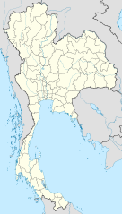
{{Information |Description= {{de|Positionskarte von Thailand}} Quadratische Plattkarte, N-S-Streckung 103 %. Geographische Begrenzung der Karte: * N: 20.6° N * S: 5.4° N * W: 97.1° O * O: 106.0° O {{en|Location map of [[:en:Thailand|T
ไฟล, thailand, location, ไฟล, ประว, ไฟล, หน, าท, ภาพน, การใช, ไฟล, วนกลาง, อม, ลเก, ยวก, บภาพขนาดของต, วอย, าง, ของไฟล, กเซล, ความละเอ, ยดอ, กเซล, กเซล, กเซล, กเซล, กเซล, กเซล, ภาพท, ความละเอ, ยดส, งกว, 8206, ไฟล, กเซล, ขนาดไฟล, โลไบต, ปภาพหร, อไฟล, เส, ยงน, น. ifl prawtiifl hnathimiphaphni karichiflswnklang khxmulekiywkbphaphkhnadkhxngtwxyang PNG nikhxngifl SVG ni 341 600 phikesl khwamlaexiydxun 136 240 phikesl 273 480 phikesl 436 768 phikesl 582 1 024 phikesl 1 164 2 048 phikesl 1 051 1 849 phikesl duphaphthimikhwamlaexiydsungkwa 8206 ifl SVG 1 051 1 849 phikesl khnadifl 662 kiolibt rupphaphhruxiflesiyngni tnchbbxyuthi khxmmxns raylaexiyddanlang epnkhxkhwamthiaesdngphlcak ifltnchbbinkhxmmxns khxmmxnsepnewbistinokhrngkarsahrbekbrwbrwmsuxesri thi khunsamarthchwyid khwamyx khaxthibayThailand location map svg Deutsch Positionskarte von Thailand Quadratische Plattkarte N S Streckung 103 nbsp Geographische Begrenzung der Karte N 20 6 N S 5 4 N W 97 1 O O 106 0 O English Location map of Thailand Equirectangular projection N S stretching 103 nbsp Geographic limits of the map N 20 6 N S 5 4 N W 97 1 E E 106 0 E wnthi 28 minakhm ph s 2552 aehlngthima ngankhxngtw using United States National Imagery and Mapping Agency data World Data Base II data phusrangsrrkh NordNordWest aephnthinithuksranghruxphthnakhuncak Kartenwerkstatt hxngptibtikaraephnthi khxngwikiphiediyphasaeyxrmn sungkhunsamarthesnxaephnthiephuxphthnaidechnediywkn azerbaycanca nbsp Deutsch Sie Form nbsp cestina nbsp Deutsch nbsp sicilianu nbsp italiano nbsp russkij nbsp romană nbsp portugues nbsp English nbsp magyar nbsp Nederlands nbsp slovenscina nbsp polski nbsp latviesu nbsp makedonski nbsp espanol nbsp فارسی nbsp francais nbsp suomi nbsp עברית nbsp Plattduutsch nbsp ქართული nbsp հայերեն nbsp ব ল nbsp ithy nbsp 日本語 nbsp 中文 nbsp 中文 简体 nbsp 中文 繁體 nbsp العربية nbsp karxnuyatichsiththi khapheca inthanaphuthuxlikhsiththikhxngphaphhruxsuxni xnuyatihichphaphhruxsuxniphayitenguxnikhtxipni xnuyatihkhdlxk aeckcayaela hruxddaeprexksarniphayitenguxnikhkhxngsyyaxnuyatexksaresrikhxngknu run 1 2 hruxrunid nbcaknithixxkodymulnithisxftaewresri odyimmiswnidhamaekikh immikhxkhwampkhnaaelapkhlng saenakhxngsyyaxnuyatrwmxyuinswnchux syyaxnuyatexksaresrikhxngknuhttp www gnu org copyleft fdl html GFDL GNU Free Documentation License true trueiflnixyuphayitsyyaxnuyatkhriexthifkhxmmxns run aesdngthima 3 0 tnchbbkhunsamarth thicaaebngpn thicathasaena aeckcay aelasngngandngklawtxip thicaeriyberiyngihm thicaddaeplngngandngklaw phayitenguxnikhtxipni aesdngthima khuntxngihekiyrtiecakhxngnganxyangehmaasm odyephimlingkipyngsyyaxnuyat aelarabuhakmikarepliynaeplng khunxacthaechnniidinrupaebbidkidtamkhwr aettxngimichinlksnathiaenawaphuihxnuyatsnbsnunkhunhruxkarichngankhxngkhunhttps creativecommons org licenses by 3 0 CC BY 3 0 Creative Commons Attribution 3 0 true truekhunsamartheluxksyyaxnuyatdngklawtamtxngkarkhabrryayodyyxithyephimkhabrryaythrrthdediywephuxkhyaykhwamwaiflnimixairixethmthiaesdngxyuiniflniprakxbdwyphusrangbangkhathiimmiixethmwikisnethschuxphusrangsrrkh NordNordWestyuxaraexl https commons wikimedia org wiki user NordNordWestchuxphuichwikimiediy NordNordWeststhanalikhsiththimilikhsiththisyyaxnuyatCreative Commons Attribution 3 0 Unported nbsp xngkvsGNU Free Documentation License version 1 2 or later nbsp xngkvswnthisrang wnkxtng28 minakhm 2009thimakhxngiflkarsrangdngedimodyphuxpohld prawtiifl khlikwnthi ewlaephuxduiflthipraktinkhnann wnthi ewlarupyxkhnadphuichkhwamehn pccubn20 05 22 minakhm 25541 051 1 849 662 kiolibt NordNordWestupdate new province 01 00 15 emsayn 25521 052 1 849 1 04 emkaibt NordNordWestcorr 02 57 30 minakhm 25521 053 1 852 924 kiolibt NordNordWestcorr 01 03 30 minakhm 25521 053 1 852 924 kiolibt NordNordWestcorr 02 08 29 minakhm 25521 053 1 852 925 kiolibt NordNordWest Information Description de Positionskarte von Thailand Quadratische Plattkarte N S Streckung 103 Geographische Begrenzung der Karte N 20 6 N S 5 4 N W 97 1 O O 106 0 O en Location map of en Thailand T hnathimiphaphni hnatxipni oyngmathiphaphni kareluxktnginpraethsithy ph s 2555 kareluxktnginpraethsithy ph s 2556 wikvttwpraknsthanthutxisraexlpracapraethsithy ph s 2515 wikiphiediy mummxngsakl karichiflswnklang wikixuntxipniichiflni karichbn af wikipedia org Ban Chiang Sjabloon Liggingkaart Thailand karichbn als wikipedia org Bangkok Vorlage Positionskarte Thailand karichbn an wikipedia org Bangkok Plantilla Mapa de localizacion Tailandia karichbn ar wikipedia org كأس آسيا 1972 قالب خريطة مواقع تايلاند مطار يو تاباو الدولي مطار فطاني كأس آسيا تحت 17 سنة 2023 karichbn ast wikipedia org Rescate de la cueva Tham Luang Plantia Mapa de llocalizacion de Tailandia karichbn az wikipedia org Banqkok Pxuket Sablon Yer xeritesi Tailand Vat Samfran Ayuttxaya karichbn bar wikipedia org Vorlog Positionskarte Thailand karichbn ba wikipedia org Ҡalyp PozKarta Tailand karichbn be tarask wikipedia org Bangkok Shablyon Lyakalizacyjnaya mapa Tajlyandu karichbn be wikipedia org Bangkok Shablon Na karce Tajland Trat Chonbury Pataya Buryram Nakhonratchasima Yala Tajland Patani Ubonratchathani Kalasin Nangkhaj Udonthani Khanken Lej gorad Nan Chyyangraj Chyyangmaj Lampang Nakhonsithamarat Tak gorad Phitsanulok Nakhonsavan Ratbury Phetbury Chumphon Surathani Hacyaj dukarichthwolkephimetimkhxngiflnikhxmulekiywkbphaph phaphnimikhxmulephimetim sungswnihymacakklxngdicitxlhruxsaeknenxrthisamarthekbkhxmuldngklawiwrwmkbphaphid thaphaphnithukprbprungaekikhhruxepliynaeplngcakedim khxmulbangxyangcayngkhngimepliynaeplngehmuxnphaphthithukprbprungaekikhnnkhwamkwang1051 164pxkhwamsung1849 133px ekhathungcak https th wikipedia org wiki ifl Thailand location map svg, wikipedia, วิกิ หนังสือ, หนังสือ, ห้องสมุด,