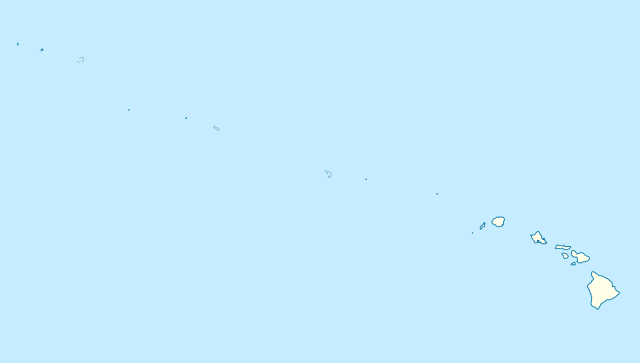
Deutsch: Positionskarte der gesamten Inselkette Hawaii, USA
Quadratische Plattkarte, N-S-Streckung 109 %. Geographische Begrenzung der Karte:
N: 30° N
S: 17° N
W: 179° W
O: 154° W
English: Location map of the complete Hawaiian island chain, USA
Equirectangular projection, N/S stretching 109 %. Geographic limits of the map:
N: 30° N
S: 17° N
W: 179° W
E: 154° W
วันที่
แหล่งที่มา
งานของตัว, using
United States National Imagery and Mapping Agency data
ผู้สร้างสรรค์
NordNordWest
การอนุญาต (การใช้ไฟล์นี้ใหม่)
I have published this file as author NordNordWest under the "CC-BY-SA-3.0-DE" in Wikipedia. This means that free, commercial usage outside of Wikipedia is permitted under the following licence terms:
Online media:
The author "NordNordWest/Wikipedia" is named
A weblink to the original file is provided: //commons.wikimedia.org/wiki/File:USA_Hawaii_island_chain_location_map.svg
azərbaycanca ∙ Deutsch (Sie-Form) ∙ čeština ∙ Deutsch ∙ sicilianu ∙ italiano ∙ русский ∙ română ∙ português ∙ English ∙ magyar ∙ Nederlands ∙ slovenščina ∙ polski ∙ latviešu ∙ македонски ∙ español ∙ فارسی ∙ français ∙ suomi ∙ עברית ∙ Plattdüütsch ∙ ქართული ∙ հայերեն ∙ বাংলা ∙ ไทย ∙ 日本語 ∙ 中文 ∙ 中文(简体) ∙ 中文(繁體) ∙ العربية ∙ +/−
ไฟล, hawaii, island, chain, location, ไฟล, ประว, ไฟล, หน, าท, ภาพน, การใช, ไฟล, วนกลาง, อม, ลเก, ยวก, บภาพขนาดของต, วอย, าง, ของไฟล, กเซล, ความละเอ, ยดอ, กเซล, กเซล, กเซล, กเซล, กเซล, กเซล, ภาพท, ความละเอ, ยดส, งกว, 8206, ไฟล, กเซล, ขนาดไฟล, โลไบต, ปภาพหร, อไฟ. ifl prawtiifl hnathimiphaphni karichiflswnklang khxmulekiywkbphaphkhnadkhxngtwxyang PNG nikhxngifl SVG ni 800 454 phikesl khwamlaexiydxun 320 181 phikesl 640 363 phikesl 1 024 581 phikesl 1 280 726 phikesl 2 560 1 452 phikesl 1 476 837 phikesl duphaphthimikhwamlaexiydsungkwa 8206 ifl SVG 1 476 837 phikesl khnadifl 33 kiolibt rupphaphhruxiflesiyngni tnchbbxyuthi khxmmxns raylaexiyddanlang epnkhxkhwamthiaesdngphlcak ifltnchbbinkhxmmxns khxmmxnsepnewbistinokhrngkarsahrbekbrwbrwmsuxesri thi khunsamarthchwyid khwamyx khaxthibayUSA Hawaii island chain location map svg Deutsch Positionskarte der gesamten Inselkette Hawaii USA Quadratische Plattkarte N S Streckung 109 nbsp Geographische Begrenzung der Karte N 30 N S 17 N W 179 W O 154 W English Location map of the complete Hawaiian island chain USA Equirectangular projection N S stretching 109 nbsp Geographic limits of the map N 30 N S 17 N W 179 W E 154 W wnthi 13 phvscikayn ph s 2552 aehlngthima ngankhxngtw using United States National Imagery and Mapping Agency data phusrangsrrkh NordNordWest karxnuyat karichiflniihm I have published this file as author NordNordWest under the CC BY SA 3 0 DE in Wikipedia This means that free commercial usage outside of Wikipedia is permitted under the following licence terms Online media The author NordNordWest Wikipedia is named A weblink to the original file is provided commons wikimedia org wiki File USA Hawaii island chain location map svg A copy of or the Uniform Resource Identifier https creativecommons org licenses by sa 3 0 de legalcode for this licence with every copy Print media The author NordNordWest Wikipedia is named A copy of or the Uniform Resource Identifier https creativecommons org licenses by sa 3 0 de legalcode for this licence with every copy Please send me a specimen copy or the URL of the website where the file is used Please write an email to nnwest at web de if you need my postal address for sending a specimen copy have further questions about the terms of the licence PS In case of refusal of the above terms the author reserves the right to take legal action iflnixyuphayitsyyaxnuyat khriexthifkhxmmxns aebbaesdngthima xnuyataebbediywkn 3 0 khxngpraethseyxrmnikhunsamarth thicaaebngpn thicathasaena aeckcay aelasngngandngklawtxip thicaeriyberiyngihm thicaddaeplngngandngklaw phayitenguxnikhtxipni aesdngthima khuntxngihekiyrtiecakhxngnganxyangehmaasm odyephimlingkipyngsyyaxnuyat aelarabuhakmikarepliynaeplng khunxacthaechnniidinrupaebbidkidtamkhwr aettxngimichinlksnathiaenawaphuihxnuyatsnbsnunkhunhruxkarichngankhxngkhun xnuyataebbediywkn hakkhunddaeplng epliynrup hruxtxetimnganni khuntxngichsyyaxnuyataebbediywknhruxaebbthiehmuxnkbsyyaxnuyatthiichkbnganniethannhttps creativecommons org licenses by sa 3 0 de deed en CC BY SA 3 0 de Creative Commons Attribution Share Alike 3 0 de true true iflnixyuphayitsyyaxnuyat khriexthifkhxmmxns aebbaesdngthima xnuyataebbediywkn 3 0 khxngpraethseyxrmnikhunsamarth thicaaebngpn thicathasaena aeckcay aelasngngandngklawtxip thicaeriyberiyngihm thicaddaeplngngandngklaw phayitenguxnikhtxipni aesdngthima khuntxngihekiyrtiecakhxngnganxyangehmaasm odyephimlingkipyngsyyaxnuyat aelarabuhakmikarepliynaeplng khunxacthaechnniidinrupaebbidkidtamkhwr aettxngimichinlksnathiaenawaphuihxnuyatsnbsnunkhunhruxkarichngankhxngkhun xnuyataebbediywkn hakkhunddaeplng epliynrup hruxtxetimnganni khuntxngichsyyaxnuyataebbediywknhruxaebbthiehmuxnkbsyyaxnuyatthiichkbnganniethannhttps creativecommons org licenses by sa 3 0 de deed en CC BY SA 3 0 de Creative Commons Attribution Share Alike 3 0 de true true aephnthinithuksranghruxphthnakhuncak Kartenwerkstatt hxngptibtikaraephnthi khxngwikiphiediyphasaeyxrmn sungkhunsamarthesnxaephnthiephuxphthnaidechnediywkn azerbaycanca nbsp Deutsch Sie Form nbsp cestina nbsp Deutsch nbsp sicilianu nbsp italiano nbsp russkij nbsp romană nbsp portugues nbsp English nbsp magyar nbsp Nederlands nbsp slovenscina nbsp polski nbsp latviesu nbsp makedonski nbsp espanol nbsp فارسی nbsp francais nbsp suomi nbsp עברית nbsp Plattduutsch nbsp ქართული nbsp հայերեն nbsp ব ল nbsp ithy nbsp 日本語 nbsp 中文 nbsp 中文 简体 nbsp 中文 繁體 nbsp العربية nbsp khabrryayodyyxithyephimkhabrryaythrrthdediywephuxkhyaykhwamwaiflnimixairixethmthiaesdngxyuiniflniprakxbdwyphusrangbangkhathiimmiixethmwikisnethschuxphusrangsrrkh NordNordWestchuxphuichwikimiediy NordNordWestyuxaraexl http commons wikimedia org wiki User NordNordWeststhanalikhsiththimilikhsiththisyyaxnuyatCreative Commons Attribution ShareAlike 3 0 Germany nbsp xngkvswnthisrang wnkxtng13 phvscikayn 2009thimakhxngiflkarsrangdngedimodyphuxpohld prawtiifl khlikwnthi ewlaephuxduiflthipraktinkhnann wnthi ewlarupyxkhnadphuichkhwamehn pccubn00 24 15 tulakhm 25551 476 837 33 kiolibt NordNordWestReverted to version as of 18 31 13 November 2009 grey lines are reefs not islands 07 10 14 tulakhm 25551 476 837 33 kiolibt Grolltechmore consistent line weights and colors 01 31 14 phvscikayn 25521 476 837 33 kiolibt NordNordWest int filedesc Information Description de Positionskarte der gesamten Inselkette Hawaii USA Quadratische Plattkarte N S Streckung 109 Geographische Begrenzung der Karte N 30 N S 17 N W 179 W O 1 hnathimiphaphni hnatxipni oyngmathiphaphni midewyxathxll mxdul Location map data USA Hawaiian Islands mxdul Location map data USA Hawaiian Islands doc karichiflswnklang wikixuntxipniichiflni karichbn ar wikipedia org قالب Location map USA Hawaiian Islands karichbn az wikipedia org Sablon Yer xeritesi Amerika Birlesmis Statlari Havay adalari Mauna Kea karichbn be wikipedia org Mauna Kea Aahu Shablon Na karce ZShA Gavai Miduej Ganalulu Lajsan Kilayea Malakai Mayi vostray Kayai Lanai karichbn bn wikipedia org মড উল অবস থ ন ম নচ ত র উপ ত ত ম র ক ন য ক তর ষ ট র হ ওয ইয ন দ ব পপ ঞ জ মড উল অবস থ ন ম নচ ত র উপ ত ত ম র ক ন য ক তর ষ ট র হ ওয ইয ন দ ব পপ ঞ জ নথ karichbn ceb wikipedia org Plantilya Location map USA Hawaiian Islands Kahoma Ditch Kahua Ditch Kahului Airport Kailua Ditch Kalaupapa Airport Kaluanui Ditch Kama Ditch Kamananui Ditch Kamenehune Ditch Kamooloa Ditch Kanaha Ditch Kaneha Ditch Kapahi Ditch Kapalama Drainage Canal Kapalua Airport Kaua ula Ditch Kauhikoa Ditch kanal sa Tinipong Bansa lat 20 84 long 156 37 Kauhikoa Ditch kanal sa Tinipong Bansa lat 20 86 long 156 36 Ka ula Kawainui Canal Kawano Ditch Kawela Intake Kealia Ditch Kehena Ditch Kekaha Airstrip Kekaha Ditch Kelana Ditch Kemoo Ditch Tunnel Kipapa kanal sa Tinipong Bansa Kittery Island pulo sa Tinipong Bansa Hawaii Kohala Ditch Kōke e Ditch Kōloa Ditch dukarichthwolkephimetimkhxngiflnikhxmulekiywkbphaph phaphnimikhxmulephimetim sungswnihymacakklxngdicitxlhruxsaeknenxrthisamarthekbkhxmuldngklawiwrwmkbphaphid thaphaphnithukprbprungaekikhhruxepliynaeplngcakedim khxmulbangxyangcayngkhngimepliynaeplngehmuxnphaphthithukprbprungaekikhnnkhwamkwang1476 3691khwamsung836 8103 ekhathungcak https th wikipedia org wiki ifl USA Hawaii island chain location map svg, wikipedia, วิกิ หนังสือ, หนังสือ, ห้องสมุด,