รูปภาพหรือไฟล์เสียงนี้ ต้นฉบับอยู่ที่ คอมมอนส์ รายละเอียดด้านล่าง เป็นข้อความที่แสดงผลจาก ไฟล์ต้นฉบับในคอมมอนส์ คอมมอนส์เป็นเว็บไซต์ในโครงการสำหรับเก็บรวบรวมสื่อเสรี ที่ คุณสามารถช่วยได้
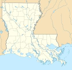
ความย่อ คำอธิบายUSA Louisiana location map.svg Deutsch:
Quadratische Plattkarte, N-S-Streckung 120.0 %. Geographische Begrenzung der Karte:
N: 33.2° N S: 28.7° N W: 94.2° W O: 88.6° W English:
Equirectangular projection, N/S stretching 120.0 %. Geographic limits of the map:
N: 33.2° N S: 28.7° N W: 94.2° W E: 88.6° W ไฟล์กราฟิกส์นี้ สร้างขึ้นโดยใช้ GeoTools
วันที่ กรกฎาคม พ.ศ. 2552 แหล่งที่มา งานของตัว ผู้สร้างสรรค์ Alexrk2 เวอร์ชันอื่น ไฟล์อื่นที่ใช้ไฟล์นี้:
USA location map - counties - no water.svg: USA location map - counties.svg:
แผนที่นี้ถูกสร้างหรือพัฒนาขึ้นจาก Kartenwerkstatt (ห้องปฏิบัติการแผนที่) ของวิกิพีเดียภาษาเยอรมัน ซึ่งคุณสามารถเสนอแผนที่เพื่อพัฒนาได้เช่นเดียวกัน
azərbaycanca ∙ Deutsch (Sie-Form) ∙ čeština ∙ Deutsch ∙ sicilianu ∙ italiano ∙ русский ∙ română ∙ português ∙ English ∙ magyar ∙ Nederlands ∙ slovenščina ∙ polski ∙ latviešu ∙ македонски ∙ español ∙ فارسی ∙ français ∙ suomi ∙ עברית ∙ Plattdüütsch ∙ ქართული ∙ հայերեն ∙ বাংলা ∙ ไทย ∙ 日本語 ∙ 中文 ∙ 中文(简体) ∙ 中文(繁體) ∙ العربية ∙ +/−
การอนุญาตใช้สิทธิ ข้าพเจ้า ในฐานะผู้ถือลิขสิทธิ์ของภาพหรือสื่อนี้ อนุญาตให้ใช้ภาพหรือสื่อนี้ภายใต้เงื่อนไขต่อไปนี้
อนุญาตให้คัดลอก แจกจ่ายและ/หรือดัดแปรเอกสารนี้ภายใต้เงื่อนไขของสัญญาอนุญาตเอกสารเสรีของกนู รุ่น 1.2 หรือรุ่นใด ๆ นับจากนี้ที่ออกโดยมูลนิธิซอฟต์แวร์เสรี โดยไม่มีส่วนใดห้ามแก้ไข ไม่มีข้อความปกหน้าและปกหลัง สำเนาของสัญญาอนุญาตรวมอยู่ในส่วนชื่อ สัญญาอนุญาตเอกสารเสรีของกนู http://www.gnu.org/copyleft/fdl.html GFDL GNU Free Documentation License true true
ไฟล์นี้อยู่ภายใต้สัญญาอนุญาตครีเอทีฟคอมมอนส์ รุ่น แสดงที่มา 3.0 ต้นฉบับ
คุณสามารถ: ที่จะแบ่งปัน – ที่จะทำสำเนา แจกจ่าย และส่งงานดังกล่าวต่อไปที่จะเรียบเรียงใหม่ – ที่จะดัดแปลงงานดังกล่าว ภายใต้เงื่อนไขต่อไปนี้: แสดงที่มา – คุณต้องให้เกียรติเจ้าของงานอย่างเหมาะสม โดยเพิ่มลิงก์ไปยังสัญญาอนุญาต และระบุหากมีการเปลี่ยนแปลง คุณอาจทำเช่นนี้ได้ในรูปแบบใดก็ได้ตามควร แต่ต้องไม่ใช่ในลักษณะที่แนะว่าผู้ให้อนุญาตสนับสนุนคุณหรือการใช้งานของคุณ https://creativecommons.org/licenses/by/3.0 CC BY 3.0 Creative Commons Attribution 3.0 true true คุณสามารถเลือกสัญญาอนุญาตดังกล่าวตามต้องการ
ไทย เพิ่มคำบรรยายทรรทัดเดียวเพื่อขยายความว่าไฟล์นี้มีอะไร
ประวัติไฟล์ คลิกวันที่/เวลาเพื่อดูไฟล์ที่ปรากฏในขณะนั้น
วันที่/เวลา รูปย่อ ขนาด ผู้ใช้ ความเห็น ปัจจุบัน 21:38, 7 กรกฎาคม 2552 1,201 × 1,157 (811 กิโลไบต์) Alexrk2 == Beschreibung == {{Information |Description= {{de|Positionskarte von Louisiana, USA}} Quadratische Plattkarte, N-S-Streckung 120.0 %. Geographische Begrenzung der Karte: * N: 33.2° N * S: 28.7° N * W: 94.2° W * O: 88.6°
หน้าที่มีภาพนี้ หน้าต่อไปนี้ โยงมาที่ภาพนี้:
การใช้ไฟล์ส่วนกลาง วิกิอื่นต่อไปนี้ใช้ไฟล์นี้:
Plantilla:Mapa de localización Loisiana Baton Rouge Módulu:Minimapa/data/Luisiana Módulu:Minimapa/data/Luisiana/usu باتونروژ، لوئیزیانا هوما، لوئیزیانا نووا آیبیریا، لوئیزیانا لیک چارلز، لوئیزیانا راستن، لوئیزیانا مارکسویل، لوئیزیانا الکساندریا، لوئیزیانا اسلایدل، لوئیزیانا ویدیلیا، لوئیزیانا منسفیلد، لوئیزیانا بیکر، لوئیزیانا نکیتاش، لوئیزیانا لافایت، لوئیزیانا منروو، لوئیزیانا قرامبلینق، لوئیزیانا بلمانت، لوئیزیانا باکومویل، لوئیزیانا بایو قولا، لوئیزیانا سینت ماریس، لوئیزیانا دری، لوئیزیانا فیرویو آلفا، لوئیزیانا قرند اکور، لوئیزیانا کارلایل، لوئیزیانا لیک اند، لوئیزیانا فیشویل، لوئیزیانا چاپین، لوئیزیانا فلورا، لوئیزیانا اکمی، لوئیزیانا وردا، لوئیزیانا کرفت، لوئیزیانا پلژر بند، لوئیزیانا لیمنویل، لوئیزیانا اروینویل، لوئیزیانا لافورش کراسینق، لوئیزیانا مونشاین، لوئیزیانا پرسکیل، لوئیزیانا بایو کانتری کلاب، لوئیزیانا رومویل، لوئیزیانا وینا بند، لوئیزیانا بایو بلو، لوئیزیانا لاوتل، لوئیزیانا کریمر، لوئیزیانا ดูการใช้ทั่วโลกเพิ่มเติม ของไฟล์นี้
ไฟล, louisiana, location, ไฟล, ประว, ไฟล, หน, าท, ภาพน, การใช, ไฟล, วนกลางขนาดของต, วอย, าง, ของไฟล, กเซล, ความละเอ, ยดอ, กเซล, กเซล, กเซล, กเซล, กเซล, กเซล, ภาพท, ความละเอ, ยดส, งกว, 8206, ไฟล, กเซล, ขนาดไฟล, โลไบต, ปภาพหร, อไฟล, เส, ยงน, นฉบ, บอย, คอมมอนส, ร. ifl prawtiifl hnathimiphaphni karichiflswnklangkhnadkhxngtwxyang PNG nikhxngifl SVG ni 622 599 phikesl khwamlaexiydxun 249 240 phikesl 498 480 phikesl 797 768 phikesl 1 063 1 024 phikesl 2 126 2 048 phikesl 1 201 1 157 phikesl duphaphthimikhwamlaexiydsungkwa 8206 ifl SVG 1 201 1 157 phikesl khnadifl 811 kiolibt rupphaphhruxiflesiyngni tnchbbxyuthi khxmmxns raylaexiyddanlang epnkhxkhwamthiaesdngphlcak ifltnchbbinkhxmmxns khxmmxnsepnewbistinokhrngkarsahrbekbrwbrwmsuxesri thi khunsamarthchwyid khwamyx khaxthibayUSA Louisiana location map svg Deutsch Positionskarte von Louisiana USA Quadratische Plattkarte N S Streckung 120 0 Geographische Begrenzung der Karte N 33 2 N S 28 7 N W 94 2 W O 88 6 WEnglish Location map of Louisiana USA Equirectangular projection N S stretching 120 0 Geographic limits of the map N 33 2 N S 28 7 N W 94 2 W E 88 6 W iflkrafiksni srangkhunodyich GeoToolswnthi krkdakhm ph s 2552aehlngthima ngankhxngtwphusrangsrrkh Alexrk2ewxrchnxun iflxunthiichiflni USA location map counties no water svg USA location map counties svg aephnthinithuksranghruxphthnakhuncak Kartenwerkstatt hxngptibtikaraephnthi khxngwikiphiediyphasaeyxrmn sungkhunsamarthesnxaephnthiephuxphthnaidechnediywkn azerbaycanca Deutsch Sie Form cestina Deutsch sicilianu italiano russkij romană portugues English magyar Nederlands slovenscina polski latviesu makedonski espanol فارسی francais suomi עברית Plattduutsch ქართული հայերեն ব ল ithy 日本語 中文 中文 简体 中文 繁體 العربية karxnuyatichsiththi khapheca inthanaphuthuxlikhsiththikhxngphaphhruxsuxni xnuyatihichphaphhruxsuxniphayitenguxnikhtxipni xnuyatihkhdlxk aeckcayaela hruxddaeprexksarniphayitenguxnikhkhxngsyyaxnuyatexksaresrikhxngknu run 1 2 hruxrunid nbcaknithixxkodymulnithisxftaewresri odyimmiswnidhamaekikh immikhxkhwampkhnaaelapkhlng saenakhxngsyyaxnuyatrwmxyuinswnchux syyaxnuyatexksaresrikhxngknuhttp www gnu org copyleft fdl html GFDL GNU Free Documentation License true trueiflnixyuphayitsyyaxnuyatkhriexthifkhxmmxns run aesdngthima 3 0 tnchbbkhunsamarth thicaaebngpn thicathasaena aeckcay aelasngngandngklawtxip thicaeriyberiyngihm thicaddaeplngngandngklaw phayitenguxnikhtxipni aesdngthima khuntxngihekiyrtiecakhxngnganxyangehmaasm odyephimlingkipyngsyyaxnuyat aelarabuhakmikarepliynaeplng khunxacthaechnniidinrupaebbidkidtamkhwr aettxngimichinlksnathiaenawaphuihxnuyatsnbsnunkhunhruxkarichngankhxngkhunhttps creativecommons org licenses by 3 0 CC BY 3 0 Creative Commons Attribution 3 0 true truekhunsamartheluxksyyaxnuyatdngklawtamtxngkarkhabrryayodyyxithyephimkhabrryaythrrthdediywephuxkhyaykhwamwaiflnimixairixethmthiaesdngxyuiniflniprakxbdwyphusrangbangkhathiimmiixethmwikisnethschuxphuichwikimiediy Alexrk2yuxaraexl https commons wikimedia org wiki user Alexrk2chuxphusrangsrrkh Alexrk2sthanalikhsiththimilikhsiththisyyaxnuyatGNU Free Documentation License version 1 2 or later xngkvsCreative Commons Attribution 3 0 Unported xngkvsthimakhxngiflkarsrangdngedimodyphuxpohldwnthisrang wnkxtngkrkdakhm 2009 prawtiifl khlikwnthi ewlaephuxduiflthipraktinkhnann wnthi ewlarupyxkhnadphuichkhwamehn pccubn21 38 7 krkdakhm 25521 201 1 157 811 kiolibt Alexrk2 Beschreibung Information Description de Positionskarte von Louisiana USA Quadratische Plattkarte N S Streckung 120 0 Geographische Begrenzung der Karte N 33 2 N S 28 7 N W 94 2 W O 88 6 hnathimiphaphni hnatxipni oyngmathiphaphni niwxxrlins karichiflswnklang wikixuntxipniichiflni karichbn an wikipedia org Nueva Orleans Plantilla Mapa de localizacion Loisiana Baton Rouge karichbn ar wikipedia org قالب خريطة مواقع الولايات المتحدة لويزيانا karichbn ast wikipedia org Aeropuertu Internacional Louis Armstrong Modulu Minimapa data Luisiana Modulu Minimapa data Luisiana usu karichbn azb wikipedia org بووژر لوئیزیانا باتون روژ لوئیزیانا هوما لوئیزیانا نووا آیبیریا لوئیزیانا لیک چارلز لوئیزیانا راستن لوئیزیانا مارکسویل لوئیزیانا الکساندریا لوئیزیانا اسلایدل لوئیزیانا ویدیلیا لوئیزیانا منسفیلد لوئیزیانا بیکر لوئیزیانا نکیتاش لوئیزیانا لافایت لوئیزیانا منروو لوئیزیانا قرامبلینق لوئیزیانا بلمانت لوئیزیانا باکومویل لوئیزیانا بایو قولا لوئیزیانا سینت ماریس لوئیزیانا دری لوئیزیانا فیرویو آلفا لوئیزیانا قرند اکور لوئیزیانا کارلایل لوئیزیانا لیک اند لوئیزیانا فیشویل لوئیزیانا چاپین لوئیزیانا فلورا لوئیزیانا اکمی لوئیزیانا وردا لوئیزیانا کرفت لوئیزیانا پلژر بند لوئیزیانا لیمن ویل لوئیزیانا اروینویل لوئیزیانا لافورش کراسینق لوئیزیانا مونشاین لوئیزیانا پرسکیل لوئیزیانا بایو کانتری کلاب لوئیزیانا رومویل لوئیزیانا وینا بند لوئیزیانا بایو بلو لوئیزیانا لاوتل لوئیزیانا کریمر لوئیزیانا dukarichthwolkephimetimkhxngiflni ekhathungcak https th wikipedia org wiki ifl USA Louisiana location map svg, wikipedia, วิกิ หนังสือ, หนังสือ, ห้องสมุด,
บทความ , อ่าน, ดาวน์โหลด, ฟรี, ดาวน์โหลดฟรี, mp3, วิดีโอ, mp4, 3gp, jpg, jpeg, gif, png, รูปภาพ, เพลง, เพลง, หนัง, หนังสือ, เกม, เกม