รูปภาพหรือไฟล์เสียงนี้ ต้นฉบับอยู่ที่ คอมมอนส์ รายละเอียดด้านล่าง เป็นข้อความที่แสดงผลจาก ไฟล์ต้นฉบับในคอมมอนส์ คอมมอนส์เป็นเว็บไซต์ในโครงการสำหรับเก็บรวบรวมสื่อเสรี ที่ คุณสามารถช่วยได้
ความย่อ คำอธิบายUSA Wisconsin location map.svg Deutsch:
Quadratische Plattkarte, N-S-Streckung 140.0 %. Geographische Begrenzung der Karte:
N: 47.5° N S: 42.3° N W: 93.1° W O: 86.0° W English:
Equirectangular projection, N/S stretching 140.0 %. Geographic limits of the map:
N: 47.5° N S: 42.3° N W: 93.1° W E: 86.0° W ไฟล์กราฟิกส์นี้ สร้างขึ้นโดยใช้ GeoTools
วันที่ กรกฎาคม พ.ศ. 2552 แหล่งที่มา งานของตัว ผู้สร้างสรรค์ Alexrk2 เวอร์ชันอื่น ไฟล์อื่นที่ใช้ไฟล์นี้: BMO Harris Bank 2012-06.png ไฟล์อื่นที่ใช้ไฟล์นี้:
USA location map - counties - no water.svg: USA location map - counties.svg:
แผนที่นี้ถูกสร้างหรือพัฒนาขึ้นจาก Kartenwerkstatt (ห้องปฏิบัติการแผนที่) ของวิกิพีเดียภาษาเยอรมัน ซึ่งคุณสามารถเสนอแผนที่เพื่อพัฒนาได้เช่นเดียวกัน
azərbaycanca ∙ Deutsch (Sie-Form) ∙ čeština ∙ Deutsch ∙ sicilianu ∙ italiano ∙ русский ∙ română ∙ português ∙ English ∙ magyar ∙ Nederlands ∙ slovenščina ∙ polski ∙ latviešu ∙ македонски ∙ español ∙ فارسی ∙ français ∙ suomi ∙ עברית ∙ Plattdüütsch ∙ ქართული ∙ հայերեն ∙ বাংলা ∙ ไทย ∙ 日本語 ∙ 中文 ∙ 中文(简体) ∙ 中文(繁體) ∙ العربية ∙ +/−
การอนุญาตใช้สิทธิ ข้าพเจ้า ในฐานะผู้ถือลิขสิทธิ์ของภาพหรือสื่อนี้ อนุญาตให้ใช้ภาพหรือสื่อนี้ภายใต้เงื่อนไขต่อไปนี้
อนุญาตให้คัดลอก แจกจ่ายและ/หรือดัดแปรเอกสารนี้ภายใต้เงื่อนไขของสัญญาอนุญาตเอกสารเสรีของกนู รุ่น 1.2 หรือรุ่นใด ๆ นับจากนี้ที่ออกโดยมูลนิธิซอฟต์แวร์เสรี โดยไม่มีส่วนใดห้ามแก้ไข ไม่มีข้อความปกหน้าและปกหลัง สำเนาของสัญญาอนุญาตรวมอยู่ในส่วนชื่อ สัญญาอนุญาตเอกสารเสรีของกนู http://www.gnu.org/copyleft/fdl.html GFDL GNU Free Documentation License true true
ไฟล์นี้อยู่ภายใต้สัญญาอนุญาตครีเอทีฟคอมมอนส์ รุ่น แสดงที่มา 3.0 ต้นฉบับ
คุณสามารถ: ที่จะแบ่งปัน – ที่จะทำสำเนา แจกจ่าย และส่งงานดังกล่าวต่อไปที่จะเรียบเรียงใหม่ – ที่จะดัดแปลงงานดังกล่าว ภายใต้เงื่อนไขต่อไปนี้: แสดงที่มา – คุณต้องให้เกียรติเจ้าของงานอย่างเหมาะสม โดยเพิ่มลิงก์ไปยังสัญญาอนุญาต และระบุหากมีการเปลี่ยนแปลง คุณอาจทำเช่นนี้ได้ในรูปแบบใดก็ได้ตามควร แต่ต้องไม่ใช่ในลักษณะที่แนะว่าผู้ให้อนุญาตสนับสนุนคุณหรือการใช้งานของคุณ https://creativecommons.org/licenses/by/3.0 CC BY 3.0 Creative Commons Attribution 3.0 true true คุณสามารถเลือกสัญญาอนุญาตดังกล่าวตามต้องการ
ไทย เพิ่มคำบรรยายทรรทัดเดียวเพื่อขยายความว่าไฟล์นี้มีอะไร
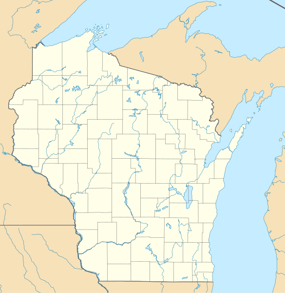
อังกฤษ Location map of Wisconsin in the United States of America
อิตาลี Mappa di localizzazione del Wisconsin, USA
ประวัติไฟล์ คลิกวันที่/เวลาเพื่อดูไฟล์ที่ปรากฏในขณะนั้น
วันที่/เวลา รูปย่อ ขนาด ผู้ใช้ ความเห็น ปัจจุบัน 17:10, 3 กรกฎาคม 2552 1,171 × 1,200 (606 กิโลไบต์) Alexrk2 == Beschreibung == {{Information |Description= {{de|Positionskarte von Wisconsin, USA}} Quadratische Plattkarte, N-S-Streckung 140.0 %. Geographische Begrenzung der Karte: * N: 47.5° N * S: 42.3° N * W: 93.1° W * O: 86.0°
หน้าที่มีภาพนี้ หน้าต่อไปนี้ โยงมาที่ภาพนี้:
การใช้ไฟล์ส่วนกลาง วิกิอื่นต่อไปนี้ใช้ไฟล์นี้:
Monroe (Wisconsin) Vorlage:Positionskarte USA Wisconsin Eau Claire (Wisconsin) Bradley Center Plantilla:Mapa de localización Wisconsin Madison (Wisconsin) هیورد، ویسکانسین هودسون، ویسکانسین ویوقا، ویسکانسین ریور فالز، ویسکانسین ایوکلیر، ویسکانسین بیور دام، ویسکانسین سوپریور، ویسکانسین مونتلو، ویسکانسین شیبویقان، ویسکانسین مینتواک، ویسکانسین نینا، ویسکانسین لیک میلز، ویسکانسین ماسینی، ویسکانسین بارابو، ویسکانسین اوکانتو، ویسکانسین قرین لیک، ویسکانسین فاکس لیک، ویسکانسین دوجویل، ویسکانسین بیفیلد، ویسکانسین مدفورد، ویسکانسین پشتیقو، ویسکانسین سینت کروی فالز، ویسکانسین اسپونر، ویسکانسین آرکادیا، ویسکانسین اوکانتو فالز، ویسکانسین دورند، ویسکانسین نیاقارا، ویسکانسین تو ریورز، ویسکانسین تامه، ویسکانسین شالزبرق، ویسکانسین ریدزبرق، ویسکانسین واپاکا، ویسکانسین ریپون، ویسکانسین لادی، ویسکانسین رایلندر، ویسکانسین بوسکوبل، ویسکانسین پورت واشینقتون، ویسکانسین دارلینقتون، ویسکانسین تامهاوک، ویسکانسین اسپارتا، ویسکانسین ดูการใช้ทั่วโลกเพิ่มเติม ของไฟล์นี้
ไฟล, wisconsin, location, ไฟล, ประว, ไฟล, หน, าท, ภาพน, การใช, ไฟล, วนกลางขนาดของต, วอย, าง, ของไฟล, กเซล, ความละเอ, ยดอ, กเซล, กเซล, กเซล, กเซล, กเซล, กเซล, ภาพท, ความละเอ, ยดส, งกว, 8206, ไฟล, กเซล, ขนาดไฟล, โลไบต, ปภาพหร, อไฟล, เส, ยงน, นฉบ, บอย, คอมมอนส, ร. ifl prawtiifl hnathimiphaphni karichiflswnklangkhnadkhxngtwxyang PNG nikhxngifl SVG ni 585 599 phikesl khwamlaexiydxun 234 240 phikesl 468 480 phikesl 749 768 phikesl 999 1 024 phikesl 1 998 2 048 phikesl 1 171 1 200 phikesl duphaphthimikhwamlaexiydsungkwa 8206 ifl SVG 1 171 1 200 phikesl khnadifl 606 kiolibt rupphaphhruxiflesiyngni tnchbbxyuthi khxmmxns raylaexiyddanlang epnkhxkhwamthiaesdngphlcak ifltnchbbinkhxmmxns khxmmxnsepnewbistinokhrngkarsahrbekbrwbrwmsuxesri thi khunsamarthchwyid khwamyx khaxthibayUSA Wisconsin location map svg Deutsch Positionskarte von Wisconsin USA Quadratische Plattkarte N S Streckung 140 0 Geographische Begrenzung der Karte N 47 5 N S 42 3 N W 93 1 W O 86 0 WEnglish Location map of Wisconsin USA Equirectangular projection N S stretching 140 0 Geographic limits of the map N 47 5 N S 42 3 N W 93 1 W E 86 0 W iflkrafiksni srangkhunodyich GeoToolswnthi krkdakhm ph s 2552aehlngthima ngankhxngtwphusrangsrrkh Alexrk2ewxrchnxun iflxunthiichiflni BMO Harris Bank 2012 06 png iflxunthiichiflni USA location map counties no water svg USA location map counties svg aephnthinithuksranghruxphthnakhuncak Kartenwerkstatt hxngptibtikaraephnthi khxngwikiphiediyphasaeyxrmn sungkhunsamarthesnxaephnthiephuxphthnaidechnediywkn azerbaycanca Deutsch Sie Form cestina Deutsch sicilianu italiano russkij romană portugues English magyar Nederlands slovenscina polski latviesu makedonski espanol فارسی francais suomi עברית Plattduutsch ქართული հայերեն ব ল ithy 日本語 中文 中文 简体 中文 繁體 العربية karxnuyatichsiththi khapheca inthanaphuthuxlikhsiththikhxngphaphhruxsuxni xnuyatihichphaphhruxsuxniphayitenguxnikhtxipni xnuyatihkhdlxk aeckcayaela hruxddaeprexksarniphayitenguxnikhkhxngsyyaxnuyatexksaresrikhxngknu run 1 2 hruxrunid nbcaknithixxkodymulnithisxftaewresri odyimmiswnidhamaekikh immikhxkhwampkhnaaelapkhlng saenakhxngsyyaxnuyatrwmxyuinswnchux syyaxnuyatexksaresrikhxngknuhttp www gnu org copyleft fdl html GFDL GNU Free Documentation License true trueiflnixyuphayitsyyaxnuyatkhriexthifkhxmmxns run aesdngthima 3 0 tnchbbkhunsamarth thicaaebngpn thicathasaena aeckcay aelasngngandngklawtxip thicaeriyberiyngihm thicaddaeplngngandngklaw phayitenguxnikhtxipni aesdngthima khuntxngihekiyrtiecakhxngnganxyangehmaasm odyephimlingkipyngsyyaxnuyat aelarabuhakmikarepliynaeplng khunxacthaechnniidinrupaebbidkidtamkhwr aettxngimichinlksnathiaenawaphuihxnuyatsnbsnunkhunhruxkarichngankhxngkhunhttps creativecommons org licenses by 3 0 CC BY 3 0 Creative Commons Attribution 3 0 true truekhunsamartheluxksyyaxnuyatdngklawtamtxngkarkhabrryayodyyxithyephimkhabrryaythrrthdediywephuxkhyaykhwamwaiflnimixairxngkvsLocation map of Wisconsin in the United States of AmericaxitaliMappa di localizzazione del Wisconsin USAixethmthiaesdngxyuiniflniprakxbdwyrthwiskhxnsinaephnthiphusrangbangkhathiimmiixethmwikisnethsyuxaraexl https commons wikimedia org wiki user Alexrk2chuxphusrangsrrkh Alexrk2chuxphuichwikimiediy Alexrk2sthanalikhsiththimilikhsiththisyyaxnuyatGNU Free Documentation License version 1 2 or later xngkvsCreative Commons Attribution 3 0 Unported xngkvsthimakhxngiflkarsrangdngedimodyphuxpohldwnthisrang wnkxtngkrkdakhm 2009MIME type xngkvsimage svg xml prawtiifl khlikwnthi ewlaephuxduiflthipraktinkhnann wnthi ewlarupyxkhnadphuichkhwamehn pccubn17 10 3 krkdakhm 25521 171 1 200 606 kiolibt Alexrk2 Beschreibung Information Description de Positionskarte von Wisconsin USA Quadratische Plattkarte N S Streckung 140 0 Geographische Begrenzung der Karte N 47 5 N S 42 3 N W 93 1 W O 86 0 hnathimiphaphni hnatxipni oyngmathiphaphni khvhasnorebirt exm aelmph aemdisn mxdul Location map data USA Wisconsin mxdul Location map data USA Wisconsin doc mxdul Location map data Wisconsin karichiflswnklang wikixuntxipniichiflni karichbn als wikipedia org New Glarus Monroe Wisconsin Vorlage Positionskarte USA Wisconsin karichbn an wikipedia org Milwaukee Eau Claire Wisconsin Bradley Center Plantilla Mapa de localizacion Wisconsin Madison Wisconsin karichbn ar wikipedia org قالب Location map USA Wisconsin karichbn azb wikipedia org مدیسن ویسکانسین هیورد ویسکانسین هودسون ویسکانسین ویوقا ویسکانسین ریور فالز ویسکانسین ایوکلیر ویسکانسین بیور دام ویسکانسین سوپریور ویسکانسین مونتلو ویسکانسین شیبویقان ویسکانسین مینتواک ویسکانسین نینا ویسکانسین لیک میلز ویسکانسین ماسینی ویسکانسین بارابو ویسکانسین اوکانتو ویسکانسین قرین لیک ویسکانسین فاکس لیک ویسکانسین دوجویل ویسکانسین بیفیلد ویسکانسین مدفورد ویسکانسین پشتیقو ویسکانسین سینت کروی فالز ویسکانسین اسپونر ویسکانسین آرکادیا ویسکانسین اوکانتو فالز ویسکانسین دورند ویسکانسین نیاقارا ویسکانسین تو ریورز ویسکانسین تامه ویسکانسین شالزبرق ویسکانسین ریدزبرق ویسکانسین واپاکا ویسکانسین ریپون ویسکانسین لادی ویسکانسین رایلندر ویسکانسین بوسکوبل ویسکانسین پورت واشینقتون ویسکانسین دارلینقتون ویسکانسین تامهاوک ویسکانسین اسپارتا ویسکانسین dukarichthwolkephimetimkhxngiflni ekhathungcak https th wikipedia org wiki ifl USA Wisconsin location map svg, wikipedia, วิกิ หนังสือ, หนังสือ, ห้องสมุด,
บทความ , อ่าน, ดาวน์โหลด, ฟรี, ดาวน์โหลดฟรี, mp3, วิดีโอ, mp4, 3gp, jpg, jpeg, gif, png, รูปภาพ, เพลง, เพลง, หนัง, หนังสือ, เกม, เกม