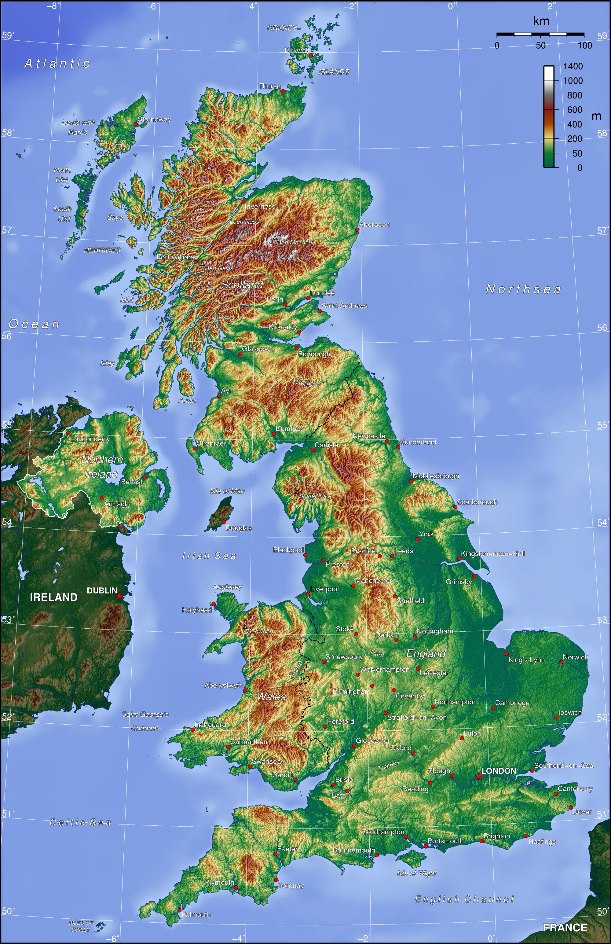
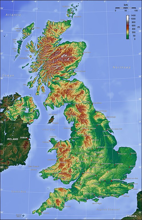
Deutsch: Topografische Karte des Vereinigten Königreichs (englische Beschriftung).
English: Topographic map of the United Kingdom.
วันที่
แหล่งที่มา
งานของตัว
ผู้สร้างสรรค์
Captain Blood
การอนุญาตใช้สิทธิ
The map has been created with the Generic Mapping Tools: https://www.generic-mapping-tools.org/ using one or more of these public-domain datasets for the relief:
ไฟล, topo, ไฟล, ประว, ไฟล, หน, าท, ภาพน, การใช, ไฟล, วนกลางขนาดของต, วอย, างน, กเซล, ความละเอ, ยดอ, กเซล, กเซล, กเซล, กเซล, กเซล, ภาพท, ความละเอ, ยดส, งกว, 8206, กเซล, ขนาดไฟล, เมกะไบต, ชน, ดไมม, image, jpeg, ปภาพหร, อไฟล, เส, ยงน, นฉบ, บอย, คอมมอนส, รายละเอ, . ifl prawtiifl hnathimiphaphni karichiflswnklangkhnadkhxngtwxyangni 388 599 phikesl khwamlaexiydxun 155 240 phikesl 311 480 phikesl 497 768 phikesl 663 1 024 phikesl 2 000 3 089 phikesl duphaphthimikhwamlaexiydsungkwa 8206 2 000 3 089 phikesl khnadifl 1 65 emkaibt chnidimm image jpeg rupphaphhruxiflesiyngni tnchbbxyuthi khxmmxns raylaexiyddanlang epnkhxkhwamthiaesdngphlcak ifltnchbbinkhxmmxns khxmmxnsepnewbistinokhrngkarsahrbekbrwbrwmsuxesri thi khunsamarthchwyid khwamyx khaxthibayUk topo en jpg Deutsch Topografische Karte des Vereinigten Konigreichs englische Beschriftung English Topographic map of the United Kingdom wnthi 7 krkdakhm ph s 2549 aehlngthima ngankhxngtw phusrangsrrkh Captain Blood karxnuyatichsiththi The map has been created with the Generic Mapping Tools https www generic mapping tools org using one or more of these public domain datasets for the relief ETOPO2 topography bathymetry http www ngdc noaa gov mgg global global html GLOBE topography http www ngdc noaa gov mgg topo gltiles html SRTM topography http www2 jpl nasa gov srtm ব ল nbsp English nbsp espanol nbsp francais nbsp italiano nbsp 日本語 nbsp makedonski nbsp sicilianu nbsp 中文 简体 nbsp 中文 繁體 nbsp xnuyatihkhdlxk aeckcayaela hruxddaeprexksarniphayitenguxnikhkhxngsyyaxnuyatexksaresrikhxngknu run 1 2 hruxrunid nbcaknithixxkodymulnithisxftaewresri odyimmiswnidhamaekikh immikhxkhwampkhnaaelapkhlng saenakhxngsyyaxnuyatrwmxyuinswnchux syyaxnuyatexksaresrikhxngknuhttp www gnu org copyleft fdl html GFDL GNU Free Documentation License true true iflnixyuphayitsyyaxnuyat khriexthifkhxmmxns aebbaesdngthima xnuyataebbediywkn 3 0 tnchbb khunsamarth thicaaebngpn thicathasaena aeckcay aelasngngandngklawtxip thicaeriyberiyngihm thicaddaeplngngandngklaw phayitenguxnikhtxipni aesdngthima khuntxngihekiyrtiecakhxngnganxyangehmaasm odyephimlingkipyngsyyaxnuyat aelarabuhakmikarepliynaeplng khunxacthaechnniidinrupaebbidkidtamkhwr aettxngimichinlksnathiaenawaphuihxnuyatsnbsnunkhunhruxkarichngankhxngkhun xnuyataebbediywkn hakkhunddaeplng epliynrup hruxtxetimnganni khuntxngichsyyaxnuyataebbediywknhruxaebbthiehmuxnkbsyyaxnuyatthiichkbnganniethann payaesdngsthanalikhsiththinithukephimephuxihepniptamkarepliynaeplngsyyaxnuyatkhxngmulnithiwikimiediy cak GFDL ipyng GFDL khwbkhukb CC BY SA 3 0 http creativecommons org licenses by sa 3 0 CC BY SA 3 0 Creative Commons Attribution Share Alike 3 0 true truekhabrryayodyyxithyephimkhabrryaythrrthdediywephuxkhyaykhwamwaiflnimixairixethmthiaesdngxyuiniflniprakxbdwysthanalikhsiththimilikhsiththisyyaxnuyatCreative Commons Attribution ShareAlike 3 0 Unported nbsp xngkvsGNU Free Documentation License version 1 2 or later nbsp xngkvswnthisrang wnkxtng7 krkdakhm 2006 prawtiifl khlikwnthi ewlaephuxduiflthipraktinkhnann wnthi ewlarupyxkhnadphuichkhwamehn pccubn00 42 27 tulakhm 25492 000 3 089 1 65 emkaibt ConsciousReverted to earlier revision 00 42 27 tulakhm 25491 400 1 670 597 kiolibt Consciousversion from en same author 05 06 8 krkdakhm 25492 000 3 089 1 65 emkaibt Captain Blood commonswiki Bild GFDL GMT hnathimiphaphni hnatxipni oyngmathiphaphni phumisastrshrachxanackr shrachxanackr karichiflswnklang wikixuntxipniichiflni karichbn af wikipedia org Verenigde Koninkryk karichbn am wikipedia org የተባበሩት የሀገር ንጉሳዊ አገዛዝ karichbn ar wikipedia org المملكة المتحدة karichbn arz wikipedia org جغرافيا المملكه المتحده Outline of the United Kingdom karichbn ast wikipedia org Xeografia del Reinu Xuniu karichbn be tarask wikipedia org Vyalikabrytaniya karichbn bg wikipedia org Geografiya na Velikobritaniya karichbn bh wikipedia org य न इट ड क गडम karichbn bn wikipedia org য ক তর জ য র ভ গ ল য ক তর জ য র র পর খ karichbn cs wikipedia org Spojene kralovstvi karichbn da wikipedia org Storbritannien Storbritanniens geografi karichbn de wikipedia org Geographie des Vereinigten Konigreichs Benutzer Ulflulfl Karten karichbn de wikibooks org Wikijunior Europa Vereinigtes Konigreich Wikijunior Europa Druckversion karichbn en wikipedia org Geography of the United Kingdom User Grunners User Rodw Wikipedia WikiProject UK geography User Pyrotec User Lozleader Wikipedia Userboxes Location United Kingdom User Jellyman User Waggers User Dbam User Coldupnorth User EP111 User Northumbrian User Mark999 User Snowy 1973 User Snowded User Ddstretch User Thedewster User Asdfasdf1231234 User Jza84 User Al Glitch User Coldmachine Template User WP UK geo Category WikiProject UK geography participants User Traveler100 User Matthewedwards Wikipedia WikiProject UK geography Members Wikipedia WikiProject UK geography Templates User Tmol42 User TicketMan User Pterre User Fifaworld07 dukarichthwolkephimetimkhxngiflni ekhathungcak https th wikipedia org wiki ifl Uk topo en jpg, wikipedia, วิกิ หนังสือ, หนังสือ, ห้องสมุด,