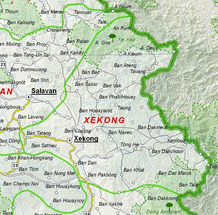
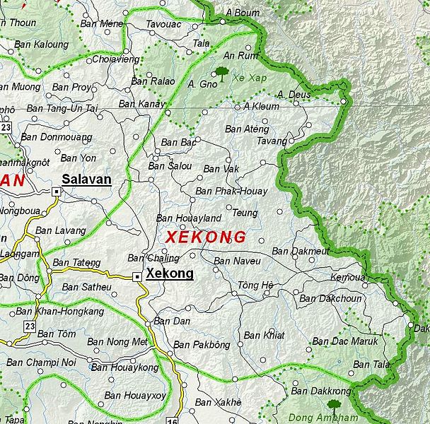
ไฟล, sekong, province, laos, ไฟล, ประว, ไฟล, หน, าท, ภาพน, การใช, ไฟล, วนกลางขนาดของต, วอย, างน, กเซล, ความละเอ, ยดอ, กเซล, กเซล, กเซล, ภาพท, ความละเอ, ยดส, งกว, 8206, กเซล, ขนาดไฟล, โลไบต, ชน, ดไมม, image, jpeg, ปภาพหร, อไฟล, เส, ยงน, นฉบ, บอย, คอมมอนส, รายละ. ifl prawtiifl hnathimiphaphni karichiflswnklangkhnadkhxngtwxyangni 608 600 phikesl khwamlaexiydxun 243 240 phikesl 487 480 phikesl 873 861 phikesl duphaphthimikhwamlaexiydsungkwa 8206 873 861 phikesl khnadifl 466 kiolibt chnidimm image jpeg rupphaphhruxiflesiyngni tnchbbxyuthi khxmmxns raylaexiyddanlang epnkhxkhwamthiaesdngphlcak ifltnchbbinkhxmmxns khxmmxnsepnewbistinokhrngkarsahrbekbrwbrwmsuxesri thi khunsamarthchwyid khwamyx khaxthibayMap of Sekong Province Laos jpg English Map of Sekong Province Laos wnthi 6 thnwakhm ph s 2555 aehlngthima Based on File UNOSAT Laos Base Map jpg phusrangsrrkh UNOSAT United Nations modified by Dr Blofeld karxnuyat karichiflniihm The original file is marked with the UN symbol which means that it is a public domain resource karxnuyatichsiththi Public domain Public domain false false This image is a map derived from a United Nations map Unless stated otherwise UN maps are to be considered in the public domain This applies worldwide Some UN maps have special copyrights as indicated on the map itself UN maps are in principle open source material and you can use them in your work or for making your own map UN requests however that you delete the UN name logo and reference number upon any modification to the map Content of your map will be your responsibility You can state in your publication if you wish something like based on UN map map name map number revision number and date See The UN Cartographic Section retrieved 16 November 2013 khabrryayodyyxithyephimkhabrryaythrrthdediywephuxkhyaykhwamwaiflnimixairixethmthiaesdngxyuiniflniprakxbdwywnthisrang wnkxtng6 thnwakhm 2012 prawtiifl khlikwnthi ewlaephuxduiflthipraktinkhnann wnthi ewlarupyxkhnadphuichkhwamehn pccubn04 06 7 thnwakhm 2555873 861 466 kiolibt Blofeld Dr Information Description en 1 d Source d Author d Date d Permission other versions d hnathimiphaphni hnatxipni oyngmathiphaphni aekhwngeskxng karichiflswnklang wikixuntxipniichiflni karichbn en wikipedia org Sekong province karichbn fa wikipedia org استان سکونگ karichbn fr wikipedia org Province de Sekong karichbn hr wikipedia org Sekong provincija karichbn id wikipedia org Provinsi Xekong karichbn ru wikipedia org Sekong karichbn ur wikipedia org سیکونگ صوبہ karichbn vi wikipedia org Sekong tỉnh ekhathungcak https th wikipedia org wiki ifl Map of Sekong Province Laos jpg, wikipedia, วิกิ หนังสือ, หนังสือ, ห้องสมุด,