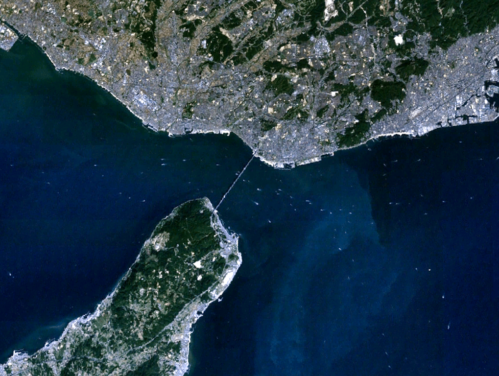
{{Information |Description={{en|1=the view of Akashi Strait in Japan, from Landsat, generated on NASA World Wind.}} {{ja|1=衛星ランドサットからの明石海峡。NASA World Windで作成。}} |Source=NASA World Wind (http://worldwind.arc.nasa.gov
ไฟล, akashi, strait, ไฟล, ประว, ไฟล, หน, าท, ภาพน, การใช, ไฟล, วนกลางขนาดของต, วอย, างน, กเซล, ความละเอ, ยดอ, กเซล, กเซล, กเซล, กเซล, ภาพท, ความละเอ, ยดส, งกว, 8206, กเซล, ขนาดไฟล, โลไบต, ชน, ดไมม, image, ปภาพหร, อไฟล, เส, ยงน, นฉบ, บอย, คอมมอนส, รายละเอ, ยดด,. ifl prawtiifl hnathimiphaphni karichiflswnklangkhnadkhxngtwxyangni 796 600 phikesl khwamlaexiydxun 319 240 phikesl 637 480 phikesl 1 019 768 phikesl 1 194 900 phikesl duphaphthimikhwamlaexiydsungkwa 8206 1 194 900 phikesl khnadifl 690 kiolibt chnidimm image png rupphaphhruxiflesiyngni tnchbbxyuthi khxmmxns raylaexiyddanlang epnkhxkhwamthiaesdngphlcak ifltnchbbinkhxmmxns khxmmxnsepnewbistinokhrngkarsahrbekbrwbrwmsuxesri thi khunsamarthchwyid khwamyx khaxthibayAkashi Strait 1 png English the view of Akashi Strait in Japan from Landsat generated on NASA World Wind 日本語 衛星ランドサットからの明石海峡 NASA World Windで作成 wnthi 1 thnwakhm ph s 2553aehlngthima NASA World Wind http worldwind arc nasa gov java phusrangsrrkh Pinqui karxnuyatichsiththi Public domain Public domain false falseThis image is in the public domain because it is a screenshot from NASA s globe software World Wind using a public domain layer such as Blue Marble MODIS Landsat SRTM USGS or GLOBE العربي ة English فارسی francais עברית makedonski മലയ ള Nederlands russkij 中文 中国大陆 khabrryayodyyxithyephimkhabrryaythrrthdediywephuxkhyaykhwamwaiflnimixairixethmthiaesdngxyuiniflniprakxbdwywnthisrang wnkxtng1 thnwakhm 2010 prawtiifl khlikwnthi ewlaephuxduiflthipraktinkhnann wnthi ewlarupyxkhnadphuichkhwamehn pccubn15 36 1 thnwakhm 25531 194 900 690 kiolibt Pinqui Information Description en 1 the view of Akashi Strait in Japan from Landsat generated on NASA World Wind ja 1 衛星ランドサットからの明石海峡 NASA World Windで作成 Source NASA World Wind http worldwind arc nasa gov hnathimiphaphni hnatxipni oyngmathiphaphni chxngaekhbxakachi karichiflswnklang wikixuntxipniichiflni karichbn en wikipedia org Akashi Strait karichbn fr wikipedia org Detroit d Akashi karichbn he wikipedia org מצר אקשי karichbn id wikipedia org Selat Akashi karichbn ja wikipedia org 明石海峡 karichbn ko wikipedia org 아카시 해협 karichbn pt wikipedia org Estreito de Akashi ekhathungcak https th wikipedia org wiki ifl Akashi Strait 1 png, wikipedia, วิกิ หนังสือ, หนังสือ, ห้องสมุด,