ข้อมูลเพิ่มเติม This map is part of a series of location maps with unified standards: SVG as file format, standardised colours and name scheme. The boundaries on these maps always show the de facto situation and do not imply any endorsement or acceptance. In case of changes of the shown area the file is updated. The old version will be uploaded as a new file and thus is still available.
วันที่
แหล่งที่มา
Own work using:
United States National Imagery and Mapping Agency data
azərbaycanca ∙ Deutsch (Sie-Form) ∙ čeština ∙ Deutsch ∙ sicilianu ∙ italiano ∙ русский ∙ română ∙ português ∙ English ∙ magyar ∙ Nederlands ∙ slovenščina ∙ polski ∙ latviešu ∙ македонски ∙ español ∙ فارسی ∙ français ∙ suomi ∙ עברית ∙ Plattdüütsch ∙ ქართული ∙ հայերեն ∙ বাংলা ∙ ไทย ∙ 日本語 ∙ 中文 ∙ 中文(简体) ∙ 中文(繁體) ∙ العربية ∙ +/−
การอนุญาตใช้สิทธิ
Usage of this file with:
Map: NordNordWest, Licence: Creative Commons by-sa-3.0 de
explanatory notes: Legally binding is only the full legalcode. For a free usage I recommend to respect the following licence conditions: 1. Provide my name as given above: NordNordWest, 2. a copy of, or the URI for, the applicable license: https://creativecommons.org/licenses/by-sa/3.0/de/legalcode, 3. the title of the work, 4. in the case of an adaptation, a credit identifying the use of the work in the adaptation. This license and the rights granted hereunder will terminate automatically upon any breach by you of the terms of this license. Any of the above conditions can be waived if you get permission from the copyright holder. If you have questions or wish differing conditions, please contact me through nnwestt-online.de or my discussion page
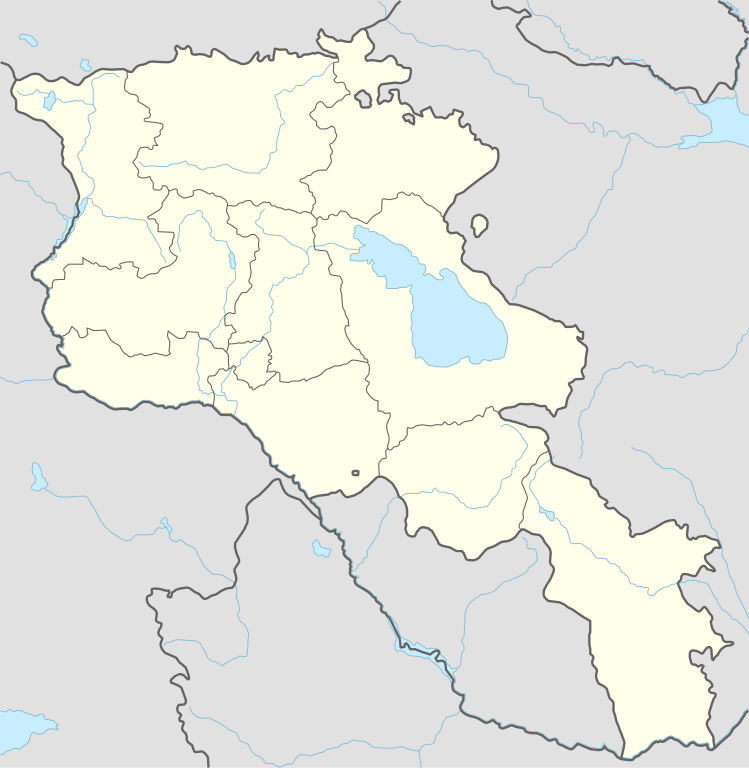
== {{int:filedesc}} == {{Information |Description= {{de|1=Positionskarte von Armenien}} {{en|1=Location map of Armenia}} {{Location map series N |stretching=130 |top=41.4 |bottom=38.8 |left=43.4 |right=46.7 }} |Source={{Own using}} * United States Nati...
ไฟล, armenia, location, ไฟล, ประว, ไฟล, หน, าท, ภาพน, การใช, ไฟล, วนกลาง, อม, ลเก, ยวก, บภาพขนาดของต, วอย, าง, ของไฟล, กเซล, ความละเอ, ยดอ, กเซล, กเซล, กเซล, กเซล, กเซล, กเซล, ภาพท, ความละเอ, ยดส, งกว, 8206, ไฟล, กเซล, ขนาดไฟล, โลไบต, ปภาพหร, อไฟล, เส, ยงน, นฉ. ifl prawtiifl hnathimiphaphni karichiflswnklang khxmulekiywkbphaphkhnadkhxngtwxyang PNG nikhxngifl SVG ni 585 600 phikesl khwamlaexiydxun 234 240 phikesl 468 480 phikesl 749 768 phikesl 999 1 024 phikesl 1 998 2 048 phikesl 1 169 1 198 phikesl duphaphthimikhwamlaexiydsungkwa 8206 ifl SVG 1 169 1 198 phikesl khnadifl 146 kiolibt rupphaphhruxiflesiyngni tnchbbxyuthi khxmmxns raylaexiyddanlang epnkhxkhwamthiaesdngphlcak ifltnchbbinkhxmmxns khxmmxnsepnewbistinokhrngkarsahrbekbrwbrwmsuxesri thi khunsamarthchwyid khwamyx khaxthibayArmenia adm location map svg Deutsch Positionskarte von Armenien English Location map of Armenia Equirectangular projection vertical stretching 130 nbsp Border coordinates41 443 4 46 7 38 8 nbsp khxmulephimetim This map is part of a series of location maps with unified standards SVG as file format standardised colours and name scheme The boundaries on these maps always show the de facto situation and do not imply any endorsement or acceptance In case of changes of the shown area the file is updated The old version will be uploaded as a new file and thus is still available wnthi 21 tulakhm ph s 2557 aehlngthima Own work using United States National Imagery and Mapping Agency data World Data Base II data phusrangsrrkh NordNordWest aephnthinithuksranghruxphthnakhuncak Kartenwerkstatt hxngptibtikaraephnthi khxngwikiphiediyphasaeyxrmn sungkhunsamarthesnxaephnthiephuxphthnaidechnediywkn azerbaycanca nbsp Deutsch Sie Form nbsp cestina nbsp Deutsch nbsp sicilianu nbsp italiano nbsp russkij nbsp romană nbsp portugues nbsp English nbsp magyar nbsp Nederlands nbsp slovenscina nbsp polski nbsp latviesu nbsp makedonski nbsp espanol nbsp فارسی nbsp francais nbsp suomi nbsp עברית nbsp Plattduutsch nbsp ქართული nbsp հայերեն nbsp ব ল nbsp ithy nbsp 日本語 nbsp 中文 nbsp 中文 简体 nbsp 中文 繁體 nbsp العربية nbsp karxnuyatichsiththi Usage of this file with Map NordNordWest Licence Creative Commons by sa 3 0 de explanatory notes Legally binding is only the full legalcode For a free usage I recommend to respect the following licence conditions 1 Provide my name as given above NordNordWest 2 a copy of or the URI for the applicable license https creativecommons org licenses by sa 3 0 de legalcode 3 the title of the work 4 in the case of an adaptation a credit identifying the use of the work in the adaptation This license and the rights granted hereunder will terminate automatically upon any breach by you of the terms of this license Any of the above conditions can be waived if you get permission from the copyright holder If you have questions or wish differing conditions please contact me through span class nowrap nnwest span typeof mw File span title span span t online de span or my discussion page iflnixyuphayitsyyaxnuyat khriexthifkhxmmxns aebbaesdngthima xnuyataebbediywkn 3 0 khxngpraethseyxrmnikaraesdngthima Karte NordNordWest Lizenz Creative Commons by sa 3 0 dekhunsamarth thicaaebngpn thicathasaena aeckcay aelasngngandngklawtxip thicaeriyberiyngihm thicaddaeplngngandngklaw phayitenguxnikhtxipni aesdngthima khuntxngihekiyrtiecakhxngnganxyangehmaasm odyephimlingkipyngsyyaxnuyat aelarabuhakmikarepliynaeplng khunxacthaechnniidinrupaebbidkidtamkhwr aettxngimichinlksnathiaenawaphuihxnuyatsnbsnunkhunhruxkarichngankhxngkhun xnuyataebbediywkn hakkhunddaeplng epliynrup hruxtxetimnganni khuntxngichsyyaxnuyataebbediywknhruxaebbthiehmuxnkbsyyaxnuyatthiichkbnganniethannhttps creativecommons org licenses by sa 3 0 de deed en CC BY SA 3 0 de Creative Commons Attribution Share Alike 3 0 de true truekhabrryayodyyxithyephimkhabrryaythrrthdediywephuxkhyaykhwamwaiflnimixairixethmthiaesdngxyuiniflniprakxbdwysthanalikhsiththimilikhsiththisyyaxnuyatCreative Commons Attribution ShareAlike 3 0 Germany nbsp xngkvswnthisrang wnkxtng21 tulakhm 2014MIME type nbsp xngkvsimage svg xmlchecksum nbsp xngkvs71862795947a81de7d11bca67f7829ca9493463bwithikarkahnd SHA 1 nbsp xngkvsdata size nbsp xngkvs155 638 ibtkhwamsung1 198 phikeslkhwamkwang1 169 phikesl prawtiifl khlikwnthi ewlaephuxduiflthipraktinkhnann wnthi ewlarupyxkhnadphuichkhwamehn pccubn01 36 21 phvscikayn 25661 169 1 198 146 kiolibt NordNordWestback to original size 17 34 20 phvscikayn 2566512 524 130 kiolibt Toghrul Rupdated 16 32 20 mkrakhm 25661 169 1 198 152 kiolibt Goldenupdating NK borders no control in the south removing old Lachin corridor 00 06 15 phvscikayn 25631 169 1 198 150 kiolibt NordNordWest 03 58 22 tulakhm 25571 169 1 198 161 kiolibt NordNordWest int filedesc Information Description de 1 Positionskarte von Armenien en 1 Location map of Armenia Location map series N stretching 130 top 41 4 bottom 38 8 left 43 4 right 46 7 Source Own using United States Nati hnathimiphaphni hnatxipni oyngmathiphaphni kyumri skhkdsxr wakarschapht wiharkarni xaramkhxbyr xartswaaechn xarmieniynphriemiyrlik eswanawngkh aekkhard okhrwirp karichiflswnklang wikixuntxipniichiflni karichbn af wikipedia org Aragats Gjoemri Sjabloon Liggingkaart Armenie Goris karichbn als wikipedia org Vorlage Positionskarte Armenien karichbn an wikipedia org Erevan Plantilla Mapa de localizacion Armenia karichbn ar wikipedia org قالب خريطة مواقع أرمينيا قائمة مواقع التراث العالمي في أرمينيا karichbn ast wikipedia org Yeghipatrush Yerevan Castiellu d Erebuni Fortaleza d Ertij Fortaleza de Kosh Lori Berd Ciudadela d Horom Castiellu de Bjni Vorotnaberd Fortaleza Ajtala Amberd Baghaberd Castiellu de Yerevan Berdkunk Fortaleza Berdavan Fortaleza Berdkunk Proshaberd Fortaleza Dashtadem Kakavaberd Fortaleza Halidzor Karmir Blur Sardari Berd Sev Berd Smbataberd Fuerte Tavush Teishebaini Yergevanits Ushiberd Tsitsernakaberd Echmiadzin Yerevandashat ciuda antigua Dvin Hnaberd Aragatsotn Argishtikhinili Fortaleza de Meghri Armavir ciuda antigua Modulu Minimapa data Armenia Modulu Minimapa data Armenia usu Guiumri Bancu Central d Armenia Yeghegnadzor dukarichthwolkephimetimkhxngiflnikhxmulekiywkbphaph phaphnimikhxmulephimetim sungswnihymacakklxngdicitxlhruxsaeknenxrthisamarthekbkhxmuldngklawiwrwmkbphaphid thaphaphnithukprbprungaekikhhruxepliynaeplngcakedim khxmulbangxyangcayngkhngimepliynaeplngehmuxnphaphthithukprbprungaekikhnnkhwamkwang1169 225pxkhwamsung1197 618px ekhathungcak https th wikipedia org wiki ifl Armenia adm location map svg, wikipedia, วิกิ หนังสือ, หนังสือ, ห้องสมุด,