This image was copied from wikipedia:fr. The original description was:
ความย่อ
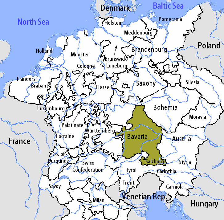
en:User:Silverhelm is the author of this image file. Its contents are based in part on a map published in the "Historical Atlas" by Prof. William R Shepherd, pub. Henry Holt & Co. (New York, 1911).
This image was copied from wikipedia:fr. The original description was: == Sommaire == fr::en:User:Silverhelm is the author of this image file. Its contents are based in part on a map published in the "Historical Atlas" by Prof. William R Shepherd,
ไฟล, bavarian, circle, 2005, ไฟล, ประว, ไฟล, หน, าท, ภาพน, การใช, ไฟล, วนกลางขนาดของต, วอย, างน, กเซล, ความละเอ, ยดอ, กเซล, กเซล, กเซล, ภาพท, ความละเอ, ยดส, งกว, 8206, กเซล, ขนาดไฟล, โลไบต, ชน, ดไมม, image, ปภาพหร, อไฟล, เส, ยงน, นฉบ, บอย, คอมมอนส, รายละเอ, ยด. ifl prawtiifl hnathimiphaphni karichiflswnklangkhnadkhxngtwxyangni 610 599 phikesl khwamlaexiydxun 244 240 phikesl 489 480 phikesl 727 714 phikesl duphaphthimikhwamlaexiydsungkwa 8206 727 714 phikesl khnadifl 67 kiolibt chnidimm image png rupphaphhruxiflesiyngni tnchbbxyuthi khxmmxns raylaexiyddanlang epnkhxkhwamthiaesdngphlcak ifltnchbbinkhxmmxns khxmmxnsepnewbistinokhrngkarsahrbekbrwbrwmsuxesri thi khunsamarthchwyid This image was copied from wikipedia fr The original description was khwamyx en User Silverhelm is the author of this image file Its contents are based in part on a map published in the Historical Atlas by Prof William R Shepherd pub Henry Holt amp Co New York 1911 karxnuyatichsiththi iflnixyuphayitsyyaxnuyat khriexthifkhxmmxns aebbaesdngthima xnuyataebbediywkn 1 0 thwipkhunsamarth thicaaebngpn thicathasaena aeckcay aelasngngandngklawtxip thicaeriyberiyngihm thicaddaeplngngandngklaw phayitenguxnikhtxipni aesdngthima khuntxngihekiyrtiecakhxngnganxyangehmaasm odyephimlingkipyngsyyaxnuyat aelarabuhakmikarepliynaeplng khunxacthaechnniidinrupaebbidkidtamkhwr aettxngimichinlksnathiaenawaphuihxnuyatsnbsnunkhunhruxkarichngankhxngkhun xnuyataebbediywkn If you alter transform or build upon this work you must distribute the resulting work under the same license as the original https creativecommons org licenses by sa 1 0 CC BY SA 1 0 Creative Commons Attribution Share Alike 1 0 true true fr Categorie Cartes d Allemagne en Bavarian Circle 2005 10 15 en png date time username resolution size edit summarykhabrryayodyyxithyephimkhabrryaythrrthdediywephuxkhyaykhwamwaiflnimixairixethmthiaesdngxyuiniflniprakxbdwysthanalikhsiththimilikhsiththisyyaxnuyatCreative Commons Attribution ShareAlike 1 0 Generic xngkvs prawtiifl khlikwnthi ewlaephuxduiflthipraktinkhnann wnthi ewlarupyxkhnadphuichkhwamehn pccubn18 27 7 singhakhm 2549727 714 67 kiolibt LovelessThis image was copied from wikipedia fr The original description was Sommaire fr en User Silverhelm is the author of this image file Its contents are based in part on a map published in the Historical Atlas by Prof William R Shepherd hnathimiphaphni hnatxipni oyngmathiphaphni ekhruxrachrthbawaeriy karichiflswnklang wikixuntxipniichiflni karichbn en wikipedia org User Silverhelm Maps karichbn es wikipedia org Circulo de Baviera karichbn it wikipedia org Ratisbona Arcidiocesi di Monaco e Frisinga Diocesi di Passavia Principato arcivescovile di Salisburgo Haag in Oberbayern Leuchtenberg Ortenburg Stornstein Circolo Bavarese Prepositura di Berchtesgaden Template Provincia Bavarese Ducato di Baviera Abbazia di Niedermunster Obermunster Elettorato di Baviera karichbn lt wikipedia org Bavarijos istorija karichbn pt wikipedia org Circulo da Baviera ekhathungcak https th wikipedia org wiki ifl Bavarian Circle 2005 10 15 en png, wikipedia, วิกิ หนังสือ, หนังสือ, ห้องสมุด,