ข้อมูลเพิ่มเติม This map is part of a series of location maps with unified standards: SVG as file format, standardised colours and name scheme. The boundaries on these maps always show the de facto situation and do not imply any endorsement or acceptance. In case of changes of the shown area the file is updated. The old version will be uploaded as a new file and thus is still available.
วันที่
แหล่งที่มา
Own work using: United States National Imagery and Mapping Agency data
azərbaycanca ∙ Deutsch (Sie-Form) ∙ čeština ∙ Deutsch ∙ sicilianu ∙ italiano ∙ русский ∙ română ∙ português ∙ English ∙ magyar ∙ Nederlands ∙ slovenščina ∙ polski ∙ latviešu ∙ македонски ∙ español ∙ فارسی ∙ français ∙ suomi ∙ עברית ∙ Plattdüütsch ∙ ქართული ∙ հայերեն ∙ বাংলা ∙ ไทย ∙ 日本語 ∙ 中文 ∙ 中文(简体) ∙ 中文(繁體) ∙ العربية ∙ +/−
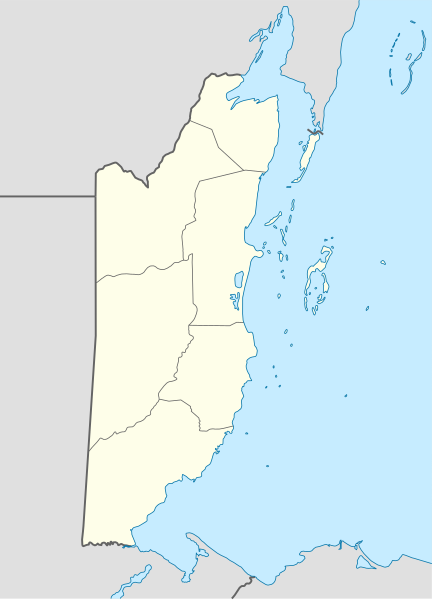
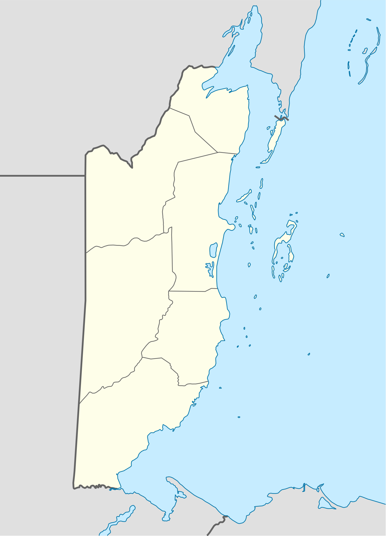
{{Information |Description= {{de|Positionskarte von Belize}} Quadratische Plattkarte, N-S-Streckung 105 %. Geographische Begrenzung der Karte: * N: 18.9° N * S: 15.6° N * W: 89.7° W * O: 87.2° W {{en|Location map of [[:en:Belize|Belize]
ไฟล, belize, location, ไฟล, ประว, ไฟล, หน, าท, ภาพน, การใช, ไฟล, วนกลาง, อม, ลเก, ยวก, บภาพขนาดของต, วอย, าง, ของไฟล, กเซล, ความละเอ, ยดอ, กเซล, กเซล, กเซล, กเซล, กเซล, กเซล, ภาพท, ความละเอ, ยดส, งกว, 8206, ไฟล, กเซล, ขนาดไฟล, โลไบต, ปภาพหร, อไฟล, เส, ยงน, นฉบ. ifl prawtiifl hnathimiphaphni karichiflswnklang khxmulekiywkbphaphkhnadkhxngtwxyang PNG nikhxngifl SVG ni 432 599 phikesl khwamlaexiydxun 173 240 phikesl 346 480 phikesl 554 768 phikesl 739 1 024 phikesl 1 478 2 048 phikesl 788 1 092 phikesl duphaphthimikhwamlaexiydsungkwa 8206 ifl SVG 788 1 092 phikesl khnadifl 106 kiolibt rupphaphhruxiflesiyngni tnchbbxyuthi khxmmxns raylaexiyddanlang epnkhxkhwamthiaesdngphlcak ifltnchbbinkhxmmxns khxmmxnsepnewbistinokhrngkarsahrbekbrwbrwmsuxesri thi khunsamarthchwyid khwamyx khaxthibayBelize location map svg Deutsch Positionskarte von Belize Quadratische Plattkarte N S Streckung 105 nbsp Geographische Begrenzung der Karte N 18 9 N S 15 6 N W 89 7 W O 87 2 W English Location map of Belize Equirectangular projection vertical stretching 105 nbsp Border coordinates18 9 89 7 87 2 15 6 nbsp khxmulephimetim This map is part of a series of location maps with unified standards SVG as file format standardised colours and name scheme The boundaries on these maps always show the de facto situation and do not imply any endorsement or acceptance In case of changes of the shown area the file is updated The old version will be uploaded as a new file and thus is still available wnthi 4 knyayn ph s 2551 aehlngthima Own work using United States National Imagery and Mapping Agency data phusrangsrrkh NordNordWest SVG nbsp genesisInfoField nbsp sxrsokhdkhxng SVG nitrwcsxbthuktxngaelw nbsp iflphaphkrafiksewketxrni srangkhunodyich nbsp Inkscape aephnthiSVGnithuksranghruxphthnakhuncak Kartenwerkstatt hxngptibtikaraephnthi khxngwikiphiediyphasaeyxrmn sungkhunsamarthesnxaephnthiephuxphthnaidechnediywkn azerbaycanca nbsp Deutsch Sie Form nbsp cestina nbsp Deutsch nbsp sicilianu nbsp italiano nbsp russkij nbsp romană nbsp portugues nbsp English nbsp magyar nbsp Nederlands nbsp slovenscina nbsp polski nbsp latviesu nbsp makedonski nbsp espanol nbsp فارسی nbsp francais nbsp suomi nbsp עברית nbsp Plattduutsch nbsp ქართული nbsp հայերեն nbsp ব ল nbsp ithy nbsp 日本語 nbsp 中文 nbsp 中文 简体 nbsp 中文 繁體 nbsp العربية nbsp karxnuyatichsiththi NordNordWest inthanaphuthuxlikhsiththikhxngphaphhruxsuxni xnuyatihichphaphhruxsuxniphayitenguxnikhtxipni xnuyatihkhdlxk aeckcayaela hruxddaeprexksarniphayitenguxnikhkhxngsyyaxnuyatexksaresrikhxngknu run 1 2 hruxrunid nbcaknithixxkodymulnithisxftaewresri odyimmiswnidhamaekikh immikhxkhwampkhnaaelapkhlng saenakhxngsyyaxnuyatrwmxyuinswnchux syyaxnuyatexksaresrikhxngknuhttp www gnu org copyleft fdl html GFDL GNU Free Documentation License true true iflnixyuphayitsyyaxnuyat khriexthifkhxmmxns aebbaesdngthima xnuyataebbediywkn 3 0 tnchbbkaraesdngthima NordNordWestkhunsamarth thicaaebngpn thicathasaena aeckcay aelasngngandngklawtxip thicaeriyberiyngihm thicaddaeplngngandngklaw phayitenguxnikhtxipni aesdngthima khuntxngihekiyrtiecakhxngnganxyangehmaasm odyephimlingkipyngsyyaxnuyat aelarabuhakmikarepliynaeplng khunxacthaechnniidinrupaebbidkidtamkhwr aettxngimichinlksnathiaenawaphuihxnuyatsnbsnunkhunhruxkarichngankhxngkhun xnuyataebbediywkn hakkhunddaeplng epliynrup hruxtxetimnganni khuntxngichsyyaxnuyataebbediywknhruxaebbthiehmuxnkbsyyaxnuyatthiichkbnganniethannhttps creativecommons org licenses by sa 3 0 CC BY SA 3 0 Creative Commons Attribution Share Alike 3 0 true true khunsamartheluxksyyaxnuyatdngklawtamtxngkarkhabrryayodyyxithyephimkhabrryaythrrthdediywephuxkhyaykhwamwaiflnimixairixethmthiaesdngxyuiniflniprakxbdwyphusrangbangkhathiimmiixethmwikisnethsyuxaraexl https commons wikimedia org wiki user NordNordWestchuxphuichwikimiediy NordNordWestchuxphusrangsrrkh NordNordWeststhanalikhsiththimilikhsiththisyyaxnuyatGNU Free Documentation License version 1 2 or later nbsp xngkvsCreative Commons Attribution ShareAlike 3 0 Unported nbsp xngkvsMIME type nbsp xngkvsimage svg xmlchecksum nbsp xngkvs9050029eb94214e98c8816ca7038f0d6ab343ebfwithikarkahnd SHA 1 nbsp xngkvsdata size nbsp xngkvs108 239 ibtkhwamsung1 092 phikeslkhwamkwang788 phikesl prawtiifl khlikwnthi ewlaephuxduiflthipraktinkhnann wnthi ewlarupyxkhnadphuichkhwamehn pccubn14 15 10 thnwakhm 2559788 1 092 106 kiolibt KaldariFixing Cayo District border per http www elections gov bz modules wfdownloads visit php cid 109 amp lid 213 02 37 5 knyayn 2551788 1 092 106 kiolibt NordNordWestsize correction 02 34 5 knyayn 2551630 874 106 kiolibt NordNordWest Information Description de Positionskarte von Belize Quadratische Plattkarte N S Streckung 105 Geographische Begrenzung der Karte N 18 9 N S 15 6 N W 89 7 W O 87 2 W en Location map of en Belize Belize hnathimiphaphni hnatxipni oyngmathiphaphni aemaebb Location map Belize mxdul Location map data Belize mxdul Location map data Belize doc karichiflswnklang wikixuntxipniichiflni karichbn af wikipedia org Sjabloon Liggingkaart Belize karichbn an wikipedia org Plantilla Mapa de localizacion Belize Belmopan karichbn ar wikipedia org قالب خريطة مواقع بليز karichbn ast wikipedia org Ciuda de Belize Belmopan Gran furacu azul Modulu Mapa de llocalizacion datos Belize Modulu Mapa de llocalizacion datos Belize usu Aeropuertu de Corozal Aeropuertu de Dangriga Aeropuertu de Placencia Aeropuertu de Punta Gorda Aeropuertu de San Pedro Pista d Aterrizaxe Hector Silva Puertu de Belize Puertu de Big Creek karichbn az wikipedia org Belmopan Sablon Yer xeritesi Beliz Serros karichbn ba wikipedia org Ҡalyp PozKarta Beliz karichbn be tarask wikipedia org Beliz gorad San Ignasiyo Oranzh Ўok San Pedra Beliz Karosal Dangryga Benke Vieha del Karmen Punta Gorda Shablyon Lyakalizacyjnaya mapa Belizu karichbn be wikipedia org Belmapan Shablon Na karce Beliz San Pedra Beliz Dangryga Vyalikaya blakitnaya dzira Beliz gorad Oryndzh Uolk Punta Gorda Karasal San Ignasia Beliz Benke V eha del Karmen karichbn bg wikipedia org Shablon PK Beliz karichbn bn wikipedia org ভ গ ল ক আয তন অন য য স র বভ ম র ষ ট র ও ন র ভরশ ল অঞ চলসম হ র ত ল ক মড উল অবস থ ন ম নচ ত র উপ ত ত ব ল জ মড উল অবস থ ন ম নচ ত র উপ ত ত ব ল জ নথ karichbn bs wikipedia org Belmopan Sablon Lokacijska karta Beliz karichbn ceb wikipedia org Plantilya Location map Belize Spanish Point Saddle Hill dukarichthwolkephimetimkhxngiflnikhxmulekiywkbphaph phaphnimikhxmulephimetim sungswnihymacakklxngdicitxlhruxsaeknenxrthisamarthekbkhxmuldngklawiwrwmkbphaphid thaphaphnithukprbprungaekikhhruxepliynaeplngcakedim khxmulbangxyangcayngkhngimepliynaeplngehmuxnphaphthithukprbprungaekikhnnkhwamkwang787 58276khwamsung1092 345 ekhathungcak https th wikipedia org wiki ifl Belize location map svg, wikipedia, วิกิ หนังสือ, หนังสือ, ห้องสมุด,