รูปภาพหรือไฟล์เสียงนี้ ต้นฉบับอยู่ที่ คอมมอนส์ รายละเอียดด้านล่าง เป็นข้อความที่แสดงผลจาก ไฟล์ต้นฉบับในคอมมอนส์ คอมมอนส์เป็นเว็บไซต์ในโครงการสำหรับเก็บรวบรวมสื่อเสรี ที่ คุณสามารถช่วยได้
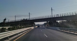
คำอธิบายBoten–Vientiane railway crossing Vientiane–Boten Expressway - Mapillary (vwog4i1S3AEbshtZp5Gi49).jpg Boten–Vientiane railway crossing Vientiane–Boten Expressway วันที่ 6 กุมภาพันธ์ พ.ศ. 2564 09:25:09.359Z แหล่งที่มา This file comes from Mapillary , a service for sharing geotagged photos. All photos are under a CC BY-SA 4.0 license meaning the individual photographer must be credited for each image.
vwog4i1S3AEbshtZp5Gi49
This tag does not indicate the copyright status of the attached work. A normal copyright tag is still required. See Commons:Licensing.
Deutsch | English | español | English | македонски | Nederlands | português | suomi | svenska | Tiếng Việt | 中文 | +/−
ผู้สร้างสรรค์ _khamla_phimmasone_US$ @ Mapillary.com การอนุญาต(การใช้ไฟล์นี้ใหม่)
ไฟล์นี้อยู่ภายใต้สัญญาอนุญาต ครีเอทีฟคอมมอนส์ แบบแสดงที่มา-อนุญาตแบบเดียวกัน 4.0 นานาชาติ
คุณสามารถ: ที่จะแบ่งปัน – ที่จะทำสำเนา แจกจ่าย และส่งงานดังกล่าวต่อไปที่จะเรียบเรียงใหม่ – ที่จะดัดแปลงงานดังกล่าว ภายใต้เงื่อนไขต่อไปนี้: แสดงที่มา – คุณต้องให้เกียรติเจ้าของงานอย่างเหมาะสม โดยเพิ่มลิงก์ไปยังสัญญาอนุญาต และระบุหากมีการเปลี่ยนแปลง คุณอาจทำเช่นนี้ได้ในรูปแบบใดก็ได้ตามควร แต่ต้องไม่ใช่ในลักษณะที่แนะว่าผู้ให้อนุญาตสนับสนุนคุณหรือการใช้งานของคุณอนุญาตแบบเดียวกัน – หากคุณดัดแปลง เปลี่ยนรูป หรือต่อเติมงานนี้ คุณต้องใช้สัญญาอนุญาตแบบเดียวกันหรือแบบที่เหมือนกับสัญญาอนุญาตที่ใช้กับงานนี้เท่านั้น https://creativecommons.org/licenses/by-sa/4.0 CC BY-SA 4.0 Creative Commons Attribution-Share Alike 4.0 true true
ตำแหน่งที่ตั้งกล้อง 18° 13′ 40.82″ เหนือ, 102° 28′ 56.2″ ตะวันออก ภาพนี้และภาพอื่น ๆ ณ สถานที่เดียวกันที่ OpenStreetMap 18.228005; 102.482279
ไทย เพิ่มคำบรรยายทรรทัดเดียวเพื่อขยายความว่าไฟล์นี้มีอะไร
ประวัติไฟล์ คลิกวันที่/เวลาเพื่อดูไฟล์ที่ปรากฏในขณะนั้น
วันที่/เวลา รูปย่อ ขนาด ผู้ใช้ ความเห็น ปัจจุบัน 21:41, 4 พฤษภาคม 2564 1,620 × 878 (174 กิโลไบต์) Pieceofmetalwork crop, reduced reflection 02:42, 3 พฤษภาคม 2564 2,048 × 967 (202 กิโลไบต์) Pieceofmetalwork Transferred from https://d1cuyjsrcm0gby.cloudfront.net/vwog4i1S3AEbshtZp5Gi49/thumb-2048.jpg
หน้าที่มีภาพนี้ หน้าต่อไปนี้ โยงมาที่ภาพนี้:
การใช้ไฟล์ส่วนกลาง วิกิอื่นต่อไปนี้ใช้ไฟล์นี้:
China-Laos-Eisenbahn Vientiane-Boten Expressway List of projects of the Belt and Road Initiative ภาพนี้มีข้อมูลเพิ่มเติม ซึ่งส่วนใหญ่มาจากกล้องดิจิตอลหรือสแกนเนอร์ที่สามารถเก็บข้อมูลดังกล่าวไว้รวมกับภาพได้ ถ้าภาพนี้ถูกปรับปรุงแก้ไขหรือเปลี่ยนแปลงจากเดิม ข้อมูลบางอย่างจะยังคงไม่เปลี่ยนแปลงเหมือนภาพที่ถูกปรับปรุงแก้ไขนั้น
ไฟล, boten, vientiane, railway, crossing, vientiane, boten, expressway, mapillary, vwog4i1s3aebshtzp5gi49, ไฟล, ประว, ไฟล, หน, าท, ภาพน, การใช, ไฟล, วนกลาง, อม, ลเก, ยวก, บภาพขนาดของต, วอย, างน, กเซล, ความละเอ, ยดอ, กเซล, กเซล, กเซล, กเซล, ภาพท, ความละเอ, ยดส,. ifl prawtiifl hnathimiphaphni karichiflswnklang khxmulekiywkbphaphkhnadkhxngtwxyangni 800 434 phikesl khwamlaexiydxun 320 173 phikesl 640 347 phikesl 1 024 555 phikesl 1 620 878 phikesl duphaphthimikhwamlaexiydsungkwa 8206 1 620 878 phikesl khnadifl 174 kiolibt chnidimm image jpeg rupphaphhruxiflesiyngni tnchbbxyuthi khxmmxns raylaexiyddanlang epnkhxkhwamthiaesdngphlcak ifltnchbbinkhxmmxns khxmmxnsepnewbistinokhrngkarsahrbekbrwbrwmsuxesri thi khunsamarthchwyid khaxthibayBoten Vientiane railway crossing Vientiane Boten Expressway Mapillary vwog4i1S3AEbshtZp5Gi49 jpg Boten Vientiane railway crossing Vientiane Boten Expressway wnthi 6 kumphaphnth ph s 2564 09 25 09 359Z aehlngthima This file comes from Mapillary a service for sharing geotagged photos All photos are under a CC BY SA 4 0 license meaning the individual photographer must be credited for each image vwog4i1S3AEbshtZp5Gi49 This tag does not indicate the copyright status of the attached work A normal copyright tag is still required See Commons Licensing Deutsch nbsp English nbsp espanol nbsp English nbsp makedonski nbsp Nederlands nbsp portugues nbsp suomi nbsp svenska nbsp Tiếng Việt nbsp 中文 nbsp phusrangsrrkh khamla phimmasone US Mapillary com karxnuyat karichiflniihm iflnixyuphayitsyyaxnuyat khriexthifkhxmmxns aebbaesdngthima xnuyataebbediywkn 4 0 nanachatikhunsamarth thicaaebngpn thicathasaena aeckcay aelasngngandngklawtxip thicaeriyberiyngihm thicaddaeplngngandngklaw phayitenguxnikhtxipni aesdngthima khuntxngihekiyrtiecakhxngnganxyangehmaasm odyephimlingkipyngsyyaxnuyat aelarabuhakmikarepliynaeplng khunxacthaechnniidinrupaebbidkidtamkhwr aettxngimichinlksnathiaenawaphuihxnuyatsnbsnunkhunhruxkarichngankhxngkhun xnuyataebbediywkn hakkhunddaeplng epliynrup hruxtxetimnganni khuntxngichsyyaxnuyataebbediywknhruxaebbthiehmuxnkbsyyaxnuyatthiichkbnganniethannhttps creativecommons org licenses by sa 4 0 CC BY SA 4 0 Creative Commons Attribution Share Alike 4 0 true true taaehnngthitngklxng18 nbsp 13 nbsp 40 82 nbsp ehnux 102 nbsp 28 nbsp 56 2 nbsp tawnxxk nbsp nbsp nbsp phaphniaelaphaphxun n sthanthiediywknthi OpenStreetMap18 228005 102 482279khabrryayodyyxithyephimkhabrryaythrrthdediywephuxkhyaykhwamwaiflnimixairixethmthiaesdngxyuiniflniprakxbdwysthanalikhsiththimilikhsiththisyyaxnuyatCreative Commons Attribution ShareAlike 4 0 International nbsp xngkvscoordinates of the point of view nbsp xngkvs18 13 40 8198 N 102 28 56 2030 Eheading nbsp xngkvs 203 95042419433594 xngsa prawtiifl khlikwnthi ewlaephuxduiflthipraktinkhnann wnthi ewlarupyxkhnadphuichkhwamehn pccubn21 41 4 phvsphakhm 25641 620 878 174 kiolibt Pieceofmetalworkcrop reduced reflection 02 42 3 phvsphakhm 25642 048 967 202 kiolibt PieceofmetalworkTransferred from https d1cuyjsrcm0gby cloudfront net vwog4i1S3AEbshtZp5Gi49 thumb 2048 jpg hnathimiphaphni hnatxipni oyngmathiphaphni karkhnsnginpraethslaw praethslaw karichiflswnklang wikixuntxipniichiflni karichbn de wikipedia org Laos China Laos Eisenbahn Vientiane Boten Expressway karichbn en wikipedia org Transport in Laos List of projects of the Belt and Road Initiative karichbn ja wikipedia org ヴィエンチャン ボーテン高速道路 karichbn km wikipedia org ក រដ កជញ ជ នន ប រទ សឡ វ karichbn lo wikipedia org ປະເທດລາວkhxmulekiywkbphaph phaphnimikhxmulephimetim sungswnihymacakklxngdicitxlhruxsaeknenxrthisamarthekbkhxmuldngklawiwrwmkbphaphid thaphaphnithukprbprungaekikhhruxepliynaeplngcakedim khxmulbangxyangcayngkhngimepliynaeplngehmuxnphaphthithukprbprungaekikhnnkhwamkwang2 048 phikeslkhwamsung967 phikeslbittxkhxmophennt8 8 8phikeslkhxmophsichnRGBkarcdwangphaphpkticanwnkhxmophennt3khwamlaexiydaenwnxn72 dpikhwamlaexiydaenwtng72 dpisxftaewrthiichAdobe Photoshop 22 3 Windows aekikhphaphlasud16 40 4 phvsphakhm 2564runexksif Exif 2 31sepssiimidprbethiybID echphaakhxngexksartnchbb73476A3CFFA18F53D85446C62FE6329Dewlathiaeplngepndicithl18 37 4 phvsphakhm 2564wnthiaekikhkhxmulemtalasud18 40 4 phvsphakhm 2564 ekhathungcak https th wikipedia org wiki ifl Boten Vientiane railway crossing Vientiane Boten Expressway Mapillary vwog4i1S3AEbshtZp5Gi49 jpg, wikipedia, วิกิ หนังสือ, หนังสือ, ห้องสมุด,
บทความ , อ่าน, ดาวน์โหลด, ฟรี, ดาวน์โหลดฟรี, mp3, วิดีโอ, mp4, 3gp, jpg, jpeg, gif, png, รูปภาพ, เพลง, เพลง, หนัง, หนังสือ, เกม, เกม