รูปภาพหรือไฟล์เสียงนี้ ต้นฉบับอยู่ที่ คอมมอนส์ รายละเอียดด้านล่าง เป็นข้อความที่แสดงผลจาก ไฟล์ต้นฉบับในคอมมอนส์ คอมมอนส์เป็นเว็บไซต์ในโครงการสำหรับเก็บรวบรวมสื่อเสรี ที่ คุณสามารถช่วยได้
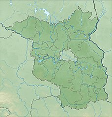
คำอธิบายBrandenburg relief location map.jpg Deutsch:
Quadratische Plattkarte, N-S-Streckung 160 %. Geographische Begrenzung der Karte:
N: 53.7° N S: 51.2° N W: 11.1° O O: 14.9° O English:
Equirectangular projection, N/S stretching 160 %. Geographic limits of the map:
N: 53.7° N S: 51.2° N W: 11.1° E E: 14.9° E วันที่ ตุลาคม พ.ศ. 2552 แหล่งที่มา งานของตัว
File:Brandenburg_location_map.svg SRTM3 ผู้สร้างสรรค์ Grundkarte NordNordWest, Relief Alexrk2 เวอร์ชันอื่น Equivalent administrative map
แผนที่นี้ถูกสร้างหรือพัฒนาขึ้นจาก Kartenwerkstatt (ห้องปฏิบัติการแผนที่) ของวิกิพีเดียภาษาเยอรมัน ซึ่งคุณสามารถเสนอแผนที่เพื่อพัฒนาได้เช่นเดียวกัน
azərbaycanca ∙ Deutsch (Sie-Form) ∙ čeština ∙ Deutsch ∙ sicilianu ∙ italiano ∙ русский ∙ română ∙ português ∙ English ∙ magyar ∙ Nederlands ∙ slovenščina ∙ polski ∙ latviešu ∙ македонски ∙ español ∙ فارسی ∙ français ∙ suomi ∙ עברית ∙ Plattdüütsch ∙ ქართული ∙ հայերեն ∙ বাংলা ∙ ไทย ∙ 日本語 ∙ 中文 ∙ 中文(简体) ∙ 中文(繁體) ∙ العربية ∙ +/−
การอนุญาตใช้สิทธิ ข้าพเจ้า ในฐานะผู้ถือลิขสิทธิ์ของภาพหรือสื่อนี้ อนุญาตให้ใช้ภาพหรือสื่อนี้ภายใต้เงื่อนไขต่อไปนี้
ไฟล์นี้อยู่ภายใต้สัญญาอนุญาต ครีเอทีฟคอมมอนส์ แบบแสดงที่มา-อนุญาตแบบเดียวกัน 3.0 ต้นฉบับ
คุณสามารถ: ที่จะแบ่งปัน – ที่จะทำสำเนา แจกจ่าย และส่งงานดังกล่าวต่อไปที่จะเรียบเรียงใหม่ – ที่จะดัดแปลงงานดังกล่าว ภายใต้เงื่อนไขต่อไปนี้: แสดงที่มา – คุณต้องให้เกียรติเจ้าของงานอย่างเหมาะสม โดยเพิ่มลิงก์ไปยังสัญญาอนุญาต และระบุหากมีการเปลี่ยนแปลง คุณอาจทำเช่นนี้ได้ในรูปแบบใดก็ได้ตามควร แต่ต้องไม่ใช่ในลักษณะที่แนะว่าผู้ให้อนุญาตสนับสนุนคุณหรือการใช้งานของคุณอนุญาตแบบเดียวกัน – หากคุณดัดแปลง เปลี่ยนรูป หรือต่อเติมงานนี้ คุณต้องใช้สัญญาอนุญาตแบบเดียวกันหรือแบบที่เหมือนกับสัญญาอนุญาตที่ใช้กับงานนี้เท่านั้น https://creativecommons.org/licenses/by-sa/3.0 CC BY-SA 3.0 Creative Commons Attribution-Share Alike 3.0 true true ไทย เพิ่มคำบรรยายทรรทัดเดียวเพื่อขยายความว่าไฟล์นี้มีอะไร
ประวัติไฟล์ คลิกวันที่/เวลาเพื่อดูไฟล์ที่ปรากฏในขณะนั้น
วันที่/เวลา รูปย่อ ขนาด ผู้ใช้ ความเห็น ปัจจุบัน 01:13, 15 ตุลาคม 2552 1,578 × 1,661 (794 กิโลไบต์) Alexrk2 {{Information |Description= {{de|Physische Positionskarte von Brandenburg, Deutschland}} Quadratische Plattkarte, N-S-Streckung 160 %. Geographische Begrenzung der Karte: * N: 53.7° N * S: 51.2° N * W: 11.1° O *
หน้าที่มีภาพนี้ หน้าต่อไปนี้ โยงมาที่ภาพนี้:
การใช้ไฟล์ส่วนกลาง วิกิอื่นต่อไปนี้ใช้ไฟล์นี้:
Vorlog:Positionskarte Deutschland Brandenburg Котбус Франкфурт на Одер Нойрупин Цойтен Вернойхен Ютербог Айзенхютенщат Нойхарденберг Шаблон:ПК Германия Бранденбург Бабелсберг Зоневалде Барут/Марк Визенбург Ланц Перлеберг মডিউল:অবস্থান মানচিত্র/উপাত্ত/জার্মানি ব্রান্ডেনবুর্গ/নথি Talsperre Spremberg Burg Ziesar Zauche Burg Blankenburg Griebnitzsee Mittelturm (Königs Wusterhausen) Hagelberg Scharmützelsee Kleiner Ravensberg Pfingstberg (Potsdam) Werbellinsee Burg Rabenstein (Fläming) Schermützelsee Klostersee (Lehnin) Fahrlander See Heiliger See (Potsdam) Kutschenberg Heidehöhe Sacrower See Weißer See (Potsdam) Blankensee (See bei Trebbin) Bischofsburg Wittstock Kmehlener Berge Senftenberger See ดูการใช้ทั่วโลกเพิ่มเติม ของไฟล์นี้
ภาพนี้มีข้อมูลเพิ่มเติม ซึ่งส่วนใหญ่มาจากกล้องดิจิตอลหรือสแกนเนอร์ที่สามารถเก็บข้อมูลดังกล่าวไว้รวมกับภาพได้ ถ้าภาพนี้ถูกปรับปรุงแก้ไขหรือเปลี่ยนแปลงจากเดิม ข้อมูลบางอย่างจะยังคงไม่เปลี่ยนแปลงเหมือนภาพที่ถูกปรับปรุงแก้ไขนั้น
ไฟล, brandenburg, relief, location, ไฟล, ประว, ไฟล, หน, าท, ภาพน, การใช, ไฟล, วนกลาง, อม, ลเก, ยวก, บภาพขนาดของต, วอย, างน, กเซล, ความละเอ, ยดอ, กเซล, กเซล, กเซล, กเซล, กเซล, ภาพท, ความละเอ, ยดส, งกว, 8206, กเซล, ขนาดไฟล, โลไบต, ชน, ดไมม, image, jpeg, ปภาพหร, . ifl prawtiifl hnathimiphaphni karichiflswnklang khxmulekiywkbphaphkhnadkhxngtwxyangni 570 600 phikesl khwamlaexiydxun 228 240 phikesl 456 480 phikesl 730 768 phikesl 973 1 024 phikesl 1 578 1 661 phikesl duphaphthimikhwamlaexiydsungkwa 8206 1 578 1 661 phikesl khnadifl 794 kiolibt chnidimm image jpeg rupphaphhruxiflesiyngni tnchbbxyuthi khxmmxns raylaexiyddanlang epnkhxkhwamthiaesdngphlcak ifltnchbbinkhxmmxns khxmmxnsepnewbistinokhrngkarsahrbekbrwbrwmsuxesri thi khunsamarthchwyid khaxthibayBrandenburg relief location map jpg Deutsch Physische Positionskarte von Brandenburg Deutschland Quadratische Plattkarte N S Streckung 160 Geographische Begrenzung der Karte N 53 7 N S 51 2 N W 11 1 O O 14 9 OEnglish Physical Location map of Brandenburg Germany Equirectangular projection N S stretching 160 Geographic limits of the map N 53 7 N S 51 2 N W 11 1 E E 14 9 Ewnthi tulakhm ph s 2552aehlngthima ngankhxngtw File Brandenburg location map svg SRTM3phusrangsrrkh Grundkarte NordNordWest Relief Alexrk2ewxrchnxun Equivalent administrative map aephnthinithuksranghruxphthnakhuncak Kartenwerkstatt hxngptibtikaraephnthi khxngwikiphiediyphasaeyxrmn sungkhunsamarthesnxaephnthiephuxphthnaidechnediywkn azerbaycanca Deutsch Sie Form cestina Deutsch sicilianu italiano russkij romană portugues English magyar Nederlands slovenscina polski latviesu makedonski espanol فارسی francais suomi עברית Plattduutsch ქართული հայերեն ব ল ithy 日本語 中文 中文 简体 中文 繁體 العربية karxnuyatichsiththi khapheca inthanaphuthuxlikhsiththikhxngphaphhruxsuxni xnuyatihichphaphhruxsuxniphayitenguxnikhtxipniiflnixyuphayitsyyaxnuyat khriexthifkhxmmxns aebbaesdngthima xnuyataebbediywkn 3 0 tnchbbkhunsamarth thicaaebngpn thicathasaena aeckcay aelasngngandngklawtxip thicaeriyberiyngihm thicaddaeplngngandngklaw phayitenguxnikhtxipni aesdngthima khuntxngihekiyrtiecakhxngnganxyangehmaasm odyephimlingkipyngsyyaxnuyat aelarabuhakmikarepliynaeplng khunxacthaechnniidinrupaebbidkidtamkhwr aettxngimichinlksnathiaenawaphuihxnuyatsnbsnunkhunhruxkarichngankhxngkhun xnuyataebbediywkn hakkhunddaeplng epliynrup hruxtxetimnganni khuntxngichsyyaxnuyataebbediywknhruxaebbthiehmuxnkbsyyaxnuyatthiichkbnganniethannhttps creativecommons org licenses by sa 3 0 CC BY SA 3 0 Creative Commons Attribution Share Alike 3 0 true truekhabrryayodyyxithyephimkhabrryaythrrthdediywephuxkhyaykhwamwaiflnimixairixethmthiaesdngxyuiniflniprakxbdwyphusrangbangkhathiimmiixethmwikisnethshnathikhxngwtthuphayitpraphcnni changphaphchuxphusrangsrrkh NordNordWestchuxphuichwikimiediy NordNordWestyuxaraexl http commons wikimedia org wiki User NordNordWeststhanalikhsiththimilikhsiththisyyaxnuyatCreative Commons Attribution ShareAlike 3 0 Unported xngkvswnthisrang wnkxtngtulakhm 2009thimakhxngiflkarsrangdngedimodyphuxpohld prawtiifl khlikwnthi ewlaephuxduiflthipraktinkhnann wnthi ewlarupyxkhnadphuichkhwamehn pccubn01 13 15 tulakhm 25521 578 1 661 794 kiolibt Alexrk2 Information Description de Physische Positionskarte von Brandenburg Deutschland Quadratische Plattkarte N S Streckung 160 Geographische Begrenzung der Karte N 53 7 N S 51 2 N W 11 1 O hnathimiphaphni hnatxipni oyngmathiphaphni mxdul Location map data Germany Brandenburg mxdul Location map data Germany Brandenburg doc karichiflswnklang wikixuntxipniichiflni karichbn als wikipedia org Vorlage Positionskarte Deutschland Brandenburg karichbn ar wikipedia org قالب Location map Germany Brandenburg karichbn bar wikipedia org Kanincheninsl Vorlog Positionskarte Deutschland Brandenburg karichbn ba wikipedia org Ҡalyp PozKarta Germaniya Brandenburg karichbn bg wikipedia org Potsdam Kotbus Frankfurt na Oder Nojrupin Cojten Vernojhen Yuterbog Ajzenhyutenshat Nojhardenberg Shablon PK Germaniya Brandenburg Babelsberg Zonevalde Barut Mark Vizenburg Lanc Perleberg karichbn bn wikipedia org মড উল অবস থ ন ম নচ ত র উপ ত ত জ র ম ন ব র ন ড নব র গ মড উল অবস থ ন ম নচ ত র উপ ত ত জ র ম ন ব র ন ড নব র গ নথ karichbn ceb wikipedia org Plantilya Location map Germany Brandenburg karichbn cs wikipedia org Sablona LocMap Nemecko Braniborsko karichbn de wikipedia org Benutzer Diskussion Ahoerstemeier Talsperre Spremberg Burg Ziesar Zauche Burg Blankenburg Griebnitzsee Mittelturm Konigs Wusterhausen Hagelberg Scharmutzelsee Kleiner Ravensberg Pfingstberg Potsdam Werbellinsee Burg Rabenstein Flaming Schermutzelsee Klostersee Lehnin Fahrlander See Heiliger See Potsdam Kutschenberg Heidehohe Sacrower See Weisser See Potsdam Blankensee See bei Trebbin Bischofsburg Wittstock Kmehlener Berge Senftenberger See dukarichthwolkephimetimkhxngiflnikhxmulekiywkbphaph phaphnimikhxmulephimetim sungswnihymacakklxngdicitxlhruxsaeknenxrthisamarthekbkhxmuldngklawiwrwmkbphaphid thaphaphnithukprbprungaekikhhruxepliynaeplngcakedim khxmulbangxyangcayngkhngimepliynaeplngehmuxnphaphthithukprbprungaekikhnn error0 ekhathungcak https th wikipedia org wiki ifl Brandenburg relief location map jpg, wikipedia, วิกิ หนังสือ, หนังสือ, ห้องสมุด,
บทความ , อ่าน, ดาวน์โหลด, ฟรี, ดาวน์โหลดฟรี, mp3, วิดีโอ, mp4, 3gp, jpg, jpeg, gif, png, รูปภาพ, เพลง, เพลง, หนัง, หนังสือ, เกม, เกม