รูปภาพหรือไฟล์เสียงนี้ ต้นฉบับอยู่ที่ คอมมอนส์ รายละเอียดด้านล่าง เป็นข้อความที่แสดงผลจาก ไฟล์ต้นฉบับในคอมมอนส์ คอมมอนส์เป็นเว็บไซต์ในโครงการสำหรับเก็บรวบรวมสื่อเสรี ที่ คุณสามารถช่วยได้
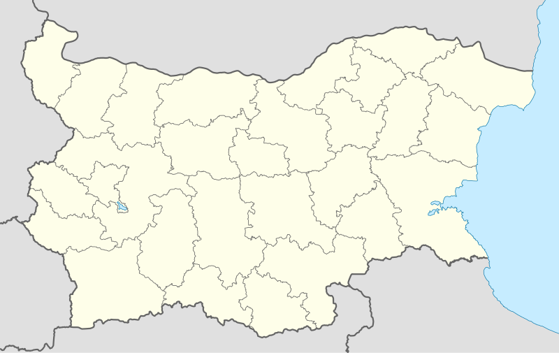
ความย่อ คำอธิบายBulgaria location map.svg Deutsch:
Quadratische Plattkarte, N-S-Streckung 130 %. Geographische Begrenzung der Karte:
N: 44.4° N S: 41.1° N W: 22.1° O O: 28.9° O English:
Equirectangular projection, N/S stretching 130 %. Geographic limits of the map:
N: 44.4° N S: 41.1° N W: 22.1° E E: 28.9° E วันที่ 05-08-2008 แหล่งที่มา own work, using
United States National Imagery and Mapping Agency data file:Bulgaria’s Planning Regions (2009).svg by Пакко ผู้สร้างสรรค์ NordNordWest เวอร์ชันอื่น ไฟล์อื่นที่ใช้ไฟล์นี้:
Belene Municipality Within Bulgaria.png DolnaMitropoliya Municipality Within Bulgaria.png Elena Municipality Within Bulgaria.png Gulyantsi Municipality Within Bulgaria.png Levski Municipality Within Bulgaria.png Pleven Municipality Within Bulgaria.png Pordim Municipality Within Bulgaria.png Relief Map of Bulgaria.jpg
แผนที่นี้ถูกสร้างหรือพัฒนาขึ้นจาก Kartenwerkstatt (ห้องปฏิบัติการแผนที่) ของวิกิพีเดียภาษาเยอรมัน ซึ่งคุณสามารถเสนอแผนที่เพื่อพัฒนาได้เช่นเดียวกัน
azərbaycanca ∙ Deutsch (Sie-Form) ∙ čeština ∙ Deutsch ∙ sicilianu ∙ italiano ∙ русский ∙ română ∙ português ∙ English ∙ magyar ∙ Nederlands ∙ slovenščina ∙ polski ∙ latviešu ∙ македонски ∙ español ∙ فارسی ∙ français ∙ suomi ∙ עברית ∙ Plattdüütsch ∙ ქართული ∙ հայերեն ∙ বাংলা ∙ ไทย ∙ 日本語 ∙ 中文 ∙ 中文(简体) ∙ 中文(繁體) ∙ العربية ∙ +/−
การอนุญาตใช้สิทธิ ข้าพเจ้า ในฐานะผู้ถือลิขสิทธิ์ของภาพหรือสื่อนี้ อนุญาตให้ใช้ภาพหรือสื่อนี้ภายใต้เงื่อนไขต่อไปนี้
อนุญาตให้คัดลอก แจกจ่ายและ/หรือดัดแปรเอกสารนี้ภายใต้เงื่อนไขของสัญญาอนุญาตเอกสารเสรีของกนู รุ่น 1.2 หรือรุ่นใด ๆ นับจากนี้ที่ออกโดยมูลนิธิซอฟต์แวร์เสรี โดยไม่มีส่วนใดห้ามแก้ไข ไม่มีข้อความปกหน้าและปกหลัง สำเนาของสัญญาอนุญาตรวมอยู่ในส่วนชื่อ สัญญาอนุญาตเอกสารเสรีของกนู http://www.gnu.org/copyleft/fdl.html GFDL GNU Free Documentation License true true
ไฟล์นี้อยู่ภายใต้สัญญาอนุญาต ครีเอทีฟคอมมอนส์ แบบแสดงที่มา-อนุญาตแบบเดียวกัน 3.0 ต้นฉบับ
คุณสามารถ: ที่จะแบ่งปัน – ที่จะทำสำเนา แจกจ่าย และส่งงานดังกล่าวต่อไปที่จะเรียบเรียงใหม่ – ที่จะดัดแปลงงานดังกล่าว ภายใต้เงื่อนไขต่อไปนี้: แสดงที่มา – คุณต้องให้เกียรติเจ้าของงานอย่างเหมาะสม โดยเพิ่มลิงก์ไปยังสัญญาอนุญาต และระบุหากมีการเปลี่ยนแปลง คุณอาจทำเช่นนี้ได้ในรูปแบบใดก็ได้ตามควร แต่ต้องไม่ใช่ในลักษณะที่แนะว่าผู้ให้อนุญาตสนับสนุนคุณหรือการใช้งานของคุณอนุญาตแบบเดียวกัน – หากคุณดัดแปลง เปลี่ยนรูป หรือต่อเติมงานนี้ คุณต้องใช้สัญญาอนุญาตแบบเดียวกันหรือแบบที่เหมือนกับสัญญาอนุญาตที่ใช้กับงานนี้เท่านั้น https://creativecommons.org/licenses/by-sa/3.0 CC BY-SA 3.0 Creative Commons Attribution-Share Alike 3.0 true true คุณสามารถเลือกสัญญาอนุญาตดังกล่าวตามต้องการ
ไทย เพิ่มคำบรรยายทรรทัดเดียวเพื่อขยายความว่าไฟล์นี้มีอะไร
อังกฤษ Province map of the Republic of Bulgaria
ประวัติไฟล์ คลิกวันที่/เวลาเพื่อดูไฟล์ที่ปรากฏในขณะนั้น
วันที่/เวลา รูปย่อ ขนาด ผู้ใช้ ความเห็น ปัจจุบัน 01:28, 7 ตุลาคม 2553 1,642 × 1,036 (275 กิโลไบต์) NordNordWest upd 01:23, 13 สิงหาคม 2552 1,536 × 970 (204 กิโลไบต์) Пакко fixed Iskar Lake 01:12, 4 สิงหาคม 2552 1,534 × 967 (207 กิโลไบต์) Пакко fixed some borders according to current administrative division 01:52, 26 สิงหาคม 2551 1,645 × 1,038 (297 กิโลไบต์) NordNordWest size correction 19:25, 12 สิงหาคม 2551 548 × 346 (291 กิโลไบต์) NordNordWest corrected 03:30, 6 สิงหาคม 2551 548 × 346 (289 กิโลไบต์) NordNordWest {{Information |Description= {{de|Positionskarte von Bulgarien}} Quadratische Plattkarte, N-S-Streckung 130 %. Geographische Begrenzung der Karte: * N: 44.4° N * S: 41.1° N * W: 22.1° O * O: 28.9° O {{en|Location map of [[:en:Bulgaria
หน้าที่มีภาพนี้ หน้าต่อไปนี้ โยงมาที่ภาพนี้:
การใช้ไฟล์ส่วนกลาง วิกิอื่นต่อไปนี้ใช้ไฟล์นี้:
Rilaklooster Sjabloon:Liggingkaart Bulgarye Vorlage:Positionskarte Bulgarien መለጠፊያ:Location map ቡልጋሪያ Silistra Blagoevgrad Burgas Plovdiv Varna Veliko Tarnovo Plantilla:Mapa de localización Bulgaria تفجير حافلة بورغاس 2012 قالب:خريطة مواقع بلغاريا مطار صوفيا دير ريلا قائمة مواقع التراث العالمي في بلغاريا ميلنيك فيليكي بريسلاف هاسكوفو كارجلي كيوستينديل لوفتش غوتسه دلتشو رازلوغ ساندانسكي سيميتلي معركة كارجلي جائحة فيروس كورونا في بلغاريا Sofía Varna Plovdiv Veliko Tarnovo Stara Zagora Pleven Vidin Asenovgrad Montes Rila Sredna Gora Ruse Catedral d'Alexandre Nevski de Sofía Módulu:Minimapa/data/Bulgaria Aeropuertu de Burgas Aeropuertu de Plovdiv ดูการใช้ทั่วโลกเพิ่มเติม ของไฟล์นี้
ภาพนี้มีข้อมูลเพิ่มเติม ซึ่งส่วนใหญ่มาจากกล้องดิจิตอลหรือสแกนเนอร์ที่สามารถเก็บข้อมูลดังกล่าวไว้รวมกับภาพได้ ถ้าภาพนี้ถูกปรับปรุงแก้ไขหรือเปลี่ยนแปลงจากเดิม ข้อมูลบางอย่างจะยังคงไม่เปลี่ยนแปลงเหมือนภาพที่ถูกปรับปรุงแก้ไขนั้น
ไฟล, bulgaria, location, ไฟล, ประว, ไฟล, หน, าท, ภาพน, การใช, ไฟล, วนกลาง, อม, ลเก, ยวก, บภาพขนาดของต, วอย, าง, ของไฟล, กเซล, ความละเอ, ยดอ, กเซล, กเซล, กเซล, กเซล, กเซล, กเซล, ภาพท, ความละเอ, ยดส, งกว, 8206, ไฟล, กเซล, ขนาดไฟล, โลไบต, ปภาพหร, อไฟล, เส, ยงน, น. ifl prawtiifl hnathimiphaphni karichiflswnklang khxmulekiywkbphaphkhnadkhxngtwxyang PNG nikhxngifl SVG ni 800 505 phikesl khwamlaexiydxun 320 202 phikesl 640 404 phikesl 1 024 646 phikesl 1 280 808 phikesl 2 560 1 615 phikesl 1 642 1 036 phikesl duphaphthimikhwamlaexiydsungkwa 8206 ifl SVG 1 642 1 036 phikesl khnadifl 275 kiolibt rupphaphhruxiflesiyngni tnchbbxyuthi khxmmxns raylaexiyddanlang epnkhxkhwamthiaesdngphlcak ifltnchbbinkhxmmxns khxmmxnsepnewbistinokhrngkarsahrbekbrwbrwmsuxesri thi khunsamarthchwyid khwamyx khaxthibayBulgaria location map svg Deutsch Positionskarte von Bulgarien Quadratische Plattkarte N S Streckung 130 nbsp Geographische Begrenzung der Karte N 44 4 N S 41 1 N W 22 1 O O 28 9 O English Location map of Bulgaria Equirectangular projection N S stretching 130 nbsp Geographic limits of the map N 44 4 N S 41 1 N W 22 1 E E 28 9 E wnthi 05 08 2008 aehlngthima own work using United States National Imagery and Mapping Agency data file Bulgaria s Planning Regions 2009 svg by Pakko phusrangsrrkh NordNordWest ewxrchnxun iflxunthiichiflni Belene Municipality Within Bulgaria png DolnaMitropoliya Municipality Within Bulgaria png Elena Municipality Within Bulgaria png Gulyantsi Municipality Within Bulgaria png Levski Municipality Within Bulgaria png Pleven Municipality Within Bulgaria png Pordim Municipality Within Bulgaria png Relief Map of Bulgaria jpg aephnthinithuksranghruxphthnakhuncak Kartenwerkstatt hxngptibtikaraephnthi khxngwikiphiediyphasaeyxrmn sungkhunsamarthesnxaephnthiephuxphthnaidechnediywkn azerbaycanca nbsp Deutsch Sie Form nbsp cestina nbsp Deutsch nbsp sicilianu nbsp italiano nbsp russkij nbsp romană nbsp portugues nbsp English nbsp magyar nbsp Nederlands nbsp slovenscina nbsp polski nbsp latviesu nbsp makedonski nbsp espanol nbsp فارسی nbsp francais nbsp suomi nbsp עברית nbsp Plattduutsch nbsp ქართული nbsp հայերեն nbsp ব ল nbsp ithy nbsp 日本語 nbsp 中文 nbsp 中文 简体 nbsp 中文 繁體 nbsp العربية nbsp karxnuyatichsiththi khapheca inthanaphuthuxlikhsiththikhxngphaphhruxsuxni xnuyatihichphaphhruxsuxniphayitenguxnikhtxipni xnuyatihkhdlxk aeckcayaela hruxddaeprexksarniphayitenguxnikhkhxngsyyaxnuyatexksaresrikhxngknu run 1 2 hruxrunid nbcaknithixxkodymulnithisxftaewresri odyimmiswnidhamaekikh immikhxkhwampkhnaaelapkhlng saenakhxngsyyaxnuyatrwmxyuinswnchux syyaxnuyatexksaresrikhxngknuhttp www gnu org copyleft fdl html GFDL GNU Free Documentation License true trueiflnixyuphayitsyyaxnuyat khriexthifkhxmmxns aebbaesdngthima xnuyataebbediywkn 3 0 tnchbbkhunsamarth thicaaebngpn thicathasaena aeckcay aelasngngandngklawtxip thicaeriyberiyngihm thicaddaeplngngandngklaw phayitenguxnikhtxipni aesdngthima khuntxngihekiyrtiecakhxngnganxyangehmaasm odyephimlingkipyngsyyaxnuyat aelarabuhakmikarepliynaeplng khunxacthaechnniidinrupaebbidkidtamkhwr aettxngimichinlksnathiaenawaphuihxnuyatsnbsnunkhunhruxkarichngankhxngkhun xnuyataebbediywkn hakkhunddaeplng epliynrup hruxtxetimnganni khuntxngichsyyaxnuyataebbediywknhruxaebbthiehmuxnkbsyyaxnuyatthiichkbnganniethannhttps creativecommons org licenses by sa 3 0 CC BY SA 3 0 Creative Commons Attribution Share Alike 3 0 true truekhunsamartheluxksyyaxnuyatdngklawtamtxngkarkhabrryayodyyxithyephimkhabrryaythrrthdediywephuxkhyaykhwamwaiflnimixairxngkvsProvince map of the Republic of BulgariarsesiyKarta Bolgariiixethmthiaesdngxyuiniflniprakxbdwyphusrangbangkhathiimmiixethmwikisnethsyuxaraexl https commons wikimedia org wiki user NordNordWestchuxphuichwikimiediy NordNordWestchuxphusrangsrrkh NordNordWeststhanalikhsiththimilikhsiththisyyaxnuyatGNU Free Documentation License version 1 2 or lateral nbsp xngkvsCreative Commons Attribution ShareAlike 3 0 Unported nbsp xngkvsMIME type nbsp xngkvsimage svg xml prawtiifl khlikwnthi ewlaephuxduiflthipraktinkhnann wnthi ewlarupyxkhnadphuichkhwamehn pccubn01 28 7 tulakhm 25531 642 1 036 275 kiolibt NordNordWestupd 01 23 13 singhakhm 25521 536 970 204 kiolibt Pakkofixed Iskar Lake 01 12 4 singhakhm 25521 534 967 207 kiolibt Pakkofixed some borders according to current administrative division 01 52 26 singhakhm 25511 645 1 038 297 kiolibt NordNordWestsize correction 19 25 12 singhakhm 2551548 346 291 kiolibt NordNordWestcorrected 03 30 6 singhakhm 2551548 346 289 kiolibt NordNordWest Information Description de Positionskarte von Bulgarien Quadratische Plattkarte N S Streckung 130 Geographische Begrenzung der Karte N 44 4 N S 41 1 N W 22 1 O O 28 9 O en Location map of en Bulgaria hnathimiphaphni hnatxipni oyngmathiphaphni karwingkhbephlingoxlimpikvdurxn 1936 silistra dxbrich thxrkxwichet nikxpxl praethsblaekeriy blakxaexfkrt bxsaenk burkas plxfdif pxmxriaex pasarcik raychuxaehlngmrdkolkinpraethsblaekeriy rues lxaewch wxlelybxlchaychingaechmpolk 2018 wxlelybxlhyingchingaechmpyuorp 2021 warna widin somlyn xasnwiharxelksanedxr enfski osefiy ekrin cnghwdstarasakxra ebelen eprnik efistoprefschnnlfutbxllik blaekeriy aewlikiaeprslf aewlioketxronow aemaebb Location map Bulgaria mxdul Location map data Bulgaria mxdul Location map data Bulgaria doc karichiflswnklang wikixuntxipniichiflni karichbn af wikipedia org Sofia Rilaklooster Sjabloon Liggingkaart Bulgarye karichbn als wikipedia org Sofia Vorlage Positionskarte Bulgarien karichbn am wikipedia org ነሰብር መለጠፊያ Location map ቡልጋሪያ karichbn an wikipedia org Sofiya Silistra Blagoevgrad Burgas Plovdiv Varna Veliko Tarnovo Plantilla Mapa de localizacion Bulgaria karichbn ar wikipedia org فارنا تفجير حافلة بورغاس 2012 قالب خريطة مواقع بلغاريا مطار صوفيا دير ريلا قائمة مواقع التراث العالمي في بلغاريا ميلنيك فيليكي بريسلاف هاسكوفو كارجلي كيوستينديل لوفتش غوتسه دلتشو رازلوغ ساندانسكي سيميتلي معركة كارجلي جائحة فيروس كورونا في بلغاريا karichbn arz wikipedia org قالب Location map Bulgaria karichbn ast wikipedia org Burgas Sofia Varna Plovdiv Veliko Tarnovo Stara Zagora Pleven Vidin Asenovgrad Montes Rila Sredna Gora Ruse Catedral d Alexandre Nevski de Sofia Modulu Minimapa data Bulgaria Aeropuertu de Burgas Aeropuertu de Plovdiv dukarichthwolkephimetimkhxngiflnikhxmulekiywkbphaph phaphnimikhxmulephimetim sungswnihymacakklxngdicitxlhruxsaeknenxrthisamarthekbkhxmuldngklawiwrwmkbphaphid thaphaphnithukprbprungaekikhhruxepliynaeplngcakedim khxmulbangxyangcayngkhngimepliynaeplngehmuxnphaphthithukprbprungaekikhnnkhwamkwang1642 321pxkhwamsung1036 14px ekhathungcak https th wikipedia org wiki ifl Bulgaria location map svg, wikipedia, วิกิ หนังสือ, หนังสือ, ห้องสมุด,
บทความ , อ่าน, ดาวน์โหลด, ฟรี, ดาวน์โหลดฟรี, mp3, วิดีโอ, mp4, 3gp, jpg, jpeg, gif, png, รูปภาพ, เพลง, เพลง, หนัง, หนังสือ, เกม, เกม