| | รูปภาพหรือไฟล์เสียงนี้ ต้นฉบับอยู่ที่ คอมมอนส์ รายละเอียดด้านล่าง เป็นข้อความที่แสดงผลจาก ไฟล์ต้นฉบับในคอมมอนส์ คอมมอนส์เป็นเว็บไซต์ในโครงการสำหรับเก็บรวบรวมสื่อเสรี ที่ คุณสามารถช่วยได้ |
ความย่อ
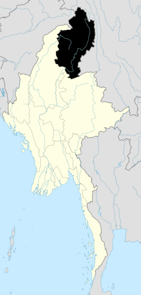
| คำอธิบายBurma Kachin locator map.png | English: Map showing Kachin State in Burma |
| วันที่ | |
| แหล่งที่มา | Based on File:Myanmar location map.svg. Made with Natural Earth. Free vector and raster map data @ naturalearthdata.com and Microsoft Paint. |
| ผู้สร้างสรรค์ | Dr. Blofeld based on work by Uwe Dedering |
การอนุญาตใช้สิทธิ
ข้าพเจ้า ในฐานะผู้ถือลิขสิทธิ์ของภาพหรือสื่อนี้ อนุญาตให้ใช้ภาพหรือสื่อนี้ภายใต้เงื่อนไขต่อไปนี้
ไฟล์นี้อยู่ภายใต้สัญญาอนุญาต ครีเอทีฟคอมมอนส์ แบบแสดงที่มา-อนุญาตแบบเดียวกัน 3.0 ต้นฉบับ
- คุณสามารถ:
- ที่จะแบ่งปัน – ที่จะทำสำเนา แจกจ่าย และส่งงานดังกล่าวต่อไป
- ที่จะเรียบเรียงใหม่ – ที่จะดัดแปลงงานดังกล่าว
- ภายใต้เงื่อนไขต่อไปนี้:
- แสดงที่มา – คุณต้องให้เกียรติเจ้าของงานอย่างเหมาะสม โดยเพิ่มลิงก์ไปยังสัญญาอนุญาต และระบุหากมีการเปลี่ยนแปลง คุณอาจทำเช่นนี้ได้ในรูปแบบใดก็ได้ตามควร แต่ต้องไม่ใช่ในลักษณะที่แนะว่าผู้ให้อนุญาตสนับสนุนคุณหรือการใช้งานของคุณ
- อนุญาตแบบเดียวกัน – หากคุณดัดแปลง เปลี่ยนรูป หรือต่อเติมงานนี้ คุณต้องใช้สัญญาอนุญาตแบบเดียวกันหรือแบบที่เหมือนกับสัญญาอนุญาตที่ใช้กับงานนี้เท่านั้น
https://creativecommons.org/licenses/by-sa/3.0CC BY-SA 3.0 Creative Commons Attribution-Share Alike 3.0 truetrue | | อนุญาตให้คัดลอก แจกจ่ายและ/หรือดัดแปรเอกสารนี้ภายใต้เงื่อนไขของสัญญาอนุญาตเอกสารเสรีของกนู รุ่น 1.2 หรือรุ่นใด ๆ นับจากนี้ที่ออกโดยมูลนิธิซอฟต์แวร์เสรี โดยไม่มีส่วนใดห้ามแก้ไข ไม่มีข้อความปกหน้าและปกหลัง สำเนาของสัญญาอนุญาตรวมอยู่ในส่วนชื่อ สัญญาอนุญาตเอกสารเสรีของกนูhttp://www.gnu.org/copyleft/fdl.htmlGFDLGNU Free Documentation Licensetruetrue |
คุณสามารถเลือกสัญญาอนุญาตดังกล่าวตามต้องการ
เพิ่มคำบรรยายทรรทัดเดียวเพื่อขยายความว่าไฟล์นี้มีอะไร
ประวัติไฟล์
คลิกวันที่/เวลาเพื่อดูไฟล์ที่ปรากฏในขณะนั้น
| วันที่/เวลา | รูปย่อ | ขนาด | ผู้ใช้ | ความเห็น |
|---|
| ปัจจุบัน | 19:54, 26 กันยายน 2553 | | 1,000 × 2,100 (475 กิโลไบต์) | Blofeld Dr. | {{Information |Description={{en|1=h}} |Source=h |Author=h |Date=h |Permission= |other_versions= }} |
หน้าที่มีภาพนี้
หน้าต่อไปนี้ โยงมาที่ภาพนี้:
การใช้ไฟล์ส่วนกลาง
วิกิอื่นต่อไปนี้ใช้ไฟล์นี้:
Myitkyina Bhamo Putao, Kachin State Mogaung Shwegu Myitkyina District Laiza Abegong Template:Kachin State Bhamo District Putao District Myitkyina Township Waingmaw Township Injangyang Township Mogaung Township Mohnyin Township Hpakant Township Tanai Township Chipwi Township Hsawlaw Township Bhamo Township Shwegu Township Momauk Township Mansi Township Putao Township Sumprabum Township Machanbaw Township Kawnglanghpu Township Nogmung Township Waingmaw Injangyang Hsawlaw Chipwi Tanai Kamaing Hpakant Mohnyin Momauk Lweje Kawnglanghpu Nogmung Sumprabum Machanbaw Mansi, Myanmar Chārpāte ดูการใช้ทั่วโลกเพิ่มเติมของไฟล์นี้
ไฟล, burma, kachin, locator, ไฟล, ประว, ไฟล, หน, าท, ภาพน, การใช, ไฟล, วนกลางขนาดของต, วอย, างน, กเซล, ความละเอ, ยดอ, กเซล, กเซล, กเซล, ภาพท, ความละเอ, ยดส, งกว, 8206, กเซล, ขนาดไฟล, โลไบต, ชน, ดไมม, image, ปภาพหร, อไฟล, เส, ยงน, นฉบ, บอย, คอมมอนส, รายละเอ, ยด. ifl prawtiifl hnathimiphaphni karichiflswnklangkhnadkhxngtwxyangni 285 599 phikesl khwamlaexiydxun 114 240 phikesl 228 480 phikesl 1 000 2 100 phikesl duphaphthimikhwamlaexiydsungkwa 8206 1 000 2 100 phikesl khnadifl 475 kiolibt chnidimm image png rupphaphhruxiflesiyngni tnchbbxyuthi khxmmxns raylaexiyddanlang epnkhxkhwamthiaesdngphlcak ifltnchbbinkhxmmxns khxmmxnsepnewbistinokhrngkarsahrbekbrwbrwmsuxesri thi khunsamarthchwyid khwamyx khaxthibayBurma Kachin locator map png English Map showing Kachin State in Burma wnthi 26 knyayn ph s 2553 aehlngthima Based on File Myanmar location map svg Made with Natural Earth Free vector and raster map data naturalearthdata com and Microsoft Paint phusrangsrrkh Dr Blofeld based on work by Uwe Dedering karxnuyatichsiththi khapheca inthanaphuthuxlikhsiththikhxngphaphhruxsuxni xnuyatihichphaphhruxsuxniphayitenguxnikhtxipni iflnixyuphayitsyyaxnuyat khriexthifkhxmmxns aebbaesdngthima xnuyataebbediywkn 3 0 tnchbbkhunsamarth thicaaebngpn thicathasaena aeckcay aelasngngandngklawtxip thicaeriyberiyngihm thicaddaeplngngandngklaw phayitenguxnikhtxipni aesdngthima khuntxngihekiyrtiecakhxngnganxyangehmaasm odyephimlingkipyngsyyaxnuyat aelarabuhakmikarepliynaeplng khunxacthaechnniidinrupaebbidkidtamkhwr aettxngimichinlksnathiaenawaphuihxnuyatsnbsnunkhunhruxkarichngankhxngkhun xnuyataebbediywkn hakkhunddaeplng epliynrup hruxtxetimnganni khuntxngichsyyaxnuyataebbediywknhruxaebbthiehmuxnkbsyyaxnuyatthiichkbnganniethannhttps creativecommons org licenses by sa 3 0 CC BY SA 3 0 Creative Commons Attribution Share Alike 3 0 true true xnuyatihkhdlxk aeckcayaela hruxddaeprexksarniphayitenguxnikhkhxngsyyaxnuyatexksaresrikhxngknu run 1 2 hruxrunid nbcaknithixxkodymulnithisxftaewresri odyimmiswnidhamaekikh immikhxkhwampkhnaaelapkhlng saenakhxngsyyaxnuyatrwmxyuinswnchux syyaxnuyatexksaresrikhxngknuhttp www gnu org copyleft fdl html GFDL GNU Free Documentation License true true khunsamartheluxksyyaxnuyatdngklawtamtxngkarkhabrryayodyyxithyephimkhabrryaythrrthdediywephuxkhyaykhwamwaiflnimixairixethmthiaesdngxyuiniflniprakxbdwysthanalikhsiththimilikhsiththisyyaxnuyatCreative Commons Attribution ShareAlike 3 0 Unported nbsp xngkvsGNU Free Documentation License version 1 2 or later nbsp xngkvswnthisrang wnkxtng26 knyayn 2010MIME type nbsp xngkvsimage pngchecksum nbsp xngkvs747ef7bbbfb065977cd2c3e26d9c7bf4df08b1a5withikarkahnd SHA 1 nbsp xngkvsdata size nbsp xngkvs486 814 ibtkhwamsung2 100 phikeslkhwamkwang1 000 phikesl prawtiifl khlikwnthi ewlaephuxduiflthipraktinkhnann wnthi ewlarupyxkhnadphuichkhwamehn pccubn19 54 26 knyayn 25531 000 2 100 475 kiolibt Blofeld Dr Information Description en 1 h Source h Author h Date h Permission other versions hnathimiphaphni hnatxipni oyngmathiphaphni lingcmukechidphma karichiflswnklang wikixuntxipniichiflni karichbn arz wikipedia org ميانمار قرد افطس الانف karichbn bg wikipedia org Mianmarska chiponosa majmuna karichbn ca wikipedia org Rinopitec de Stryker karichbn ceb wikipedia org Rhinopithecus strykeri karichbn en wikipedia org Kachin State Myitkyina Bhamo Putao Kachin State Mogaung Shwegu Myitkyina District Laiza Abegong Template Kachin State Bhamo District Putao District Myitkyina Township Waingmaw Township Injangyang Township Mogaung Township Mohnyin Township Hpakant Township Tanai Township Chipwi Township Hsawlaw Township Bhamo Township Shwegu Township Momauk Township Mansi Township Putao Township Sumprabum Township Machanbaw Township Kawnglanghpu Township Nogmung Township Waingmaw Injangyang Hsawlaw Chipwi Tanai Kamaing Hpakant Mohnyin Momauk Lweje Kawnglanghpu Nogmung Sumprabum Machanbaw Mansi Myanmar Charpate dukarichthwolkephimetimkhxngiflni ekhathungcak https th wikipedia org wiki ifl Burma Kachin locator map png, wikipedia, วิกิ หนังสือ, หนังสือ, ห้องสมุด,
บทความ
, อ่าน, ดาวน์โหลด, ฟรี, ดาวน์โหลดฟรี, mp3, วิดีโอ, mp4, 3gp, jpg, jpeg, gif, png, รูปภาพ, เพลง, เพลง, หนัง, หนังสือ, เกม, เกม